Home > Europe > United Kingdom > England > Suffolk > Felixstowe
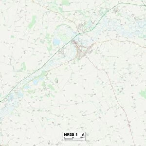
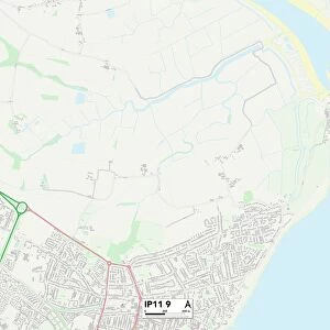
Felixstowe Suffolk UK City Street Map

![]()
Wall Art and Photo Gifts from Fine Art Storehouse
Felixstowe Suffolk UK City Street Map
Vector Illustration of a City Street Map of Felixstowe, Suffolk, UK. Included files are EPS (v10) and Hi-Res JPG.
Data courtesy from Ordnance Survey: VectorMap District
https:/ordnancesurvey.co.uk/business-and-government/products/vectormap-district.html
OS OpenData is free to use under the Open Government Licence (OGL).
Contains OS data eCrown copyright and database right 2017.
http:/nationalarchives.gov.uk/doc/open-government-licence/version/3/
Unleash your creativity and transform your space into a visual masterpiece!
Frank Ramspott
Media ID 15055195
© Frank Ramspott, all rights reserved
Aerial View Computer Graphic Directly Above Gray Green North Sea Port Road Map Street Map Suffolk Text Digitally Generated Image Felixstowe
FEATURES IN THESE COLLECTIONS
> Aerial Photography
> Related Images
> Arts
> Portraits
> Pop art gallery
> Street art portraits
> Europe
> United Kingdom
> England
> Suffolk
> Felixstowe
> Europe
> United Kingdom
> Maps
> Fine Art Storehouse
> Map
> Street Maps
> Maps and Charts
> Related Images
EDITORS COMMENTS
This print showcases a detailed and intricate city street map of Felixstowe, Suffolk, UK. Created using vector illustration techniques, the image beautifully captures the essence of this coastal town. The print includes EPS (v10) and Hi-Res JPG files for versatile usage. The data used to create this stunning map is courtesy of Ordnance Survey: VectorMap District, ensuring accuracy and reliability. It's worth noting that OS OpenData is freely available under the Open Government Licence (OGL), highlighting its accessibility to all users. Felixstowe's unique features are highlighted in this artwork, including its proximity to the North Sea coastline and bustling port area. The buildings and streets are meticulously depicted, providing a comprehensive overview of the city's layout. With its vibrant colors and digitally generated design, this visually striking aerial view offers an engaging perspective on Felixstowe's physical geography. The text elements are presented in shades of gray against a backdrop of green, blue, and white hues. Perfect for cartography enthusiasts or those with an affinity for maps, this Fine Art Storehouse print by Frank Ramspott brings together artistry and functionality in one captivating piece.
MADE IN AUSTRALIA
Safe Shipping with 30 Day Money Back Guarantee
FREE PERSONALISATION*
We are proud to offer a range of customisation features including Personalised Captions, Color Filters and Picture Zoom Tools
SECURE PAYMENTS
We happily accept a wide range of payment options so you can pay for the things you need in the way that is most convenient for you
* Options may vary by product and licensing agreement. Zoomed Pictures can be adjusted in the Cart.