Fraud Blocker Skip to main content

1500s Collection

The 1500s were a time of exploration, innovation, and cultural transformation

Background image1500s Collection: Human skeleton

Human skeleton. Historical artwork of a human skeleton holding an hourglass. The 206 bones of the skeleton provide protection and support to the body

Background image1500s Collection: Skull anatomy by Leonardo da Vinci

Skull anatomy by Leonardo da Vinci. Historical artwork and notes on the anatomy of the human skull and teeth, by the Italian artist and scientist Leonardo da Vinci (1452-1519)

Background image1500s Collection: Orteliuss map of Ottoman Empire, 1570

Orteliuss map of Ottoman Empire, 1570
Orteliuss map of the Ottoman Empire. This map is from the 1570 first edition of Theatrum orbis terrarum ( Theatre of the World )

Background image1500s Collection: GGBR2A-00076

GGBR2A-00076
Map of Scotland in the 1520s, showing territories of the Highland Clans. Printed color lithograph of a 19th century illustration

Background image1500s Collection: Durers world map, 1515

Durers world map, 1515. Albrecht Durer (1471- 1528) was a German artist. His skillful use of perspective and mathematical proportions made him one of the outstanding artistic figures of the early

Background image1500s Collection: Oronce Fines world map, 1531

Oronce Fines world map, 1531
Oronce Fines world map. Map of the worlds northern and southern hemispheres by the French mathematician and cartographer Oronce Fine (1494-1555)

Background image1500s Collection: HENRY WRIOTHESLEY (1573-1624). 3rd Earl of Southampton in the Tower of London

HENRY WRIOTHESLEY (1573-1624). 3rd Earl of Southampton in the Tower of London. Oil painting by John de Critz, 1603

Background image1500s Collection: Map of Palestine, 1588

Map of Palestine, 1588
16th century map of Palestine. North is towards upper right. Published in 1588, this German map shows the geography of Palestine, centred on the area that later become the state of Israel

Background image1500s Collection: 16th century map of the British Isles

16th century map of the British Isles
Map of the British Isles, in the 1570 edition of Ortelius Atlas (Theatrum Orbis Terrarum). Abraham Ortelius (1527-1598) was a Flemish mapmaker who is considered to have produced the first true atlas

Background image1500s Collection: 16th Century Plan of Florence

16th Century Plan of Florence
16th century plan of Florence, Italy. Detail from the map of Etruria (Tuscany and Northern Lazio), in the Gallery of Maps in the Vatican Museum.The Gallery of Maps holds maps which were commissioned

Background image1500s Collection: John Calvin

John Calvin portrait. Hand-colored engraving

Background image1500s Collection: Nottingham Castle in the 1500s

Nottingham Castle in the 1500s
Nottingham Castle overlooking the surrounding countryside in the 1500s. Hand-colored 19th-century woodcut reproduction of an earlier illustration

Background image1500s Collection: Map of Europe, 1600

Map of Europe, 1600
16th century map of Europe. Published in Sienna in 1600, this Italian map shows the latest knowledge of the geography of Europe

Background image1500s Collection: Medieval goldsmith at work

Medieval goldsmith at work
Workshop of Etienne Delaulne, a goldsmith in Paris, 1500s. Hand-colored woodcut reproduction of a 16th-century illustration

Background image1500s Collection: ChAteau de Chenonceau over the Cher River at dusk, Chenonceaux, Indre-et-Loire, Centre

ChAteau de Chenonceau over the Cher River at dusk, Chenonceaux, Indre-et-Loire, Centre
Chateau de Chenonceau over the Cher River at dusk, Chenonceaux, Indre-et-Loire, Centre, France

Background image1500s Collection: 16th century world map

16th century world map
World map, published around 1565 in Venice, Italy, by Italian mapmaker Ferando Bertelli. The title of the map: Universale Descrittione di Tutta la Terra Conosciuta Fin Qui

Background image1500s Collection: Tower of London in the late Middle Ages

Tower of London in the late Middle Ages
London during the time of Henry VII (1457-1509). Color lithograph reproduction of an illuminated manuscript: Roy 16F, ii

Background image1500s Collection: Spanish galleon at sea

Spanish galleon at sea
Spanish galleon, an improved caravel three times longer than wide, used in the 1500s and 1600s. Hand-colored woodcut of a 19th-century illustration

Background image1500s Collection: Use of an arquebusse, 16th century

Use of an arquebusse, 16th century
Spanish arquebusier, 1500s. Hand-colored 19th-century woodcut reproduction of an earlier illustration

Background image1500s Collection: Actors on stage in the days of Shakespeare

Actors on stage in the days of Shakespeare
Theatrical performance in the days of Shakespeare. Hand-colored woodcut of a 19th-century illustration

Background image1500s Collection: Shrewsbury, England, in the 1500s

Shrewsbury, England, in the 1500s
High Street, Shrewsbury, in Tudor England. Hand-colored woodcut of a 19th century illustration

Background image1500s Collection: John Dee and Edward Kelly

John Dee and Edward Kelly
John Dee, English alchemist, mathematician and astrologer, with his assistant Edward Kelly, medium, alchemist and sorcerer

Background image1500s Collection: John Calvin and the four syndics at Geneva

John Calvin and the four syndics at Geneva
John Calvin and the four syndics founding the seminary which became the College of Geneva, 1559. Hand-colored woodcut of a 19th-century illustration

Background image1500s Collection: Women of Tudor England

Women of Tudor England
City women and a country-woman in Elizabethan England, 1500s. Hand-colored woodcut of a 19th-century illustration

Background image1500s Collection: Notes by Leonardo da Vinci

Notes by Leonardo da Vinci on the flow of water. Leonardo da Vinci (1452-1519), an Italian artist, sculptor, architect and musician

Background image1500s Collection: 16th century map of Venice

16th century map of Venice showing the lagoon. Venice is a coastal city in the north-east of Italy. The main bulk of Venice is in the upper frame of the image

Background image1500s Collection: Northern hemisphere star chart, 1537

Northern hemisphere star chart, 1537
Northern hemisphere star chart, 16th century. Star chart (planisphere) of the northern hemisphere, based on Albrecht Durers star charts of 1515. The illustrations show the constellations

Background image1500s Collection: MEXICO: INDIANS, c1500. P urhepecha (Tarascan) Indians of Michoacan Province, Mexico

MEXICO: INDIANS, c1500. P urhepecha (Tarascan) Indians of Michoacan Province, Mexico, flee their village shortly before the arrival of Spanish conquistadors

Background image1500s Collection: Undersea exploration in 16th-century Europe

Undersea exploration in 16th-century Europe
Underwater diver and man-at-arms, France, 1532. Hand-colored woodcut of a 19th century illustration

Background image1500s Collection: Martin Luther

Martin Luther portrait. Hand-colored engraving reproduction of a portrait by Holbein

Background image1500s Collection: William Tyndale

William Tyndale, English translator of the New Testament. Hand-colored woodcut of a 19th-century illustration

Background image1500s Collection: NATL2A-00001

NATL2A-00001
Temple ceremony in an Aztec city. Hand-colored woodcut of a 19th-century illustration

Background image1500s Collection: Hand-colored woodcut

Hand-colored woodcut
Aztec tiger knight in a costume of cotton and a helmet made of wood, from a model in Spain. Hand-colored woodcut of a 19th-century illustration

Background image1500s Collection: Trephination evidence in an Inca skull

Trephination evidence in an Inca skull
Inca skull showing evidence of prehistoric trephining or brain surgery in Peru. Woodcut with a watercolor wash

Background image1500s Collection: Bakers at their trade in the late Middle Ages

Bakers at their trade in the late Middle Ages
Bakers of York, showing their guild ordinances, England, 1590s. Hand-colored 19th-century woodcut reproduction of an earlier illustration

Background image1500s Collection: Spanish Armada, 1588

Spanish Armada, 1588
Defeat of the Spanish Armada by the English navy, 1588. Hand-colored woodcut reproduction of an earlier illustration

Background image1500s Collection: Map of Western Europe, 1590

Map of Western Europe, 1590
16th century map of Western Europe. Published around 1590, this map shows the coasts of Western Europe and the Mediterranean

Background image1500s Collection: Europe, 16th century nautical map

Europe, 16th century nautical map
Nautical map of Europe, 1544 copy of Agnese Atlas. Several copies of this atlas were produced between 1536 and 1564, in Venice, by the Italian mapmaker Battista Agnese

Background image1500s Collection: Durers Celestial Globe, 1515

Durers Celestial Globe, 1515. This shows the northern hemisphere, and was prepared in conjunction with the astronomer Stabius

Background image1500s Collection: Nicolaus Copernicus, Polish astronomer

Nicolaus Copernicus, Polish astronomer
Nicolaus Copernicus (1473-1543) observing a lunar eclipse in Rome, Italy, in 1500. Copernicus was a Polish astronomer who studied in both Poland and Italy

Background image1500s Collection: Medieval scholar, 16th century

Medieval scholar, 16th century

Background image1500s Collection: Martin Luther, German theologian

Martin Luther, German theologian
Martin Luther (1483-1546), German theologian and founder of the Protestant Reformation. Luther was born at Eisleben. Initially trained in law

Background image1500s Collection: Orteliuss map of Italy, 1570

Orteliuss map of Italy, 1570
Orteliuss map of Italy. This map is from the 1570 first edition of Theatrum orbis terrarum ( Theatre of the World ). Drawn by the Flemish mapmaker Abraham Ortelius (1527-1598)

Background image1500s Collection: Orteliuss map of Poland, 1570

Orteliuss map of Poland, 1570
Orteliuss map of Poland. This map is from the 1570 first edition of Theatrum orbis terrarum ( Theatre of the World ). Drawn by the Flemish mapmaker Abraham Ortelius (1527-1598)

Background image1500s Collection: Orteliuss map of Greece, 1570

Orteliuss map of Greece, 1570
Orteliuss map of Greece. This map is from the 1570 first edition of Theatrum orbis terrarum ( Theatre of the World ). Drawn by the Flemish mapmaker Abraham Ortelius (1527-1598)

Background image1500s Collection: Hugo Grotius, Dutch jurist

Hugo Grotius, Dutch jurist
Hugo Grotius (1583-1645), Dutch jurist and founder of international law. Grotius was born at Delft and at just 11 years of age went to university at Leiden. He became an advocate in 1599

Background image1500s Collection: Front entrance to ChAteau de Chenonceau castle, Chenonceaux, Indre-et-Loire, Centre

Front entrance to ChAteau de Chenonceau castle, Chenonceaux, Indre-et-Loire, Centre
Front entrance to Chateau de Chenonceau castle, Chenonceaux, Indre-et-Loire, Centre, France

Background image1500s Collection: Carrack, a merchant ship of the late 1400s

Carrack, a merchant ship of the late 1400s
Armed Genoese carrack, a merchant ship of the 1400s and 1500s. Hand-colored woodcut of a 19th-century illustration


All Professionally Made to Order for Quick Shipping

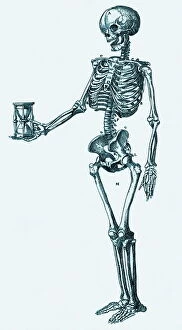
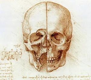
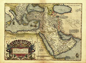
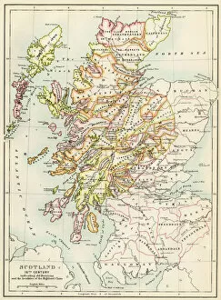
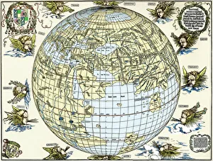
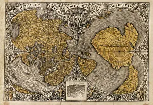
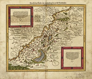
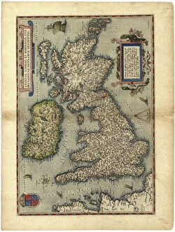
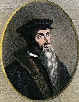
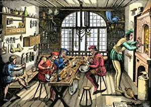
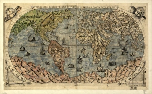
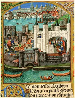
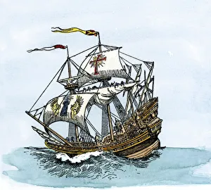
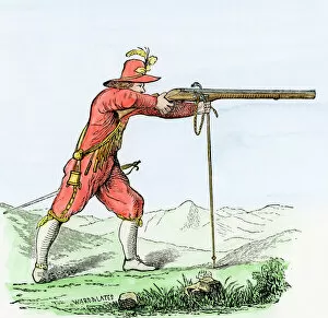
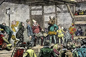
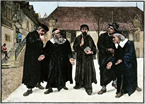
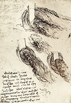
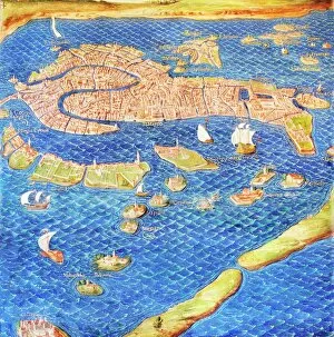
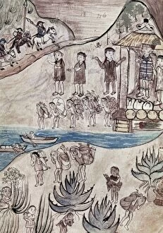
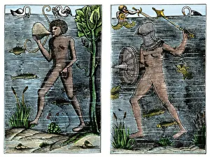
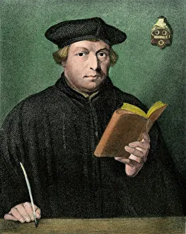
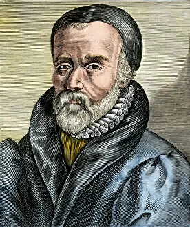
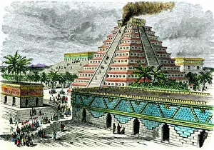
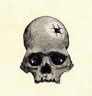
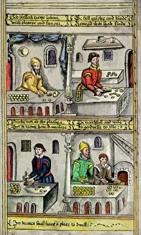
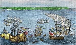
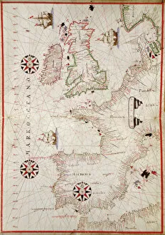
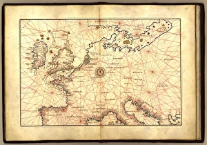
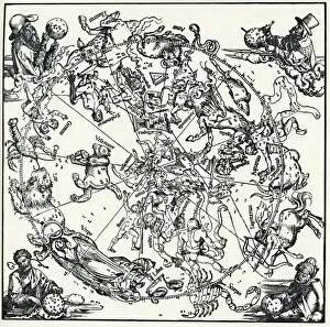
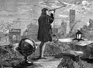
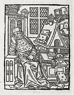
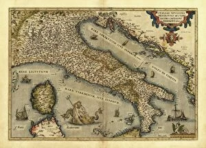
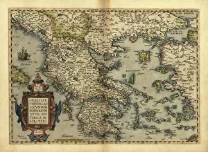
The 1500s were a time of exploration, innovation, and cultural transformation. In the realm of art and science, geniuses like Leonardo da Vinci left their mark with groundbreaking works such as "Skull anatomy, " revealing the intricacies of human anatomy. Meanwhile, cartographers like Gerardus Mercator (GGBR2A-00076) created maps that expanded our understanding of the world. Orteliuss map of the Ottoman Empire in 1570 showcased the vast territories under its rule, while Durer's world map from 1515 provided a glimpse into how people perceived Earth at that time. These maps painted a picture of an ever-expanding global landscape. In Florence during this era, architects and urban planners crafted detailed plans for cities like never before seen. The 16th Century Plan of Florence exemplified this meticulous approach to city design. Oronce Fine's world map from 1531 furthered geographical knowledge by incorporating new discoveries made during expeditions around the globe. It was through these maps that Europeans began to comprehend just how vast our planet truly is. The use of firearms also revolutionized warfare during this period. Arquebusses became prevalent on battlefields across Europe in the 16th century, changing military tactics forever. Religion played a significant role in shaping society during this time as well. Figures like John Calvin emerged as influential theologians whose ideas would have lasting impacts on Protestantism and beyond. Maps continued to evolve throughout the century; one notable example being Map of Palestine in 1588 which depicted important biblical sites within its borders. Similarly, a detailed map showcasing British Isles shed light on England's growing influence over neighboring lands. By the turn of the century, Europe had undergone immense changes politically and culturally - reflected by Map of Europe from 1600 which captured shifting borders and emerging nation-states.