Fraud Blocker Skip to main content

Cartographic Collection

"Unveiling the World Through Cartographic Masterpieces" Step back in time and embark on a journey through history with these captivating cartographic treasures

Background imageCartographic Collection: Al-Idrisis world map, 1154

Al-Idrisis world map, 1154
Al-Idrisis world map. This world map, known as the Tabula Rogeriana, dates from 1154, and is orientated with North at bottom

Background imageCartographic Collection: Orteliuss map of Ottoman Empire, 1570

Orteliuss map of Ottoman Empire, 1570
Orteliuss map of the Ottoman Empire. This map is from the 1570 first edition of Theatrum orbis terrarum ( Theatre of the World )

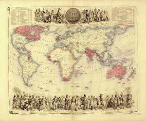
Background imageCartographic Collection: British Empire world map, 19th century

British Empire world map, 19th century
British Empire world map. This world map shows the 19th-century British Empire (pink) and its indigenous peoples. Five illustrations (clockwise from upper left) show the people of Australia

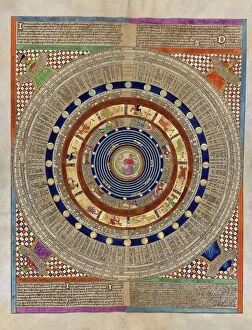
Background imageCartographic Collection: Catalan Atlas, 14th century

Catalan Atlas, 14th century. The 6-page Catalan Atlas (1375) was produced on vellum by the Jewish cartographer Abraham Cresques
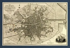
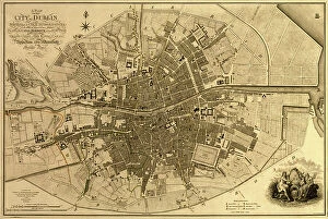
Background imageCartographic Collection: Map of the City of Dublin, 1797

Map of the City of Dublin, 1797
Map of the City of Dublin, Ireland. Published in 1797, this map includes details of the canals being built at the time. Canal Harbour (lower right)

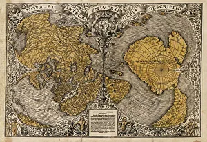
Background imageCartographic Collection: Oronce Fines world map, 1531

Oronce Fines world map, 1531
Oronce Fines world map. Map of the worlds northern and southern hemispheres by the French mathematician and cartographer Oronce Fine (1494-1555)

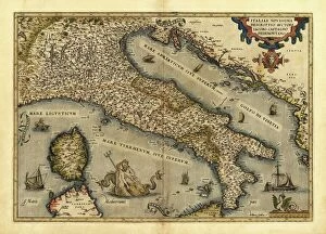
Background imageCartographic Collection: Orteliuss map of Italy, 1570

Orteliuss map of Italy, 1570
Orteliuss map of Italy. This map is from the 1570 first edition of Theatrum orbis terrarum ( Theatre of the World ). Drawn by the Flemish mapmaker Abraham Ortelius (1527-1598)

Background imageCartographic Collection: Orteliuss map of Poland, 1570

Orteliuss map of Poland, 1570
Orteliuss map of Poland. This map is from the 1570 first edition of Theatrum orbis terrarum ( Theatre of the World ). Drawn by the Flemish mapmaker Abraham Ortelius (1527-1598)

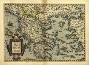
Background imageCartographic Collection: Orteliuss map of Greece, 1570

Orteliuss map of Greece, 1570
Orteliuss map of Greece. This map is from the 1570 first edition of Theatrum orbis terrarum ( Theatre of the World ). Drawn by the Flemish mapmaker Abraham Ortelius (1527-1598)

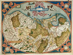
Background imageCartographic Collection: Map of Germany and current Netherlands. Theatrum Orbis Terra

Map of Germany and current Netherlands. Theatrum Orbis Terrarum by Abraham Ortelius (1527-1598). First Edition. Antwerp, 1574. Library of Catalonia. Barcelona. Spain

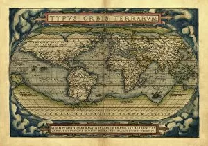
Background imageCartographic Collection: Orteliuss world map, 1570

Orteliuss world map, 1570
Orteliuss world map. This world map is from the 1570 first edition of Theatrum orbis terrarum ( Theatre of the World ). Drawn by the Flemish mapmaker Abraham Ortelius (1527-1598)

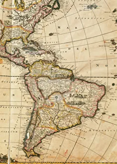
Background imageCartographic Collection: Map of America. Nova Totius Americae Descriptio by Frederik

Map of America. Nova Totius Americae Descriptio by Frederik
Nova Totius Americae Descriptio. Map of America. By Frederik de Wit (1630-1706). Amsterdam, 1666

Background imageCartographic Collection: Uranographia constellations, 1801 C013 / 8953

Uranographia constellations, 1801 C013 / 8953
Uranographia constellations. This page of this star atlas shows Northern Hemisphere constellations. The constellations are groupings of stars in the night sky

Background imageCartographic Collection: Barcelona (19th c. ). Geometrical map, by Jos項

Barcelona (19th c. ). Geometrical map, by Jos項
Barcelona (19th c.). Geometrical map, by Jos頍 as y Vila. SPAIN. Barcelona. Historical Archive of Barcelona

Background imageCartographic Collection: Trigonometry Point

Trigonometry Point
A Trigonometry Point at Buvita in the Belgium Congo, topped off with a broom!

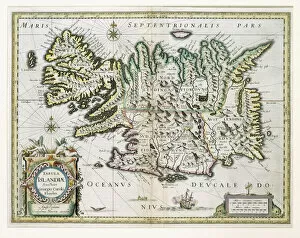
Background imageCartographic Collection: Map of Iceland (colour engraving)

Map of Iceland (colour engraving)
STC255317 Map of Iceland (colour engraving) by Blaeu, Willem (1571-1638); Private Collection; The Stapleton Collection; Dutch, out of copyright

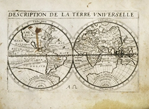
Background imageCartographic Collection: Description de la Terre Universelle (1667). Map

Description de la Terre Universelle (1667). Map. Engraving

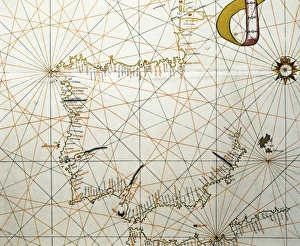
Background imageCartographic Collection: Portolan Atlas, 1587. Map of the Iberian Peninsula

Portolan Atlas, 1587. Map of the Iberian Peninsula, the north coastline of Africa and the Vasque Countrys region in France. Made in Messina. Facsimile. Miniature Painting. SPAIN. Madrid

Background imageCartographic Collection: Orteliuss map of Holland, 1570

Orteliuss map of Holland, 1570
Orteliuss map of Holland. This map is from the 1570 first edition of Theatrum orbis terrarum ( Theatre of the World ). Drawn by the Flemish mapmaker Abraham Ortelius (1527-1598)

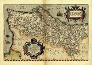
Background imageCartographic Collection: Orteliuss map of Portugal, 1570

Orteliuss map of Portugal, 1570
Orteliuss map of Portugal. This map is from the 1570 first edition of Theatrum orbis terrarum ( Theatre of the World ). Drawn by the Flemish mapmaker Abraham Ortelius (1527-1598)

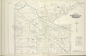
Background imageCartographic Collection: Vol. 6. Plate, H. Map bound by Van Cott Ave. Van Pelt Ave. Monitor St. Meeker Ave

Vol. 6. Plate, H. Map bound by Van Cott Ave. Van Pelt Ave. Monitor St. Meeker Ave. Richardson St. Humboldt St. Conselyea St. Union Ave.; Including Jane St. Newton St. Bayard St. Frost St. Withers St

Background imageCartographic Collection: Ireland, Dublin, 1791

Ireland, Dublin, 1791
2902832 Ireland, Dublin, 1791; (add.info.: Ireland, Dublin, 1791.); Buyenlarge Archive/UIG.

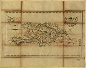
Background imageCartographic Collection: Santo Domingo, 1796

Santo Domingo, 1796
2902892 Santo Domingo, 1796; (add.info.: Santo Domingo, Dominican Republic, 1796.); Buyenlarge Archive/UIG.

Background imageCartographic Collection: Panorama of harbor showing siege of Curacao by English sailors and soldiers in 1800

Panorama of harbor showing siege of Curacao by English sailors and soldiers in 1800
2902887 Panorama of harbor showing siege of Curacao by English sailors and soldiers in 1800; (add.info.: Panorama of harbor showing siege of Curacao by English sailors and soldiers in 1800)

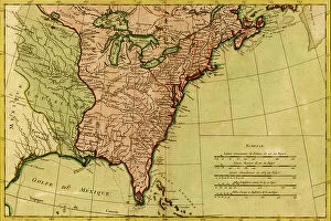
Background imageCartographic Collection: French View of North America, 1762

French View of North America, 1762
2902787 French View of North America, 1762; (add.info.: North America from the Gulf of St. Lawrence to the Gulf of Mexico, west nearly to the Rocky Mountains.); Buyenlarge Archive/UIG.

Background imageCartographic Collection: Chart of the West Indies, 1796

Chart of the West Indies, 1796
2902871 Chart of the West Indies, 1796; (add.info.: Chart of the West Indies, 1796.); Buyenlarge Archive/UIG.

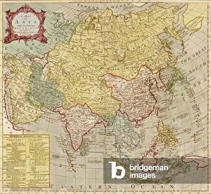
Background imageCartographic Collection: Asia - 1787

Asia - 1787
2902865 Asia - 1787; (add.info.: Asia, est nor ashkharhagrakan znnuteants); Buyenlarge Archive/UIG.

Background imageCartographic Collection: North America, 1826

North America, 1826
2902785 North America, 1826; (add.info.: North America, 1826.); Buyenlarge Archive/UIG.

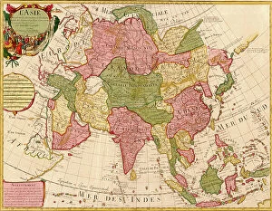
Background imageCartographic Collection: Asia - 1700

Asia - 1700
2902856 Asia - 1700; (add.info.: LAsie - dres?e sur les observations de lAcademie Royale des Sciences et quelques autres, et sur les memoires les plus recens. - par G. de LIsle, geographe)

Background imageCartographic Collection: India, Hindustan, 1782

India, Hindustan, 1782
2902855 India, Hindustan, 1782; (add.info.: India, Hindustan, 1782.); Buyenlarge Archive/UIG.

2902772

2902847

Background imageCartographic Collection: Northern Hemisphere, 1750

Northern Hemisphere, 1750
2902813 Northern Hemisphere, 1750; (add.info.: Northern Hemisphere, 1750.); Buyenlarge Archive/UIG.

Background imageCartographic Collection: West Indies, 1849

West Indies, 1849
2902888 West Indies, 1849; (add.info.: West Indies, 1849.); Buyenlarge Archive/UIG.

Background imageCartographic Collection: Dominions of New Spain in North America, 1759

Dominions of New Spain in North America, 1759
2902801 Dominions of New Spain in North America, 1759; (add.info.: Dominions of New Spain in North America, 1759.); Buyenlarge Archive/UIG.

Background imageCartographic Collection: Havana, Cuba City Plan, 1700s

Havana, Cuba City Plan, 1700s
2902878 Havana, Cuba City Plan, 1700s; (add.info.: Plan of the city and harbor of Havana, Cuba, 1700s.); Buyenlarge Archive/UIG.

Background imageCartographic Collection: A Map of British - French Settlements in America, 1755

A Map of British - French Settlements in America, 1755
2902786 A Map of British - French Settlements in America, 1755; (add.info.: A Map of British - French Settlements in America, 1755.); Buyenlarge Archive/UIG.

Background imageCartographic Collection: Asia - 1700s

Asia - 1700s
2902857 Asia - 1700s; (add.info.: Asia - 1700s); Buyenlarge Archive/UIG.

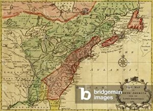
Background imageCartographic Collection: North America, 1763

North America, 1763
2902783 North America, 1763; (add.info.: A New map of North America from the latest discoveries, 1763.); Buyenlarge Archive/UIG.

Background imageCartographic Collection: Queretaro, 1844

Queretaro, 1844
2902773 Queretaro, 1844; (add.info.: Queretaro, 1844.); Buyenlarge Archive/UIG.

Background imageCartographic Collection: Theater of operations, Japan-China War, 1894-5

Theater of operations, Japan-China War, 1894-5
2902853 Theater of operations, Japan-China War, 1894-5; (add.info.: Theater of operations, Japan-China War, 1894-5.); Buyenlarge Archive/UIG.

Background imageCartographic Collection: Zacatecas

Zacatecas
2902769 Zacatecas; (add.info.: Zacatecas, 1844.); Buyenlarge Archive/UIG.

Background imageCartographic Collection: Tabasco

Tabasco
2902758 Tabasco; (add.info.: Tabasco, 1844.); Buyenlarge Archive/UIG.

Background imageCartographic Collection: Tamaulipas

Tamaulipas
2902756 Tamaulipas; (add.info.: Tamaulipas, 1844.); Buyenlarge Archive/UIG.

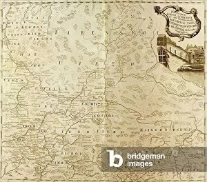
Background imageCartographic Collection: Russia, 1745

Russia, 1745
2902749 Russia, 1745; (add.info.: Russia, 1745.); Buyenlarge Archive/UIG.

Background imageCartographic Collection: Map of Persia and adjacent countries, for Sir John Malcolms History of Persia, 1815

Map of Persia and adjacent countries, for Sir John Malcolms History of Persia, 1815
2902278 Map of Persia and adjacent countries, for Sir John Malcolms History of Persia, 1815; (add.info.: Map of Persia and adjacent countries, for Sir John Malcolms History of Persia)

Background imageCartographic Collection: The Hindu Kush and passes between the Kabul and Oxus, 1879

The Hindu Kush and passes between the Kabul and Oxus, 1879
2902277 The Hindu Kush and passes between the Kabul and Oxus, 1879; (add.info.: The Hindu Kush and passes between the Kabul and Oxus, 1879.); Buyenlarge Archive/UIG.

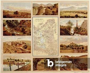
Background imageCartographic Collection: Valleys of Mexico, 1885

Valleys of Mexico, 1885
2902264 Valleys of Mexico, 1885; (add.info.: Historic map of Mexico with Valleys, amphitheaters, industry, groves, waterways, plains. Printed in Spanish.); Buyenlarge Archive/UIG.


All Professionally Made to Order for Quick Shipping

"Unveiling the World Through Cartographic Masterpieces" Step back in time and embark on a journey through history with these captivating cartographic treasures. From Al-Idrisi's world map of 1154 to Orteliuss' intricate creations from the 16th century, each map tells a unique story about the world as it was known at that time. Al-Idrisi's world map, crafted in 1154, offers a glimpse into medieval Islamic geography, showcasing an impressive understanding of global trade routes and geographical features. Meanwhile, the British Empire world map from the 19th century illustrates the vast extent of Britain's dominion across continents and oceans. The Catalan Atlas transports us to the 14th century with its exquisite craftsmanship and detailed depictions of various regions. It serves as a testament to Catalonia's rich maritime tradition and exploration during this period. Orteliuss' maps take center stage throughout this collection, providing invaluable insights into specific regions such as Ottoman Empire, Italy, Poland, Greece, Germany, Netherlands - all meticulously documented in his renowned Theatrum Orbis Terrarum. These masterpieces not only showcase Orteliuss' cartographic expertise but also shed light on political boundaries and cultural nuances prevalent during his era. Moving closer to home is the Map of City Dublin from 1797 which showcases Ireland's capital city at that time - offering glimpses into its urban layout and architectural landmarks that have shaped Dublin's identity over centuries. Lastly Zaragoza’s (19th c. ) Map takes us to Spain where we can explore Madrid through intricate details capturing its streetscape during that period - allowing us to immerse ourselves in Spanish history while navigating through its vibrant capital city. These remarkable cartographic works serve as windows into our past – they are not just maps; they are gateways connecting us with bygone eras.