Fraud Blocker Skip to main content

Cartographic Collection (page 20)

"Unveiling the World Through Cartographic Masterpieces" Step back in time and embark on a journey through history with these captivating cartographic treasures

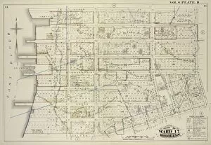
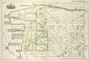
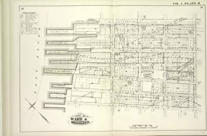
Background imageCartographic Collection: Vol. 6. Plate, B. Map bound by Huron St. Oakland St

Vol. 6. Plate, B. Map bound by Huron St. Oakland St. Calyer St. East River; Including India St. Java St. Kent St. Green Point St. Milton St. Noble St. Oak St. West St. Franklin St. Guernsey St

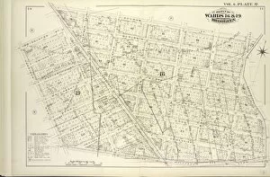
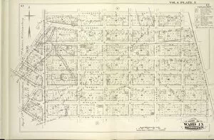
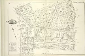
Background imageCartographic Collection: Detailed Estate and Old Farm Line Atlas of The City of Brooklyn. Complete In Six Volumes

Detailed Estate and Old Farm Line Atlas of The City of Brooklyn. Complete In Six Volumes. Vol. 6. Comprising Wards 13, 14, 15, 16, 17 & 19

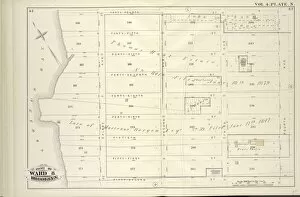
Background imageCartographic Collection: Vol. 5. Plate, S. Map bound by Lorraine St. Hamilton Ave. Gowanus Bay, Otsego St

Vol. 5. Plate, S. Map bound by Lorraine St. Hamilton Ave. Gowanus Bay, Otsego St.; Including Crinnell St. Bay St. Sigourney St. Halleck St. Percival St. Bryant St. Columbia St. Hicks St. Hicks St

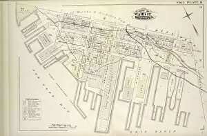
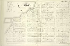
Background imageCartographic Collection: Vol. 5. Plate, R. Map bound by Partition St

Vol. 5. Plate, R. Map bound by Partition St. Otsego St. Erie Basin, New York Bay; Including Van Dyke St. Elizabeth St. Reid St. Ferris St. Conover St. Van Brunt St. Richards St

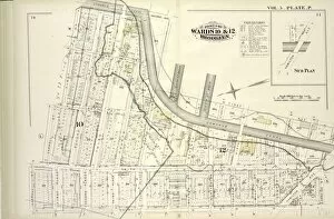
Background imageCartographic Collection: Vol. 5. Plate, P. Map bound by Gowanus Canal, Second Ave. Fifth St. First Ave

Vol. 5. Plate, P. Map bound by Gowanus Canal, Second Ave. Fifth St. First Ave. Thirteenth St. Hamilton Ave. Lorraine St. Court St. Carroll St. First St.; Including Bond St. Hoyt St. Smith St

Background imageCartographic Collection: Vol. 5. Plate, O. Map bound by Court St. Lorraine St. Columbia St. Carroll St

Vol. 5. Plate, O. Map bound by Court St. Lorraine St. Columbia St. Carroll St.; Including Clinton St. Henry St. Manhasset Place, Hicks St. Hamilton Ave. First Place, Summit St

Background imageCartographic Collection: Vol. 5. Plate, Q. Map bound by Atlantic Basin, Verona St. Columbia St. Otsego St

Vol. 5. Plate, Q. Map bound by Atlantic Basin, Verona St. Columbia St. Otsego St. Partition St. Buttermilk Channel; Including Tremont St. Clinton Wharf, William St. King St. Sullivan St. Bush St

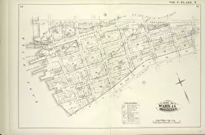
Background imageCartographic Collection: Vol. 5. Plate, N. Map bound by Hamilton Ave. Carroll St. Columbia St. Verona St

Vol. 5. Plate, N. Map bound by Hamilton Ave. Carroll St. Columbia St. Verona St. East River; Including India St. Atlantic Basin, Summit St. Rapelyea St. Woodhull St. Bowne St. Seabring St

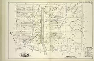
Background imageCartographic Collection: Vol. 5. Plate, M. Map bound by Butler St

Vol. 5. Plate, M. Map bound by Butler St. Fourth Ave. First St. Hoyt St.; Including Douglass St. Degraw St. Union St. President St. Carroll St. Bond St. Gowanus Canal, Nevins St. Third Ave

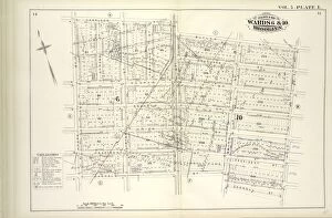
Background imageCartographic Collection: Vol. 5. Plate, L. Map bound by Harrison St. Court St. Butler St. Hoyt St. Carroll St

Vol. 5. Plate, L. Map bound by Harrison St. Court St. Butler St. Hoyt St. Carroll St. Smith St. Henry St.; Including Degraw St. Sackett St. Union St. President St. Clinton St. Tompkins St

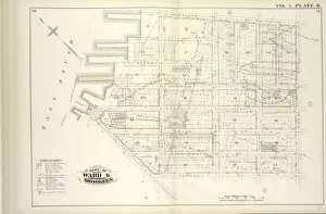
Background imageCartographic Collection: Vol. 5. Plate, K. Map bound by Harrison St. Henry St. Carroll St. Hamilton Ave

Vol. 5. Plate, K. Map bound by Harrison St. Henry St. Carroll St. Hamilton Ave. East River; Including Irving St. Sedgwick St. Degraw St. Sackett St. Union St. President St. Beach Pl. Van Brunt St

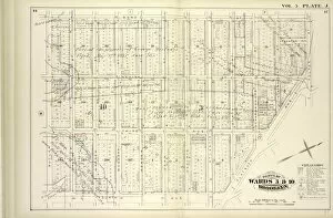
Background imageCartographic Collection: Vol. 5. Plate, J. Map bound by Bond St. Fulton St

Vol. 5. Plate, J. Map bound by Bond St. Fulton St. Flatbush Ave. Fourth Ave. Butler St.; Including Nevins St. Hanover Pl. Third Ave. Baltic St. Warren St. Wyckoff St. Bergen St. Dean St. Pacific St

Background imageCartographic Collection: ol. 5. Plate, I. Map bound by Atlantic St. State St. Bond St. Butler St. Court St

ol. 5. Plate, I. Map bound by Atlantic St. State St. Bond St. Butler St. Court St. Harrison St. Clinton St.; Including Pacific St. Dean St. Bergen St. Wyckoff St. Warren St. Baltic St. Boerum St

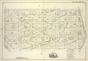
Background imageCartographic Collection: Vol. 6. Plate, P. Map bound by Ten Eyck St. Old Bushwick Ave. Broadway, Boerum St

Vol. 6. Plate, P. Map bound by Ten Eyck St. Old Bushwick Ave. Broadway, Boerum St. Union Ave.; Including Stagg St. Scholes St. Meserole St. Montrose Ave. Johnson St. Lorimer St. Leonard St. Ewen St

Background imageCartographic Collection: Vol. 6. Plate, Q. Map bound by Boerum St. Bushwick Ave. Flushing Ave. Harrison Ave

Vol. 6. Plate, Q. Map bound by Boerum St. Bushwick Ave. Flushing Ave. Harrison Ave. Middleton St. Broadway; Including Mc Kibbin St. Gwinnett St. Seigel St. Walton St. Moore St. Gerry St. Varet St

Background imageCartographic Collection: Vol. 6. Plate, O. Map bound by Grand St. Eleventh St. S. 2nd St. Union Ave. Broadway

Vol. 6. Plate, O. Map bound by Grand St. Eleventh St. S. 2nd St. Union Ave. Broadway
Vol. 6. Plate, O. Map bound by Grand St. Eleventh St. S.2nd St. Union Ave. Broadway, Division Ave. Seventh St.; Including S.1St St. S.2nd St. S.3rd St. S.4th St. S.5th St. S.9th St. Seventh St

Background imageCartographic Collection: Vol. 6. Plate, R. Map bound by Broadway, Middleton St. Harrison Ave. Flushing Ave

Vol. 6. Plate, R. Map bound by Broadway, Middleton St. Harrison Ave. Flushing Ave. Lee Ave. Keap St.; Including Marcy Ave. Hooper St. Hewes St. Penn St. Rutledge St. Hayward St. Lynch St

Background imageCartographic Collection: Vol. 6. Plate, N. Map bound by S. Sixth St. Broadway, Seventh St. Division Ave

Vol. 6. Plate, N. Map bound by S. Sixth St. Broadway, Seventh St. Division Ave. S. Eleventh St. East River; Including S. Eighth St. S. Ninth St. S. Tenth St. First St. Second St. Third St. Fourth St

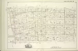
Background imageCartographic Collection: Vol. 6. Plate, M. Map bound by Grand St. Seventh St

Vol. 6. Plate, M. Map bound by Grand St. Seventh St. Broadway, S. Sixth St. East River; Including S. First St. S. Second St. S. Third St. S. Fourth St. S. Fifth St. River St. First St. Second St

Background imageCartographic Collection: Vol. 6. Plate, J. Map bound by Sixth St. N. 6th St. Fifth St. Union Ave. Tenth St

Vol. 6. Plate, J. Map bound by Sixth St. N. 6th St. Fifth St. Union Ave. Tenth St
Vol. 6. Plate, J. Map bound by Sixth St. N.6th St. Fifth St. Union Ave. Tenth St. Grand St.; Including Seventh St. Eighth St. Ninth St. Hope St. Ainslie St. N.2nd St. 5th St. N.7th St. N.8th St

Background imageCartographic Collection: Vol. 6. Plate, L. Map bound by N. 6th St. Sixth St. Grand St. East River; Including N

Vol. 6. Plate, L. Map bound by N. 6th St. Sixth St. Grand St. East River; Including N
Vol. 6. Plate, L. Map bound by N.6th St. Sixth St. Grand St. East River; Including N.5th St. N.4th St. N.3rd St. N.2nd St. Fillmore Pl. N.1St St. First St. Second St. Third St. Fourth St. Fifth St

Background imageCartographic Collection: Vol. 6. Plate, K. Map bound by Bushwick Inlet, N

Vol. 6. Plate, K. Map bound by Bushwick Inlet, N.14th St. Fifth St. N.6th St. East River; Including Banker St. N.13th St. N.12th St. N.11th St. N.10th St. N.9th St. N.8th St. N.7th St. First St

Background imageCartographic Collection: Vol. 6. Plate, I. Map bound by Conselyea St. Bushwick Ave. Ten Eyck St. S. Second St

Vol. 6. Plate, I. Map bound by Conselyea St. Bushwick Ave. Ten Eyck St. S. Second St. Eleventh St. Grand St. Tenth St. Union Ave.; Including N. Second St. Devoe St. Ainslie St. Hope St. Powers St. S

Background imageCartographic Collection: Vol. 6. Plate, G. Map bound by Norman Ave. Kingsland Ave. Meserole Ave. Charlick St

Vol. 6. Plate, G. Map bound by Norman Ave. Kingsland Ave. Meserole Ave. Charlick St. Newtown Creek, Meeker Ave. Van Pelt Ave. N. Henry St. Van Cott Ave. Russell St.; Including Webster St. Pollock St

Background imageCartographic Collection: Vol. 4. Plate, M. Map bound by Greenwood Cemetery, City Line, Forty-Fourth St. Fifth Ave

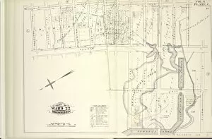
Vol. 4. Plate, M. Map bound by Greenwood Cemetery, City Line, Forty-Fourth St. Fifth Ave.; Including Thirty-Seventh St. Thirty-Eighth St. Thirty-Ninth St. Fortieth St. Forty-First St

Background imageCartographic Collection: Vol. 4. Plate, L. Map bound by Thirty-Sixth, Fifth Ave

Vol. 4. Plate, L. Map bound by Thirty-Sixth, Fifth Ave. Forty-Fourth St. Gowanus Bay; Including Third St. Forty-Fourth St. Thirty-Seventh St. Thirty-Eighth St. Thirty-Ninth St. Fortieth St

Background imageCartographic Collection: Vol. 4. Plate, K. Map bound by Twenty-Eighth St. Fifth Ave. Thirty-Sixth St. First Ave

Vol. 4. Plate, K. Map bound by Twenty-Eighth St. Fifth Ave. Thirty-Sixth St. First Ave.; Including Twenty-Ninth St. Thirtieth St. Thirty-First St. Thirty-Second St. Thirty-Third St. Thirty-Fourth St

Background imageCartographic Collection: Vol. 4. Plate, I. Map bound by Ninth Ave

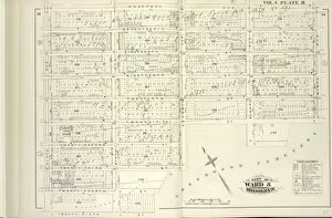
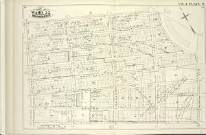
Vol. 4. Plate, I. Map bound by Ninth Ave. Prospect Park, City Line, Greenwood Cemetery; Including Howard Pl. Fuller Pl. Tenth Ave. Eleventh Ave. Twenty-Second St. Twenty-First St. Nineteenth St

Background imageCartographic Collection: Vol. 4. Plate, H. Map bound by Prospect Ave

Vol. 4. Plate, H. Map bound by Prospect Ave. Ninth Ave. Greenwood Cemetery, Twenty-Fifth St. Fifth Ave.; Including Seventeenth St. Eighteenth St. Nineteenth St. Twentieth St. Twenty-First St

Background imageCartographic Collection: Vol. 4. Plate, G. Map bound by Thirteenth St

Vol. 4. Plate, G. Map bound by Thirteenth St. Fifth Ave. Twentieth St. Gowanus Bay; Including Fourteenth St. Fifteenth St. Fifteenth St. Sixteenth St. Prospect Ave. Seventeenth St. Eighteenth St

Background imageCartographic Collection: Vol. 4. Plate, F. Map bound by Tenth St. Ninth Ave

Vol. 4. Plate, F. Map bound by Tenth St. Ninth Ave. Prospect Ave. Fifth Ave.; Including Eleventh St. Twelfth St. Thirteen St. Fourteenth St. Fifteenth St. Sixteenth St. Sixth Ave. Webster Pl

Background imageCartographic Collection: Vol. 4. Plate, E. Map bound by First St. Ninth Ave

Vol. 4. Plate, E. Map bound by First St. Ninth Ave. Tenth St. Fifth Ave.; Including Second St. Third St. Fourth St. Fifth St. Sixth St. Seventh St. Eighth St. Ninth St. Sixth Ave. Seventh Ave

Background imageCartographic Collection: Vol. 4. Plate, C. Map bound by Fifth Ave

Vol. 4. Plate, C. Map bound by Fifth Ave. Fifth St. Sixth St. Second Ave. Gowanus Canal, First St. Fourth Ave. Douglass Ave.; Including Third Ave. Degraw St. Sackett St. Union St. President St

Background imageCartographic Collection: Vol. 4. Plate, D. Map bound by Fifth St. Sixth St

Vol. 4. Plate, D. Map bound by Fifth St. Sixth St. Fifth Ave. Thirteenth St. First Ave. Gowanus Canal; Including Seventh St. Eighth St. Ninth St. Tenth St. Eleventh St. Twelfth St. Second Ave

Background imageCartographic Collection: Vol. 4. Plate, B. Map bound by St. Johns Place, PLaza, Ninth Ave. First St. Fifth Ave

Vol. 4. Plate, B. Map bound by St. Johns Place, PLaza, Ninth Ave. First St. Fifth Ave.; Including Lincoln Place, Sackett St. Union St. President St. Carroll St. Macomb St. Sixth Ave. Seventh Ave

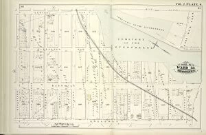
Background imageCartographic Collection: Vol. 2. Plate, S. Map bound by Central Ave. Cemetery of the Evergreens, City Line

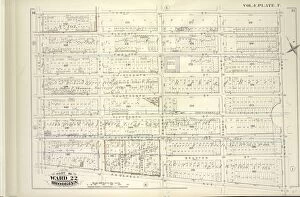
Vol. 2. Plate, S. Map bound by Central Ave. Cemetery of the Evergreens, City Line, Broadway, Schaeffer St.; Including Evergreen Ave. Bushwick Ave. Van Voorhees St. Cooper St. Fairfax St. Pilling St

Background imageCartographic Collection: Vol. 4. Plate, A. Map bound by Atlantic Ave. Flatbush Ave. St. Johns Place, Douglass St

Vol. 4. Plate, A. Map bound by Atlantic Ave. Flatbush Ave. St. Johns Place, Douglass St. Fourth Ave.; Including Pacific St. Dean St. Berg St. Wyckoff St. St. Marks Ave. Warren St. Prospect Pl

Background imageCartographic Collection: Vol. 2. Plate, R. Map bound by City Line, Cemetery Lane, Central Ave

Vol. 2. Plate, R. Map bound by City Line, Cemetery Lane, Central Ave. Weirfield; Including Irving Ave. Knickerbocker Ave. Hamburg St. Margaretta St. Eldert St. Covert St. Schaeffer St

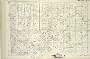
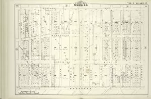
Background imageCartographic Collection: Vol. 2. Plate, P. Map bound by Central Ave. Schaeffer St. Broadway, Magnolia St

Vol. 2. Plate, P. Map bound by Central Ave. Schaeffer St. Broadway, Magnolia St.; Including Evergreen Ave. Bushwick Ave. Palmetto St. Woodbine St. Ivy St. Jacob St. Cornelia St. Vigelius St

Background imageCartographic Collection: Vol. 2. Plate, Q. Map bound by Magnolia St. City Line, Weirfield St. Central Ave

Vol. 2. Plate, Q. Map bound by Magnolia St. City Line, Weirfield St. Central Ave.; Including Palmetto St. Woodbine St. Ivy St. Jacob St. Cornelia St. Vigelius St. Duryea St. Hamburg St

Background imageCartographic Collection: Vol. 2. Plate, N. Map bound by La Fayette Ave. Himrod St. Stanhope St. Hamburg St

Vol. 2. Plate, N. Map bound by La Fayette Ave. Himrod St. Stanhope St. Hamburg St. Magnolia St. Broadway; Including Van Buren Ave. Harman St. Greene Ave. Bleecker St. Ralph St. Grove St. Linden St

Background imageCartographic Collection: Vol. 2. Plate, O. Map bound by Stanhope St. Wyckoff Ave. Greene Ave. St. Nicholas Ave

Vol. 2. Plate, O. Map bound by Stanhope St. Wyckoff Ave. Greene Ave. St. Nicholas Ave. Magnolia St. Hamburg St.; Including Himrod St. Harman St. Bleecker St. Ralph St. Grove St. Linden St

Background imageCartographic Collection: Vol. 5. Plate, H. Map bound by Atlantic Ave

Vol. 5. Plate, H. Map bound by Atlantic Ave. Clinton St. Harrison St. East River; Including Pacific St. Amity St. Congress St. Verandan Pl. Warren St. Baltic St. Columbia St. Hicks St. Henry St

Background imageCartographic Collection: Vol. 5. Plate, G. Map bound by Washington Park, Portland Ave. Atlantic Ave. Fourth Ave

Vol. 5. Plate, G. Map bound by Washington Park, Portland Ave. Atlantic Ave. Fourth Ave. Flatbush Ave. Fulton St. Fleet St. Fleet Pl. Bolivar St.; Including Elliot Place, Canton St

Background imageCartographic Collection: Vol. 5. Plate, F. Map bound by Johnson St. Pearl St. Myrtle Ave. Fleet Place, Fleet St

Vol. 5. Plate, F. Map bound by Johnson St. Pearl St. Myrtle Ave. Fleet Place, Fleet St. Bond St. State St. Boerum St. Atlantic Ave. Court St. Fulton St.; Including Fair St. Willoughby St

Background imageCartographic Collection: Vol. 5. Plate, E. Map bound by Pierrepont St. Fulton St. Court St. Atlantic Ave

Vol. 5. Plate, E. Map bound by Pierrepont St. Fulton St. Court St. Atlantic Ave. East River; Including Montague St. Remsen St. Grace Court, Joralemon St. Livingston St. Schermerhorn St. State St

Background imageCartographic Collection: Vol. 5. Plate, D. Map bound by Sands St. U. S. Navy Yard, Portland Ave. Myrtle Ave

Vol. 5. Plate, D. Map bound by Sands St. U. S. Navy Yard, Portland Ave. Myrtle Ave
Vol. 5. Plate, D. Map bound by Sands St. U.S. Navy Yard, Portland Ave. Myrtle Ave. Canton St. Bolivar St. Fleet Place, Pearl St. Concord St. Jay St.; Including High St. Nassau St. Flushing Ave

Background imageCartographic Collection: Vol. 5. Plate, C. Map bound by Poplar St. Sands St. Jay St. Pearl St. Johnson St

Vol. 5. Plate, C. Map bound by Poplar St. Sands St. Jay St. Pearl St. Johnson St. Pierrepont St. East River; Including Middagh St. High St. Cranberry St. Orange St. Nassau St. Pineapple St


All Professionally Made to Order for Quick Shipping

"Unveiling the World Through Cartographic Masterpieces" Step back in time and embark on a journey through history with these captivating cartographic treasures. From Al-Idrisi's world map of 1154 to Orteliuss' intricate creations from the 16th century, each map tells a unique story about the world as it was known at that time. Al-Idrisi's world map, crafted in 1154, offers a glimpse into medieval Islamic geography, showcasing an impressive understanding of global trade routes and geographical features. Meanwhile, the British Empire world map from the 19th century illustrates the vast extent of Britain's dominion across continents and oceans. The Catalan Atlas transports us to the 14th century with its exquisite craftsmanship and detailed depictions of various regions. It serves as a testament to Catalonia's rich maritime tradition and exploration during this period. Orteliuss' maps take center stage throughout this collection, providing invaluable insights into specific regions such as Ottoman Empire, Italy, Poland, Greece, Germany, Netherlands - all meticulously documented in his renowned Theatrum Orbis Terrarum. These masterpieces not only showcase Orteliuss' cartographic expertise but also shed light on political boundaries and cultural nuances prevalent during his era. Moving closer to home is the Map of City Dublin from 1797 which showcases Ireland's capital city at that time - offering glimpses into its urban layout and architectural landmarks that have shaped Dublin's identity over centuries. Lastly Zaragoza’s (19th c. ) Map takes us to Spain where we can explore Madrid through intricate details capturing its streetscape during that period - allowing us to immerse ourselves in Spanish history while navigating through its vibrant capital city. These remarkable cartographic works serve as windows into our past – they are not just maps; they are gateways connecting us with bygone eras.