Fraud Blocker Skip to main content

Cartographic Collection (page 4)

"Unveiling the World Through Cartographic Masterpieces" Step back in time and embark on a journey through history with these captivating cartographic treasures

Background imageCartographic Collection: Canada to Louisiana, Eastern USA, 1756

Canada to Louisiana, Eastern USA, 1756
2902815 Canada to Louisiana, Eastern USA, 1756; (add.info.: Canada to Louisiana, Eastern USA, 1756.); Buyenlarge Archive/UIG.

Background imageCartographic Collection: China - Hainan Island, 1737

China - Hainan Island, 1737
2902866 China - Hainan Island, 1737; (add.info.: China - Hainan Island, 1737.); Buyenlarge Archive/UIG.

Background imageCartographic Collection: English Claims to North America, 1755

English Claims to North America, 1755
2902802 English Claims to North America, 1755; (add.info.: The English empire in North America; Representing their rightful claim as confirmed by charters)

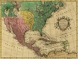
Background imageCartographic Collection: North America, 1811

North America, 1811
2902788 North America, 1811; (add.info.: North America, 1811.); Buyenlarge Archive/UIG.

Background imageCartographic Collection: Coahila

Coahila
2902782 Coahila; (add.info.: Coahila, 1844.); Buyenlarge Archive/UIG.

Background imageCartographic Collection: Mexico Federal District, 1844

Mexico Federal District, 1844
2902780 Mexico Federal District, 1844; (add.info.: Mexico Federal District, 1844.); Buyenlarge Archive/UIG.

Background imageCartographic Collection: Morelos, 1844

Morelos, 1844
2902776 Morelos, 1844; (add.info.: Morelos, 1844.); Buyenlarge Archive/UIG.

Background imageCartographic Collection: Coahila

Coahila
2902763 Coahila; (add.info.: Coahila, 1844.); Buyenlarge Archive/UIG.

Background imageCartographic Collection: European Russia, North, 1745

European Russia, North, 1745
2902747 European Russia, North, 1745; (add.info.: European Russia, North, 1745.); Buyenlarge Archive/UIG.

Background imageCartographic Collection: Kiev, Smolensk - Voronezh, Russia, 1745

Kiev, Smolensk - Voronezh, Russia, 1745
2902746 Kiev, Smolensk - Voronezh, Russia, 1745; (add.info.: Kiev, Smolensk - Voronezh, Russia, 1745.); Buyenlarge Archive/UIG.

Background imageCartographic Collection: St Petersburg, the White Sea and the Source of the Volga, 1745

St Petersburg, the White Sea and the Source of the Volga, 1745
2902743 St Petersburg, the White Sea and the Source of the Volga, 1745; (add.info.: St. Petersburg, the White Sea and the Source of the Volga, 1745.); Buyenlarge Archive/UIG.

Background imageCartographic Collection: Russian Lapland, 1745

Russian Lapland, 1745
2902742 Russian Lapland, 1745; (add.info.: Lapponia or Laponia is the Latin name of the historic region, later province (landskap) of Lapland

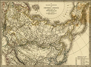
Background imageCartographic Collection: Imperial Russia, 1876

Imperial Russia, 1876
2902727 Imperial Russia, 1876; (add.info.: Imperial Russia, 1876.); Buyenlarge Archive/UIG.

Background imageCartographic Collection: Palestine and Adjacent Countries, 1849

Palestine and Adjacent Countries, 1849
2902288 Palestine and Adjacent Countries, 1849; (add.info.: Palestine and Adjacent Countries, 1849.); Buyenlarge Archive/UIG.

Background imageCartographic Collection: Kafiristan, 1881

Kafiristan, 1881
2902275 Kafiristan, 1881; (add.info.: Kafiristan, 1881.); Buyenlarge Archive/UIG.

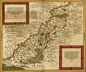
Background imageCartographic Collection: Portuguese Map of the Red Sea, The Middle east, 1630

Portuguese Map of the Red Sea, The Middle east, 1630
2902267 Portuguese Map of the Red Sea, The Middle east, 1630; (add.info.: Portuguese Map of the Red Sea, The Middle east, 1630.); Buyenlarge Archive/UIG.

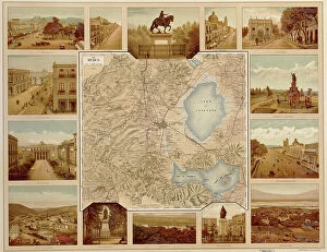
Background imageCartographic Collection: Mexican statuary, plazas, courtyards, thoroughfares, roads, 1885

Mexican statuary, plazas, courtyards, thoroughfares, roads, 1885
2902265 Mexican statuary, plazas, courtyards, thoroughfares, roads, 1885; (add.info.: Historic map of Mexico with Mexican statuary, plazas, courtyards, thoroughfares, roads, 1885)

Background imageCartographic Collection: Mexican map of Major Physical Geologic Features, 1885

Mexican map of Major Physical Geologic Features, 1885
2902258 Mexican map of Major Physical Geologic Features, 1885; (add.info.: Mexican map of Major Physical Geologic Features, mountains, volcanoes, grottos, forests, plateaus)

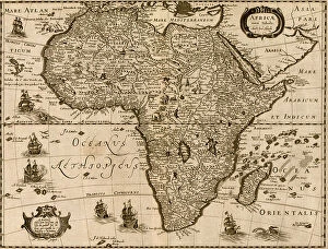
Background imageCartographic Collection: Africa, 1640

Africa, 1640
2902123 Africa, 1640; (add.info.: Africa, 1640.); Buyenlarge Archive/UIG.

Background imageCartographic Collection: African Languages, 1883

African Languages, 1883
2902116 African Languages, 1883; (add.info.: African Languages, 1883.); Buyenlarge Archive/UIG.

Background imageCartographic Collection: Africa, 1740

Africa, 1740
2902109 Africa, 1740; (add.info.: Shows boundaries, rivers, forests and principal settlements, with tents symbolizing areas inhabited by nomads.); Buyenlarge Archive/UIG.

Background imageCartographic Collection: Seat of War in Africa, 1899

Seat of War in Africa, 1899
2902106 Seat of War in Africa, 1899; (add.info.: Seat of War in Africa, 1899.); Buyenlarge Archive/UIG.

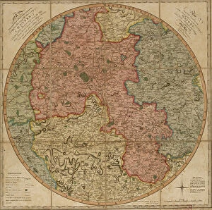
Background imageCartographic Collection: Oxford University Area Pocket Guide, England, 1805

Oxford University Area Pocket Guide, England, 1805
2902839 Oxford University Area Pocket Guide, England, 1805; (add.info.: A new and accurate map of the country for twenty five miles round the University of Oxford)

Background imageCartographic Collection: Ireland, 1849

Ireland, 1849
2902838 Ireland, 1849; (add.info.: Ireland, 1849.); Buyenlarge Archive/UIG.

Background imageCartographic Collection: Naval Military Map of the United States, 1862

Naval Military Map of the United States, 1862
2902808 Naval Military Map of the United States, 1862; (add.info.: Naval Military Map of the United States, 1862.); Buyenlarge Archive/UIG.

Background imageCartographic Collection: Tlaxcala, 1844

Tlaxcala, 1844
2902778 Tlaxcala, 1844; (add.info.: Tlaxcala, 1844.); Buyenlarge Archive/UIG.

Background imageCartographic Collection: Mexico, 1844

Mexico, 1844
2902775 Mexico, 1844; (add.info.: Mexico, 1844.); Buyenlarge Archive/UIG.

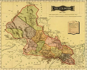
Background imageCartographic Collection: San Luis Potosi

San Luis Potosi
2902771 San Luis Potosi; (add.info.: San Luis Potosi, 1844.); Buyenlarge Archive/UIG.

Background imageCartographic Collection: Michoacan, 1844

Michoacan, 1844
2902764 Michoacan, 1844; (add.info.: Michoacan, 1844.); Buyenlarge Archive/UIG.

Background imageCartographic Collection: Sinaloa

Sinaloa
2902761 Sinaloa; (add.info.: Sinaloa, 1844.); Buyenlarge Archive/UIG.

Background imageCartographic Collection: New Brighton

New Brighton
2903133 New Brighton; (add.info.: New Brighton, Pennsylvania, 1883.); Buyenlarge Archive/UIG.

Background imageCartographic Collection: Towanda, Pennsylvania, 1880

Towanda, Pennsylvania, 1880
2903101 Towanda, Pennsylvania, 1880; (add.info.: Towanda, Pennsylvania, 1880.); Buyenlarge Archive/UIG.

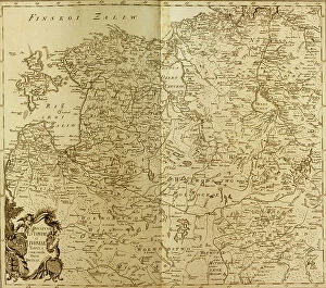
Background imageCartographic Collection: Estonia - Lithuania, 1745

Estonia - Lithuania, 1745
2902744 Estonia - Lithuania, 1745; (add.info.: Estonia - Lithuania, 1745.); Buyenlarge Archive/UIG.

Background imageCartographic Collection: map of Haiti, Santo Domingo - Hispaniola, 18th century (engraving)

map of Haiti, Santo Domingo - Hispaniola, 18th century (engraving)
2902890 map of Haiti, Santo Domingo - Hispaniola, 18th century (engraving); Buyenlarge Archive/UIG.

Background imageCartographic Collection: Portuguese Navigational Map of Caribbean Ports, 1630

Portuguese Navigational Map of Caribbean Ports, 1630
2902886 Portuguese Navigational Map of Caribbean Ports, 1630; (add.info.: Portuguese Navigational Map of Caribbean Ports, 1630.); Buyenlarge Archive/UIG.

Background imageCartographic Collection: The West Indies, 1782

The West Indies, 1782
2902873 The West Indies, 1782; (add.info.: Map of the West Indies.); Buyenlarge Archive/UIG.

Background imageCartographic Collection: West Indies and the adjacent parts of North and South America, 1755

West Indies and the adjacent parts of North and South America, 1755
2902872 West Indies and the adjacent parts of North and South America, 1755; (add.info.: West Indies and the adjacent parts of North and South America, 1755.); Buyenlarge Archive/UIG.

Background imageCartographic Collection: The Three Arabias, 1654

The Three Arabias, 1654
2902859 The Three Arabias, 1654; (add.info.: The Three Arabias, 1654.); Buyenlarge Archive/UIG.

Background imageCartographic Collection: Ulster, Ireland, 1885

Ulster, Ireland, 1885
2902829 Ulster, Ireland, 1885; (add.info.: Ulster, Ireland, 1885.); Buyenlarge Archive/UIG.

Background imageCartographic Collection: Quebec, Canada - French North America, 1700

Quebec, Canada - French North America, 1700
2902806 Quebec, Canada - French North America, 1700; (add.info.: Quebec, Canada - French North America, 1700.); Buyenlarge Archive/UIG.

Background imageCartographic Collection: New France, 1673

New France, 1673
2902804 New France, 1673; (add.info.: New France, 1673.); Buyenlarge Archive/UIG.

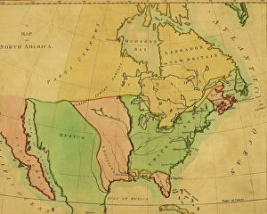
Background imageCartographic Collection: North America, 1763

North America, 1763
2902789 North America, 1763; (add.info.: North America, 1763.); Buyenlarge Archive/UIG.

Background imageCartographic Collection: North America, 1803

North America, 1803
2902784 North America, 1803; (add.info.: North America, 1803.); Buyenlarge Archive/UIG.

Background imageCartographic Collection: Durango, 1844

Durango, 1844
2902768 Durango, 1844; (add.info.: Durango, 1844.); Buyenlarge Archive/UIG.

Background imageCartographic Collection: Chipas, 1844

Chipas, 1844
2902767 Chipas, 1844; (add.info.: Chipas, 1844.); Buyenlarge Archive/UIG.

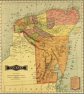
Background imageCartographic Collection: Yucatan

Yucatan
2902760 Yucatan; (add.info.: Yucatan, 1844.); Buyenlarge Archive/UIG.

Background imageCartographic Collection: The Moscow Region, Russia, 1745

The Moscow Region, Russia, 1745
2902745 The Moscow Region, Russia, 1745; (add.info.: The Moscow Region, Russia, 1745.); Buyenlarge Archive/UIG.

Background imageCartographic Collection: Ludlow, Vermont, 1859 from South Hill

Ludlow, Vermont, 1859 from South Hill
2903020 Ludlow, Vermont, 1859 from South Hill; (add.info.: Ludlow, Vermont, 1859 from South Hill.); Buyenlarge Archive/UIG.


All Professionally Made to Order for Quick Shipping

"Unveiling the World Through Cartographic Masterpieces" Step back in time and embark on a journey through history with these captivating cartographic treasures. From Al-Idrisi's world map of 1154 to Orteliuss' intricate creations from the 16th century, each map tells a unique story about the world as it was known at that time. Al-Idrisi's world map, crafted in 1154, offers a glimpse into medieval Islamic geography, showcasing an impressive understanding of global trade routes and geographical features. Meanwhile, the British Empire world map from the 19th century illustrates the vast extent of Britain's dominion across continents and oceans. The Catalan Atlas transports us to the 14th century with its exquisite craftsmanship and detailed depictions of various regions. It serves as a testament to Catalonia's rich maritime tradition and exploration during this period. Orteliuss' maps take center stage throughout this collection, providing invaluable insights into specific regions such as Ottoman Empire, Italy, Poland, Greece, Germany, Netherlands - all meticulously documented in his renowned Theatrum Orbis Terrarum. These masterpieces not only showcase Orteliuss' cartographic expertise but also shed light on political boundaries and cultural nuances prevalent during his era. Moving closer to home is the Map of City Dublin from 1797 which showcases Ireland's capital city at that time - offering glimpses into its urban layout and architectural landmarks that have shaped Dublin's identity over centuries. Lastly Zaragoza’s (19th c. ) Map takes us to Spain where we can explore Madrid through intricate details capturing its streetscape during that period - allowing us to immerse ourselves in Spanish history while navigating through its vibrant capital city. These remarkable cartographic works serve as windows into our past – they are not just maps; they are gateways connecting us with bygone eras.