Fraud Blocker Skip to main content

Cartography Collection (page 2)

Cartography, the art of mapmaking, has a rich history that spans centuries and continents

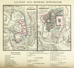
Background imageCartography Collection: Ancient and Modern Jerusalem Map Engraving

Ancient and Modern Jerusalem Map Engraving
Engraved illustration of Ancient and Modern Jerusalem Map Engraving from The Popular Pictorial Bible, Containing the Old and New Testaments, Published in 1862. Copyright has expired on this artwork

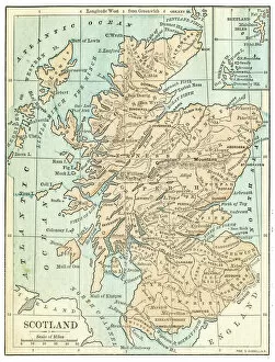
Background imageCartography Collection: Scotland map 1875

Scotland map 1875
The Independent Course Comprehensive Geography by James Monteith, A.S. Barnes & Co, New York & Chicago 1875

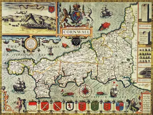
Background imageCartography Collection: Map of Cornwall from the Theatre of the Empire of Great Britain, pub

Map of Cornwall from the Theatre of the Empire of Great Britain, pub
BAL16023 Map of Cornwall from the Theatre of the Empire of Great Britain, pub. in London by George Humble, 1627 edition (hand coloured engraving) by Speed, John (1552-1629); Map House, London

Background imageCartography Collection: Oldest map of Palestine, mosaic, dated AD 560, St. Georges Church, Madaba, Jordan
Oldest map of Palestine, mosaic, dated AD 560, St. Georges Church, Madaba, Jordan, Middle East

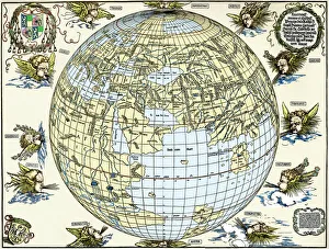
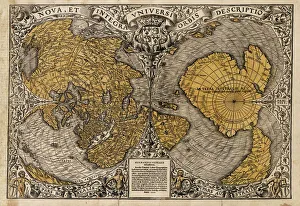
Background imageCartography Collection: Durers world map, 1515

Durers world map, 1515. Albrecht Durer (1471- 1528) was a German artist. His skillful use of perspective and mathematical proportions made him one of the outstanding artistic figures of the early

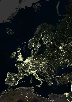
Background imageCartography Collection: Europe at night, satellite image

Europe at night, satellite image. City lights (yellow) of increasing intensity show areas of increasing population, with areas of few lights being more sparsely populated

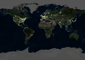
Background imageCartography Collection: Whole Earth at night, satellite image

Whole Earth at night, satellite image
Whole Earth map at night, satellite image. Here, Africa is seen at centre. City lights (yellow) of increasing intensity show areas of increasing population

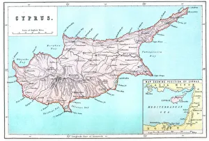
Background imageCartography Collection: Map of Cyprus

Map of Cyprus
Vintage 19th Century map of Cyprus in the eastern Mediterranean Sea

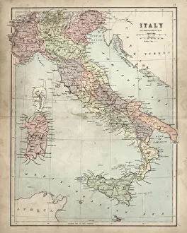
Background imageCartography Collection: Antique Damaged Map of Italy 19th Century

Antique Damaged Map of Italy 19th Century
Antique damaged map of Italy 19th Century

Background imageCartography Collection: Oronce Fines world map, 1531

Oronce Fines world map, 1531
Oronce Fines world map. Map of the worlds northern and southern hemispheres by the French mathematician and cartographer Oronce Fine (1494-1555)

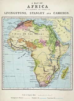
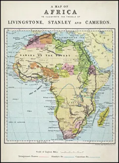
Background imageCartography Collection: Map of Africa illustrating travels of explorers

Map of Africa illustrating travels of explorers
A map of Africa which illustrates the travels of the explorers Livingstone, Stanley and Cameron

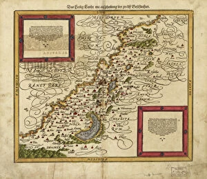
Background imageCartography Collection: Map of Palestine, 1588

Map of Palestine, 1588
16th century map of Palestine. North is towards upper right. Published in 1588, this German map shows the geography of Palestine, centred on the area that later become the state of Israel

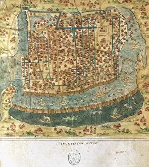
Background imageCartography Collection: Map of Tenochtitlan. Mexico, 1560. By Alonso de Santa Cruz

Map of Tenochtitlan. Mexico, 1560. By Alonso de Santa Cruz
Map of Tenochtitlan. Mexico, 1560. General islario of all the islands in the world. Work of the chronicler and cosmographer Alonso de Santa Cruz (1505-1567). National Library. Madrid. Spain

Background imageCartography Collection: 1886, Telescopic View and Map of the Moon, topography, cartography, geography, land

1886, Telescopic View and Map of the Moon, topography, cartography, geography, land
1886, Telescopic View and Map of the Moon

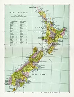
Background imageCartography Collection: Antique Map of New Zealand

Antique Map of New Zealand
Vintage map of New Zealand, from 1894

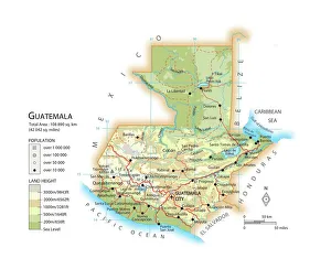
Background imageCartography Collection: Map of Guatemala

Map of Guatemala

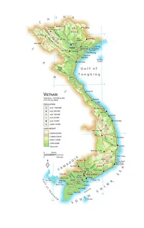
Background imageCartography Collection: Map of Vietnam

Map of Vietnam

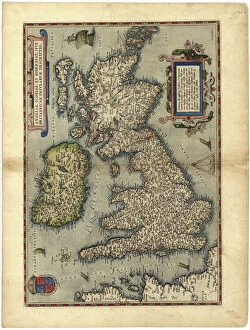
Background imageCartography Collection: 16th century map of the British Isles

16th century map of the British Isles
Map of the British Isles, in the 1570 edition of Ortelius Atlas (Theatrum Orbis Terrarum). Abraham Ortelius (1527-1598) was a Flemish mapmaker who is considered to have produced the first true atlas

Background imageCartography Collection: 16th Century Plan of Florence

16th Century Plan of Florence
16th century plan of Florence, Italy. Detail from the map of Etruria (Tuscany and Northern Lazio), in the Gallery of Maps in the Vatican Museum.The Gallery of Maps holds maps which were commissioned

Background imageCartography Collection: Map of Africa illustrating travels of explorers

Map of Africa illustrating travels of explorers
A map of Africa which illustrates the travels of Livingstone, Stanley and Cameron. Date: 19th Century

Background imageCartography Collection: Map of Europe, 1600

Map of Europe, 1600
16th century map of Europe. Published in Sienna in 1600, this Italian map shows the latest knowledge of the geography of Europe

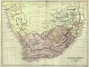
Background imageCartography Collection: Antique map of South Africa, 1884, 19th Century

Antique map of South Africa, 1884, 19th Century
Vintage engraving of Antique map of South Africa, 1884, 19th Century

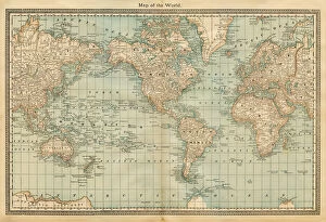
Background imageCartography Collection: map of the world 1882

map of the world 1882
map of the world - 1882

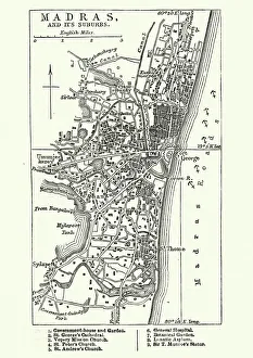
Background imageCartography Collection: Map of Madras (Chennai), India, 19th Century

Map of Madras (Chennai), India, 19th Century
Vintage engraving of Map of Madras (Chennai), India, 19th Century

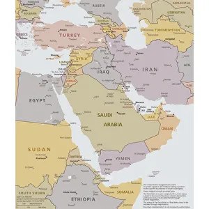
Background imageCartography Collection: Political map of The Middle East

Political map of The Middle East
Vector illustration of the policital map of The Middle East Reference map was created by the US Central Intelligence Agency

Background imageCartography Collection: The Babylonian Map of the World, c. 510-c. 500 BC. Artist: Assyrian Art

The Babylonian Map of the World, c. 510-c. 500 BC. Artist: Assyrian Art
The Babylonian Map of the World, c. 510-c. 500 BC. Found in the collection of British Museum

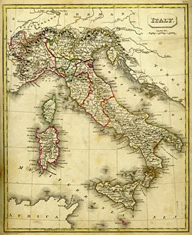
Background imageCartography Collection: Antquie Map of Italy

Antquie Map of Italy
Vintage map of Italy fron 1837

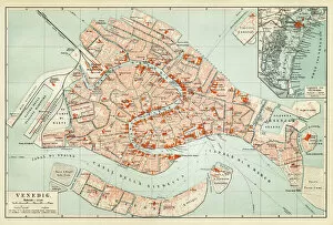
Background imageCartography Collection: Map of Venice 1897

Map of Venice 1897
Map of the city of Venice, Italy

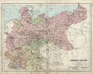
Background imageCartography Collection: Antique damaged map of German Empire 19th Century

Antique damaged map of German Empire 19th Century

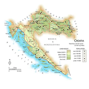
Background imageCartography Collection: Map of Croatia

Map of Croatia

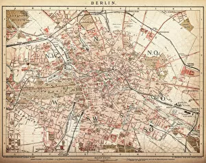
Background imageCartography Collection: Map of Berlin 1898

Map of Berlin 1898
Historic city map of Berlin, Germany. Lithograph, published in 1898

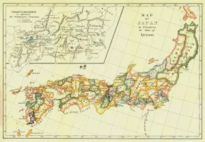
Background imageCartography Collection: Map of Japan in Provinces in time of Iyeyasu, 1903. Creator: Unknown

Map of Japan in Provinces in time of Iyeyasu, 1903. Creator: Unknown
Map of Japan in Provinces in time of Iyeyasu, 1903. Tokugawa Ieyasu (1543-1616) first shogun of the Tokugawa shogunate which ruled Japan from 1600-1868 and is known as the Edo period

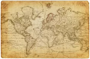
Background imageCartography Collection: Map of the world 1800

Map of the world 1800

Background imageCartography Collection: Map of Saint Lucia, 19th Century

Map of Saint Lucia, 19th Century
Vintage engraving of Map of Saint Lucia, 19th Century

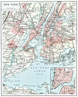
Background imageCartography Collection: Map of New York city 1896

Map of New York city 1896
Ilustration of a Map of New York city 1896

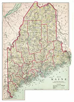
Background imageCartography Collection: Map of Maine USA 1883

Map of Maine USA 1883
Warrens Common School Geography

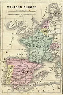
Background imageCartography Collection: France Spain Portugal map 1856

France Spain Portugal map 1856
Colton and Fitchs Modern School Geography by George W. Fitch - New York 1856

Background imageCartography Collection: Antique map of Hadrians wall

Antique map of Hadrians wall

Background imageCartography Collection: Iowa 1852 Map

Iowa 1852 Map

Background imageCartography Collection: Antique map of Scotland

Antique map of Scotland, 1864

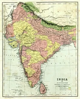
Background imageCartography Collection: Antique map of India

Antique map of India, 1864

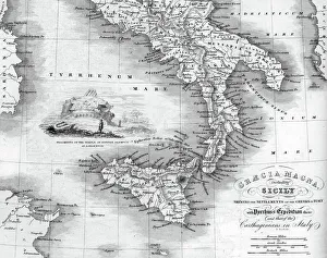
Background imageCartography Collection: Vintage map of Magna Graecia

Vintage map of Magna Graecia, showing the settlements of the ancient greeks in Italy. Magna GrA|cia is the name of the coastal areas of Southern Italy on the Tarentine Gulf that was extensively

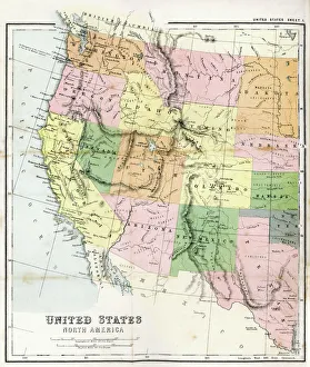
Background imageCartography Collection: Antique Map of Western USA

Antique Map of Western USA
Antique Map from 1867 of Western United States of America

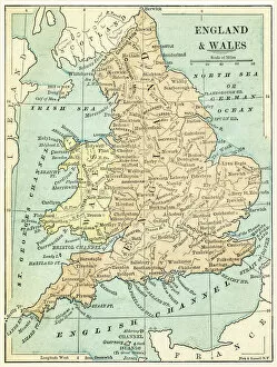
Background imageCartography Collection: England and Wales map 1875

England and Wales map 1875
The Independent Course Comprehensive Geography by James Monteith, A.S. Barnes & Co, New York & Chicago 1875

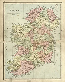
Background imageCartography Collection: Antique damaged map of Ireland in the 19th Century

Antique damaged map of Ireland in the 19th Century
Vintage engraving of a Antique damaged map of Ireland in the 19th Century, 1873

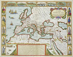
Background imageCartography Collection: A New Map of the Roman Empire, from A Prospect of the Most Famous Parts of the World, pub

A New Map of the Roman Empire, from A Prospect of the Most Famous Parts of the World, pub
BAL42841 A New Map of the Roman Empire, from A Prospect of the Most Famous Parts of the World, pub. by Bassett & Chiswell, 1676 (hand coloured plate engraving) by Speed

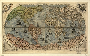
Background imageCartography Collection: 16th century world map

16th century world map
World map, published around 1565 in Venice, Italy, by Italian mapmaker Ferando Bertelli. The title of the map: Universale Descrittione di Tutta la Terra Conosciuta Fin Qui

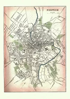
Background imageCartography Collection: Antique Map of Norwich, England, 1880

Antique Map of Norwich, England, 1880
Vintage Antquie Map of the city of Norwich, Norfolk, England in 1880


All Professionally Made to Order for Quick Shipping

Cartography, the art of mapmaking, has a rich history that spans centuries and continents. From ancient civilizations to modern times, maps have been used as powerful tools for navigation, exploration, and understanding the world around us. One notable example of early the Hereford Mappa Mundi, created in 1285 by Richard de Bello. This intricate map depicts a combination of geographical features and religious symbolism, offering a unique perspective on medieval Europe. Another remarkable piece is Al-Idrisi's world map from 1154. Crafted during the Islamic Golden Age, this map showcases an impressive level of detail and accuracy for its time. It highlights trade routes and important cities across Africa, Asia, and Europe. For those interested in British history, antique maps provide fascinating insights into different eras. An antique map depicting Britain under the Anglo Saxons offers a glimpse into the island's past before Norman conquests reshaped its landscape. Similarly captivating is an antique map showcasing the vast Roman Empire at its height. This visual representation allows us to trace their expansive territories across Europe, North Africa, and parts of Asia. Moving forward in time brings us to more recent cartographic works like the Map of Cyprus published in 1880. This detailed depiction captures not only geographical features but also cultural landmarks that define this Mediterranean island nation. Maps are not limited to landmasses alone; they can also illustrate political boundaries on larger scales. A Political Map of Africa provides valuable information about countries' borders and capital cities within this diverse continent. On a smaller scale but equally significant is California Highway Map—a practical tool for travelers navigating through one of America's most populous states with ease. Exploring historical empires leads us to delve into Byzantine history with a Map of the Byzantine Empire from the 9th century—showcasing Constantinople as its vibrant heart while encompassing regions stretching from Greece to Egypt.