Fraud Blocker Skip to main content

Cartography Collection (page 21)

Cartography, the art of mapmaking, has a rich history that spans centuries and continents

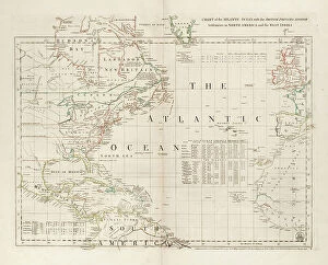
Background imageCartography Collection: Chart of the Atlantic Ocean, with the British, French & Spanish settlements in North America

Chart of the Atlantic Ocean, with the British, French & Spanish settlements in North America and the West Indies
7295390 Chart of the Atlantic Ocean, with the British, French & Spanish settlements in North America and the West Indies, 1753 (engraving) by Jefferys

Background imageCartography Collection: Falkland's Islands, c.1805 (coloured manuscript)

Falkland's Islands, c.1805 (coloured manuscript)
7295386 Falkland's Islands, c.1805 (coloured manuscript) by Unknown Artist, (19th century); 30x34.5 cm; National Maritime Museum, London, UK; (add.info.: Creator: Anonymous Single sheet)

Background imageCartography Collection: Map of Asia and America, 1777 (coloured engraving)

Map of Asia and America, 1777 (coloured engraving)
7295385 Map of Asia and America, 1777 (coloured engraving) by Krevelt, Abram van (1732-84); 26x390 cm; National Maritime Museum, London

Background imageCartography Collection: North America, c.1765 (coloured engraving)

North America, c.1765 (coloured engraving)
7295384 North America, c.1765 (coloured engraving) by Unknown artist, (18th century); 56x97 cm; National Maritime Museum, London, UK; (add.info.: Creator: Anonymous Single sheet. Hand col. engr)

Background imageCartography Collection: World map on vellum, c.1540 (vellum)

World map on vellum, c.1540 (vellum)
7295751 World map on vellum, c.1540 (vellum) by Italian School, (16th century); 35.4x50.8 cm; National Maritime Museum, London, UK; (add.info.: Creator: Brother of Giovanni Verrazano Single sheet)

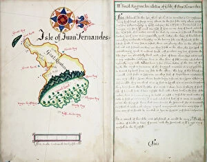
Background imageCartography Collection: Isle of Juan Fernandes, 1685 (bound sheet)

Isle of Juan Fernandes, 1685 (bound sheet)
7295405 Isle of Juan Fernandes, 1685 (bound sheet) by Hack, William (17th Century); 40.5x50 cm; National Maritime Museum, London

Background imageCartography Collection: Map of Virginia, 1585 (etching)

Map of Virginia, 1585 (etching)
7295569 Map of Virginia, 1585 (etching); 30x41.2 cm; National Maritime Museum, London, UK; (add.info.: This map was drawn by John White)

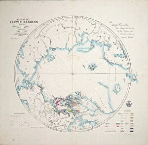
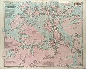
Background imageCartography Collection: Chart of the Arctic regions from the Admiralty surveys, third edition, c.1854 (engraving)

Chart of the Arctic regions from the Admiralty surveys, third edition, c.1854 (engraving)
7295402 Chart of the Arctic regions from the Admiralty surveys, third edition, c.1854 (engraving) by Wyld, James the Younger (1812-87); 37.5x40 cm; National Maritime Museum, London

Background imageCartography Collection: Discoveries in the Arctic Sea between Baffin Bay and Melville Island, 1851 (engraving)

Discoveries in the Arctic Sea between Baffin Bay and Melville Island, 1851 (engraving)
7295397 Discoveries in the Arctic Sea between Baffin Bay and Melville Island, 1851 (engraving) by Arrowsmith, John (1790-1873); 44x64 cm; National Maritime Museum, London

Background imageCartography Collection: Chart of discoveries made in the South Pacific Ocean in his majesty's ship 'Resolution' under

Chart of discoveries made in the South Pacific Ocean in his majesty's ship 'Resolution' under the command
7295394 Chart of discoveries made in the South Pacific Ocean in his majesty's ship 'Resolution' under the command of Captain Cook, 1777-76 (engraving) by Cook

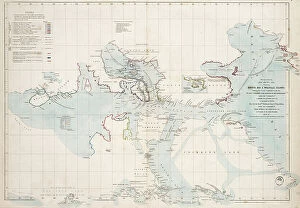
Background imageCartography Collection: The Arctic shores of America from Baffin Bay to Cape Bathurst, showing the coasts

The Arctic shores of America from Baffin Bay to Cape Bathurst, showing the coasts
7295391 The Arctic shores of America from Baffin Bay to Cape Bathurst, showing the coasts and rivers explored by the officers of the several British expeditions, between 1818 & 1859

Background imageCartography Collection: A general chart for the purpose of picking off a ship's track, 1860 (print)

A general chart for the purpose of picking off a ship's track, 1860 (print)
7337585 A general chart for the purpose of picking off a ship's track, 1860 (print) by British School, (19th century); 820 cm; National Maritime Museum, London

Background imageCartography Collection: 16th Century map of Russia by Herbestein

16th Century map of Russia by Herbestein
3330979 16th Century map of Russia by Herbestein; (add.info.: 16th Century map of Russia by Herbestein.); Universal History Archive/UIG.

Background imageCartography Collection: Map of the neighbourhood of San Juan in Madrid

Map of the neighbourhood of San Juan in Madrid
3329846 Map of the neighbourhood of San Juan in Madrid; (add.info.: Map of the neighbourhood of San Juan in Madrid during the 17th Century.); Universal History Archive/UIG.

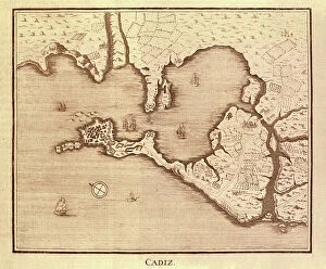
Background imageCartography Collection: Map of Cadiz by Antonio Ponz (1794). Engraving. SPAIN. MADRID (AUTONOMOUS COMMUNITY). Madrid

Map of Cadiz by Antonio Ponz (1794). Engraving. SPAIN. MADRID (AUTONOMOUS COMMUNITY). Madrid. National Library
CUL4869615 Map of Cadiz by Antonio Ponz (1794). Engraving. SPAIN. MADRID (AUTONOMOUS COMMUNITY). Madrid. National Library; Biblioteca Nacional, Madrid

Background imageCartography Collection: ROBERTS, David (1796-1864). Toledo Bridge in Madrid, circa 1832-1833. View of Madrid. Litography

ROBERTS, David (1796-1864). Toledo Bridge in Madrid, circa 1832-1833. View of Madrid. Litography. SPAIN
CUL4874946 ROBERTS, David (1796-1864). Toledo Bridge in Madrid, circa 1832-1833. View of Madrid. Litography. SPAIN. MADRID (AUTONOMOUS COMMUNITY). Madrid

Background imageCartography Collection: Theatrum Orbis Terrarum, 1570 (etching)

Theatrum Orbis Terrarum, 1570 (etching)
CUL4860343 Theatrum Orbis Terrarum, 1570 (etching) by Ortelius, Abraham (1527-98) (after); (add.info.: ORTELIUS, Abraham (1527-1598). Theatrum Orbis Terrarum. 1570

Background imageCartography Collection: BRAUN, George (1541-1622). ORTELIUS, Abraham (1527-1598). HOGENBERG, Franz (1535-1590)

BRAUN, George (1541-1622). ORTELIUS, Abraham (1527-1598). HOGENBERG, Franz (1535-1590)
CUL4853388 BRAUN, George (1541-1622). ORTELIUS, Abraham (1527-1598). HOGENBERG, Franz (1535-1590). Civitatis Orbis Terrarum (Theatrum orbis terrarum). 1572-1617. Granada (1572). Left detail

Background imageCartography Collection: BRAUN, George (1541-1622). ORTELIUS, Abraham (1527-1598). HOGENBERG, Franz (1535-1590)

BRAUN, George (1541-1622). ORTELIUS, Abraham (1527-1598). HOGENBERG, Franz (1535-1590)
CUL4853363 BRAUN, George (1541-1622). ORTELIUS, Abraham (1527-1598). HOGENBERG, Franz (1535-1590). Civitatis Orbis Terrarum (Theatrum orbis terrarum). 1572-1617. Paris (1572). Left lower detail

Background imageCartography Collection: Map of Antigua during the 18th Century

Map of Antigua during the 18th Century
3521866 Map of Antigua during the 18th Century; (add.info.: Map of Antigua during the 18th Century); Universal History Archive/UIG.

Background imageCartography Collection: Map depicting the Europeanisation of the World

Map depicting the Europeanisation of the World
3522059 Map depicting the Europeanisation of the World; (add.info.: Map depicting the Europeanisation of the World. Dated 19th Century); Universal History Archive/UIG.

Background imageCartography Collection: Strategic Map of Our War with Spain

Strategic Map of Our War with Spain
2902891 Strategic Map of Our War with Spain; (add.info.: Strategic Map of Our War with Spain, 1898.); Buyenlarge Archive/UIG.

Background imageCartography Collection: Point Royal, Jamaica New Granada, 18th century (engraving)

Point Royal, Jamaica New Granada, 18th century (engraving)
2902884 Point Royal, Jamaica New Granada, 18th century (engraving); Buyenlarge Archive/UIG.

Background imageCartography Collection: Plan of Guantanamo Bay, Cuba, 1751

Plan of Guantanamo Bay, Cuba, 1751
2902880 Plan of Guantanamo Bay, Cuba, 1751; (add.info.: Plan of Guantanamo Bay, Cuba, 1751.); Buyenlarge Archive/UIG.

Background imageCartography Collection: Guantanamo Bay, 1741

Guantanamo Bay, 1741
2902877 Guantanamo Bay, 1741; (add.info.: A plan of George Stadt Camp near the River Guantamano in the island of Cuba and also of the entrenchments made on the adjacent hills)

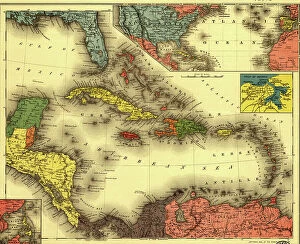
Background imageCartography Collection: The Evening Post map of the West Indies, 1898

The Evening Post map of the West Indies, 1898
2902870 The Evening Post map of the West Indies, 1898; (add.info.: The Evening Post map of the West Indies, 1898.); Buyenlarge Archive/UIG.

Background imageCartography Collection: China, 1864

China, 1864
2902864 China, 1864; (add.info.: China, 1864.); Buyenlarge Archive/UIG.

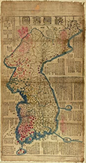
Background imageCartography Collection: Korea, 1822

Korea, 1822
2902862 Korea, 1822; (add.info.: Korea, 1822.); Buyenlarge Archive/UIG.

Background imageCartography Collection: China, 1700

China, 1700
2902861 China, 1700; (add.info.: China, 1700.); Buyenlarge Archive/UIG.

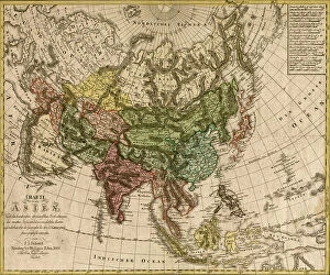
Background imageCartography Collection: Asia - 1805

Asia - 1805
2902852 Asia - 1805; (add.info.: Asia; - Charte von Asien - nach de bew?hrtesten astronomischen Beobachtungen den neuesten Reisen, und de vorz)

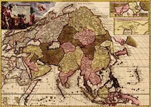
Background imageCartography Collection: Asia - 1680

Asia - 1680
2902849 Asia - 1680; (add.info.: Asia in praecipuas ipsius partes distributa, ad ovesrvationes academiae regiae scientiarum, et exquisitissimas tabulas, quae nunquam antehac lucem viderunt)

Background imageCartography Collection: Asia - 1835

Asia - 1835
2902846 Asia - 1835; (add.info.: Asia - 1835); Buyenlarge Archive/UIG.

Background imageCartography Collection: Asia - 1814

Asia - 1814
2902845 Asia - 1814; (add.info.: Asia - 1814); Buyenlarge Archive/UIG.

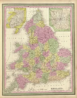
Background imageCartography Collection: England

England
2902836 England; (add.info.: England, 1849.); Buyenlarge Archive/UIG.

Background imageCartography Collection: London

London
2902834 London; (add.info.: London, England, 1682.); Buyenlarge Archive/UIG.

Background imageCartography Collection: Ireland, 1665

Ireland, 1665
2902831 Ireland, 1665; (add.info.: Ireland, 1665.); Buyenlarge Archive/UIG.

Background imageCartography Collection: Ireland, 1750

Ireland, 1750
2902830 Ireland, 1750; (add.info.: Ireland, 1750.); Buyenlarge Archive/UIG.

Background imageCartography Collection: Theatre of War, 1779

Theatre of War, 1779
2902817 Theatre of War, 1779; (add.info.: Theatre of War, 1779.); Buyenlarge Archive/UIG.

Background imageCartography Collection: Civil War Railroad Map, 1862

Civil War Railroad Map, 1862
2902811 Civil War Railroad Map, 1862; (add.info.: New railroad map of the middle states including New York, New Jersey, Pennsylvania, Delaware, Maryland, Ohio and Canada.); Buyenlarge Archive/UIG.

Background imageCartography Collection: America Divided amongst Claimants, 1694

America Divided amongst Claimants, 1694
2902803 America Divided amongst Claimants, 1694; (add.info.: America Divided amongst Claimants, 1694.); Buyenlarge Archive/UIG.

Background imageCartography Collection: Theatre of War in North America, 1755

Theatre of War in North America, 1755
2902794 Theatre of War in North America, 1755; (add.info.: Theatre of War in North America, 1755.); Buyenlarge Archive/UIG.

Background imageCartography Collection: America in 1754 (engraving)

America in 1754 (engraving)
2902791 America in 1754 (engraving); Buyenlarge Archive/UIG.

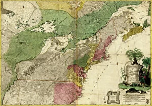
Background imageCartography Collection: British - French Claims to North America, 1756

British - French Claims to North America, 1756
2902790 British - French Claims to North America, 1756; (add.info.: British - French Claims to North America, 1756.); Buyenlarge Archive/UIG.

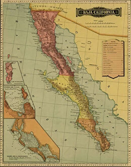
Background imageCartography Collection: Baja California, 1844

Baja California, 1844
2902779 Baja California, 1844; (add.info.: Baja California, 1844.); Buyenlarge Archive/UIG.

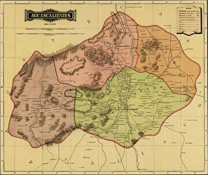
Background imageCartography Collection: Aguascalientes, 1844

Aguascalientes, 1844
2902770 Aguascalientes, 1844; (add.info.: Aguascalientes, 1844.); Buyenlarge Archive/UIG.

Background imageCartography Collection: Oaxaca, 1844

Oaxaca, 1844
2902766 Oaxaca, 1844; (add.info.: Oaxaca, 1844.); Buyenlarge Archive/UIG.

Background imageCartography Collection: Guerrero, 1844

Guerrero, 1844
2902765 Guerrero, 1844; (add.info.: Guerrero, 1844.); Buyenlarge Archive/UIG.

Background imageCartography Collection: Jalisco, 1844

Jalisco, 1844
2902762 Jalisco, 1844; (add.info.: Jalisco, 1844.); Buyenlarge Archive/UIG.


All Professionally Made to Order for Quick Shipping

Cartography, the art of mapmaking, has a rich history that spans centuries and continents. From ancient civilizations to modern times, maps have been used as powerful tools for navigation, exploration, and understanding the world around us. One notable example of early the Hereford Mappa Mundi, created in 1285 by Richard de Bello. This intricate map depicts a combination of geographical features and religious symbolism, offering a unique perspective on medieval Europe. Another remarkable piece is Al-Idrisi's world map from 1154. Crafted during the Islamic Golden Age, this map showcases an impressive level of detail and accuracy for its time. It highlights trade routes and important cities across Africa, Asia, and Europe. For those interested in British history, antique maps provide fascinating insights into different eras. An antique map depicting Britain under the Anglo Saxons offers a glimpse into the island's past before Norman conquests reshaped its landscape. Similarly captivating is an antique map showcasing the vast Roman Empire at its height. This visual representation allows us to trace their expansive territories across Europe, North Africa, and parts of Asia. Moving forward in time brings us to more recent cartographic works like the Map of Cyprus published in 1880. This detailed depiction captures not only geographical features but also cultural landmarks that define this Mediterranean island nation. Maps are not limited to landmasses alone; they can also illustrate political boundaries on larger scales. A Political Map of Africa provides valuable information about countries' borders and capital cities within this diverse continent. On a smaller scale but equally significant is California Highway Map—a practical tool for travelers navigating through one of America's most populous states with ease. Exploring historical empires leads us to delve into Byzantine history with a Map of the Byzantine Empire from the 9th century—showcasing Constantinople as its vibrant heart while encompassing regions stretching from Greece to Egypt.