
Continental Collection
"Exploring the Continents: From Al-Idrisi's World Map to Satellite Images of Earth" Discovering the world has always been a fascinating journey, and throughout history


All Professionally Made to Order for Quick Shipping
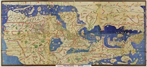
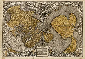
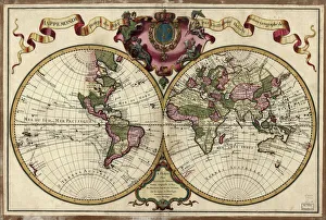
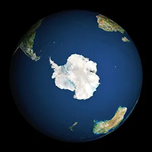
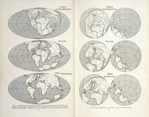
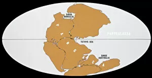
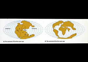
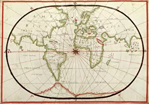
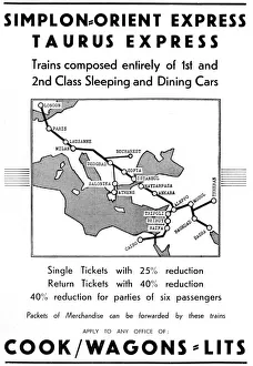
"Exploring the Continents: From Al-Idrisi's World Map to Satellite Images of Earth" Discovering the world has always been a fascinating journey, and throughout history, various maps and images have allowed us to explore the continents in different ways. In 1154, Al-Idrisi created a remarkable world map that showcased the vastness of our planet. Fast forward to modern times, where satellite imagery captures breathtaking views like Europe at night or an awe-inspiring snapshot of Earth from space. While maps provide us with geographical knowledge, they also serve as reminders of cultural milestones. The Bentley Continental R Mulliner represents luxury and elegance on wheels - a symbol of automotive craftsmanship that effortlessly traverses continents. Similarly, Oronce Fine's 1531 world map showcases how cartography evolved over time. Satellite images continue to amaze us with their ability to capture stunning visuals from above. North America at night reveals dazzling city lights illuminating its vast landscape while reminding us of human progress and innovation. On the other hand, Soho in London offers a glimpse into urban life on one particular street - 66 Old Compton Street W1 - bustling with activity day and night. Maps not only depict physical boundaries but also tell stories about our ever-changing planet. A map from 1720 takes us back in time when exploration was still ongoing, providing insights into how people perceived continents centuries ago. Additionally, continental drift maps shed light on geological processes that shape our landmasses even today. The Bentley R-Type Continental embodies both classic design and timeless sophistication—a testament to how automobiles can connect distant places through seamless travel experiences across continents. Lastly, continental drift reminds us that our Earth is constantly evolving; tectonic plates shift imperceptibly beneath our feet over millions of years—reshaping coastlines and forming mountain ranges—a reminder that change is inevitable.