Fraud Blocker Skip to main content

Earth Observation Collection (page 19)

"Earth Observation: Glimpses of Our Pale Blue Dot and Beyond" In the vast expanse of space

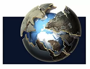
Background imageEarth Observation Collection: Earth after global warming

Earth after global warming. Computer artwork of a future Earth where the ice-caps have melted due to global warming. Greenland (green, upper left) has lost its ice-cap

Background imageEarth Observation Collection: 1906 San Francisco quake intensity map

1906 San Francisco quake intensity map
1906 San Francisco earthquake intensity map, as applied to the area in 2003. The earthquake of 18th April 1906 had a magnitude of around 7.9

Background imageEarth Observation Collection: Merapi volcano, Indonesia

Merapi volcano, Indonesia
Merapi volcano (2911 metres), Java, Indonesia, seen from the International Space Station (ISS). It is one of Indonesias most active volcanoes and its steam plume is seen being blown to lower left

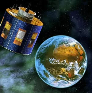
Background imageEarth Observation Collection: MSG-2 weather satellite, artwork

MSG-2 weather satellite, artwork. This Meteosat Second Generation (MSG) satellite is one of the weather satellites operated by EUMETSAT

Background imageEarth Observation Collection: Herschel orbital separation, artwork

Herschel orbital separation, artwork. The Herschel Space Observatory (left) was launched into space on 14 May 2009 by an Ariane 5 rocket

Background imageEarth Observation Collection: Oceanography satellites, artwork

Oceanography satellites, artwork
Oceanography satellites orbiting the Earth, artwork. They are Topex-Poseidon (left) and Jason-1 (right). Topex-Poseidon, launched in 1992

Background imageEarth Observation Collection: Global temperatures, artwork

Global temperatures, artwork
Global temperatures. Computer artwork of a map of the World showing the average temperatures for all the different land areas

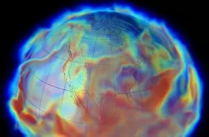
Background imageEarth Observation Collection: Atmospheric humidity, computer simulation

Atmospheric humidity, computer simulation
Atmospheric humidity. Computer simulation showing specific atmospheric humidity in the Earths northern hemisphere on 17th June 1993, during the Great Flood that hit the Midwestern United States

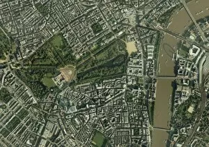
Background imageEarth Observation Collection: Central London, aerial view

Central London, aerial view. Buckingham Palace is at centre left. The river Thames is at right
Background imageEarth Observation Collection: Spider crater, Australia, satellite image

Spider crater, Australia, satellite image
Spider Crater, satellite image. This crater (centre left), in Western Australia, is estimated to have been formed between 900 and 600 million years ago. Vegetation is green and bare rock is red

Background imageEarth Observation Collection: Serra da Cangalha crater, Brazil

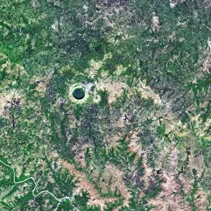
Serra da Cangalha crater, Brazil
Serra da Cangalha crater, satellite image. This impact crater, in Tocantins, Brazil, was formed 220 million years ago. It has a diameter of 12 kilometres. Vegetation is green, bare ground is purple

Background imageEarth Observation Collection: France-Italy border at night, ISS image

France-Italy border at night, ISS image. Image taken by astronauts aboard the International Space Station (ISS) of the border between France and Italy. North is centre bottom

Background imageEarth Observation Collection: Nicholson crater, Canada, satellite image

Nicholson crater, Canada, satellite image
Nicholson crater, satellite image. This crater, in the Northwest Territories, Canada, was formed by a meteorite impact 400 million years ago. Water is dark blue, ice is light blue

Background imageEarth Observation Collection: Tenoumer Crater, satellite image

Tenoumer Crater, satellite image. This impact crater is in Mauritania in the Sahara Desert. It is 1.9 kilometres in diameter and has a rim 110 metres high

Background imageEarth Observation Collection: Lonar Crater lake, India, satellite image

Lonar Crater lake, India, satellite image
Lonar Crater lake, India, Satellite image. The basin for this saltwater lake was formed by a meteorite impact roughly 50, 000 years ago. The crater is 1.8 kilometres in diameter and 137 metres deep

Background imageEarth Observation Collection: Barringer Crater, Arizona

Barringer Crater, Arizona
Barringer Crater, also known as Meteor Crater, Arizona, USA. The crater is about 170 metres deep and 1200 metres in diameter

Background imageEarth Observation Collection: Antarctic ozone hole, 2009

Antarctic ozone hole, 2009
Antarctic ozone hole. Satellite image of the ozone hole (blue) over Antarctica (centre) on 10th September 2009. Ozone layer thicknesses are colour coded from purple (lowest) through blue

Background imageEarth Observation Collection: San Francisco earthquake risk forecast

San Francisco earthquake risk forecast. Satellite image of California, USA, showing earthquake faults (red lines) and synthetic aperture radar patterns of seismic deformations resulting from a model

Background imageEarth Observation Collection: Sikhote-Alin meteorite site

Sikhote-Alin meteorite site (centre) seen from space. The Sikhote-Alin meteorite fell at around 10.30am on 12th February 1947, in the Sikhote-Alin Mountains, Siberia, Russia

Background imageEarth Observation Collection: Atlantic Ocean, ISS image

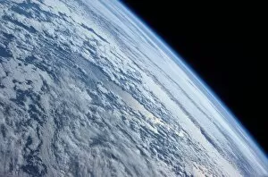
Atlantic Ocean, ISS image
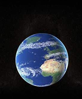
Atlantic Ocean. International Space Station (ISS) image of clouds over the Atlantic Ocean. Image taken by an expedition 7 crew member on 4th October 2003

Background imageEarth Observation Collection: Lake Yanisyarvi, satellite image

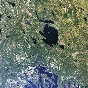
Lake Yanisyarvi, satellite image
Lake Yanisyarvi, Republic of Karelia, Russia. The basin for this lake was formed by a meteorite impact 700 million years ago. It measures 14 kilometres in diameter

Background imageEarth Observation Collection: Nordlinger Ries Crater, Germany

Nordlinger Ries Crater, Germany
Nordlinger Ries Crater, satellite image. The crater, whose perimeter is shown in orange, is located in Bravaria, Germany. The city of Nordlinger is located within the crater

Background imageEarth Observation Collection: Gosses Bluff crater, Australia

Gosses Bluff crater, Australia
Gosses Bluff crater, seen from spaces. This impact crater is 160 kilometres to the west of Alice Springs, Australia. It is seen between two mountain ranges

Background imageEarth Observation Collection: Aorounga Crater, Chad, satellite image

Aorounga Crater, Chad, satellite image
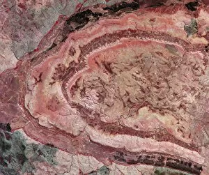
Aorounga Crater, satellite image. This impact crater is in the Sahara Desert, in Chad. It is one of the best-preserved impact structures in the world

Background imageEarth Observation Collection: Wolfe Creek Crater, Australia

Wolfe Creek Crater, Australia
Wolfe Creek Crater, Western Australia. This crater (round area with white centre at upper centre left) measures roughly 880 meters in diameter

Background imageEarth Observation Collection: Strait of Gibraltar, satellite image

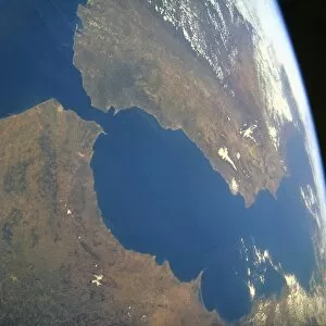
Strait of Gibraltar, satellite image. North is at top, land is brown and water is blue. The Strait of Gibraltar (narrow, blue, upper left) separates Spain (top) from Africa (bottom)

Background imageEarth Observation Collection: North Africa at night, ISS image

North Africa at night, ISS image
North Africa at night. International Space Station (ISS) image of Egypt (centre) and the Sinai Peninsula (bottom right) at night. The Mediterranean Sea is across top

Background imageEarth Observation Collection: Tabun Khara Obo crater, Mongolia

Tabun Khara Obo crater, Mongolia
Tabun Khara Obo crater, satellite image. This impact crater (upper left, indicated by orange arrows) is in the south east of Mongolia

Background imageEarth Observation Collection: Manicouagan Crater, Canada

Manicouagan Crater, Canada
Manicouagan Crater, satellite image. This crater in Quebec, Canada, was formed by a asteroid impact around 200 million years ago. It is thought the asteroid measured 5 kilometres in diameter

Background imageEarth Observation Collection: Pingualuit crater, Canada

Pingualuit crater, Canada
Pingualuit crater, satellite image. This impact crater (blue circle at centre left) is in northern Quebec, Canada. The crater measures 3.4 kilometres in diameter

Background imageEarth Observation Collection: Southwestern USA, ISS image

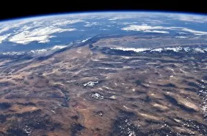
Southwestern USA, ISS image. Image taken by astronauts aboard the International Space Station (ISS) of the Southwestern United States and Pacific Ocean (upper half). North is right

Background imageEarth Observation Collection: Gulf of Mexico hurricane, isobar diagram

Gulf of Mexico hurricane, isobar diagram. The isobars (white lines) connect areas of equal pressure, and are used on meteorological maps to help predict future weather patterns

Background imageEarth Observation Collection: European severe storm, isobar diagram

European severe storm, isobar diagram. The isobars (white lines) connect areas of equal pressure, and are used on meteorological maps to help predict future weather patterns

Background imageEarth Observation Collection: Hurricane Emily, ISS image

Hurricane Emily, ISS image
Hurricane Emily. International Space Station (ISS) image of Hurricane Emily (eye at lower centre) passing over the southern Gulf of Mexico on 16 July 2005

Background imageEarth Observation Collection: Mekong River Delta, satellite image

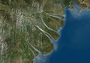
Mekong River Delta, satellite image. This delta is where the Mekong River flows into the South China Sea, on the southern coast of Vietnam

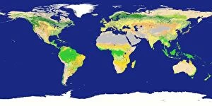
Background imageEarth Observation Collection: Earths land cover classification, 2003

Earths land cover classification, 2003. Produced using data obtained during 2003 from the MODIS instrument on NASAs Terra satellite

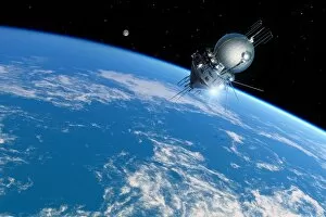
Background imageEarth Observation Collection: Vostok 1 orbiting the Earth, 1961

Vostok 1 orbiting the Earth, 1961
Vostok 1 orbiting the Earth. Artwork of the Vostok 1 spacecraft carrying Soviet cosmonaut Yuri Gagarin (1934-1968) around the Earth as the first human in space on 12 April 1961

Background imageEarth Observation Collection: Jakarta, 1976 - 2004

Jakarta, 1976 - 2004
Jakarta, Indonesia. Satellite image showing the growth of Jakarta, on the island of Java in Indonesia. Each square is 40 kilometres wide

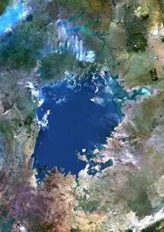
Background imageEarth Observation Collection: Lake Victoria, satellite image

Lake Victoria, satellite image. This African Great Lake is located between Kenya, Uganda and Tanzania. Composite image obtained using data from the Landsat 5 satellite

Background imageEarth Observation Collection: Libyan agriculture, satellite image

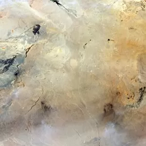
Libyan agriculture, satellite image. The dark green areas seen in the desert sands are numerous centre pivot irrigation fields. These ones are in the Libyan Desert, in the eastern part of Libya

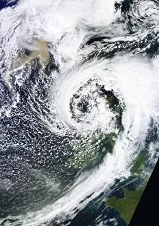
Background imageEarth Observation Collection: British Isles storm and ash plume, 2011

British Isles storm and ash plume, 2011

Background imageEarth Observation Collection: Grimsvotn ash plume, May 2011

Grimsvotn ash plume, May 2011, satellite image. This ash cloud (brown, lower right) has been produced by the eruption of the Grimsvotn volcano in Iceland

Background imageEarth Observation Collection: Space shuttle over Argentina and Chile

Space shuttle over Argentina and Chile
Space shuttle over the Andes. Photograph, taken by astronauts on board the International space Stations showing the NASA space shuttle orbiting over the Andean mountains in South america

Background imageEarth Observation Collection: International Space Station, 2011

International Space Station, 2011

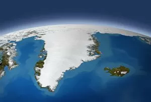
Background imageEarth Observation Collection: Greenland, artwork

Greenland, artwork
Greenland. Artwork of the Arctic island of Greenland, as seen from space. This view looks north, towards the Arctic pack ice on the Earths curved limb

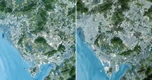
Background imageEarth Observation Collection: Shenzhen, China, 1999 - 2008

Shenzhen, China, 1999 - 2008, satellite image. Shenzhen is located in southern Chinas Guangdong province directly north of Hong Kong

Background imageEarth Observation Collection: A new start for Earth, conceptual image

A new start for Earth, conceptual image. Computer artwork representing the potential for the Earth to recover from current environmental concerns such as global warming and pollution

Background imageEarth Observation Collection: Mississippi Delta, satellite image

Mississippi Delta, satellite image
Mississippi Delta. True colour Landsat satellite image of the Mississippi River Delta, Louisiana, USA. North is at top. The Mississippi River is seen running from top left into the Gulf of Mexico at


All Professionally Made to Order for Quick Shipping

"Earth Observation: Glimpses of Our Pale Blue Dot and Beyond" In the vast expanse of space, Voyager 1 captured an awe-inspiring image that forever changed our perspective. The iconic "Pale Blue Dot" photograph revealed Earth as a tiny speck in the cosmic ocean, reminding us of our interconnectedness on this magnificent planet. Zooming in closer, we witness the intricate details of human achievements. The Wimbledon tennis complex stands out amidst the bustling cityscape of London, UK. From high above, a satellite image showcases the British Isles with its lush green landscapes and rugged coastlines – a testament to nature's beauty. As night falls, lights illuminate cities across Europe like constellations on Earth's canvas. A mesmerizing satellite image captures the brilliance of UK at night from space – a tapestry woven by millions living their lives under starry skies. Expanding further into darkness reveals Europe at night; clusters of light representing vibrant metropolises and quiet towns alike. And then there it is - an astonishing view showcasing our entire planet bathed in nocturnal glow - Whole Earth at night seen from space. Venturing beyond terrestrial boundaries, Tenerife emerges through a satellite lens – its volcanic terrain contrasting against azure waters surrounding this Spanish island paradise. The International Space Station floats gracefully in orbit around Earth during 2008 – humanity's outpost where astronauts conduct research while gazing back upon their home planet with wonderment. From afar, another satellite image depicts Earth from space - swirling clouds dance over continents and oceans; an ever-changing masterpiece painted by atmospheric currents and weather patterns. Closer to home once more, Scotland's stunning landscape unfolds beneath us through yet another captivating satellite image. Majestic mountains blend seamlessly with lochs and glens creating breathtaking scenery that captivates all who behold it.