Fraud Blocker Skip to main content

Earth Observation Collection (page 3)

"Earth Observation: Glimpses of Our Pale Blue Dot and Beyond" In the vast expanse of space

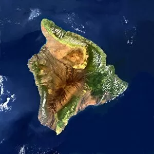
Background imageEarth Observation Collection: Hawai i, satellite image

Hawai i, satellite image. Satellite image of the island of Hawai i, also known as Big Island. Vegetation is green, water is blue, and cloud is white

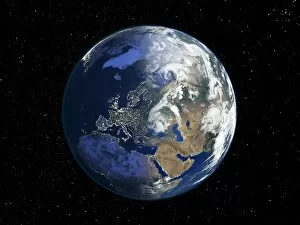
Background imageEarth Observation Collection: Europe, night-day satellite image

Europe, night-day satellite image. This composite image of the Earth is set against a background of stars, and is centred on Europe. North is at top

Background imageEarth Observation Collection: The Arctic, satellite image

The Arctic, satellite image
The Arctic. Satellite image of the Earth centred on the Arctic. The North Pole is at centre. Clouds and Arctic sea ice are white, oceans are blue and land is green and brown

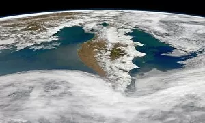
Background imageEarth Observation Collection: The Kamchatka Peninsula of far eastern Russian

The Kamchatka Peninsula of far eastern Russian
May 23, 2013 - The Kamchatka Peninsula of far eastern Russian was surrounded by life in late May 2013, at least the oceanic sort

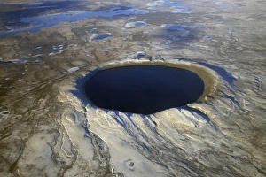
Background imageEarth Observation Collection: Aerial view of Pingualuit Crater, Quebec, Canada

Aerial view of Pingualuit Crater, Quebec, Canada
October 12, 2007 - Aerial view of Pingualuit Crater, Quebec, Canada. The crater was formed millions of years ago by meteorites striking the surface, and today they hold deep lakes

Background imageEarth Observation Collection: New York City from space

New York City from space, ISS image. New York City photographed from the International Space Station on the 14th March 2012

Background imageEarth Observation Collection: Earth and moon, ISS image

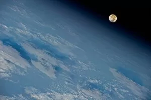
Earth and moon, ISS image
Earth and moon taken by astronauts on the International Space Shuttle (ISS). Photographed 21st October 2011

Background imageEarth Observation Collection: Nile at night, satellite image

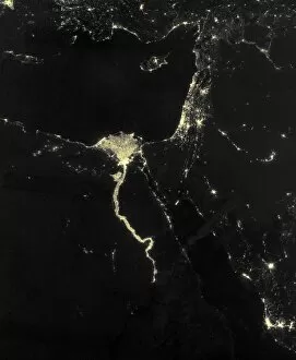
Nile at night, satellite image
Nile at night. Black marble satellite image of the Nile at night. The Nile is illuminated by the many boats along its length
Background imageEarth Observation Collection: India at night, satellite image

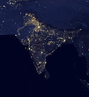
India at night, satellite image
India at night. Black marble satellite image of India at night. More densely populated areas are brighter. The nocturnal glow produced by the Earths atmosphere is shown as well as man-made light

Background imageEarth Observation Collection: DR Congo, satellite image

DR Congo, satellite image
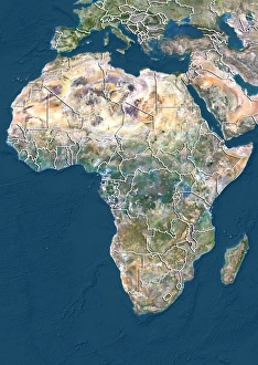
DR Congo. North is at top. Satellite image of the Democratic Republic of the Congo (DRC) in Central Africa, with the surrounding countries shaded out

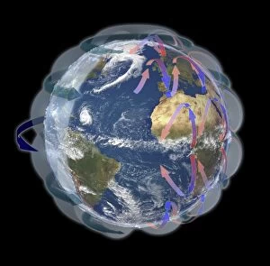
Background imageEarth Observation Collection: Global winds, satellite-based diagram C016 / 3731

Global winds, satellite-based diagram C016 / 3731
Global winds, satellite-based diagram. The rotation of this Earth globe (dark blue arrow) and the Coriolis effect causes the wind patterns shown

Background imageEarth Observation Collection: Early Earth globe, artwork C016 / 3733

Early Earth globe, artwork C016 / 3733
Early Earth globe, artwork. On this early Earth, the first continents are forming with clouds present in the atmosphere. On the existing land masses, there is widespread volcanic activity

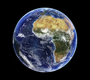
Background imageEarth Observation Collection: Africa and Atlantic Ocean, with clouds C016 / 3727

Africa and Atlantic Ocean, with clouds C016 / 3727
Africa and Atlantic Ocean, with clouds. Computer graphic of an Earth globe centred on West Africa, generated using satellite and mapping data

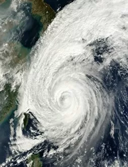
Background imageEarth Observation Collection: Typhoon Tokage

Typhoon Tokage. Satellite image of Typhoon Tokage (centre) hitting the western coast of Japan (upper left) on 19 October 2004 at 0215 GMT. The typhoon produced winds of 225 kilometres per hour

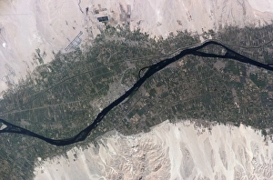
Background imageEarth Observation Collection: River Nile, Luxor, Egypt

River Nile, Luxor, Egypt, as seen from the International Space Station (ISS). North is towards bottom left. Agricultural fields (green) are sustained by the waters of the Nile (dark blue)

Background imageEarth Observation Collection: High-altitude clouds, satellite image

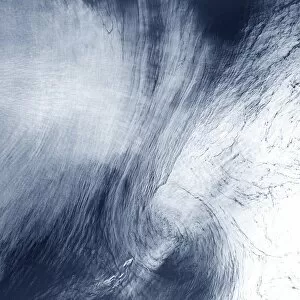
High-altitude clouds, satellite image. These swirling clouds are being shaped by high-altitude winds. They are over the Mediterranean Sea, just north of the coast of Morocco

Background imageEarth Observation Collection: Extratropical storm Katia, 2011

Extratropical storm Katia, 2011
Extratropical storm Katia. Satellite image of the remains of Hurricane Katia approaching the UK as an extratropical storm on 11 September 2011. North is at top

Background imageEarth Observation Collection: Chilean fjords

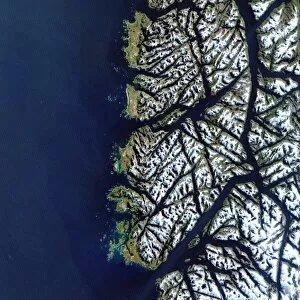
Chilean fjords, satellite image. During the last ice age, glaciers on the southern tip of Chile gouged out deep valleys. When the ice age ended the glaciers melted and the sea level rose

Background imageEarth Observation Collection: Cardiff, aerial photograph

Cardiff, aerial photograph
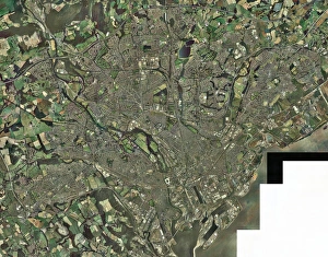
Cardiff, Wales, UK, aerial photograph. Cardiff is the capital city of Wales. It is a port on the Bristol Channel (not imaged at lower right)

Background imageEarth Observation Collection: Leeds, UK, aerial image

Leeds, UK, aerial image
Leeds, UK, aerial photograph. Leeds is a city of around half a million people in West Yorkshire. It is linked to London to the south by the M1 motorway (running from bottom centre to far right)

Background imageEarth Observation Collection: Asia

Asia. Satellite image centred on Asia. The North Pole is at upper right. Water is blue, vegetation is green, arid areas are brown, and snow and ice are white

Background imageEarth Observation Collection: Blue Marble image of Earth (2005)

Blue Marble image of Earth (2005)
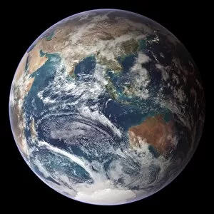
Blue Marble image of Earth. Composite satellite image of Earths eastern hemisphere, centred on the Indian Ocean. North is at top

Background imageEarth Observation Collection: Earth

Earth. Satellite image of the Earth, centred on North America. The North Pole is at upper centre. Water is blue, vegetation is green, arid areas are brown, and snow and ice are white

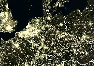
Background imageEarth Observation Collection: Central Europe at night, satellite image

Central Europe at night, satellite image
Central Europe at night. Satellite image showing Central Europe and parts of Western Europe at night. City lights (yellow) show areas of dense population. International borders are shown in white

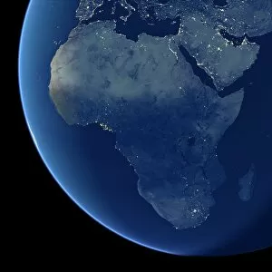
Background imageEarth Observation Collection: Africa at night, satellite image

Africa at night, satellite image. City lights (yellow) show areas of dense population, particularly in Europe and the Middle East (top)

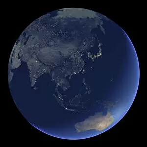
Background imageEarth Observation Collection: East Asia at night, satellite image

East Asia at night, satellite image
East Asia at night. Satellite image of the Earth at night, centred over China. City lights (yellow) show areas of dense population

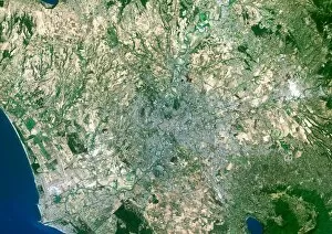
Background imageEarth Observation Collection: Rome, satellite image

Rome, satellite image. North is at top. Vegetationis green, bare ground is brown, urban areas aregrey and water is blue. Rome is the capital cityof Italy

Background imageEarth Observation Collection: London from the ISS

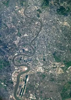
London from the ISS
London, UK, photographed from theInternational Space Station. North is at right.The River Thames flows eastwards down centre. Thebright white circle at lower left is theMillennium Dome

Background imageEarth Observation Collection: View from space of the Strait of Gibraltar

View from space of the Strait of Gibraltar
August 23, 2013 - View from space of the Strait of Gibraltar, where Europe and Africa meet and where the Atlantic Ocean waters flow through the strait into the Mediterranean Sea

Background imageEarth Observation Collection: Panoramic view of Texas, the Gulf of Mexico and surrounding area

Panoramic view of Texas, the Gulf of Mexico and surrounding area
September 8, 2011 - Panoramic view of Texas, the Gulf of Mexico and surrounding area. Big smoke near the Red River is from the Magnolia/Longview complex of fires; the fire just northwest of Houston

Background imageEarth Observation Collection: Natural color image of Qadisiyah Reservoir in Iraq

Natural color image of Qadisiyah Reservoir in Iraq
September 15, 2009 - Natural color image of Qadisiyah Reservoir in Iraq

Background imageEarth Observation Collection: Satellite view of Mount Etna emitting plumes of volcanic gases

Satellite view of Mount Etna emitting plumes of volcanic gases
March 31, 2013 - This false-color satellite image shows several vents near the summit of Mount Etna emitting plumes of volcanic gases

Background imageEarth Observation Collection: Satellite view of snow cover in the Northeastern United States

Satellite view of snow cover in the Northeastern United States
February 10, 2013 - Satellite view of snow cover stretching from the East Coast westward past Lake Ontario

Background imageEarth Observation Collection: Satellite view of the southern Alaska coast and the Gulf of Alaska

Satellite view of the southern Alaska coast and the Gulf of Alaska
May 2, 2014 - Satellite view of the southern Alaska coast and the Gulf of Alaska

Background imageEarth Observation Collection: View from space of Indianapolis, Indiana

View from space of Indianapolis, Indiana
February 25, 2013 - View from space of Indianapolis, Indiana

Background imageEarth Observation Collection: Satellite image showing clouds stretching from Texas to the U. S. northeast

Satellite image showing clouds stretching from Texas to the U. S. northeast
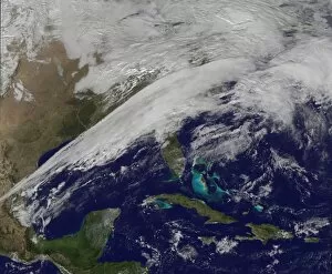
December 17, 2012 - Satellite image showing clouds associated with a frontal system as a very sharp line stretching from Texas to the U.S. northeast

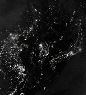
Background imageEarth Observation Collection: Satellite view of the Korean Peninsula showing city lights at night

Satellite view of the Korean Peninsula showing city lights at night
September 24, 2012 - Satellite view of the Korean Peninsula showing city lights at night. Also visible are parts of China and Japan, the Yellow Sea, and the Sea of Japan

Background imageEarth Observation Collection: Satellite view of the Rocky Mountains

Satellite view of the Rocky Mountains
March 12, 2014 - Satellite view of the Rocky Mountains

Background imageEarth Observation Collection: View from space of linear dunes in the Great Sand Sea in southwest Egypt

View from space of linear dunes in the Great Sand Sea in southwest Egypt
May 11, 2012 - View from space of linear dunes in the Great Sand Sea in southwest Egypt. In southwestern Egypt, deep in the Sahara Desert

Background imageEarth Observation Collection: Satellite view showing round domes of the Air Mountains in the Sahara Desert

Satellite view showing round domes of the Air Mountains in the Sahara Desert
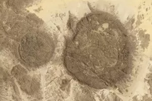
May 26, 2013 - Satellite view showing the unique geology of the ring dikes and the relative isolation of the formation. The dark round domes of the Air Mountains rise out of the Sahara Desert

Background imageEarth Observation Collection: A shadow of the moon from a solar eclipse spreads across cloud cover on Earth

A shadow of the moon from a solar eclipse spreads across cloud cover on Earth
May 20, 2012 - A shadow of the moon from a solar eclipse spreads across cloud cover on Earth

Background imageEarth Observation Collection: Satellite view of the Southern California June Gloom

Satellite view of the Southern California June Gloom
June 10, 2013 - Satellite view of the Southern California June Gloom, a weather pattern that creates cloudy, overcast skies and cool temperatures

Background imageEarth Observation Collection: Satellite view of Southern Florida

Satellite view of Southern Florida
November 10, 2011 - Satellite view of Southern Florida. Farms, forests, wetlands and urban areas are of many diverse landscapes packed into this relatively small area

Background imageEarth Observation Collection: Unusual cloud patterns surrounding Guadalupe Island in the Pacific Ocean

Unusual cloud patterns surrounding Guadalupe Island in the Pacific Ocean
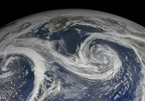
August 24, 2013 - Unusual cloud patterns surrounding Guadalupe Island in the Pacific Ocean (left center). These are the result of a ubiquitous occurrence in the motion of fluids, a vortex street

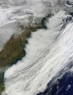
Background imageEarth Observation Collection: Cloud streets off the East Coast of the United States

Cloud streets off the East Coast of the United States
January 7, 2014 - Cloud streets off the East Coast of the United States

Background imageEarth Observation Collection: Satellite view of the Lesser Antilles

Satellite view of the Lesser Antilles
March 6, 2014 - Satellite view of the Lesser Antilles

Background imageEarth Observation Collection: Satellite view of Italy and the Adriatic Sea

Satellite view of Italy and the Adriatic Sea
November 17, 2004 - Satellite view of Italy and the Adriatic Sea. The waters along the Italian coastline are a milky green where the wind-tossed waves have churned the water

Background imageEarth Observation Collection: Oblique photo of Ethiopia and part of the Red Sea as viewed from space

Oblique photo of Ethiopia and part of the Red Sea as viewed from space
October 20, 2012 - Oblique photo of Ethiopia and part of the Red Sea as viewed from space. The name of the funnel-shaped area is the Afar Depression or Afar Triangle


All Professionally Made to Order for Quick Shipping

"Earth Observation: Glimpses of Our Pale Blue Dot and Beyond" In the vast expanse of space, Voyager 1 captured an awe-inspiring image that forever changed our perspective. The iconic "Pale Blue Dot" photograph revealed Earth as a tiny speck in the cosmic ocean, reminding us of our interconnectedness on this magnificent planet. Zooming in closer, we witness the intricate details of human achievements. The Wimbledon tennis complex stands out amidst the bustling cityscape of London, UK. From high above, a satellite image showcases the British Isles with its lush green landscapes and rugged coastlines – a testament to nature's beauty. As night falls, lights illuminate cities across Europe like constellations on Earth's canvas. A mesmerizing satellite image captures the brilliance of UK at night from space – a tapestry woven by millions living their lives under starry skies. Expanding further into darkness reveals Europe at night; clusters of light representing vibrant metropolises and quiet towns alike. And then there it is - an astonishing view showcasing our entire planet bathed in nocturnal glow - Whole Earth at night seen from space. Venturing beyond terrestrial boundaries, Tenerife emerges through a satellite lens – its volcanic terrain contrasting against azure waters surrounding this Spanish island paradise. The International Space Station floats gracefully in orbit around Earth during 2008 – humanity's outpost where astronauts conduct research while gazing back upon their home planet with wonderment. From afar, another satellite image depicts Earth from space - swirling clouds dance over continents and oceans; an ever-changing masterpiece painted by atmospheric currents and weather patterns. Closer to home once more, Scotland's stunning landscape unfolds beneath us through yet another captivating satellite image. Majestic mountains blend seamlessly with lochs and glens creating breathtaking scenery that captivates all who behold it.