Fraud Blocker Skip to main content

Empire Collection (page 2)

"Tracing the Footsteps of Empires

Background imageEmpire Collection: Map of the Americas, 1660

Map of the Americas, 1660
17th century map of the Americas. Published in Amsterdam in 1660, this map by the Dutch cartographer Frederick de Witt (1630-1706) shows the geography of the Americas

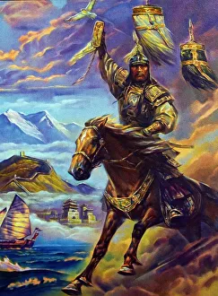
Background imageEmpire Collection: Genghis Khan (c. 1158 - 1227)

Genghis Khan (c. 1158 - 1227)
Genghis Khan (c.1158 - 1227), born Temujin, the founder and first Great Khan (Emperor) of the Mongol Empire, which became the largest contiguous empire in history after his death

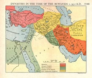
Background imageEmpire Collection: Dynasties in the time of the Buwayids, circa 932 A. D. c1915. Creator: Emery Walker Ltd

Dynasties in the time of the Buwayids, circa 932 A. D. c1915. Creator: Emery Walker Ltd
Dynasties in the time of the Buwayids, circa 932 A.D. c1915. Map of civilisations in the Middle East during the 10th century: Byzantine, Buwayid Kingdom, Abbasid Caliphate, Kingdom of the Ikhshids

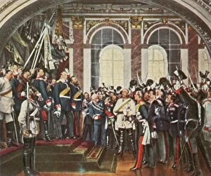
Background imageEmpire Collection: The Proclamation of the German Empire at Versailles, 18 January 1871, (1936). Creator: Unknown

The Proclamation of the German Empire at Versailles, 18 January 1871, (1936). Creator: Unknown
The Proclamation of the German Empire at Versailles, 18 January 1871, (1936). Kaiserproklamation in Versailles, 18 Januar 1871

Background imageEmpire Collection: Map of the British Empire in 1837

Map of the British Empire in 1837. At its height, the British Empire was the largest empire in history and, for over a century, was the foremost global power

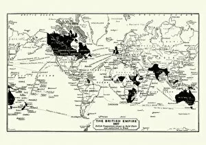
Background imageEmpire Collection: Map of the British Empire in 1897

Map of the British Empire in 1897. At its height, the British Empire was the largest empire in history and, for over a century, was the foremost global power

Background imageEmpire Collection: Turkey Ottoman Empire map 1895

Turkey Ottoman Empire map 1895
Meyers Konversations-Lexikon. Ein Nachschlagewerk des allgemeinen Wissens, 5th edition 17 volumes Bibliographisches Institut - Leipzig 1895-1897

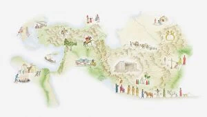
Background imageEmpire Collection: Illustrated map of ancient Persia

Illustrated map of ancient Persia

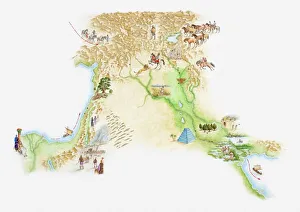
Background imageEmpire Collection: Illustrated map of ancient Assyrian empire

Illustrated map of ancient Assyrian empire

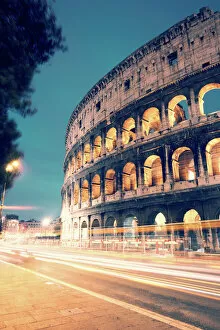
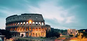
Background imageEmpire Collection: Colosseum at night with light trails from cars

Colosseum at night with light trails from cars
Colosseum illuminated at night with light trails from cars passing on the street, Rome, Italy

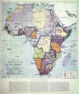
Background imageEmpire Collection: Map of Africa showing Treaty Boundaries, 1891 (colour lithograph)

Map of Africa showing Treaty Boundaries, 1891 (colour lithograph)
XCF282018 Map of Africa showing Treaty Boundaries, 1891 (colour lithograph) by English School, (19th century); British Museum, London, UK; English, out of copyright

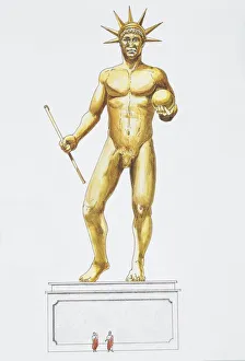
Background imageEmpire Collection: Colossal Nero statue, 1st century, drawing

Colossal Nero statue, 1st century, drawing
Ancient Rome. Colossal Nero statue. Rome, 1st century. Color illustration
Background imageEmpire Collection: AUSTRIAN EMPIRE MAP, 1795. Map of Prussia and the Austrian Empire as they appeared in the year 1795

AUSTRIAN EMPIRE MAP, 1795. Map of Prussia and the Austrian Empire as they appeared in the year 1795

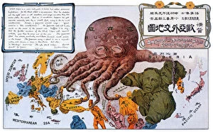
Background imageEmpire Collection: ANTI-RUSSIAN MAP, 1904. A Humorous Diplomatic Atlas of Europe and Asia

ANTI-RUSSIAN MAP, 1904. A Humorous Diplomatic Atlas of Europe and Asia. Japanese propaganda handbill of 1904 portraying Russia as a grasping octopus

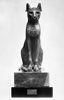
Background imageEmpire Collection: EGYPT: GODDESS BASTET. The Gayer-Anderson cat, representing the Egyptian goddess Bastet

EGYPT: GODDESS BASTET. The Gayer-Anderson cat, representing the Egyptian goddess Bastet. Bronze, after 30 B. C
EGYPT: GODDESS BASTET. The Gayer-Anderson cat, representing the Egyptian goddess Bastet. Bronze, after 30 B.C

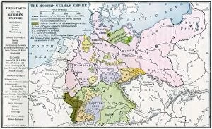
Background imageEmpire Collection: Germany before World War I

Germany before World War I
Map of the German Empire before World War I, circa 1912. Printed color lithograph

Background imageEmpire Collection: EVNT2A-00048

EVNT2A-00048
British capturing Quebec in the Battle of the Plains of Abraham, French and Indian War, 1759. Hand-colored woodcut

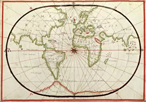
Background imageEmpire Collection: Map of the world, 1590

Map of the world, 1590
16th century map of the world. Published around 1590, this map shows the known world, including the new lands being discovered by Europeans exploring across the Atlantic

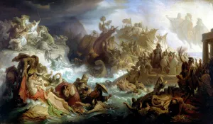
Background imageEmpire Collection: Allegory of the Battle of Salamis, 1858 (oil on canvas)

Allegory of the Battle of Salamis, 1858 (oil on canvas)
2973583 Allegory of the Battle of Salamis, 1858 (oil on canvas) by Kaulbach, Wilhelm von (1805-74); length: 535 cm; Bayerische Landtag, Munich

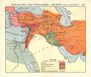
Background imageEmpire Collection: Byzantine and Crusaders v. Seljuks, circa 1130 A. D. c1915. Creator: Emery Walker Ltd

Byzantine and Crusaders v. Seljuks, circa 1130 A. D. c1915. Creator: Emery Walker Ltd
Byzantine and Crusaders v. Seljuks, circa 1130 A.D. c1915. Map of civilisations in the Middle East during the 12th century: Byzantine, other Christian states, Abbasid Caliphate, Seljuks, Fatimids

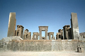
Background imageEmpire Collection: Palace of Darius, Persepolis, Iran

Palace of Darius, Persepolis, Iran. Persepolis was built as Persias new capital city during the reign of Darius I (522-485 BC), first king of the Achaemenid dynasty

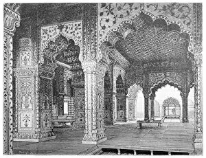
Background imageEmpire Collection: Interior of a hall in the palace of the Mughal kings in Delhi

Interior of a hall in the palace of the Mughal kings in Delhi

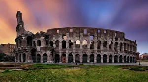
Background imageEmpire Collection: Sunrise at the Colosseum, Rome, Lazio, Italy

Sunrise at the Colosseum, Rome, Lazio, Italy

Background imageEmpire Collection: OTTO VON BISMARCK (1815-1898). Prince Otto von Bismarck-Schonhausen

OTTO VON BISMARCK (1815-1898). Prince Otto von Bismarck-Schonhausen. American cartoon of 1886 by Joseph Keppler mocking Bismarck as an Angel of Peace in the Balkans following his role as honest

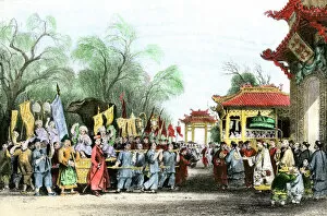
Background imageEmpire Collection: EXPL2A-00146

EXPL2A-00146
Marco Polo welcomed at the court of Kublai Khan in China, 1200s. Hand-colored halftone of a 19th-century illustration

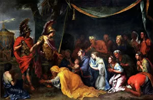
Background imageEmpire Collection: The Queens of Persia at the feet of Alexander, also called The Tent of Darius, c

The Queens of Persia at the feet of Alexander, also called The Tent of Darius, c. 1660 (oil on canvas)
5974049 The Queens of Persia at the feet of Alexander, also called The Tent of Darius, c.1660 (oil on canvas) by Le Brun, Charles (1619-90); 117.3x453 cm; Chateau de Versailles

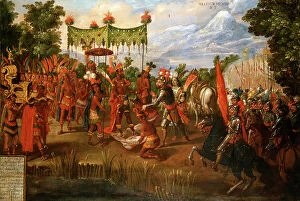
Background imageEmpire Collection: Hernan Cortes meets Emperor Moctezuma

Hernan Cortes meets Emperor Moctezuma
3846960 Hernan Cortes meets Emperor Moctezuma by Unknown Artist, (16th century); (add.info.: Hernan Cortes meets Emperor Moctezuma, 8 November 1519)

Background imageEmpire Collection: The Roman Empire

The Roman Empire
3794133 The Roman Empire - by Williamson, J. (fl.1850-1919); (add.info.: The Roman Empire - dinner in the garden. Romans, food, feast, feasts, banquet, banquets, meal, fountain, fountains, leisure)

Background imageEmpire Collection: Plan of the Battle of Aliwal, c1891. Creator: James Grant

Plan of the Battle of Aliwal, c1891. Creator: James Grant
Plan of the Battle of Aliwal, c1891. From " Cassells Illustrated History of India Vol. II.", by James Grant. [Cassell Petter & Galpin, London, Paris and New York]

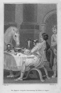
Background imageEmpire Collection: The Roman Emperor Caligula entertaining his favourite horse, Incitatus, at supper (engraving)

The Roman Emperor Caligula entertaining his favourite horse, Incitatus, at supper (engraving)
7148832 The Roman Emperor Caligula entertaining his favourite horse, Incitatus, at supper (engraving) by English School, (19th century); Private Collection; (add.info)

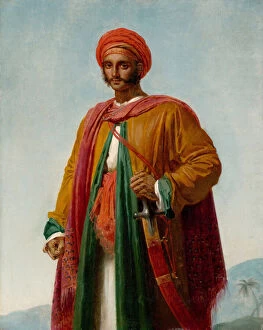
Background imageEmpire Collection: Study for Portrait of an Indian, c. 1807 (oil on canvas)

Study for Portrait of an Indian, c. 1807 (oil on canvas)
3613963 Study for Portrait of an Indian, c.1807 (oil on canvas) by Girodet de Roucy-Trioson, Anne Louis (1767-1824); 40.6x32.7 cm; Metropolitan Museum of Art, New York

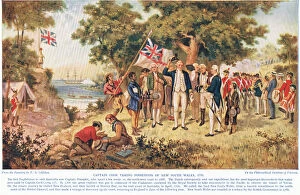
Background imageEmpire Collection: Captain Cook taking possession of New South Wales, c. 1910 (colour litho)

Captain Cook taking possession of New South Wales, c. 1910 (colour litho)
IL433772 Captain Cook taking possession of New South Wales, c.1910 (colour litho) by Gilfillan, John Alexander (1793-1867) (after); Private Collection; (add.info)

Background imageEmpire Collection: Antique Map of Gaul

Antique Map of Gaul
Antique Map from 1862 of Gaul at the time of Julius Caesar. The Roman proconsul and general Julius Caesar pushed his army into Gaul in 58 BC

Background imageEmpire Collection: Map Of The World Showing In Red The Extent Of The British Empire In 1901

Map Of The World Showing In Red The Extent Of The British Empire In 1901

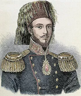
Background imageEmpire Collection: Abdulmecit I (1823-1861). Ottoman Sultan (1839-1861)

Abdulmecit I (1823-1861). Ottoman Sultan (1839-1861)

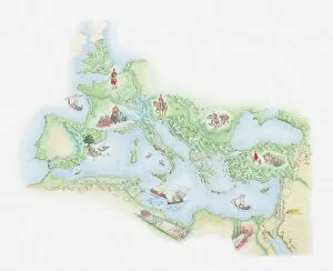
Background imageEmpire Collection: Illustrated map of Roman Empire, BC

Illustrated map of Roman Empire, BC

Background imageEmpire Collection: Panoramic of the Colosseum at night

Panoramic of the Colosseum at night
The Roman Coliseum illuminated at night

Background imageEmpire Collection: Lingering Garden, Suzhou, Jiangsu, China

Lingering Garden, Suzhou, Jiangsu, China
Lingering Garden (Liu Yuan) is a renowned classical Chinese garden. It is located at 338 Liuyuan Rd. Suzhou, Jiangsu province, China

Background imageEmpire Collection: Bayon Castle, Angkor Thom, Cambodia

Bayon Castle, Angkor Thom, Cambodia

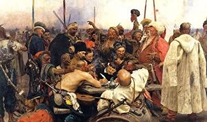
Background imageEmpire Collection: Reply of the Zaporozhian Cossacks to Sultan Mehmed IV of the Ottoman Empire, 1880-91

Reply of the Zaporozhian Cossacks to Sultan Mehmed IV of the Ottoman Empire, 1880-91. Oil on canvas. Ilya Repin (1844-1930) Russian artist

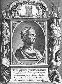
Background imageEmpire Collection: Vespasian, Roman emperor

Vespasian, Roman emperor
Vespasian (9 AD-79 AD), Roman emperor. Vespasian was the ninth emperor of the Roman Empire, ascending to power after a year of civil wars and ruling for nearly 10 years from 69 AD until his death

Background imageEmpire Collection: Egyptian queen. Painted limestone head, 18th Dynasty

Egyptian queen. Painted limestone head, 18th Dynasty
EGYPT: NEFERTITI. Egyptian queen. Painted limestone head, 18th Dynasty

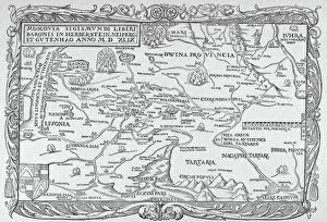
Background imageEmpire Collection: RUSSIA: MAP, 1549. Engraved map of Russia from Sigismund Herbersteins Rerum Moscoviticarum

RUSSIA: MAP, 1549. Engraved map of Russia from Sigismund Herbersteins Rerum Moscoviticarum Commentarii printed at Basel, 1549

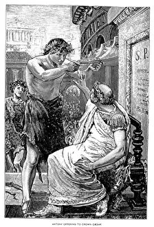
Background imageEmpire Collection: JULIUS CAESAR (100-44 B. C. ). Roman general and statesman. Caesar refusing the crown offered by

JULIUS CAESAR (100-44 B. C. ). Roman general and statesman. Caesar refusing the crown offered by Marc Antony, 44 B. C
JULIUS CAESAR (100-44 B.C.). Roman general and statesman. Caesar refusing the crown offered by Marc Antony, 44 B.C. Line engraving, late 19th century

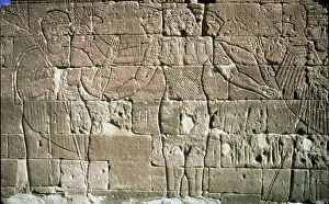
Background imageEmpire Collection: SUDAN: LION GOD OF KUSH. King Natakamani paying homage to Apedemak, lion god of Kush

SUDAN: LION GOD OF KUSH. King Natakamani paying homage to Apedemak, lion god of Kush. Temple engraving, Naqa, Sudan

Background imageEmpire Collection: THE HOLY LAND: MASADA. Aerial view of the plateau

THE HOLY LAND: MASADA. Aerial view of the plateau

Background imageEmpire Collection: French noble in formal clothes, 1808. 1825 (lithograph)

French noble in formal clothes, 1808. 1825 (lithograph)
7236918 French noble in formal clothes, 1808. 1825 (lithograph) by Lecomte, Hippolyte (1781-1857); Private Collection; (add.info.: French noble in formal clothes, 1808)


All Professionally Made to Order for Quick Shipping

"Tracing the Footsteps of Empires: A Journey through Time and Territories" Step into the captivating world of empires with a collection of antique maps that unveil their grandeur and influence. Delve into the depths of history as you explore an ancient map showcasing the sprawling Roman Empire, a testament to its dominance in antiquity. Marvel at the Byzantine Empire's vast territories depicted on a 9th-century map, revealing its enduring legacy. Transport yourself to an era when Britannia ruled the waves with a meticulously detailed 19th-century world map illustrating the expanse of the British Empire. Witness Ottoman magnificence unfold before your eyes through Orteliuss' intricate cartography from 1570, capturing every inch of this formidable empire. Travel back even further to Greece during one of its most tumultuous periods -the Peloponnesian War- as portrayed on an intriguing historical map. Immerse yourself in Roman glory once again with another depiction highlighting their extensive dominion across Europe, Africa, and Asia. Discover remnants of German history etched upon a damaged yet evocative 19th-century map showcasing the German Empire's territorial reach. Follow in Alexander the Great's footsteps by exploring his Macedonian Empire after his legendary conquests reshaped nations forever. Venture beyond geographical boundaries and delve into artistic expressions depicting societal dynamics during different epochs. Behold Hieronymus Bosch's enigmatic "The Garden of Earthly Delights, " inviting contemplation on human desires and earthly pursuits during Renaissance times. Witness political satire come alive through "The Plum Pudding in Danger, " offering insight into European power struggles amidst Napoleon Bonaparte's reign. Admire French uniforms adorning soldiers who fought valiantly during Napoleonic Wars, symbolizing both military might and national identity. Finally, gaze upon flags representing unity under Germany's imperial banner while reflecting upon shifting alliances throughout time.