Fraud Blocker Skip to main content

Farm Lane Collection

Discover the picturesque charm of Farm Lane, a hidden gem tucked away in various corners of the UK

Background imageFarm Lane Collection: Sussex PO18 8 Map

Sussex PO18 8 Map
Postcode Sector Map of Sussex PO18 8

Background imageFarm Lane Collection: Stockton-on-Tees TS17 0 Map

Stockton-on-Tees TS17 0 Map
Postcode Sector Map of Stockton-on-Tees TS17 0

Background imageFarm Lane Collection: Tonbridge and Malling TN10 3 Map

Tonbridge and Malling TN10 3 Map
Postcode Sector Map of Tonbridge and Malling TN10 3

Background imageFarm Lane Collection: Telford and Wrekin TF4 2 Map

Telford and Wrekin TF4 2 Map
Postcode Sector Map of Telford and Wrekin TF4 2

Background imageFarm Lane Collection: Wiltshire SP2 7 Map

Wiltshire SP2 7 Map
Postcode Sector Map of Wiltshire SP2 7

Background imageFarm Lane Collection: Newport NP19 7 Map

Newport NP19 7 Map
Postcode Sector Map of Newport NP19 7

Background imageFarm Lane Collection: Warrington WA4 3 Map

Warrington WA4 3 Map
Postcode Sector Map of Warrington WA4 3

Background imageFarm Lane Collection: Three Rivers WD3 4 Map

Three Rivers WD3 4 Map
Postcode Sector Map of Three Rivers WD3 4

Background imageFarm Lane Collection: Shropshire SY12 9 Map

Shropshire SY12 9 Map
Postcode Sector Map of Shropshire SY12 9

Background imageFarm Lane Collection: Shropshire SY6 7 Map

Shropshire SY6 7 Map
Postcode Sector Map of Shropshire SY6 7

Background imageFarm Lane Collection: Rother TN31 7 Map

Rother TN31 7 Map
Postcode Sector Map of Rother TN31 7

Background imageFarm Lane Collection: Somerset TA20 3 Map

Somerset TA20 3 Map
Postcode Sector Map of Somerset TA20 3

Background imageFarm Lane Collection: East Hertfordshire SG11 1 Map

East Hertfordshire SG11 1 Map
Postcode Sector Map of East Hertfordshire SG11 1

Background imageFarm Lane Collection: Tameside SK14 5 Map

Tameside SK14 5 Map
Postcode Sector Map of Tameside SK14 5

Background imageFarm Lane Collection: Cheshire East SK11 9 Map

Cheshire East SK11 9 Map
Postcode Sector Map of Cheshire East SK11 9

Background imageFarm Lane Collection: Cheshire East SK12 2 Map

Cheshire East SK12 2 Map
Postcode Sector Map of Cheshire East SK12 2

Background imageFarm Lane Collection: North Hertfordshire SG8 7 Map

North Hertfordshire SG8 7 Map
Postcode Sector Map of North Hertfordshire SG8 7

Background imageFarm Lane Collection: Kennet SN8 3 Map

Kennet SN8 3 Map
Postcode Sector Map of Kennet SN8 3

Background imageFarm Lane Collection: Kennet SN8 2 Map

Kennet SN8 2 Map
Postcode Sector Map of Kennet SN8 2

Background imageFarm Lane Collection: Wigan WN2 1 Map

Wigan WN2 1 Map
Postcode Sector Map of Wigan WN2 1

Background imageFarm Lane Collection: Wakefield WF9 5 Map

Wakefield WF9 5 Map
Postcode Sector Map of Wakefield WF9 5

Background imageFarm Lane Collection: Wychavon WR11 8 Map

Wychavon WR11 8 Map
Postcode Sector Map of Wychavon WR11 8

Background imageFarm Lane Collection: North East Derbyshire S21 4 Map

North East Derbyshire S21 4 Map
Postcode Sector Map of North East Derbyshire S21 4

Background imageFarm Lane Collection: Somerset TA5 1 Map

Somerset TA5 1 Map
Postcode Sector Map of Somerset TA5 1

Background imageFarm Lane Collection: Hammersmith and Fulham SW6 1 Map

Hammersmith and Fulham SW6 1 Map
Postcode Sector Map of Hammersmith and Fulham SW6 1

Background imageFarm Lane Collection: West Oxfordshire OX29 9 Map

West Oxfordshire OX29 9 Map
Postcode Sector Map of West Oxfordshire OX29 9

Background imageFarm Lane Collection: Cornwall PL12 4 Map

Cornwall PL12 4 Map
Postcode Sector Map of Cornwall PL12 4

Background imageFarm Lane Collection: South Ribble PR5 4 Map

South Ribble PR5 4 Map
Postcode Sector Map of South Ribble PR5 4

Background imageFarm Lane Collection: Plymouth PL5 3 Map

Plymouth PL5 3 Map
Postcode Sector Map of Plymouth PL5 3

Background imageFarm Lane Collection: Isle of Wight PO32 6 Map

Isle of Wight PO32 6 Map
Postcode Sector Map of Isle of Wight PO32 6

Background imageFarm Lane Collection: Tandridge RH9 8 Map

Tandridge RH9 8 Map
Postcode Sector Map of Tandridge RH9 8

Background imageFarm Lane Collection: Norfolk NR13 6 Map

Norfolk NR13 6 Map
Postcode Sector Map of Norfolk NR13 6

Background imageFarm Lane Collection: Torfaen NP44 1 Map

Torfaen NP44 1 Map
Postcode Sector Map of Torfaen NP44 1

Background imageFarm Lane Collection: Enfield N14 4 Map

Enfield N14 4 Map
Postcode Sector Map of Enfield N14 4

Background imageFarm Lane Collection: Bury M25 2 Map

Bury M25 2 Map
Postcode Sector Map of Bury M25 2

Background imageFarm Lane Collection: Salford M28 2 Map

Salford M28 2 Map
Postcode Sector Map of Salford M28 2

Background imageFarm Lane Collection: North Lanarkshire ML4 2 Map

North Lanarkshire ML4 2 Map
Postcode Sector Map of North Lanarkshire ML4 2

Background imageFarm Lane Collection: Northumberland NE46 4 Map

Northumberland NE46 4 Map
Postcode Sector Map of Northumberland NE46 4

Background imageFarm Lane Collection: Newark and Sherwood NG22 0 Map

Newark and Sherwood NG22 0 Map
Postcode Sector Map of Newark and Sherwood NG22 0

Background imageFarm Lane Collection: Wrexham LL11 5 Map

Wrexham LL11 5 Map
Postcode Sector Map of Wrexham LL11 5

Background imageFarm Lane Collection: Leicester LE67 2 Map

Leicester LE67 2 Map
Postcode Sector Map of Leicester LE67 2

Background imageFarm Lane Collection: Runnymede KT15 1 Map

Runnymede KT15 1 Map
Postcode Sector Map of Runnymede KT15 1

Background imageFarm Lane Collection: Mole Valley KT21 1 Map

Mole Valley KT21 1 Map
Postcode Sector Map of Mole Valley KT21 1

Background imageFarm Lane Collection: Waverley GU10 5 Map

Waverley GU10 5 Map
Postcode Sector Map of Waverley GU10 5

Background imageFarm Lane Collection: Hereford HR9 6 Map

Hereford HR9 6 Map
Postcode Sector Map of Hereford HR9 6

Background imageFarm Lane Collection: Chiltern HP9 2 Map

Chiltern HP9 2 Map
Postcode Sector Map of Chiltern HP9 2

Background imageFarm Lane Collection: Guildford KT24 5 Map

Guildford KT24 5 Map
Postcode Sector Map of Guildford KT24 5

Background imageFarm Lane Collection: Guildford GU23 7 Map

Guildford GU23 7 Map
Postcode Sector Map of Guildford GU23 7


All Professionally Made to Order for Quick Shipping

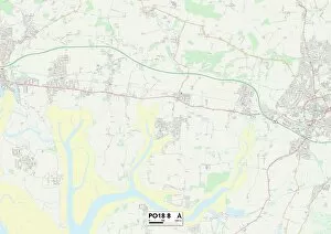
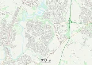
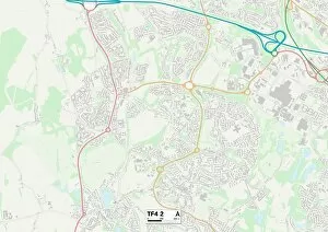
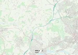
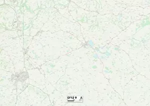
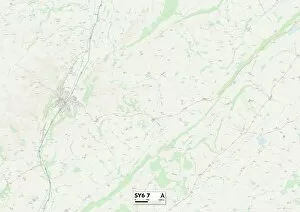
Discover the picturesque charm of Farm Lane, a hidden gem tucked away in various corners of the UK. From Sussex to Somerset, this collection of farms offers a serene escape from the hustle and bustle of city life. In Sussex (PO18 8 Map), immerse yourself in the idyllic countryside as you stroll along Farm Lane. The rolling hills and lush greenery create a postcard-worthy scene that will leave you feeling refreshed and rejuvenated. Head up north to Stockton-on-Tees (TS17 0 Map) where Farm Lane awaits with its rustic beauty. Take a leisurely walk through fields dotted with farm animals, breathing in the crisp country air as you go. Telford and Wrekin (TF4 2 Map) is home to another enchanting stretch of Farm Lane. Lose yourself amidst blooming wildflowers and charming cottages, experiencing rural England at its finest. Make your way to Newport (NP19 7 Map), where Farm Lane invites you on an adventure through nature's wonders. Explore winding pathways lined with ancient trees, providing shade on sunny days while offering glimpses of wildlife along the way. Warrington (WA4 3 Map) boasts yet another delightful spot known as Farm Lane. Here, tranquility reigns supreme as you meander past quaint farmhouses surrounded by vibrant gardens bursting with color. Nestled within Three Rivers (WD3 4 Map), discover a slice of paradise at Farm Lane. Let your worries melt away as you wander through fields adorned with wildflowers and listen to birdsong echoing throughout this peaceful haven. Shropshire beckons twice - SY12 9 Map & SY6 7 Map - inviting visitors to experience two distinct versions of Farm Lane's allure. Whether it's exploring historic landmarks or enjoying panoramic views over rolling hillsides, both locations promise unforgettable moments for all who venture there. Rother (TN31 7 Map) offers a taste of rural bliss with its own Farm Lane.