
Geographic Collection
"Exploring the World Through Geographic Treasures" Step back in time with the 1768 James Craig Map of New Town, Edinburgh, Scotland


All Professionally Made to Order for Quick Shipping
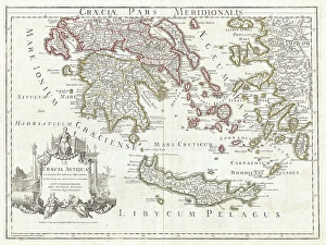
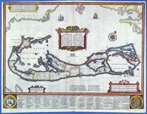
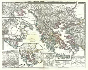
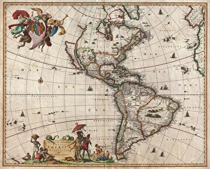
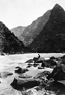
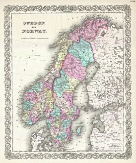
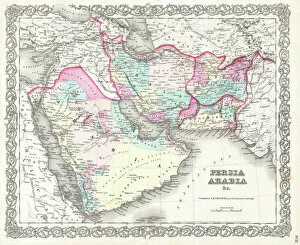
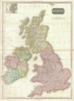
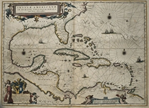
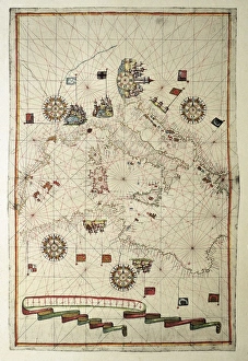
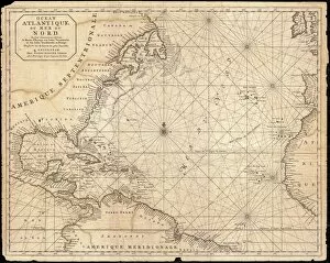
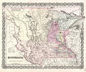
"Exploring the World Through Geographic Treasures" Step back in time with the 1768 James Craig Map of New Town, Edinburgh, Scotland, and witness the birth of a vibrant cityscape. This First Plan of New Town showcases not only its topography but also the visionary mind behind its design. Traveling further south to ancient Greece, immerse yourself in history with the 1794 Delisle Map. Discover Southern Ancient Greece, Greek Isles, and Crete through this remarkable depiction of their topography. Let your imagination wander as you envision the lives lived on these mythical lands. For those who dream beyond Earth's boundaries, indulge in celestial wonderment with an 1886 Telescopic View and Map of the Moon. Marvel at its intricate topography while appreciating the artistry involved in cartography and geography. Closer to home lies Pulpit Rock at Portland Bill, Dorset, England—a natural marvel that stands tall against crashing waves. Its rugged beauty reminds us of nature's power and resilience. Take a leap across continents with a captivating map from 1720 showcasing our vast world. Witness how explorers navigated uncharted territories using limited resources—truly a testament to human curiosity and ingenuity. Venturing into paradise itself brings us to Bermuda—an enchanting island captured beautifully in a color engraving map. Lose yourself amidst turquoise waters and lush landscapes that beckon exploration. Scandinavia awaits with its majestic fjords and breathtaking vistas depicted on various maps throughout history. From Colton's detailed representation in 1855 to other timeless renditions—these maps invite you to embark on Nordic adventures like never before. Journeying westward brings us face-to-face with Triplet Falls in Colorado's Green River Canyon—a mesmerizing display of nature's grandeur etched into our collective memory through vivid imagery captured in 1871. Vienna—the heartland of Austria—beckons with its rich history and cultural heritage.