Fraud Blocker Skip to main content

Geographical Collection (page 2)

"Journey through Time and Space: Exploring the Geographical Evolution" Al-Idrisi's World Map, 1154: Unveiling ancient cartographic wisdom

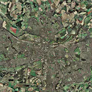
Background imageGeographical Collection: Reading, UK

Reading, UK, aerial photograph

Background imageGeographical Collection: Barbados, satellite image

Barbados, satellite image
Barbados. Landsat image of the island of Barbados in the Caribbean sea. North is at top. Barbados has a total land area of about 430 square kilometres

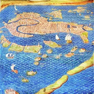
Background imageGeographical Collection: 16th century map of Venice

16th century map of Venice showing the lagoon. Venice is a coastal city in the north-east of Italy. The main bulk of Venice is in the upper frame of the image

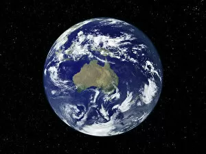
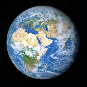
Background imageGeographical Collection: Earth from space

Earth from space. Computer artwork of a gibbous Earth, seen from space

Background imageGeographical Collection: Australia, satellite image

Australia, satellite image
Australia. Satellite image of the Earth, set against a background of stars, centred on the island continent of Australia. North is at top. Clouds (white) are seen in the atmosphere

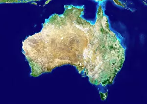
Background imageGeographical Collection: Australia, satellite image

Australia, satellite image. North is at top. Australia is the worlds smallest continent. It is located in the southern hemisphere, southeast of Asia

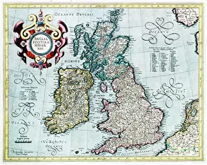
Background imageGeographical Collection: 16th century map of the British Isles

16th century map of the British Isles
British Isles, 16th century Dutch map. This shows England, Scotland, Wales and Ireland, though Ireland is not yet accurately mapped. Published in 1595, from work by Gerard Mercator
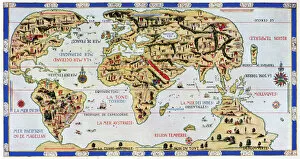
Background imageGeographical Collection: 16th century world map

16th century world map made by Pierre Desceliers in 1546 on a commission by King Francis I for Henri II of France. Most noticeable is that the Northern hemisphere is upside-down

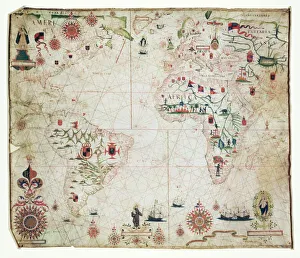
Background imageGeographical Collection: 17th Century nautical map of the Atlantic

17th Century nautical map of the Atlantic Ocean. Historical portolan chart showing the Atlantic Ocean and adjacent continents

Background imageGeographical Collection: Geological map, South-East England, 1830s

Geological map, South-East England, 1830s. This map, dating from between 1830 and 1833, shows the denudation of The Weald

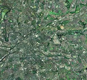
Background imageGeographical Collection: Central Manchester, aerial view

Central Manchester, aerial view. North is at top. Manchester is one of the largest cities in the UK. The River Irwell (upper left) flows through the city centre (centre left)
Background imageGeographical Collection: Antarctic exploration, route maps

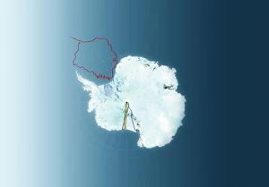
Antarctic exploration, route maps
Antarctic exploration. Map of Antarctica showing the routes taken by Ernest Shackleton (1914 to 1916, red), Roald Amundsen (1911 to 1912, brown), Robert Scott (1911 to 1912)

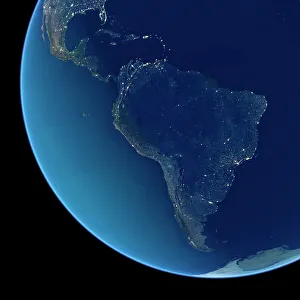
Background imageGeographical Collection: South America at night, satellite image

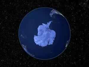
South America at night, satellite image
South America at night. Satellite image of the Earth at night, set against a background of stars, centred on the continent of South America. North is at top

Background imageGeographical Collection: India at night, satellite image

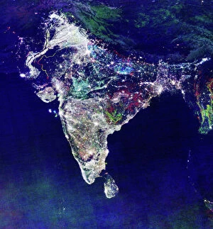
India at night, satellite image
India at night, satellite view. This image is a composite showing the change in illumination over India from 1992-2003. Satellite data from 2003 is coloured red

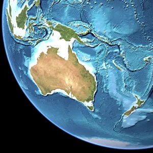
Background imageGeographical Collection: Australia, topographic map

Australia, topographic map. Highlands and lowlands of the continents are shown as ridges and flat areas. Southeast Asia (top left), New Zealand (lower right) and Antarctica (bottom right)

Background imageGeographical Collection: South America at night, satellite image

South America at night, satellite image. City lights (yellow) show areas of dense population, particularly in North America (top left) and South Americas coasts

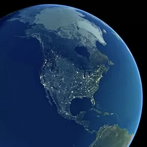
Background imageGeographical Collection: North America at night, satellite image

North America at night, satellite image. City lights (yellow) show areas of dense population, particularly in North America (upper centre)

Background imageGeographical Collection: London, UK, satellite image

London, UK, satellite image
London, UK. Satellite image of the city of London (centre) and its surrounding area. North is at top. The River Thames is seen running through the city from left to right

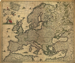
Background imageGeographical Collection: Map of Europe, 1700

Map of Europe, 1700
17th century map of Europe. Published in 1700, this map by the Dutch cartographer Frederick de Witt (1630-1706) shows the latest knowledge of the geography of Europe

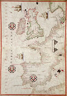
Background imageGeographical Collection: Map of Western Europe, 1590

Map of Western Europe, 1590
16th century map of Western Europe. Published around 1590, this map shows the coasts of Western Europe and the Mediterranean

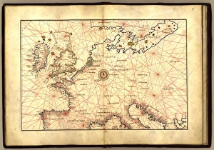
Background imageGeographical Collection: Europe, 16th century nautical map

Europe, 16th century nautical map
Nautical map of Europe, 1544 copy of Agnese Atlas. Several copies of this atlas were produced between 1536 and 1564, in Venice, by the Italian mapmaker Battista Agnese

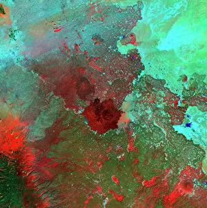
Background imageGeographical Collection: Syrian Desert, satellite image

Syrian Desert, satellite image. North is at top. Vegetation is red and dark green, while arid areas of sand and rock are light green and light blue. Water is blue

Background imageGeographical Collection: Venus radar map, North Pole

Venus radar map, North Pole
Venus radar map, centred on the Venusian North Pole. The map is colour-coded for altitude, going from low altitude (purple) through blue, green, yellow and orange to high altitude (red)

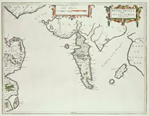
Background imageGeographical Collection: Map of the Isle of Bute (colour litho)

Map of the Isle of Bute (colour litho)
XCF285177 Map of the Isle of Bute (colour litho) by English School; Private Collection; English, out of copyright

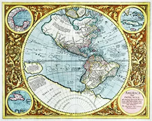
Background imageGeographical Collection: 17th century map of the New World

17th century map of the New World

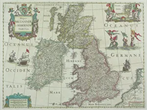
Background imageGeographical Collection: 1643, antiquity, archival, british isles, cartography, england, europe, geographical

1643, antiquity, archival, british isles, cartography, england, europe, geographical, geography, historical, map, nobody, old-fashioned, text, uk, vintage, Antique Maps, 89687337

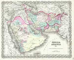
Background imageGeographical Collection: 1855, Colton Map of Persia, Afghanistan, and Arabia, topography, cartography, geography

1855, Colton Map of Persia, Afghanistan, and Arabia, topography, cartography, geography
1855, Colton Map of Persia, Afghanistan, and Arabia

Background imageGeographical Collection: 1848, Crutchley Pocket Map or Plan of London, England, topography, cartography, geography

1848, Crutchley Pocket Map or Plan of London, England, topography, cartography, geography
1848, Crutchley Pocket Map or Plan of London, England

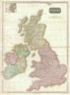
Background imageGeographical Collection: 1818, Pinkerton Map of the British Isles, England, Scotland, Ireland, John Pinkerton

1818, Pinkerton Map of the British Isles, England, Scotland, Ireland, John Pinkerton, 1758 - 1826, Scottish antiquarian, cartographer, UK

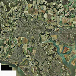
Background imageGeographical Collection: Fareham, UK, aerial image

Fareham, UK, aerial image
Fareham, UK, aerial photograph. Fareham is a market town in Hampshire, England, between the two cities of Portsmouth and Southampton

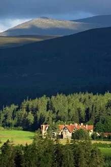
Background imageGeographical Collection: Mar Lodge Estate, Scotland, UK

Mar Lodge Estate, Scotland, UK
Mar Lodge Estate house and the Cairngorms mountain range. Photographed in August, in Cairngorms National Park, Aberdeenshire, Scotland, UK

Background imageGeographical Collection: Fridtjof Nansen, Norwegian explorer

Fridtjof Nansen, Norwegian explorer
Fridtjof Nansen (1861-1930), Norwegian explorer, biologist and humanitarian. In 1888 he was the first to cross the Greenland ice sheet and showed that it covered the entire island

Background imageGeographical Collection: Earth from space, artwork

Earth from space, artwork. View of the Earth centred on 165 degrees East, showing Russia (top left), Southeast Asia (centre left), China and Japan (upper left), Australia (lower left)

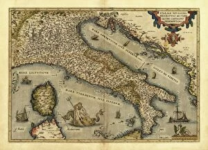
Background imageGeographical Collection: Orteliuss map of Italy, 1570

Orteliuss map of Italy, 1570
Orteliuss map of Italy. This map is from the 1570 first edition of Theatrum orbis terrarum ( Theatre of the World ). Drawn by the Flemish mapmaker Abraham Ortelius (1527-1598)

Background imageGeographical Collection: Orteliuss map of Poland, 1570

Orteliuss map of Poland, 1570
Orteliuss map of Poland. This map is from the 1570 first edition of Theatrum orbis terrarum ( Theatre of the World ). Drawn by the Flemish mapmaker Abraham Ortelius (1527-1598)

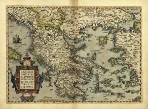
Background imageGeographical Collection: Orteliuss map of Greece, 1570

Orteliuss map of Greece, 1570
Orteliuss map of Greece. This map is from the 1570 first edition of Theatrum orbis terrarum ( Theatre of the World ). Drawn by the Flemish mapmaker Abraham Ortelius (1527-1598)

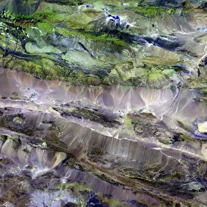
Background imageGeographical Collection: Steppe-desert border, satellite image

Steppe-desert border, satellite image. North is at top. Arid areas of desert rock are brown, while grassy steppe areas are green. A small area of desert sands (yellow) is seen at far centre right

Background imageGeographical Collection: Earth, topographic and bathymetric map

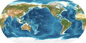
Earth, topographic and bathymetric map. This map is centred on the Pacific Ocean, at longitude 140 degrees west. Highlands and lowlands of the continents are shown as ridges and flat areas

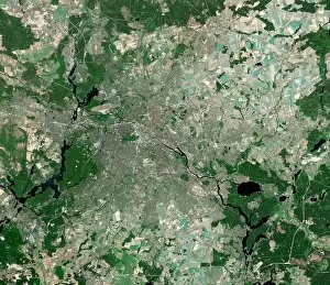
Background imageGeographical Collection: Berlin, Germany, satellite image

Berlin, Germany, satellite image
Berlin, Germany. Satellite image of the city of Berlin (centre) and its surrounding area in northeastern Germany. North is at top

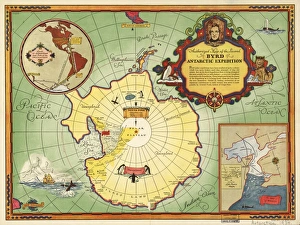
Background imageGeographical Collection: Second Byrd Antarctic Expedition, 1933-35

Second Byrd Antarctic Expedition, 1933-35
Second Byrd Antarctic Expedition, historical map. This expedition took place between 1933 and 1935, and followed an earlier expedition from 1928 to 1930

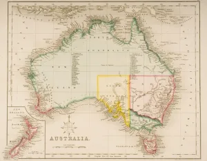
Background imageGeographical Collection: Map of Australia and New Zealand (coloured engraving)

Map of Australia and New Zealand (coloured engraving)
KW270862 Map of Australia and New Zealand (coloured engraving) by Archer, J. (fl.1830); Private Collection; Ken Welsh; English, out of copyright

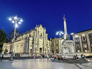
Background imageGeographical Collection: Italy, Sicily, Catania, Cathedral of Catania

Italy, Sicily, Catania, Cathedral of Catania

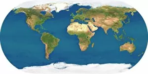
Background imageGeographical Collection: Whole Earth, satellite image

Whole Earth, satellite image. This map is centred on the Greenwich meridian, at zero degrees latitude. Arctic and Antarctic ice is white, oceans are blue and land is green and brown

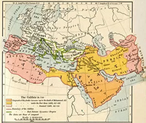
Background imageGeographical Collection: Map of the Muslim expansion and the Byzantine Empire at the end of the Umayyad Caliphate, in 750

Map of the Muslim expansion and the Byzantine Empire at the end of the Umayyad Caliphate, in 750. From Historical Atlas, published 1923

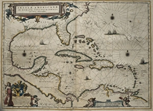
Background imageGeographical Collection: Atlas Novus, 17th c Map of the Caribbean

Atlas Novus, 17th c Map of the Caribbean
BLAEU, Jan (1596-1673). Atlas Novus or Atlas Maior. 1635 - 1665. Insulae Americanae in Oceano Septentrionali cum Terris Adiacentibus. Map of the Caribbean islands printed in Amsterdam circa 1645

Background imageGeographical Collection: Isle of Sheppey, UK, aerial view C014 / 6171

Isle of Sheppey, UK, aerial view C014 / 6171
Isle of Sheppey. Aerial photograph of the Isle of Sheppey, Kent, UK

Background imageGeographical Collection: Ross Arctic search expedition, 1848-9 C016 / 4490

Ross Arctic search expedition, 1848-9 C016 / 4490
Ross Arctic search expedition. 19th-century artwork of the ships HMS Enterprise and HMS Investigator caught in pack ice in Baffin Bay off Devils Point in the Arctic


All Professionally Made to Order for Quick Shipping

"Journey through Time and Space: Exploring the Geographical Evolution" Al-Idrisi's World Map, 1154: Unveiling ancient cartographic wisdom, this map showcases the Islamic scholar's remarkable understanding of global geography. Continental Drift after 250 Million Years: Witnessing Earth's transformative power, this concept reveals how tectonic plates shaped our continents over millions of years. Malham Cove, Yorkshire Dales: A geological marvel standing tall in the picturesque Yorkshire Dales, showcasing nature's artistic prowess carved by ice and water. British Empire World Map, 19th Century: Tracing the vast expanse of an empire on which the sun never set; a testament to Britain's once-global dominance. James Craig Map of New Town, Edinburgh, Scotland (1768): The birth of urban planning captured in ink; explore Edinburgh’s meticulously designed New Town with its unique topography. Anglo-Saxon 10th Century World Map: Delving into medieval perceptions of our planet; discover how early societies envisioned their place within a world still shrouded in mystery. Catalan Atlas, 14th Century: Marvel at one of history’s most exquisite maps as it unveils Europe’s expanding knowledge during the Middle Ages – a true masterpiece. UK at Night from Space: Behold Britain illuminated like never before. This awe-inspiring view from space captures the vibrant tapestry that is modern-day United Kingdom after sundown. Orteliuss Map of Ottoman Empire (1570): Step back into time and witness one man’s meticulous depiction of an empire that spanned three continents - revealing cultural diversity and grandeur. Europe at Night - Satellite Image & Europe at Night - Illuminating Boundaries : Gaze upon two contrasting images capturing Europe under different lights – highlighting both unity and division across nations 17th Century World Map.