Fraud Blocker Skip to main content

Geographical Collection (page 4)

"Journey through Time and Space: Exploring the Geographical Evolution" Al-Idrisi's World Map, 1154: Unveiling ancient cartographic wisdom

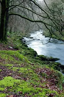
Background imageGeographical Collection: Woodland river

Woodland river. This is the East Lyn river, which flows through Exmoor National Park. Photographed near Rockford, Somerset, UK

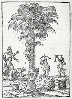
Background imageGeographical Collection: Egyptian palm tree, 16th century artwork

Egyptian palm tree, 16th century artwork. The fruits of this palm tree are being harvested. The palm tree most commonly cultivated in this way is the date palm tree, which has sweet edible fruit

Background imageGeographical Collection: Stromboli double eruption

Stromboli double eruption. Two craters of the volcano Stromboli erupting at night, throwing out pyroclastic material in the form of lava (molten rock)

Background imageGeographical Collection: Glacier crevasse, Canada

Glacier crevasse, Canada
Glacier crevasse. Crevasse in the surface of the Tellot glacier. Crevasses form in glaciers as the ice cracks when the glacier moves

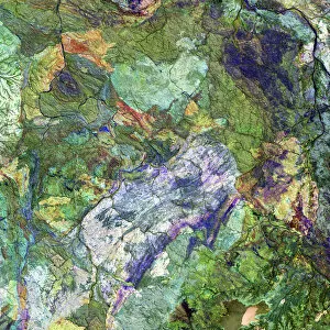
Background imageGeographical Collection: Great Sandy Desert, satellite image

Great Sandy Desert, satellite image. North is at upper left. Vegetation is green and purple, while more barren, rocky areas are various shades of white and brown

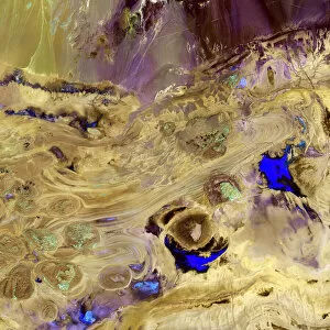
Background imageGeographical Collection: Great Salt Desert, satellite image

Great Salt Desert, satellite image. North is at top. Desert soil and mud is light brown, barren rocky areas are pink, and salt pans are blue
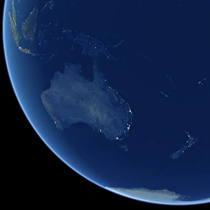
Background imageGeographical Collection: Australia at night, satellite image

Australia at night, satellite image. City lights (yellow) show areas of more dense population, particularly in Southeast Asia (top left) and on Australias east coast
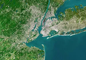
Background imageGeographical Collection: New York City, satellite image

New York City, satellite image
New York City, USA, satellite image. North is attop. Urban areas are white, vegetation is greenand water is blue. The island of Manhattan is atupper centre on the east coast of the HudsonRiver

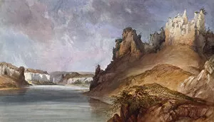
Background imageGeographical Collection: View of the Stone walls on the Upper Missouri, 1832-34 (w / c on paper)

View of the Stone walls on the Upper Missouri, 1832-34 (w / c on paper)
5054763 View of the Stone walls on the Upper Missouri, 1832-34 (w/c on paper) by Bodmer, Karl (1809-93); Joslyn Museum, Omaha, Nebraska

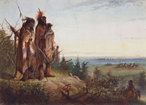
Background imageGeographical Collection: Crossing the Divide or Thirsty Trappers Making a Rush for the River, c. 1837 (w / c on paper)

Crossing the Divide or Thirsty Trappers Making a Rush for the River, c. 1837 (w / c on paper)
5310546 Crossing the Divide or Thirsty Trappers Making a Rush for the River, c.1837 (w/c on paper) by Miller, Alfred Jacob (1810-74); 21.6x29.3 cm; Joslyn Museum, Omaha, Nebraska

Background imageGeographical Collection: Map of Mongolia showing part of Russia, Japan and China, c. 1680 (coloured engraving)

Map of Mongolia showing part of Russia, Japan and China, c. 1680 (coloured engraving)
BAL42852 Map of Mongolia showing part of Russia, Japan and China, c.1680 (coloured engraving) by Wit, Frederick de (1630-1706); O Shea Gallery, London, UK; Dutch, out of copyright

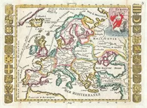
Background imageGeographical Collection: 1706, De La Feuille Map of Europe, topography, cartography, geography, land, illustration

1706, De La Feuille Map of Europe, topography, cartography, geography, land, illustration
1706, De La Feuille Map of Europe

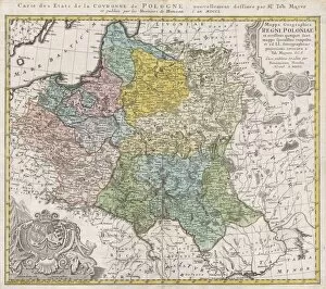
Background imageGeographical Collection: 1750, Homann Heirs Map of Poland, topography, cartography, geography, land, illustration

1750, Homann Heirs Map of Poland, topography, cartography, geography, land, illustration
1750, Homann Heirs Map of Poland

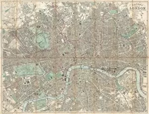
Background imageGeographical Collection: 1890, Bacon Travelers Pocket Map of London, England, topography, cartography

1890, Bacon Travelers Pocket Map of London, England, topography, cartography
1890, Bacon Travelers Pocket Map of London, England

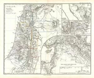
Background imageGeographical Collection: 1865, Spruner Map of Israel, Canaan, or Palestine in Ancient Times, topography, cartography

1865, Spruner Map of Israel, Canaan, or Palestine in Ancient Times, topography, cartography
1865, Spruner Map of Israel, Canaan, or Palestine in Ancient Times

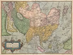
Background imageGeographical Collection: 1570, Ortelius Map of Asia, first edition, Abraham Ortelius, also Orthellius, 1527 - 1598

1570, Ortelius Map of Asia, first edition, Abraham Ortelius, also Orthellius, 1527 - 1598, Flemish, Netherlandish cartographer and geographer

Background imageGeographical Collection: Wylds Military Sketch of Zululand, 1879 (colour engraving)

Wylds Military Sketch of Zululand, 1879 (colour engraving)
XCF282014 Wylds Military Sketch of Zululand, 1879 (colour engraving) by Wyld, James the Elder (1790-1836); British Museum, London, UK; (add.info.: the Transvaal and adjoining territories; ); British

Background imageGeographical Collection: Glow Worms, Ruakuri Caves, Waitomo, King Country, North Island, New Zealand

Glow Worms, Ruakuri Caves, Waitomo, King Country, North Island, New Zealand

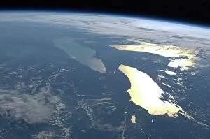
Background imageGeographical Collection: The Great Lakes, ISS image C016 / 3870

The Great Lakes, ISS image C016 / 3870
The Great Lakes. View from the International Space Station (ISS) of the Great Lakes of the USA and Canada. North is towards upper right. Here, the ISS is over a point to the southeast of Nova Scotia

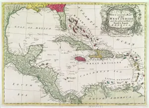
Background imageGeographical Collection: New and accurate map of the West Indies (colour litho)

New and accurate map of the West Indies (colour litho)
XCF274391 New and accurate map of the West Indies (colour litho) by American School; Private Collection; American, out of copyright

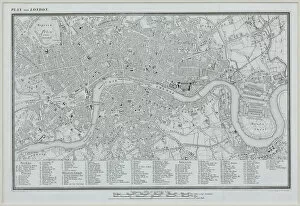
Background imageGeographical Collection: antiquity, archival, cartography, city, england, europe, geographical, geography

antiquity, archival, cartography, city, england, europe, geographical, geography, great britain, historical, london, map, nobody, old-fashioned, roads, streets, text, thames river, uk, urban

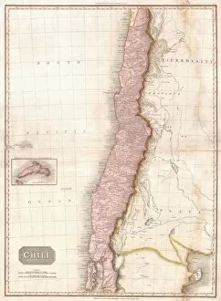
Background imageGeographical Collection: 1818, Pinkerton Map of Chile, John Pinkerton, 1758 - 1826, Scottish antiquarian, cartographer

1818, Pinkerton Map of Chile, John Pinkerton, 1758 - 1826, Scottish antiquarian, cartographer, UK

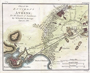
Background imageGeographical Collection: 1784, Bocage Map of the City of Athens in Ancient Greece, topography, cartography

1784, Bocage Map of the City of Athens in Ancient Greece, topography, cartography
1784, Bocage Map of the City of Athens in Ancient Greece

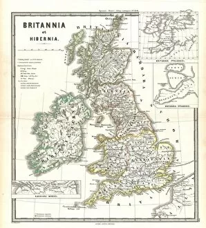
Background imageGeographical Collection: 1865, Spruner Map of the British Isles, England, Scotland, Ireland, topography, cartography

1865, Spruner Map of the British Isles, England, Scotland, Ireland, topography, cartography
1865, Spruner Map of the British Isles, England, Scotland, Ireland

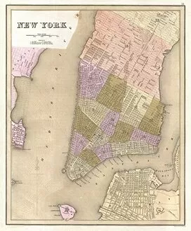
Background imageGeographical Collection: 1839, Bradford Map of New York City, New York, topography, cartography, geography

1839, Bradford Map of New York City, New York, topography, cartography, geography
1839, Bradford Map of New York City, New York

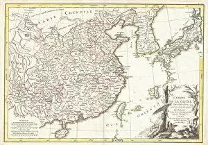
Background imageGeographical Collection: 1770, Bonne Map of China, Korea, Japan and Formosa, Rigobert Bonne 1727 - 1794, one

1770, Bonne Map of China, Korea, Japan and Formosa, Rigobert Bonne 1727 - 1794, one of the most important cartographers of the late 18th century

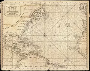
Background imageGeographical Collection: 1683, Mortier Map of North America, the West Indies, and the Atlantic Ocean, topography

1683, Mortier Map of North America, the West Indies, and the Atlantic Ocean, topography
1683, Mortier Map of North America, the West Indies, and the Atlantic Ocean

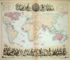
Background imageGeographical Collection: British Empire throughout the World (coloured engraving)

British Empire throughout the World (coloured engraving)
XCF275033 British Empire throughout the World (coloured engraving) by English School, (19th century); Private Collection; English, out of copyright

Background imageGeographical Collection: Soviet Arctic explorer Papanin, 1937

Soviet Arctic explorer Papanin, 1937
Soviet Arctic explorer Ivan Papanin (1894-1986) in 1937 while commanding the first Soviet drifting station " North Pole-1". Expedition members and equipment are in the background

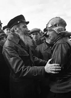
Background imageGeographical Collection: Otto Schmidt, Soviet Arctic explorer

Otto Schmidt, Soviet Arctic explorer
Otto Yulievich Schmidt (left, 1891-1956), Soviet Arctic explorer and geophysicist, greeting one of the rescue pilots (right) during the Chelyuskin expedition to the Arctic

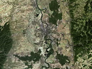
Background imageGeographical Collection: Mannheim, satellite image

Mannheim, satellite image
Mannheim, Germany, satellite image. Mannheim is situated in the state of Baden-Wuttemburg. The city has a population of around 320

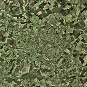
Background imageGeographical Collection: Hemel Hempstead, UK, aerial image

Hemel Hempstead, UK, aerial image
Hemel Hempstead, UK, aerial photograph. Hemel Hempstead is a town in Hertfordshire, England. It was developed after World War II as a new town, but has existed since the 8th century

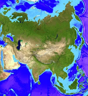
Background imageGeographical Collection: Asia

Asia. Computer artwork, based on a satellite image, of Asia. North is at top. Water is blue, vegetation is green and desert is yellow

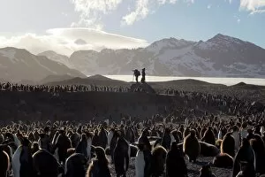
Background imageGeographical Collection: Penguin breeding colony research

Penguin breeding colony research, with researchers and photographers in the background. Located at St Andrews Bay, this is the largest breeding colony of king penguins (Aptenodytes patagonicus)

Background imageGeographical Collection: Spider rock, Arizona, USA

Spider rock, Arizona, USA
Spider Rock (lower centre left). This eroded sandstone spire is located in Canyon de Chelley National Monument, Arizona, USA

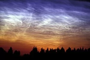
Background imageGeographical Collection: Noctilucent cloud

Noctilucent cloud over trees. This type of cloud, also known as polar mesospheric, is visible only in deep twilight and is seen mostly during the summer

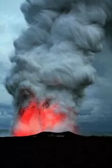
Background imageGeographical Collection: Lava meeting the ocean

Lava meeting the ocean. Lava from the Kilauea volcano exploding and producing a plume of steam, smoke and gases where it meets the Pacific Ocean

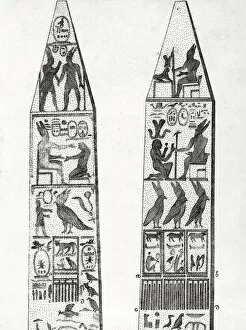
Background imageGeographical Collection: Egyptian obelisks, 18th century artwork

Egyptian obelisks, 18th century artwork. Egyptian hieroglyphics can be seen carved on the sides. This artwork is from the Italian edition of De l origine des lois, des arts et des sciences

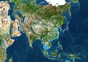
Background imageGeographical Collection: Asia, satellite image

Asia, satellite image. The land is mostly covered by vegetation and seen as the green areas. Deserts are shown in yellow, and mountain ranges are grey

Background imageGeographical Collection: Orteliuss map of Holland, 1570

Orteliuss map of Holland, 1570
Orteliuss map of Holland. This map is from the 1570 first edition of Theatrum orbis terrarum ( Theatre of the World ). Drawn by the Flemish mapmaker Abraham Ortelius (1527-1598)

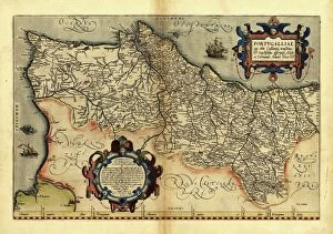
Background imageGeographical Collection: Orteliuss map of Portugal, 1570

Orteliuss map of Portugal, 1570
Orteliuss map of Portugal. This map is from the 1570 first edition of Theatrum orbis terrarum ( Theatre of the World ). Drawn by the Flemish mapmaker Abraham Ortelius (1527-1598)

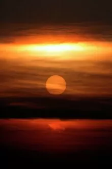
Background imageGeographical Collection: Sunset

Sunset. Sun setting behind clouds

Background imageGeographical Collection: Grand Canyon

Grand Canyon. Coloured optical and infrared, Landsat satellite image of the Grand Canyon, Arizona, USA. North is at top. Arid areas are brown and purple, forests are green and water is black

Background imageGeographical Collection: Wilkins Ice Shelf, Antarctica

Wilkins Ice Shelf, Antarctica
Wilkins Ice Shelf. Satellite image showing the location of the Wilkins Ice Shelf (just above and right of centre) on the Antarctic Peninsula

Background imageGeographical Collection: Speke & Grant. Lecture

Speke & Grant. Lecture
The explorers deliver a lecture at the Royal Geographical Society

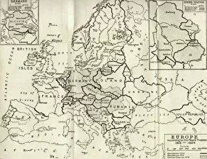
Background imageGeographical Collection: Map of Europe according to the Peace Treaties 1918 - 1924. From The Evolution of Modern Europe

Map of Europe according to the Peace Treaties 1918 - 1924. From The Evolution of Modern Europe, 1453 - 1932, published 1933

Background imageGeographical Collection: Map of Europe in 1815. From The Evolution of Modern Europe, 1453 - 1932, published 1933

Map of Europe in 1815. From The Evolution of Modern Europe, 1453 - 1932, published 1933

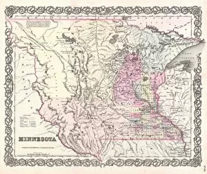
Background imageGeographical Collection: 1855, Colton Map of Minnesota, topography, cartography, geography, land, illustration

1855, Colton Map of Minnesota, topography, cartography, geography, land, illustration
1855, Colton Map of Minnesota


All Professionally Made to Order for Quick Shipping

"Journey through Time and Space: Exploring the Geographical Evolution" Al-Idrisi's World Map, 1154: Unveiling ancient cartographic wisdom, this map showcases the Islamic scholar's remarkable understanding of global geography. Continental Drift after 250 Million Years: Witnessing Earth's transformative power, this concept reveals how tectonic plates shaped our continents over millions of years. Malham Cove, Yorkshire Dales: A geological marvel standing tall in the picturesque Yorkshire Dales, showcasing nature's artistic prowess carved by ice and water. British Empire World Map, 19th Century: Tracing the vast expanse of an empire on which the sun never set; a testament to Britain's once-global dominance. James Craig Map of New Town, Edinburgh, Scotland (1768): The birth of urban planning captured in ink; explore Edinburgh’s meticulously designed New Town with its unique topography. Anglo-Saxon 10th Century World Map: Delving into medieval perceptions of our planet; discover how early societies envisioned their place within a world still shrouded in mystery. Catalan Atlas, 14th Century: Marvel at one of history’s most exquisite maps as it unveils Europe’s expanding knowledge during the Middle Ages – a true masterpiece. UK at Night from Space: Behold Britain illuminated like never before. This awe-inspiring view from space captures the vibrant tapestry that is modern-day United Kingdom after sundown. Orteliuss Map of Ottoman Empire (1570): Step back into time and witness one man’s meticulous depiction of an empire that spanned three continents - revealing cultural diversity and grandeur. Europe at Night - Satellite Image & Europe at Night - Illuminating Boundaries : Gaze upon two contrasting images capturing Europe under different lights – highlighting both unity and division across nations 17th Century World Map.