Fraud Blocker Skip to main content

Geographie Collection

Geographie, the study of our world's vast landscapes and intricate details, encompasses a multitude of captivating historical moments

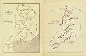
Background imageGeographie Collection: Middle course: map of the Rhone basin to be reproduced, c.1880-90 (print)

Middle course: map of the Rhone basin to be reproduced, c.1880-90 (print)
8713431 Middle course: map of the Rhone basin to be reproduced, c.1880-90 (print); 22 x 17 cm; Private Collection; (add.info.: in "Practical method of writing-reading by A)

Background imageGeographie Collection: Durenstein, 1839 (engraving)

Durenstein, 1839 (engraving)
7268746 Durenstein, 1839 (engraving); 20.0x28.5 cm; JMK Archiv, Bremen, Germany; (add.info.: Captions' Durenstein 'and 'Aus d. Kunstanst. d. Bibliogr. Instit. in Hildbh)

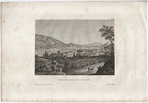
Background imageGeographie Collection: Lake Como in Italy, 1833 (engraving)

Lake Como in Italy, 1833 (engraving)
7273657 Lake Como in Italy, 1833 (engraving); 19.9x28.8 cm; JMK Archiv, Bremen, Germany; (add.info.: Captions 'Como on Lake Como in Italy. 'and 'Aus d. Kunstanst. d. Bibliogr. Inst)

The capture of Raab by Adolf Schwarzenberg on 28/03/1598. 1653 Print by Franz Hogenberg (1535-1590)
BEN5464282 The capture of Raab by Adolf Schwarzenberg on 28/03/1598. 1653 Print by Franz Hogenberg (1535-1590) Cabinet des Estampes, B.N, Paris

Background imageGeographie Collection: Geography: portulan of the Mediterranean and Black Seas (author Gabriele?) , 1449

Geography: portulan of the Mediterranean and Black Seas (author Gabriele?) , 1449. Archivio di Stato di Florence
BEN5464243 Geography: portulan of the Mediterranean and Black Seas (author Gabriele?) , 1449. Archivio di Stato di Florence.; Photo © Raffaello Bencini.

Background imageGeographie Collection: View of the city of Innsbruck, Austria. View of the cities of the Habsburg Empire

View of the city of Innsbruck, Austria. View of the cities of the Habsburg Empire
BEN5473954 View of the city of Innsbruck, Austria. View of the cities of the Habsburg Empire. Fresco of the Michelozzo Court at the Palazzo Vecchio in Florence

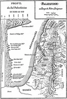
Background imageGeographie Collection: Map of Palestine at the time of Jesus Christ, 1908 (printing)

Map of Palestine at the time of Jesus Christ, 1908 (printing)
8672362 Map of Palestine at the time of Jesus Christ, 1908 (printing); Private Collection; (add.info.: Map of Palestine in the time of Our Lord Jesus Christ)

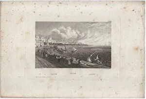
Background imageGeographie Collection: Cadix, 1833 (engraving)

Cadix, 1833 (engraving)
7273640 Cadix, 1833 (engraving); 19.3x28.8 cm; JMK Archiv, Bremen, Germany; (add.info.: Captions 'Cadix, Cadiz; Cadiz 'and 'Bibl. Inst. in Hildbh. and N. York. ', 'Friedr)

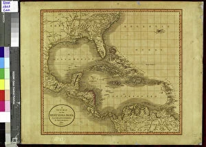
Background imageGeographie Collection: Geography: map showing the Gulf of Mexico, the Caribbean Islands, Central America (Honduras)

Geography: map showing the Gulf of Mexico, the Caribbean Islands, Central America (Honduras, Costarica)
VEN5031255 Geography: map showing the Gulf of Mexico, the Caribbean Islands, Central America (Honduras, Costarica), northern South America (Venezuela) and southern United States

Background imageGeographie Collection: Geography: representation of the Gulf of Mexico with the coasts of Mexico, Yucatan

Geography: representation of the Gulf of Mexico with the coasts of Mexico, Yucatan, Florida and Cuba (Antilles)
VEN5031179 Geography: representation of the Gulf of Mexico with the coasts of Mexico, Yucatan, Florida and Cuba (Antilles)

Geography map: representation of the island of Hispaniola (Santo Domingo and Haiti) (Greater Antilles)
VEN5030472 Geography map: representation of the island of Hispaniola (Santo Domingo and Haiti) (Greater Antilles), of the Virgin Islands (Lesser Antilles)

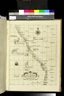
Background imageGeographie Collection: Geography map: representation of Peru's South American coast from an Atlas made by Italian

Geography map: representation of Peru's South American coast from an Atlas made by Italian cartographer Antonio
VEN5030459 Geography map: representation of Peru's South American coast from an Atlas made by Italian cartographer Antonio Francesco Lucini (born 1605), 1661 approximately Biblioteca Angelica

Background imageGeographie Collection: Geography: Earth globe realized by cartographer Willem Janszoon Blaeu (1571-1638)

Geography: Earth globe realized by cartographer Willem Janszoon Blaeu (1571-1638)
VEN5030392 Geography: Earth globe realized by cartographer Willem Janszoon Blaeu (1571-1638). Debut of the 17th century Biblioteca Angelica

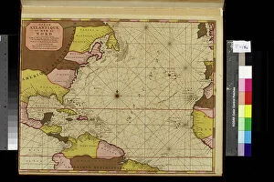
Background imageGeographie Collection: Geography map: representation of the Atlantic Ocean (or North Sea) with the coasts of the Americas

Geography map: representation of the Atlantic Ocean (or North Sea) with the coasts of the Americas
VEN5030386 Geography map: representation of the Atlantic Ocean (or North Sea) with the coasts of the Americas (South and United States), the Caribbean Sea and the Caribbean

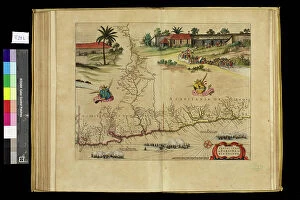
Geography map: representation of the Paraiba region in northern Brazil where the Rio Grande river of the North in South
VEN5030364 Geography map: representation of the Paraiba region in northern Brazil where the Rio Grande river of the North in South America is located from an Atlas made by the cartographer Willem

Geography map: representation of Chile from an Atlas by Willem Janszoon Blaeu (1571-1638), approximately 1630
VEN5030319 Geography map: representation of Chile from an Atlas by Willem Janszoon Blaeu (1571-1638), approximately 1630. Biblioteca Angelica

Background imageGeographie Collection: Geography map: representation of Magellan Detroit and Tierra del Fuego in the extreme south of

Geography map: representation of Magellan Detroit and Tierra del Fuego in the extreme south of South America from an
VEN5030314 Geography map: representation of Magellan Detroit and Tierra del Fuego in the extreme south of South America from an Atlas by Willem Janszoon Blaeu (1571-1638), approximately 1630

Background imageGeographie Collection: Geography map: representation of Barbados Island (Barbados) from an Atlas by Charles Price

Geography map: representation of Barbados Island (Barbados) from an Atlas by Charles Price
VEN5030270 Geography map: representation of Barbados Island (Barbados) from an Atlas by Charles Price, beginning of the 18th century

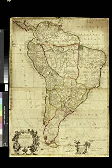
Background imageGeographie Collection: Geography map: representation of South America from an Atlas by Charles Price

Geography map: representation of South America from an Atlas by Charles Price, beginning of the 18th century
VEN5030268 Geography map: representation of South America from an Atlas by Charles Price, beginning of the 18th century. Biblioteca Angelica

Background imageGeographie Collection: Geography map: representation of South America from an Atlas of Guillaume de l'Isle (1675-1726)

Geography map: representation of South America from an Atlas of Guillaume de l'Isle (1675-1726), 1700
VEN5030263 Geography map: representation of South America from an Atlas of Guillaume de l'Isle (1675-1726), 1700. Biblioteca Angelica

Background imageGeographie Collection: Geography map: representation of the meridional part of South America (Argentina, Chile)

Geography map: representation of the meridional part of South America (Argentina, Chile)
VEN5030237 Geography map: representation of the meridional part of South America (Argentina, Chile, Falkland Islands) from the Atlas " Amerique meridionale" by French cartographer

Background imageGeographie Collection: Geography map: representation of the coasts of Colombia, made by Dutch cartographer Gerard van

Geography map: representation of the coasts of Colombia, made by Dutch cartographer Gerard van Keulen (1678-1726)
VEN5030222 Geography map: representation of the coasts of Colombia, made by Dutch cartographer Gerard van Keulen (1678-1726) 1709-1713

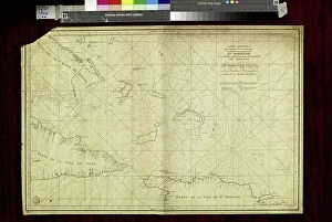
Background imageGeographie Collection: Geography map: representation of the coasts of Cuba and Havana Bay in the West Indies

Geography map: representation of the coasts of Cuba and Havana Bay in the West Indies
VEN5030185 Geography map: representation of the coasts of Cuba and Havana Bay in the West Indies, made by Dutch cartographer Gerard van Keulen (1678-1726) 1709-1713

Background imageGeographie Collection: Geography map: representation of Turtle Island off Hispaniola near the Passage of the Winds

Geography map: representation of Turtle Island off Hispaniola near the Passage of the Winds between Cuba
VEN5030175 Geography map: representation of Turtle Island off Hispaniola near the Passage of the Winds between Cuba and Hispaniola, made by Dutch cartographer Gerard van Keulen (1678-1726) 1709-1713

Background imageGeographie Collection: Geography map: representation of the coasts of New Spain (which included part of present-day Mexico)

Geography map: representation of the coasts of New Spain (which included part of present-day Mexico)
VEN5030163 Geography map: representation of the coasts of New Spain (which included part of present-day Mexico, California and some southern states of the United States)

Background imageGeographie Collection: Geography Atlas: representation of the Bahamas islands, northern Hispaniola (Santo Domingo)

Geography Atlas: representation of the Bahamas islands, northern Hispaniola (Santo Domingo)
VEN5031335 Geography Atlas: representation of the Bahamas islands, northern Hispaniola (Santo Domingo) and the Leewind Passage between Cuba and Hispaniola in the West Indies

Background imageGeographie Collection: Geography: Map of Puerto Rico Island, Beata Island, Hispaniola coasts in the West Indies

Geography: Map of Puerto Rico Island, Beata Island, Hispaniola coasts in the West Indies
VEN5031327 Geography: Map of Puerto Rico Island, Beata Island, Hispaniola coasts in the West Indies. Map from an Atlas of Maritime Geography of 1767
Background imageGeographie Collection: COSA, Juan de la (1460-1510). Cartographer. Chart by Juan de la Cosa (1500). SPAIN

COSA, Juan de la (1460-1510). Cartographer. Chart by Juan de la Cosa (1500). SPAIN. MADRID (AUTONOMOUS COMMUNITY)
CUL4877189 COSA, Juan de la (1460-1510). Cartographer. Chart by Juan de la Cosa (1500). SPAIN. MADRID (AUTONOMOUS COMMUNITY). Madrid. Navy Museum; (add.info.: COSA, Juan de la (1460-1510)

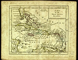
Background imageGeographie Collection: Geography Atlas: representation of the Caribbean Sea region, the Caribbean (Cuba, Jamaica)

Geography Atlas: representation of the Caribbean Sea region, the Caribbean (Cuba, Jamaica, Hispaniola, Jamaica)
VEN5030043 Geography Atlas: representation of the Caribbean Sea region, the Caribbean (Cuba, Jamaica, Hispaniola, Jamaica), the Bahamas Islands, the Lesser Antilles

Background imageGeographie Collection: Geography Atlas: description of the Caribbean Sea, Caribbean Sea (Cuba, Jamaica, Hispaniola)

Geography Atlas: description of the Caribbean Sea, Caribbean Sea (Cuba, Jamaica, Hispaniola, Jamaica)
VEN5030036 Geography Atlas: description of the Caribbean Sea, Caribbean Sea (Cuba, Jamaica, Hispaniola, Jamaica), the Bahamas Islands and the Lesser Antilles with map

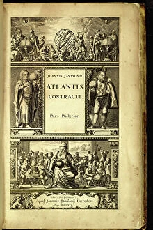
Background imageGeographie Collection: Geography Atlas: frontispiece of 'Atlantis contracti' (Atlas)

Geography Atlas: frontispiece of "Atlantis contracti" (Atlas) by geographer Johann Janssonius (or Jan Jansson)
VEN5030023 Geography Atlas: frontispiece of "Atlantis contracti" (Atlas) by geographer Johann Janssonius (or Jan Jansson) (1588-1664), 1666

Background imageGeographie Collection: Geography Atlas: representation of the island of Antigua in the Caribbean

Geography Atlas: representation of the island of Antigua in the Caribbean
VEN5030006 Geography Atlas: representation of the island of Antigua in the Caribbean. Map taken from "The west indian atlas or general description of west indies" by Thomas Jefferys

Background imageGeographie Collection: Geography Atlas: representation of Tobago Island in the Lesser Antilles

Geography Atlas: representation of Tobago Island in the Lesser Antilles. Map taken from "The west indian atlas or
VEN5029619 Geography Atlas: representation of Tobago Island in the Lesser Antilles. Map taken from "The west indian atlas or general description of west indies" by Thomas Jefferys

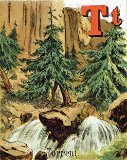
Background imageGeographie Collection: Letter T (Torrent). Waterfall in the forest. Alphabet of small geographers

Letter T (Torrent). Waterfall in the forest. Alphabet of small geographers. Children's bookshop illustrated
DUV4201997 Letter T (Torrent). Waterfall in the forest. Alphabet of small geographers. Children's bookshop illustrated. Guerin-Muller et Cie Editeurs, A. Capendu Successor, Paris, 1881. L.V

Y. Yeddo Letter: Tokyo City formerly known as Yedo. Alphabet of small geographers. Children's bookshop illustrated
DUV4202026 Y. Yeddo Letter: Tokyo City formerly known as Yedo. Alphabet of small geographers. Children's bookshop illustrated. Guerin-Muller et Cie Editeurs, A. Capendu Successor, Paris, 1881

Background imageGeographie Collection: Letter I (Islands), J (Japanese), K (Kabyles), L (Lake). Alphabet of small geographers

Letter I (Islands), J (Japanese), K (Kabyles), L (Lake). Alphabet of small geographers
DUV4201932 Letter I (Islands), J (Japanese), K (Kabyles), L (Lake). Alphabet of small geographers. Children's bookshop illustrated. Guerin-Muller et Cie Editeurs, A

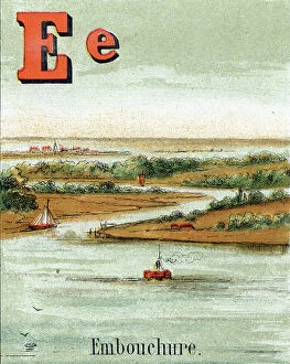
Background imageGeographie Collection: Letter E (Mouth). River flowing into the sea. Alphabet of small geographers

Letter E (Mouth). River flowing into the sea. Alphabet of small geographers. Children's bookshop illustrated
DUV4201922 Letter E (Mouth). River flowing into the sea. Alphabet of small geographers. Children's bookshop illustrated. Guerin-Muller et Cie Editeurs, A. Capendu Successor, Paris, 1881. L.V

Background imageGeographie Collection: Letter B (Wood). Alphabet of small geographers. Children's bookshop illustrated

Letter B (Wood). Alphabet of small geographers. Children's bookshop illustrated. Guerin-Muller et Cie Editeurs, A
DUV4201896 Letter B (Wood). Alphabet of small geographers. Children's bookshop illustrated. Guerin-Muller et Cie Editeurs, A. Capendu Successor, Paris, 1881. L.V. Leer and Cie Haarlem

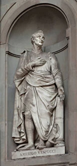
Background imageGeographie Collection: Statue of Amerigo Vespucci (1454-1512), merchant, Italian navigator

Statue of Amerigo Vespucci (1454-1512), merchant, Italian navigator, he was the first to consider the coasts of
YOU4419652 Statue of Amerigo Vespucci (1454-1512), merchant, Italian navigator, he was the first to consider the coasts of present-day South America as a new continent, distinct from Asia

Background imageGeographie Collection: Letter I (Islands). Two wild islands in the middle of the sea. Alphabet of small geographers

Letter I (Islands). Two wild islands in the middle of the sea. Alphabet of small geographers
DUV4201939 Letter I (Islands). Two wild islands in the middle of the sea. Alphabet of small geographers. Children's bookshop illustrated. Guerin-Muller et Cie Editeurs, A

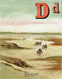
Background imageGeographie Collection: Letter D (Desert). Alphabet of small geographers. Children's bookshop illustrated

Letter D (Desert). Alphabet of small geographers. Children's bookshop illustrated
DUV4201909 Letter D (Desert). Alphabet of small geographers. Children's bookshop illustrated. Guerin-Muller et Cie Editeurs, A. Capendu Successor, Paris, 1881. L.V. Leer and Cie Haarlem

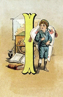
Background imageGeographie Collection: Letter I. Young boy at school during a geography lecture. Engraving (Chromolithography - Chromo)

Letter I. Young boy at school during a geography lecture. Engraving (Chromolithography - Chromo)
DUV4210203 Letter I. Young boy at school during a geography lecture. Engraving (Chromolithography - Chromo) in " The Great Bebe Alphabet"

Background imageGeographie Collection: Surveying levels or theodolites designed by Mr. Jesse Ramsden and Mr. Edward Troughton

Surveying levels or theodolites designed by Mr. Jesse Ramsden and Mr. Edward Troughton. Copperplate engraving by W
FLO4592989 Surveying levels or theodolites designed by Mr. Jesse Ramsden and Mr. Edward Troughton. Copperplate engraving by W. Lowry after an Illustration by J

Background imageGeographie Collection: Cartography: map of Florence between 1780 and 1845. Firenze Com'era Museum, Florence

Cartography: map of Florence between 1780 and 1845. Firenze Com'era Museum, Florence
BEN5464549 Cartography: map of Florence between 1780 and 1845. Firenze Com'era Museum, Florence; Photo © Raffaello Bencini.

Background imageGeographie Collection: Geographical map of Italy. Miniature from the 15th century, based on the manuscript 'Geographia'

Geographical map of Italy. Miniature from the 15th century, based on the manuscript 'Geographia' (Geography)
BEN5469694 Geographical map of Italy. Miniature from the 15th century, based on the manuscript 'Geographia' (Geography) by Claudius Ptolemaeus (Claudius Ptolemaeus, 90-168)

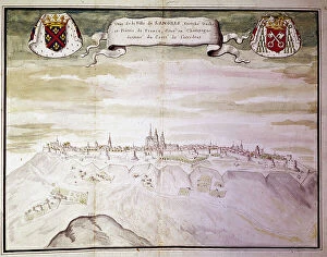
Background imageGeographie Collection: Map of the town of Langres (Haute Marne) seen from the west. Gaignieres collection, 1700

Map of the town of Langres (Haute Marne) seen from the west. Gaignieres collection, 1700. Prints studio, B.N., Paris
BEN5464139 Map of the town of Langres (Haute Marne) seen from the west. Gaignieres collection, 1700. Prints studio, B.N., Paris.; Photo © Raffaello Bencini.

Background imageGeographie Collection: Map of the town of Langres (Haute Marne) and its fortifications. Gaignieres collection, 1700

Map of the town of Langres (Haute Marne) and its fortifications. Gaignieres collection, 1700
BEN5464127 Map of the town of Langres (Haute Marne) and its fortifications. Gaignieres collection, 1700. Prints studio, B.N., Paris.; Photo © Raffaello Bencini.

Background imageGeographie Collection: Great Battle on the Sambre, Germany invaded by the Russians, 1914 (print)

Great Battle on the Sambre, Germany invaded by the Russians, 1914 (print)
PCT5618366 Great Battle on the Sambre, Germany invaded by the Russians, 1914 (print); (add.info.: First World War 14-18 (1914 - 1918)


All Professionally Made to Order for Quick Shipping

Geographie, the study of our world's vast landscapes and intricate details, encompasses a multitude of captivating historical moments. In 1667, Colbert presented the Members of the Royal Academy of Sciences to Louis XIV, showcasing their dedication to unraveling nature's mysteries. This oil on canvas masterpiece immortalizes their pursuit for knowledge. Fast forward to the end of the 19th century when a geographic map of France emerged, depicting areas afflicted by diseases such as scrofule, phtisia, malaria, goiter and cretinism, pellagre, and moth. This representation serves as a stark reminder of humanity's struggle against these ailments throughout history. In 1922, Benito Mussolini seized power in Italy; an illustration capturing this pivotal moment showcases how geography intertwines with politics and shapes nations' destinies. "Around the world with family, " an enchanting illustration from Lady Brassey's 1887 work transports us into an era where travel was both adventurous and exclusive. It reminds us that geography is not only about maps but also about exploration and discovery. The Tour de France takes center stage in Constant Amero's circa 1880-1885 illustration titled "The Tour de France of a Little Parisian. " It highlights how geography can inspire sporting events that unite people across regions. Delhi Ruins depicted in an engraving from 1833 transport us back in time to witness architectural marvels standing tall amidst changing landscapes—a testament to human resilience through centuries. A map illustrating Paris circa 1930 captures its charm while Lustucru pasta tempts our taste buds through a delightful depiction from 1934—showcasing how geography influences culture and culinary traditions. Bartolomeo Velhio's Portulan de Bartolomeo Velhio (1561) at Museo Navale de La Spezia unveils Carte de l'Amerique du Sud, revealing the exploration and cartographic advancements that shaped our understanding of distant lands.