Fraud Blocker Skip to main content

Geography Collection

"Exploring the Rich Tapestry of Geography: From Ancient Maps to Modern Wonders" The Al-Idrisi's world map from 1154 takes us back in time

Background imageGeography Collection: EXPL2A-00352

EXPL2A-00352
The Hereford Mappa Mundi of 1280 - Jerusalem is at the center, Europe lower left, Africa lower right. Printed color halftone reproduction 19th century
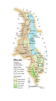
Background imageGeography Collection: Map of Malawi

Map of Malawi

Background imageGeography Collection: Tuskegee airmen flying near the Alps in their P-51 Mustangs

Tuskegee airmen flying near the Alps in their P-51 Mustangs
Tuskegee airmen of the 332nd fighter group flying near the Alps in their P-51 Mustangs

Background imageGeography Collection: Al-Idrisis world map, 1154

Al-Idrisis world map, 1154
Al-Idrisis world map. This world map, known as the Tabula Rogeriana, dates from 1154, and is orientated with North at bottom

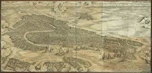
Background imageGeography Collection: Map of Venice in 1500, by Jacopo de Barbari

Map of Venice in 1500, by Jacopo de Barbari
Cartography, Italy, 16th century. Map of Venice in 1500, by Jacopo de Barbari

Background imageGeography Collection: Ross Arctic search expedition, 1848-9 C016 / 4490

Ross Arctic search expedition, 1848-9 C016 / 4490
Ross Arctic search expedition. 19th-century artwork of the ships HMS Enterprise and HMS Investigator caught in pack ice in Baffin Bay off Devils Point in the Arctic

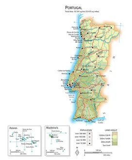
Background imageGeography Collection: Map of Portugal

Map of Portugal

Background imageGeography Collection: Derwent Water, with Blencathra behind, Lake District, Cumbria, England

Derwent Water, with Blencathra behind, Lake District, Cumbria, England, UK

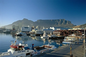
Background imageGeography Collection: The V & A. waterfront and Table Mountain cape Town

The V & A. waterfront and Table Mountain cape Town, Cape Province, South Africa

Background imageGeography Collection: Continental drift after 250 million years

Continental drift after 250 million years, showing the supercontinent of Pangea Ultima, which was named for the ancient supercontinent of Pangea

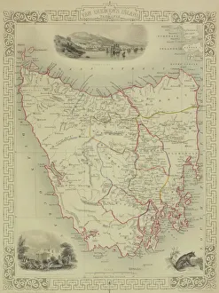
Background imageGeography Collection: Antique map of Tasmania

Antique map of Tasmania

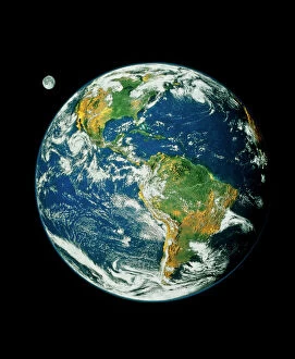
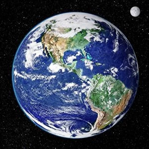
Background imageGeography Collection: Whole Earth (Blue Marble 2000)

Whole Earth (Blue Marble 2000)
Whole Earth. Composite satellite image of Earth centred on the Americas. This is Blue Marble 2000, one of the most detailed Earth images ever made

Background imageGeography Collection: Malham Cove, Yorkshire Dales

Malham Cove, Yorkshire Dales National Park, England. This curving limestone cliff feature was formed by glacial action. It used to have a waterfall running over it

Background imageGeography Collection: Orteliuss map of Ottoman Empire, 1570

Orteliuss map of Ottoman Empire, 1570
Orteliuss map of the Ottoman Empire. This map is from the 1570 first edition of Theatrum orbis terrarum ( Theatre of the World )

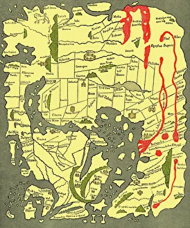
Background imageGeography Collection: Anglo-Saxon 10th century world map

Anglo-Saxon 10th century world map
Anglo-Saxon world map, dating from the 10th century. East is top. This map of the known world was probably produced by an Irish monk

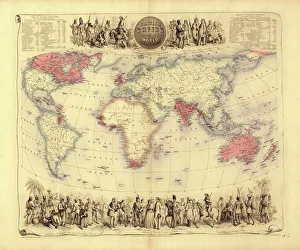
Background imageGeography Collection: British Empire world map, 19th century

British Empire world map, 19th century
British Empire world map. This world map shows the 19th-century British Empire (pink) and its indigenous peoples. Five illustrations (clockwise from upper left) show the people of Australia

Background imageGeography Collection: 1768, James Craig Map of New Town, Edinburgh, Scotland, First Plan of New Town, topography

1768, James Craig Map of New Town, Edinburgh, Scotland, First Plan of New Town, topography
1768, James Craig Map of New Town, Edinburgh, Scotland, First Plan of New Town

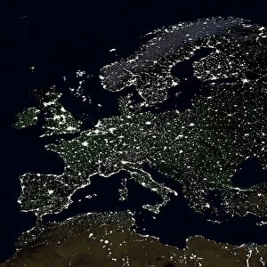
Background imageGeography Collection: Europe at night

Europe at night, satellite image. North is at top. Yellow lights mark the major cities and population areas, showing a clearly delineated Mediterranean coast

Background imageGeography Collection: 17th century world map

17th century world map
World map, published around 1664 in Amsterdam, the Netherlands, by Dutch mapmaker Joan Blaeu (c.1599- 1673). The Latin title is Nova et Accuratissima Totius Terrarum Orbis Tabula

Background imageGeography Collection: Catalan Atlas, 14th century

Catalan Atlas, 14th century. The 6-page Catalan Atlas (1375) was produced on vellum by the Jewish cartographer Abraham Cresques

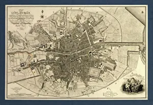
Background imageGeography Collection: Map of the City of Dublin, 1797

Map of the City of Dublin, 1797
Map of the City of Dublin, Ireland. Published in 1797, this map includes details of the canals being built at the time. Canal Harbour (lower right)

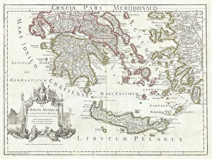
Background imageGeography Collection: 1794, Delisle Map of Southern Ancient Greece, Greeks Isles, and Crete, topography

1794, Delisle Map of Southern Ancient Greece, Greeks Isles, and Crete, topography
1794, Delisle Map of Southern Ancient Greece, Greeks Isles, and Crete

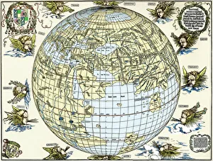
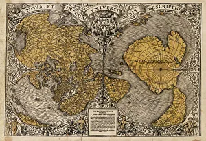
Background imageGeography Collection: Durers world map, 1515

Durers world map, 1515. Albrecht Durer (1471- 1528) was a German artist. His skillful use of perspective and mathematical proportions made him one of the outstanding artistic figures of the early

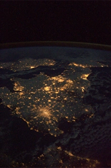
Background imageGeography Collection: UK at night from space

UK at night from space
UK at night, as seen from the International Space Station (ISS). City lights (yellow) show areas of dense population. France is at bottom. Image taken on 24th December 2010

Background imageGeography Collection: Earth from space, satellite image

Earth from space, satellite image
Earth from space. Satellite image showing North and South America as seen from 35, 000 kilometres above the Earths surface. North is at top and the Moon is at upper right

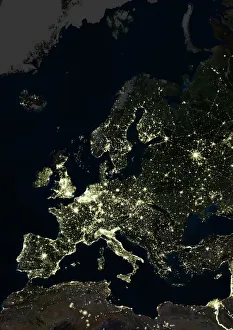
Background imageGeography Collection: Europe at night, satellite image

Europe at night, satellite image. City lights (yellow) of increasing intensity show areas of increasing population, with areas of few lights being more sparsely populated

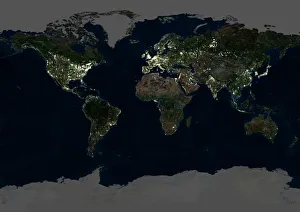
Background imageGeography Collection: Whole Earth at night, satellite image

Whole Earth at night, satellite image
Whole Earth map at night, satellite image. Here, Africa is seen at centre. City lights (yellow) of increasing intensity show areas of increasing population

Background imageGeography Collection: Oronce Fines world map, 1531

Oronce Fines world map, 1531
Oronce Fines world map. Map of the worlds northern and southern hemispheres by the French mathematician and cartographer Oronce Fine (1494-1555)

Background imageGeography Collection: Tenerife, satellite image

Tenerife, satellite image. Satellite image of Tenerife showing Mount Teide (lower centre). Vegetation is green, and water is blue

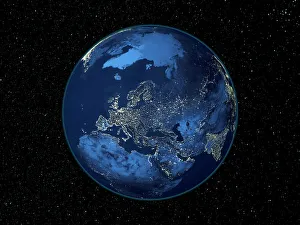
Background imageGeography Collection: Europe at night, satellite image

Europe at night, satellite image. City lights (yellow) show areas of dense population. There are few lights in North Africa (bottom) and the Arctic (top) since they are more sparsely populated

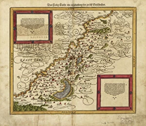
Background imageGeography Collection: Map of Palestine, 1588

Map of Palestine, 1588
16th century map of Palestine. North is towards upper right. Published in 1588, this German map shows the geography of Palestine, centred on the area that later become the state of Israel

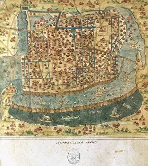
Background imageGeography Collection: Map of Tenochtitlan. Mexico, 1560. By Alonso de Santa Cruz

Map of Tenochtitlan. Mexico, 1560. By Alonso de Santa Cruz
Map of Tenochtitlan. Mexico, 1560. General islario of all the islands in the world. Work of the chronicler and cosmographer Alonso de Santa Cruz (1505-1567). National Library. Madrid. Spain

Background imageGeography Collection: 1886, Telescopic View and Map of the Moon, topography, cartography, geography, land

1886, Telescopic View and Map of the Moon, topography, cartography, geography, land
1886, Telescopic View and Map of the Moon

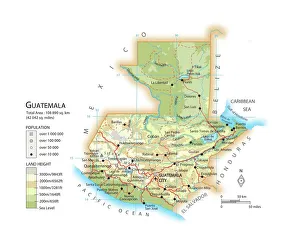
Background imageGeography Collection: Map of Guatemala

Map of Guatemala

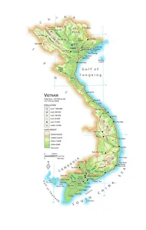
Background imageGeography Collection: Map of Vietnam

Map of Vietnam

Background imageGeography Collection: Sheffield, UK, aerial image

Sheffield, UK, aerial image
Sheffield, UK, aerial photograph. Sheffield is a city of some 510, 000 people (2003) in South Yorkshire. The M1 motorway (running down right) links Sheffield with London (to the south)

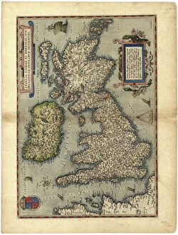
Background imageGeography Collection: 16th century map of the British Isles

16th century map of the British Isles
Map of the British Isles, in the 1570 edition of Ortelius Atlas (Theatrum Orbis Terrarum). Abraham Ortelius (1527-1598) was a Flemish mapmaker who is considered to have produced the first true atlas

Background imageGeography Collection: 16th Century Plan of Florence

16th Century Plan of Florence
16th century plan of Florence, Italy. Detail from the map of Etruria (Tuscany and Northern Lazio), in the Gallery of Maps in the Vatican Museum.The Gallery of Maps holds maps which were commissioned

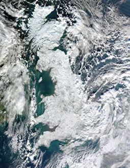
Background imageGeography Collection: Snow-covered United Kingdom, January 2010

Snow-covered United Kingdom, January 2010. Satellite image of snow and ice (white) covering the UK during the cold spell in January 2010

Background imageGeography Collection: North America at night, satellite image

North America at night, satellite image
Africa at night. Satellite image of the Earth at night, set against a background of stars, centred on the continent of Africa. North is at top. City lights (yellow) show areas of dense population

Background imageGeography Collection: Earth, topographic and bathymetric map

Earth, topographic and bathymetric map. This whole Earth map is centred on the Greenwich meridian, at zero degrees latitude

Background imageGeography Collection: Map of Europe, 1600

Map of Europe, 1600
16th century map of Europe. Published in Sienna in 1600, this Italian map shows the latest knowledge of the geography of Europe

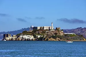
Background imageGeography Collection: Alcatraz Island and Prison in San Franciso, California, USA

Alcatraz Island and Prison in San Franciso, California, USA

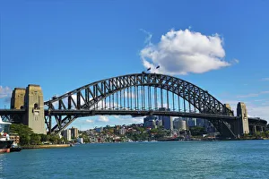
Background imageGeography Collection: Sydney Harbour Bridge, Sydney, New South Wales, Australia

Sydney Harbour Bridge, Sydney, New South Wales, Australia

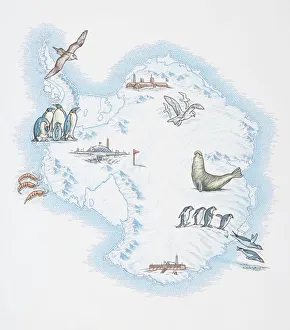
Background imageGeography Collection: Map of Antarctica overlaid with illustrations of Sea Gulls, Penguins, Elephant Seal

Map of Antarctica overlaid with illustrations of Sea Gulls, Penguins, Elephant Seal, Shrimp and buildings

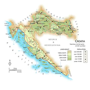
Background imageGeography Collection: Map of Croatia

Map of Croatia

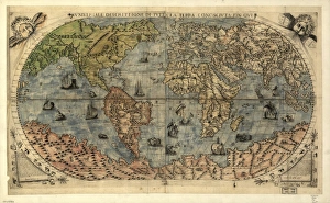
Background imageGeography Collection: 16th century world map

16th century world map
World map, published around 1565 in Venice, Italy, by Italian mapmaker Ferando Bertelli. The title of the map: Universale Descrittione di Tutta la Terra Conosciuta Fin Qui

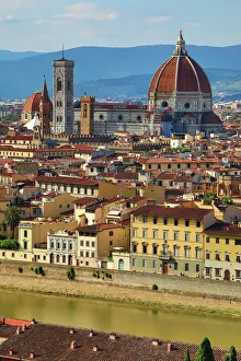
Background imageGeography Collection: General city skyline view and the Duomo, Florence, Italy

General city skyline view and the Duomo, Florence, Italy


All Professionally Made to Order for Quick Shipping

"Exploring the Rich Tapestry of Geography: From Ancient Maps to Modern Wonders" The Al-Idrisi's world map from 1154 takes us back in time, showcasing the early understanding and its importance in navigation. Derwent Water, with Blencathra standing tall behind it, offers a breathtaking view of nature's wonders in the Lake District, Cumbria, England. Jacopo de Barbari's Map of Venice in 1500 allows us to delve into the intricate layout of this enchanting city built on water. An antique map of Tasmania reveals how explorers once charted unknown territories and expanded our knowledge about distant lands. The V & A waterfront and Table Mountain create an awe-inspiring backdrop for Cape Town, South Africa – a testament to geography shaping stunning landscapes. Continental drift after 250 million years shows us that our planet is constantly evolving, reminding us of the dynamic forces at work beneath Earth's surface. Malham Cove stands as a geological marvel within Yorkshire Dales National Park, captivating visitors with its limestone formations carved by natural processes over millennia. Whole Earth (Blue Marble 2000) provides a mesmerizing image capturing our beautiful planet from space – highlighting both its vastness and interconnectedness through geography. The British Empire world map from the 19th century reflects an era when geographical exploration played a significant role in expanding colonial influence across continents. James Craig's Map of New Town Edinburgh from 1768 showcases meticulous topography planning that shaped one of Scotland's most iconic cities even today. Anglo-Saxon 10th-century world map gives insight into early European perceptions and interpretations regarding global geography during medieval times In summary, these diverse hints remind us that geography is not just about maps but also encompasses breathtaking landscapes, historical perspectives on human exploration and settlement, and the ever-changing nature of our planet.