Fraud Blocker Skip to main content

Geography Collection (page 18)

"Exploring the Rich Tapestry of Geography: From Ancient Maps to Modern Wonders" The Al-Idrisi's world map from 1154 takes us back in time

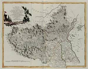
Background imageGeography Collection: The part of Piedmont that contains the Duchy of Aosta, the Contado of Canavese

The part of Piedmont that contains the Duchy of Aosta, the Contado of Canavese, the province of Biella, Valle di Sesia, Signoria di Vercelli and the Upper and Lower Novarese, engraving by G

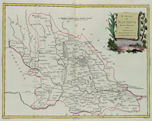
Background imageGeography Collection: Duchy of Mantua, engraving by G. Zuliani taken from Tome II of the 'Newest Atlas' published in

Duchy of Mantua, engraving by G. Zuliani taken from Tome II of the "Newest Atlas" published in Venice in 1781 by Antonio Zatta, Private Collection Florence Engraving Eighteenth Century

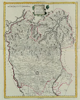
Background imageGeography Collection: Duchy of Milan, engraving by G. Zuliani taken from Tome II of the 'Newest Atlas' published in

Duchy of Milan, engraving by G. Zuliani taken from Tome II of the "Newest Atlas" published in Venice in 1784 by Antonio Zatta, Private Collection Florence Engraving Eighteenth Century

Background imageGeography Collection: The part of Modena that includes the Duchies of Modena, Reggio and Mirandola

The part of Modena that includes the Duchies of Modena, Reggio and Mirandola, the Trinitary of Carpi and Correggio and the Province of Frignano, engraving by G

Background imageGeography Collection: The Duchies of Parma, Piacenza and Guastalla, engraving by G

The Duchies of Parma, Piacenza and Guastalla, engraving by G. Zuliani taken from Tome II of the "Newest Atlas" published in Venice in 1782 by Antonio Zatta

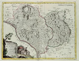
Background imageGeography Collection: The Patrimony of St. Peter and Sabine Territory, engraving by G
The Patrimony of St. Peter and Sabine Territory, engraving by G. Zuliani taken from Tome II of the "Newest Atlas" published in Venice in 1783 by Antonio Zatta

Background imageGeography Collection: The Marca (Territory) of Ancona, engraving by G. Zuliani taken from Tome II of the 'Newest Atlas'

The Marca (Territory) of Ancona, engraving by G. Zuliani taken from Tome II of the "Newest Atlas" published in Venice in 1783 by Antonio Zatta

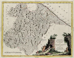
Background imageGeography Collection: Land area of the State of the Veneto: Legation of Urbino, engraving by G

Land area of the State of the Veneto: Legation of Urbino, engraving by G. Zuliani taken from Tome II of the "Newest Atlas" published in Venice in 1783 by Antonio Zatta

Background imageGeography Collection: Land area of the State of the Veneto: Legation of Romagna, engraving by G

Land area of the State of the Veneto: Legation of Romagna, engraving by G. Zuliani taken from Tome II of the "Newest Atlas" published in Venice in 1783 by Antonio Zatta

Background imageGeography Collection: Sea area of the State of the Veneto: Venetian Dalmatia, engraving by G

Sea area of the State of the Veneto: Venetian Dalmatia, engraving by G. Zuliani taken from Tome II of the "Newest Atlas" published in Venice in 1784 by Antonio Zatta

Background imageGeography Collection: Land area of the State of the Veneto: area of Padua, engraving by G

Land area of the State of the Veneto: area of Padua, engraving by G. Zuliani taken from Tome II of the "Newest Atlas" published in Venice in 1784 by Antonio Zatta

Background imageGeography Collection: Land area of the State of the Veneto: area of Verona with the district of Cologna, engraving by G

Land area of the State of the Veneto: area of Verona with the district of Cologna, engraving by G. Zuliani taken from Tome II of the "Newest Atlas" published in Venice in 1783 by Antonio

Background imageGeography Collection: Land area of the State of the Veneto: area of Belluna divided into its districts, engraving by G

Land area of the State of the Veneto: area of Belluna divided into its districts, engraving by G. Zuliani taken from Tome II of the "Newest Atlas" published in Venice in 1783 by Antonio

Background imageGeography Collection: Land area of the State of the Veneto: area of Treviso divided into its territories and districts

Land area of the State of the Veneto: area of Treviso divided into its territories and districts, engraving by G. Zuliani taken from Tome II of the "Newest Atlas" published in Venice in

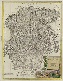
Background imageGeography Collection: Land area of the State of the Veneto: Bergamo divided into its districts, engraving by G

Land area of the State of the Veneto: Bergamo divided into its districts, engraving by G. Zuliani taken from Tome II of the "Newest Atlas" published in Venice in 1782 by Antonio Zatta

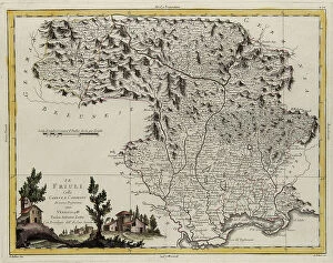
Background imageGeography Collection: Land area of the State of the Veneto: Friuli, engraving by G

Land area of the State of the Veneto: Friuli, engraving by G. Zuliani taken from Tome II of the "Newest Atlas" published in Venice in 1783 by Antonio Zatta

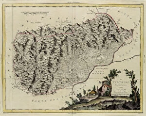
Background imageGeography Collection: Land area of the State of the Veneto: Feltrino, engraving by G

Land area of the State of the Veneto: Feltrino, engraving by G. Zuliani taken from Tome II of the "Newest Atlas" published in Venice in 1782 by Antonio Zatta

Background imageGeography Collection: Land area of the State of the Veneto: area of Rovigo, engraving by G

Land area of the State of the Veneto: area of Rovigo, engraving by G. Zuliani taken from Tome II of the "Newest Atlas" published in Venice in 1782 by Antonio Zatta

Background imageGeography Collection: Land area of the State of the Veneto, divided into its Provinces, engraving by G

Land area of the State of the Veneto, divided into its Provinces, engraving by G. Zuliani taken from Tome II of the "Newest Atlas" published in Venice in 1782 by Antonio Zatta

Background imageGeography Collection: Political map of Italy, engraving by G. Zuliani taken from Tome II of the 'Newest Atlas' published

Political map of Italy, engraving by G. Zuliani taken from Tome II of the "Newest Atlas" published in Venice in 1782 by Antonio Zatta

Background imageGeography Collection: Provinces of Frisia, Groningen and Over-Yssel with a part of Holland proper, engraving by G

Provinces of Frisia, Groningen and Over-Yssel with a part of Holland proper, engraving by G. Zuliani taken from Tome I of the "Newest Atlas" published in Venice in 1778 by Antonio Zatta

Background imageGeography Collection: English Louisiana with the western part of Florida, Georgia and South Carolina, engraving by G

English Louisiana with the western part of Florida, Georgia and South Carolina, engraving by G. Zuliani taken from Tome I of the "Newest Atlas" published in Venice in 1778 by Antonio Zatta

Background imageGeography Collection: Maryland, southern New Jersey, Delaware and the eastern part of Virginia and North Carolina

Maryland, southern New Jersey, Delaware and the eastern part of Virginia and North Carolina, engraving by G. Zuliani taken from Tome I of the "Newest Atlas" published in Venice in 1778 by

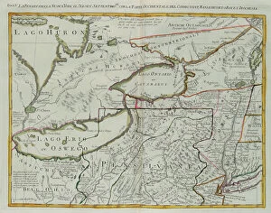
Background imageGeography Collection: Pennsylvania, New York, southern New Jersey, with the western part of Connecticut

Pennsylvania, New York, southern New Jersey, with the western part of Connecticut, Massachusetts Bay and Land of the Iroquois, engraving by G

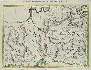
Background imageGeography Collection: The western part of New France or Canada, engraving by G. Zuliani taken from Tome I of the 'Newest

The western part of New France or Canada, engraving by G. Zuliani taken from Tome I of the "Newest Atlas" published in Venice in 1778 by Antonio Zatta

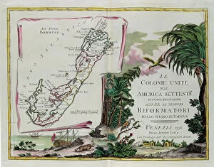
Background imageGeography Collection: The Islands of Bermuda and the frontispiece of the section dedicated to the United Colonies of

The Islands of Bermuda and the frontispiece of the section dedicated to the United Colonies of North America, engraving by G

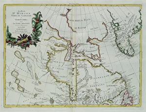
Background imageGeography Collection: Hudson Bay, Land of Labrador and Greenland with the adjacent islands, engraving by G

Hudson Bay, Land of Labrador and Greenland with the adjacent islands, engraving by G. Zuliani taken from Tome I of the "Newest Atlas" published in Venice in 1778 by Antonio Zatta

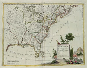
Background imageGeography Collection: Canada, the English Colonies with Louisiana and Florida, engraving by G

Canada, the English Colonies with Louisiana and Florida, engraving by G. Zuliani taken from Tome I of the "Newest Atlas" published in Venice in 1778 by Antonio Zatta

Background imageGeography Collection: Southern Scotland divided into its counties, engraving by G. Zuliani taken from Tome I of

Southern Scotland divided into its counties, engraving by G. Zuliani taken from Tome I of the "Newest Atlas" published in Venice in 1779 by Antonio Zatta

Background imageGeography Collection: The Kingdom of Ireland that the provinces of Munster and Connaught, engraving by G

The Kingdom of Ireland that the provinces of Munster and Connaught, engraving by G. Zuliani is from Volume I of Atlas Novissimo "published in Venice in 1778 by Antonio Zatta

Background imageGeography Collection: Island of Minorca and the plan of the port and the city of Mahon and its Forts, engraving by G

Island of Minorca and the plan of the port and the city of Mahon and its Forts, engraving by G. Zuliani taken from Tome I of the "Newest Atlas" published in Venice in 1778 by Antonio Zatta

Background imageGeography Collection: Province of Essex, engraving by G. Zuliani taken from Tome I of the 'Newest Atlas' published in

Province of Essex, engraving by G. Zuliani taken from Tome I of the "Newest Atlas" published in Venice in 1779 by Antonio Zatta, Private Collection Florence Engraving Eighteenth Century

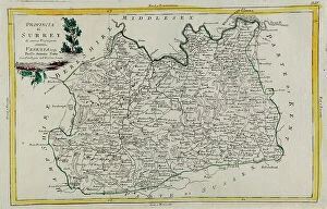
Background imageGeography Collection: Province of Surrey, engraving by G. Zuliani taken from Tome I of the 'Newest Atlas' published in

Province of Surrey, engraving by G. Zuliani taken from Tome I of the "Newest Atlas" published in Venice in 1779 by Antonio Zatta, Private Collection Florence Engraving Eighteenth Century

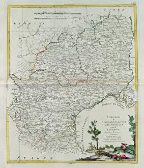
Background imageGeography Collection: Governances of Langedoc, Foix and Roussillon with Rouergue, engraving by G

Governances of Langedoc, Foix and Roussillon with Rouergue, engraving by G. Zuliani taken from Tome I of the "Newest Atlas" published in Venice in 1777 by Antonio Zatta

Background imageGeography Collection: Governances of Bourgogne, Franca Contea and Lyons, engraving by G

Governances of Bourgogne, Franca Contea and Lyons, engraving by G. Zuliani taken from Tome I of the "Newest Atlas" published in Venice in 1777 by Antonio Zatta

Background imageGeography Collection: Governances of Champagne and Brie, engraving by G. Zuliani taken from Tome I of the 'Newest Atlas'

Governances of Champagne and Brie, engraving by G. Zuliani taken from Tome I of the "Newest Atlas" published in Venice in 1777 by Antonio Zatta

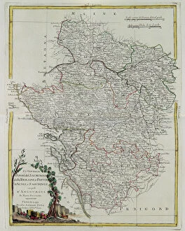
Background imageGeography Collection: Governances of Anjou, Saumurois, Touraine and Poitou, Aunis and Saintonge with that of Anjoumois

Governances of Anjou, Saumurois, Touraine and Poitou, Aunis and Saintonge with that of Anjoumois, engraving by G. Zuliani taken from Tome I of the "Newest Atlas" published in Venice in 1777

Background imageGeography Collection: Governances of French Flanders, Artois, Picardy and Boulonois, engraving by G

Governances of French Flanders, Artois, Picardy and Boulonois, engraving by G. Zuliani taken from Tome I of the "Newest Atlas" published in Venice in 1776 by Antonio Zatta

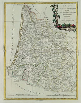
Background imageGeography Collection: Governances of Guyenne and Guascogne with that of Bearn and Lower Navarre, engraving by G

Governances of Guyenne and Guascogne with that of Bearn and Lower Navarre, engraving by G. Zuliani taken from Tome I of the "Newest Atlas" published in Venice in 1776 by Antonio Zatta

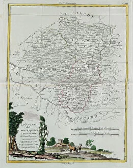
Background imageGeography Collection: Governances of Limosin, Quercy and Perigord, engraving by G. Zuliani taken from Tome I of

Governances of Limosin, Quercy and Perigord, engraving by G. Zuliani taken from Tome I of the "Newest Atlas" published in Venice in 1776 by Antonio Zatta

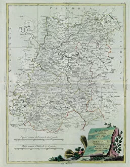
Background imageGeography Collection: The Governances of the Ile de France and Orleans, engraving by G

The Governances of the Ile de France and Orleans, engraving by G. Zuliani taken from Tome I of the "Newest Atlas" published in Venice in 1776 by Antonio Zatta

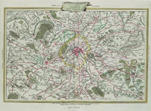
Background imageGeography Collection: The outline of Paris, The Governances of France and Orleans, engraving by G

The outline of Paris, The Governances of France and Orleans, engraving by G. Zuliani taken from Tome I of the "Newest Atlas" published in Venice in 1776 by Antonio Zatta

Background imageGeography Collection: The Kingdom of France divided into its governances, engraving by G

The Kingdom of France divided into its governances, engraving by G. Zuliani taken from Tome I of the "Newest Atlas" published in Venice in 1776 by Antonio Zatta

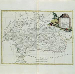
Background imageGeography Collection: Andalusia and Granada, engraving by G. Zuliani taken from Tome I of the 'Newest Atlas' published

Andalusia and Granada, engraving by G. Zuliani taken from Tome I of the "Newest Atlas" published in Venice in 1776 by Antonio Zatta

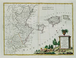
Background imageGeography Collection: Kingdoms of Valencia and Murcia with the Baleari and Pitiuse Islands, engraving by G

Kingdoms of Valencia and Murcia with the Baleari and Pitiuse Islands, engraving by G. Zuliani taken from Tome I of the "Newest Atlas" published in Venice in 1775 by Antonio Zatta

Background imageGeography Collection: Extremadura and Castilla la Nueva, engraving by G. Zuliani taken from Tome I of the 'Newest Atlas'

Extremadura and Castilla la Nueva, engraving by G. Zuliani taken from Tome I of the "Newest Atlas" published in Venice in 1776 by Antonio Zatta

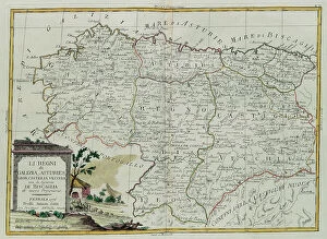
Background imageGeography Collection: The Kingdoms of Galicia, Asturies, Leon, Castilla Vieja with the Council of Biscallia

The Kingdoms of Galicia, Asturies, Leon, Castilla Vieja with the Council of Biscallia, engraving by G. Zuliani taken from Tome I of the "Newest Atlas" published in Venice in 1776 by Antonio

Background imageGeography Collection: Portugal, that is the provinces of Entre Douro, Minho, Traz-os-Montes and Beir, engraving by G

Portugal, that is the provinces of Entre Douro, Minho, Traz-os-Montes and Beir, engraving by G. Zuliani taken from Tome I of the "Newest Atlas" published in Venice in 1776 by Antonio Zatta


All Professionally Made to Order for Quick Shipping

"Exploring the Rich Tapestry of Geography: From Ancient Maps to Modern Wonders" The Al-Idrisi's world map from 1154 takes us back in time, showcasing the early understanding and its importance in navigation. Derwent Water, with Blencathra standing tall behind it, offers a breathtaking view of nature's wonders in the Lake District, Cumbria, England. Jacopo de Barbari's Map of Venice in 1500 allows us to delve into the intricate layout of this enchanting city built on water. An antique map of Tasmania reveals how explorers once charted unknown territories and expanded our knowledge about distant lands. The V & A waterfront and Table Mountain create an awe-inspiring backdrop for Cape Town, South Africa – a testament to geography shaping stunning landscapes. Continental drift after 250 million years shows us that our planet is constantly evolving, reminding us of the dynamic forces at work beneath Earth's surface. Malham Cove stands as a geological marvel within Yorkshire Dales National Park, captivating visitors with its limestone formations carved by natural processes over millennia. Whole Earth (Blue Marble 2000) provides a mesmerizing image capturing our beautiful planet from space – highlighting both its vastness and interconnectedness through geography. The British Empire world map from the 19th century reflects an era when geographical exploration played a significant role in expanding colonial influence across continents. James Craig's Map of New Town Edinburgh from 1768 showcases meticulous topography planning that shaped one of Scotland's most iconic cities even today. Anglo-Saxon 10th-century world map gives insight into early European perceptions and interpretations regarding global geography during medieval times In summary, these diverse hints remind us that geography is not just about maps but also encompasses breathtaking landscapes, historical perspectives on human exploration and settlement, and the ever-changing nature of our planet.