Fraud Blocker Skip to main content

Geology Collection

"Exploring the Earth's Rich Tapestry: A Journey through Geology" William Smith Geological Map: Unveiling the intricate layers of our planet's history

Background imageGeology Collection: William Smith Geological Map

William Smith Geological Map

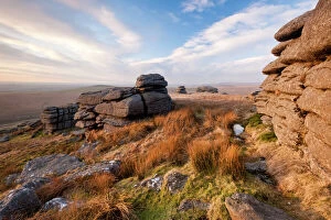
Background imageGeology Collection: Landscape view from Great Mis Tor, Dartmoor National Park, Devon, England, UK, February

Landscape view from Great Mis Tor, Dartmoor National Park, Devon, England, UK, February 2011

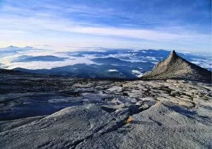
Background imageGeology Collection: Mt Kinabalu, Kinabalu National Park, Sabah, Borneo, Malaysia

Mt Kinabalu, Kinabalu National Park, Sabah, Borneo, Malaysia

Background imageGeology Collection: Derwent Water, with Blencathra behind, Lake District, Cumbria, England

Derwent Water, with Blencathra behind, Lake District, Cumbria, England, UK

Background imageGeology Collection: View to the Seven Sisters from Seaford Head, East Sussex, England, UK

View to the Seven Sisters from Seaford Head, East Sussex, England, UK

Background imageGeology Collection: Continental drift after 250 million years

Continental drift after 250 million years, showing the supercontinent of Pangea Ultima, which was named for the ancient supercontinent of Pangea

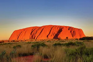
Background imageGeology Collection: Sunset at Uluru, Ayers Rock, Australia

Sunset at Uluru, Ayers Rock, Australia
Sunset at Uluru, Ayers Rock, Uluru-Kata Tjuta National Park, Northern Territory, Australia

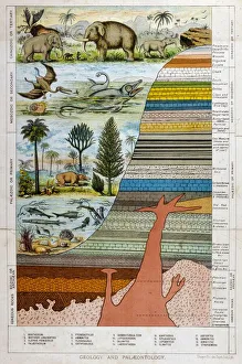
Background imageGeology Collection: Geological Strata 19C

Geological Strata 19C
A schematic representation of geology and palaeontology

Background imageGeology Collection: Malham Cove, Yorkshire Dales

Malham Cove, Yorkshire Dales National Park, England. This curving limestone cliff feature was formed by glacial action. It used to have a waterfall running over it
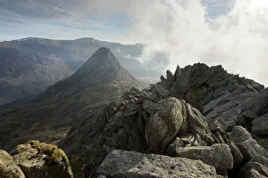
Background imageGeology Collection: Tryfan, viewed from the top of Bristly Ridge on Glyder Fach, Snowdonia, Wales, United Kingdom

Tryfan, viewed from the top of Bristly Ridge on Glyder Fach, Snowdonia, Wales, United Kingdom, Europe

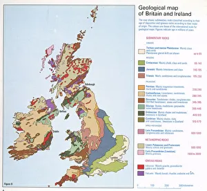
Background imageGeology Collection: Geological map of Britain and Ireland

Geological map of Britain and Ireland
Fig 9 from Britain Before Man (1978), a Geological Museum publication

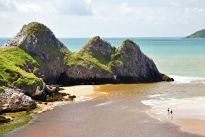
Background imageGeology Collection: Three Cliffs Bay, Gower, Wales, United Kingdom, Europe

Three Cliffs Bay, Gower, Wales, United Kingdom, Europe

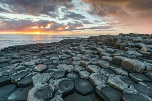
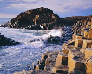
Background imageGeology Collection: Giants Causeway at sunset, UNESCO World Heritage Site, County Antrim, Ulster, Northern Ireland

Giants Causeway at sunset, UNESCO World Heritage Site, County Antrim, Ulster, Northern Ireland, United Kingdom, Europe

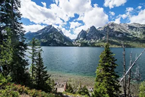
Background imageGeology Collection: Jenny Lake in front of the Teton range in the Grand Teton National Park, Wyoming

Jenny Lake in front of the Teton range in the Grand Teton National Park, Wyoming, United States of America, North America

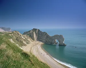
Background imageGeology Collection: Durdle Door, Dorset, England, United Kingdom, Europe

Durdle Door, Dorset, England, United Kingdom, Europe

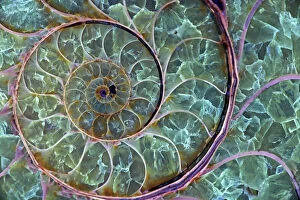
Background imageGeology Collection: Fossil ammonite- Desmoceras spp. -Upper Early Cretaceous - Albian Stage - Mahajanga Province

Fossil ammonite- Desmoceras spp. -Upper Early Cretaceous - Albian Stage - Mahajanga Province - Madagascar - Under UV
CAN-3851 Fossil ammonite Upper Early Cretaceous - Albian Stage - Mahajanga Province - Madagascar - Under UV light Desmoceras spp

Background imageGeology Collection: Antique colored illustrations: Geological map of England and Wales

Antique colored illustrations: Geological map of England and Wales

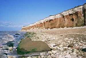
Background imageGeology Collection: Start or end of The Wash, Hunstanton Cliffs, Norfolk, England, United Kingdom, Europe

Start or end of The Wash, Hunstanton Cliffs, Norfolk, England, United Kingdom, Europe

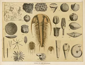
Background imageGeology Collection: Fossils from the palaeozoic era

Fossils from the palaeozoic era
Life forms of the palaeozoic era (for identification of individual items, refer to the book page 13-14)

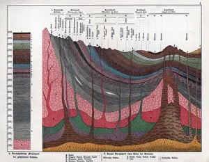
Background imageGeology Collection: Geological crosssection through the Earths crust

Geological crosssection through the Earths crust.. Chromolithograph from Dr. Fr. Rolles Geology and Paleontology section in Gotthilf Heinrich von Schuberts Natural History, Schreiber, Munich, 1886

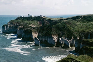
Background imageGeology Collection: UK JLM 10277 Flamborough Head, Yorkshire. © John Mason / ARDEA LONDON

UK JLM 10277 Flamborough Head, Yorkshire. © John Mason / ARDEA LONDON
JLM-10277 YORKSHIRE - Flamborough Head, UK John Mason Please note that prints are for personal display purposes only and may not be reproduced in any way

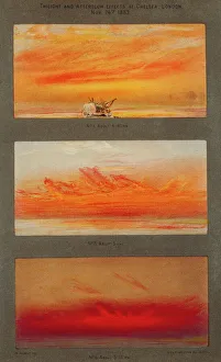
Background imageGeology Collection: Krakatoa sunsets, 1883 artworks

Krakatoa sunsets, 1883 artworks
Krakatoa sunsets. Artwork of the spectacular red and orange sunsets caused in London, England, by the August 1883 eruption of Krakatoa, a volcano thousands of kilometres away in Indonesia

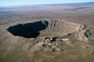
Background imageGeology Collection: Barringer Meteor crater - 3/4 mile wide. Located East of Flagstaff, Arizona, USA

Barringer Meteor crater - 3/4 mile wide. Located East of Flagstaff, Arizona, USA
FG-4176 Barringer Meteor crater - 3/4 mile wide. Located East of Flagstaff, Arizona, USA Francois Gohier Please note that prints are for personal display purposes only

Background imageGeology Collection: Volcano Kimanura Nyamulagira Virungas, Zaire, Africa

Volcano Kimanura Nyamulagira Virungas, Zaire, Africa
AW-4153 VOLCANO ERUPTION Kimanura - Nyamulgira Virungas, Democratic Repubulic of Congo (formerly Zaire) Adrian Warren Please note that prints are for personal display purposes only

Background imageGeology Collection: Apollo 17 astronaut

Apollo 17 astronaut. US astronaut and geologist Dr Harrison Schmitt exploring the Taurus-Littrow region of the Moon, as part of NASAs Apollo 17 mission

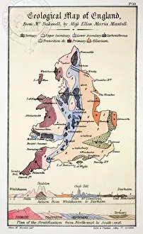
Background imageGeology Collection: 1838 Geological Map of England by Mantell

1838 Geological Map of England by Mantell
From Gideon Mantells " Wonders of Geology" 1839, drawn by his daughter Ellen

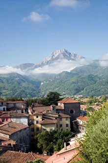
Background imageGeology Collection: Barga, Italy

Barga, Italy
Barga. View from the mediaeval Tuscan town of Barga across the Serchio river valley, towards the summit of Pania Secca (1171 metres) in the Apuan Alps, Italy

Background imageGeology Collection: Tenerife, satellite image

Tenerife, satellite image. Satellite image of Tenerife showing Mount Teide (lower centre). Vegetation is green, and water is blue

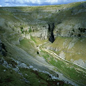
Background imageGeology Collection: Gordale Scar, Yorkshire Dales National Park, North Yorkshire, England, United Kingdom

Gordale Scar, Yorkshire Dales National Park, North Yorkshire, England, United Kingdom, Europe

Background imageGeology Collection: The Giants Causeway

The Giants Causeway, Co Antrim, Northern Ireland

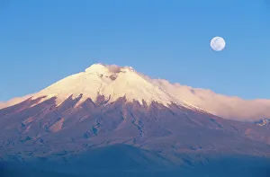
Background imageGeology Collection: Ecuador Cotopaxi, seen from the west

Ecuador Cotopaxi, seen from the west
FG-9787 ECUADOR - Cotopaxi, seen from the west, with full moon Ecuadors highest active volcano. A stratovolcano Francois Gohier Please note that prints are for personal display purposes only

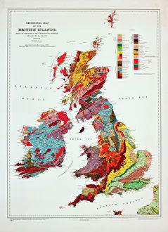
Background imageGeology Collection: Geological map of the British Islands

Geological map of the British Islands. 1941

Background imageGeology Collection: View of limestone pavement, Malham Cove, Malham, Yorkshire Dales National Park, North Yorkshire

View of limestone pavement, Malham Cove, Malham, Yorkshire Dales National Park, North Yorkshire, England, United Kingdom, Europe

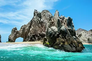
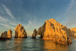
Background imageGeology Collection: Sunrise at Lands End, Cabo San Lucas, Baja California Sur, Gulf of California, Mexico, North America

Sunrise at Lands End, Cabo San Lucas, Baja California Sur, Gulf of California, Mexico, North America

Background imageGeology Collection: Morning Glory Pool and surrounds, Yellowstone National Park, UNESCO World Heritage Site, Wyoming

Morning Glory Pool and surrounds, Yellowstone National Park, UNESCO World Heritage Site, Wyoming, United States of America, North America

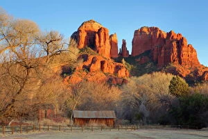
Background imageGeology Collection: Cathedral Rock at Red Rock Crossing, Sedona, Arizona, United States of America, North America

Cathedral Rock at Red Rock Crossing, Sedona, Arizona, United States of America, North America

Background imageGeology Collection: Lands End rock formation, Los Cabos, Baja California, Mexico, North America

Lands End rock formation, Los Cabos, Baja California, Mexico, North America

Background imageGeology Collection: Copper and magnesium sulphate, LM

Copper and magnesium sulphate, LM
Copper and magnesium sulphate crystals. Polarised light micrograph (LM) of copper sulphate (CuSO4) and magnesium sulphate (MgSO4) crystals

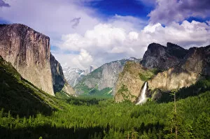
Background imageGeology Collection: Yosemite Valley from Tunnel View, Yosemite National Park, California USA

Yosemite Valley from Tunnel View, Yosemite National Park, California USA

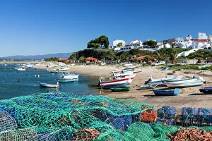
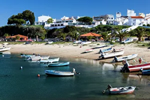
Background imageGeology Collection: The beach at Alvor, Portugal

The beach at Alvor, Portugal
A colourful beach scene at the seaside town of Alvor. This is a town in the Algarve in Portugal

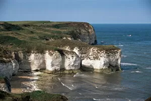
Background imageGeology Collection: Flamborough Head, East Yorkshire, Yorkshire, England, United Kingdom, Europe

Flamborough Head, East Yorkshire, Yorkshire, England, United Kingdom, Europe

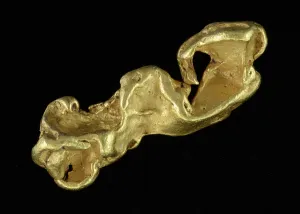
Background imageGeology Collection: Gold, Carnon Stream Works, Perranarworthal, Cornwall, England

Gold, Carnon Stream Works, Perranarworthal, Cornwall, England
Gold is a native element and precious metal which has been prized by mankind for thousands of years for its beauty, malleability and resistance to corrosion

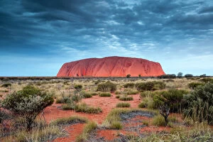
Background imageGeology Collection: Uluru / Ayers rock, Uluru Kata Tjuta National Park, Northern Territory, Australia

Uluru / Ayers rock, Uluru Kata Tjuta National Park, Northern Territory, Australia

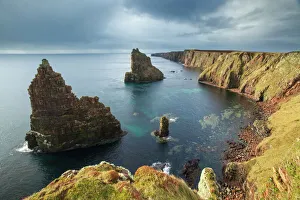
Background imageGeology Collection: Sea stacks, Duncansby Head, John O Groats, Caithness, Scotland, UK, April 2015

Sea stacks, Duncansby Head, John O Groats, Caithness, Scotland, UK, April 2015

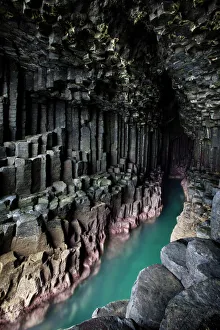
Background imageGeology Collection: Fingals Cave, showing basalt columns, Isle of Staffa, Inner Hebrides, Scotland

Fingals Cave, showing basalt columns, Isle of Staffa, Inner Hebrides, Scotland, UK, June 2010

Background imageGeology Collection: The Narrows, Zion Canyon National Park, USA

The Narrows, Zion Canyon National Park, USA
Famous hike in the Narrows, Virgin river, Zion Canyon National Park, Utah, USA

Background imageGeology Collection: The beach at Alvor, Portugal

The beach at Alvor, Portugal
A colourful beach scene at the seaside town of Alvor. This is a town in the Algarve in Portugal

Background imageGeology Collection: Picture No. 11050092

Picture No. 11050092
Marcellus Shale natural gas bearing rock gas extracted using controversial fracking or hydraulic fracturing New York, USA Date:


All Professionally Made to Order for Quick Shipping

"Exploring the Earth's Rich Tapestry: A Journey through Geology" William Smith Geological Map: Unveiling the intricate layers of our planet's history, this map showcases the pioneering work of geologist William Smith. Derwent Water, with Blencathra behind: Nature's masterpiece in Cumbria, England reveals geological wonders that have shaped this breathtaking landscape over millions of years. View to the Seven Sisters from Seaford Head: Witnessing the dramatic cliffs and rolling waves along East Sussex's coast reminds us of nature's relentless force and its impact on shaping our world. Continental drift after 250 million years: Delving into deep time, we unravel how tectonic plates have shifted and continents have drifted apart, reshaping our planet as we know it today. Sunset at Uluru, Ayers Rock: The vibrant hues painting the sky above Australia's iconic monolith remind us of ancient geological processes that formed this majestic landmark over countless millennia. Malham Cove, Yorkshire Dales: Marvel at Mother Nature's artistry as water erodes limestone to create magnificent formations like this awe-inspiring cove in England’s picturesque countryside. Tryfan viewed from Glyder Fach in Snowdonia: Gazing upon Wales' rugged beauty unveils a tale written by glaciers and volcanic activity—a testament to Earth’s dynamic past etched across these towering peaks. Antique colored illustrations - Geological map of England and Wales: Step back in time with these vintage maps that guided early geologists through uncharted territories, unlocking secrets hidden beneath our feet. Durdle Door, Dorset: Carved by relentless waves over eons, this natural limestone arch stands proudly on Dorset’s Jurassic Coast—a living testament to Earth’s ongoing transformational journey. Geological map of Britain and Ireland.