Fraud Blocker Skip to main content

Isles Collection (page 3)

"Exploring the Isles: A Journey through History, Nature, and Resilience" Unfolding history on a WW2 poster: Map of the British Army's strategic isles

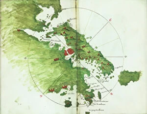
Background imageIsles Collection: Archipeligo, Rhodes Island, town and ports of Rhodes surveyed by Commander Thomas Graves

Archipeligo, Rhodes Island, town and ports of Rhodes surveyed by Commander Thomas Graves, HMS 'Beacon' 1838
7342500 Archipeligo, Rhodes Island, town and ports of Rhodes surveyed by Commander Thomas Graves, HMS 'Beacon' 1838, 1844 (print) by Walker, J. & C

Background imageIsles Collection: Plan of the Island of Dominica laid down by actual survey under the direction of the Honorable

Plan of the Island of Dominica laid down by actual survey under the direction of the Honorable the Commissioners for
7340451 Plan of the Island of Dominica laid down by actual survey under the direction of the Honorable the Commissioners for the Sale of Lands in the Ceded Islands by John Byres Chief Surveyor 1776

Background imageIsles Collection: Plan of the Island of Bequia laid down by actual survey under the direction of the Honorable

Plan of the Island of Bequia laid down by actual survey under the direction of the Honorable the Commissioners for
7340450 Plan of the Island of Bequia laid down by actual survey under the direction of the Honorable the Commissioners for the Sale of Lands in the Ceded Islands by John Byres Chief Surveyor 1776

The Magdalen Isles in the gulph of St. Lawrence, 1778 (engraving)
7340417 The Magdalen Isles in the gulph of St. Lawrence, 1778 (engraving) by DesBarres, Joseph Frederick Wallet (1721-1824); 73x55 cm; National Maritime Museum, London

A chart of the entrance into the Channel containing the west coast of Cornwall
7340130 A chart of the entrance into the Channel containing the west coast of Cornwall and Scilly Islands with all the soundings, 1779 (copperplate engraving) by British School

Background imageIsles Collection: Heradura [and] Conception, 1685 (manuscript)

Heradura [and] Conception, 1685 (manuscript)
7339771 Heradura [and] Conception, 1685 (manuscript) by Hack, William (17th Century); 40.5x5 cm; National Maritime Museum, London

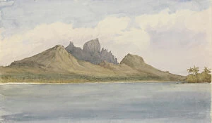
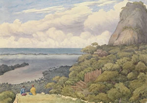
Background imageIsles Collection: 'Bora bora, SE side, within the reef, Septr 5th 1849 [Society Islands]', 1849 (watercolour)

'Bora bora, SE side, within the reef, Septr 5th 1849 [Society Islands]', 1849 (watercolour)
7295601 'Bora bora, SE side, within the reef, Septr 5th 1849 [Society Islands]', 1849 (watercolour) by Fanshawe, Admiral Sir Edward Gennys (1814-1906); 12.9x17.6 cm; National Maritime Museum

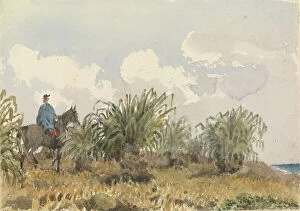
Background imageIsles Collection: Tussac Grass, Falkland Islands, 1849 (watercolour)

Tussac Grass, Falkland Islands, 1849 (watercolour)
7295586 Tussac Grass, Falkland Islands, 1849 (watercolour) by Fanshawe, Admiral Sir Edward Gennys (1814-1906); 12.7x17.9 cm; National Maritime Museum, London, UK; (add.info.: No)

Background imageIsles Collection: Mediterranean archipelago Rhodes Island surveyed...under the direction of Com'r T Graves RN HMS

Mediterranean archipelago Rhodes Island surveyed...under the direction of Com'r T Graves RN HMS 'Beacon'
7342521 Mediterranean archipelago Rhodes Island surveyed...under the direction of Com'r T Graves RN HMS 'Beacon' (1841), 1862-1906 (engraving) by Walker, J. & C

Background imageIsles Collection: A chart of the easternmost part of the East Indies with all the adjacent islands from Cape Comorin

A chart of the easternmost part of the East Indies with all the adjacent islands from Cape Comorin to Japan
7340780 A chart of the easternmost part of the East Indies with all the adjacent islands from Cape Comorin to Japan, 1675 (Hand coloured engraving) by Seller

A new and exact map of the island of Antigua in America, according to a survey made in the years 1746-1748
7340454 A new and exact map of the island of Antigua in America, according to a survey made in the years 1746-1748, c.1749 (coloured engraving) by Baker

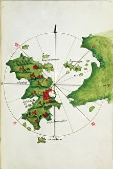
Background imageIsles Collection: Chart of Negroponte, c.1485 (Vellum)

Chart of Negroponte, c.1485 (Vellum)
7340068 Chart of Negroponte, c.1485 (Vellum) by Sonetti, Bartolomeo da li (fl.1485); 27.5x19 cm; National Maritime Museum, London

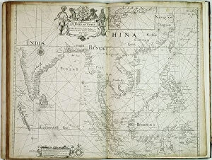
Background imageIsles Collection: A chart of the trading part of the East Indies and China, with the adjacent islands

A chart of the trading part of the East Indies and China, with the adjacent islands, from Surrat to Japan, 1677 (print)
7340055 A chart of the trading part of the East Indies and China, with the adjacent islands, from Surrat to Japan, 1677 (print) by Seller, John (1632-97); 44.5x56 cm; National Maritime Museum

Background imageIsles Collection: French illustration depicting people in traditional costumes in Majorca in Spain. 19th century

French illustration depicting people in traditional costumes in Majorca in Spain. 19th century
5304655 French illustration depicting people in traditional costumes in Majorca in Spain. 19th century; (add.info.: French illustration depicting people in traditional costumes in Majorca in Spain)

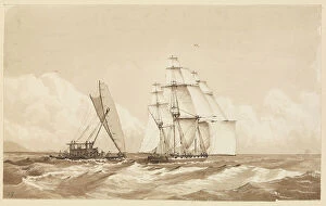
Background imageIsles Collection: Double canoe off Moalu, Feejee Islands, Septr 26th 1849 [Fiji], 1849 (pen, ink)

Double canoe off Moalu, Feejee Islands, Septr 26th 1849 [Fiji], 1849 (pen, ink)
7295606 Double canoe off Moalu, Feejee Islands, Septr 26th 1849 [Fiji], 1849 (pen, ink) by Fanshawe, Admiral Sir Edward Gennys (1814-1906); 15.7x25.8 cm; National Maritime Museum, London

Background imageIsles Collection: Sunday bonnets at the Navigators Islands (Samoa), Apia Bay, September 14 1849 (watercolour)

Sunday bonnets at the Navigators Islands (Samoa), Apia Bay, September 14 1849 (watercolour)
7295602 Sunday bonnets at the Navigators Islands (Samoa), Apia Bay, September 14 1849 (watercolour) by Fanshawe, Admiral Sir Edward Gennys (1814-1906); 19.4x32.7 cm; National Maritime Museum, London

Background imageIsles Collection: 'Bora bora [Society Islands], from a ruined native fort above the chief village on the East side

'Bora bora [Society Islands], from a ruined native fort above the chief village on the East side of the island
7295600 'Bora bora [Society Islands], from a ruined native fort above the chief village on the East side of the island, Septr 5th 1849', 1849 (watercolour) by Fanshawe

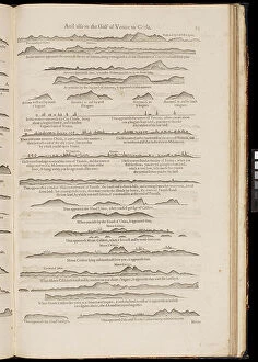
Background imageIsles Collection: Lighting colom of the Midland-Sea, 1678 (print)

Lighting colom of the Midland-Sea, 1678 (print)
7342739 Lighting colom of the Midland-Sea, 1678 (print) by Colom, Arnold (1624-68); National Maritime Museum, London, UK; (add.info.: Creator: Arnold Colom [8], 104p)

Background imageIsles Collection: Chart of Chius (Chios, Greece), 1554 (vellum)

Chart of Chius (Chios, Greece), 1554 (vellum)
7339646 Chart of Chius (Chios, Greece), 1554 (vellum) by Agnese, Battista (c.1500-64); 26x40 cm; National Maritime Museum, London, UK; (add.info.: Creator: Battista Agnese Scale circa 1:650000)

Background imageIsles Collection: Khios and adjacent mainland, c.1485 (vellum)

Khios and adjacent mainland, c.1485 (vellum)
7339635 Khios and adjacent mainland, c.1485 (vellum) by Sonetti, Bartolomeo da li (fl.1485); 27.5x19 cm; National Maritime Museum, London

Background imageIsles Collection: Astipalaia, c.1485 (vellum)

Astipalaia, c.1485 (vellum)
7339633 Astipalaia, c.1485 (vellum) by Sonetti, Bartolomeo da li (fl.1485); 27.5x19 cm; National Maritime Museum, London, UK; (add.info.: Creator: Bartolommeo dalli Sonetti Bound sheet. Col. ms)

Background imageIsles Collection: Kithira and Antikithira, 1485 (vellum)

Kithira and Antikithira, 1485 (vellum)
7339631 Kithira and Antikithira, 1485 (vellum) by Sonetti, Bartolomeo da li (fl.1485); 27x19 cm; National Maritime Museum, London

Background imageIsles Collection: A chart of Khios and adjacent mainland, c.1420 (Vellum)

A chart of Khios and adjacent mainland, c.1420 (Vellum)
7339628 A chart of Khios and adjacent mainland, c.1420 (Vellum) by Buondelmonti, Cristoforo (1385-1430); 25x18 cm; National Maritime Museum, London

Background imageIsles Collection: 'A chart of the islands in the China Sea near the Straits of Malacca with the positions of

'A chart of the islands in the China Sea near the Straits of Malacca with the positions of the English fleet
7339495 'A chart of the islands in the China Sea near the Straits of Malacca with the positions of the English fleet and the squadron of Admiral Linois on the 14 & 15th February 1804'

Chart of the Promontory of Boodroom with the Karabaghla Islands and the North Point of the Island of Kos
7339475 Chart of the Promontory of Boodroom with the Karabaghla Islands and the North Point of the Island of Kos ... by Francis Beaufort F.R.S

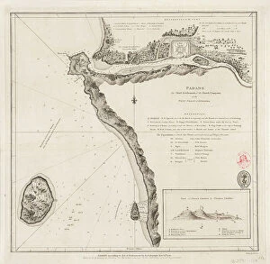
Background imageIsles Collection: Padang - the chief settlement of the Dutch Company on the west coast of Sumatra, 1782 (engraving)

Padang - the chief settlement of the Dutch Company on the west coast of Sumatra, 1782 (engraving)
7339395 Padang - the chief settlement of the Dutch Company on the west coast of Sumatra, 1782 (engraving) by Dalrymple, Alexander (18th-19th century); 30.5x31 cm; National Maritime Museum, London

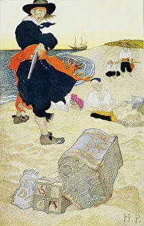
Background imageIsles Collection: Buried Treasure, early 20th century (book illustration)

Buried Treasure, early 20th century (book illustration)
7339186 Buried Treasure, early 20th century (book illustration) by Pyle, Howard (1853-1911); 57x51.7 cm; National Maritime Museum, London

Background imageIsles Collection: Eugen Zintgraff, born January 16, 1858 in Duesseldorf, died December 4, 1897 on Tenerife

Eugen Zintgraff, born January 16, 1858 in Duesseldorf, died December 4, 1897 on Tenerife, was a German explorer
UIG5413304 Eugen Zintgraff, born January 16, 1858 in Duesseldorf, died December 4, 1897 on Tenerife, was a German explorer, Woodcut from 1892 ©Bildagentur-online/UIG/Leemage.

The harbour, Rhodes, Greece, 1887
7125136 The harbour, Rhodes, Greece, 1887; (add.info.: The harbour, Rhodes, Greece. From A Popular History of Greece, published 1887. Rhodes); Photo © Ken Welsh. All rights reserved 2024.

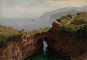
Natural Arch, Capri, 1856 (oil on paper mounted on canvas)
XOS5874854 Natural Arch, Capri, 1856 (oil on paper mounted on canvas) by Haseltine, William Stanley (1835-1900); 33.1x47.8 cm; Cleveland Museum of Art, OH

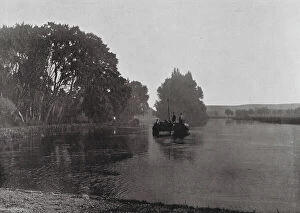
Background imageIsles Collection: Shiplake, from above the Island (b/w photo)

Shiplake, from above the Island (b/w photo)
8643819 Shiplake, from above the Island (b/w photo) by English photographer, (19th century) (after); Private Collection; (add.info.: Shiplake, from above the Island)

Background imageIsles Collection: Kingston, Jamaica: Mandeville, Manchester (colour photo)

Kingston, Jamaica: Mandeville, Manchester (colour photo)
8644428 Kingston, Jamaica: Mandeville, Manchester (colour photo) by English Photographer, (20th century); Private Collection; (add.info.: Mandeville, Manchester)

Background imageIsles Collection: Kingston, Jamaica: Bird's-Eye view of Port Antonio (colour photo)

Kingston, Jamaica: Bird's-Eye view of Port Antonio (colour photo)
8644419 Kingston, Jamaica: Bird's-Eye view of Port Antonio (colour photo) by English Photographer, (20th century); Private Collection; (add.info.: Bird's-Eye view of Port Antonio)

Kingston, Jamaica: Castleton Garden, 19 miles from Kingston (colour photo)
8644412 Kingston, Jamaica: Castleton Garden, 19 miles from Kingston (colour photo) by English Photographer, (20th century); Private Collection; (add.info.: Castleton Garden, 19 miles from Kingston)

Background imageIsles Collection: Jersey, Chanel Islands: Rozel Lane (litho)

Jersey, Chanel Islands: Rozel Lane (litho)
8640431 Jersey, Chanel Islands: Rozel Lane (litho) by English School, (19th century); Private Collection; (add.info.: Rozel Lane. Illustration for a booklet, Views of Jersey (np, c 1885)

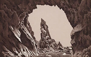
Jersey, Chanel Islands: Nedle Rock Plemont (litho)
8640417 Jersey, Chanel Islands: Nedle Rock Plemont (litho) by English School, (19th century); Private Collection; (add.info.: Nedle Rock Plemont)

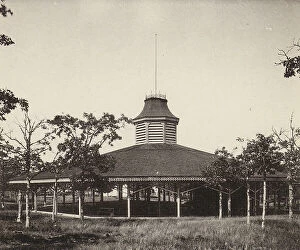
Background imageIsles Collection: Martha's Vineyard: Baptist Temple, Highlands (b/w photo)

Martha's Vineyard: Baptist Temple, Highlands (b/w photo)
8640641 Martha's Vineyard: Baptist Temple, Highlands (b/w photo) by American Photographer, (19th century); Private Collection; (add.info.: Baptist Temple, Highlands)

Background imageIsles Collection: Martha's Vineyard: Episcopal Chapel (b/w photo)

Martha's Vineyard: Episcopal Chapel (b/w photo)
8640628 Martha's Vineyard: Episcopal Chapel (b/w photo) by American Photographer, (19th century); Private Collection; (add.info.: Episcopal Chapel)

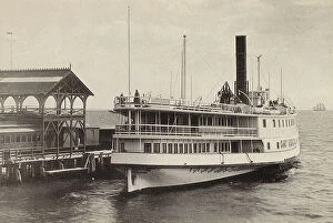
Background imageIsles Collection: Martha's Vineyard: Steamer Gay Head (b/w photo)

Martha's Vineyard: Steamer Gay Head (b/w photo)
8640619 Martha's Vineyard: Steamer Gay Head (b/w photo) by American Photographer, (19th century); Private Collection; (add.info.: Steamer Gay Head)

Jersey, Chanel Islands: Nouvelle Eglise de St Thomas (litho)
8640430 Jersey, Chanel Islands: Nouvelle Eglise de St Thomas (litho) by English School, (19th century); Private Collection; (add.info.: Nouvelle Eglise de St Thomas)

Background imageIsles Collection: Jersey, Chanel Islands: The Parade, St Helier, showing the Don Statue (litho)

Jersey, Chanel Islands: The Parade, St Helier, showing the Don Statue (litho)
8640426 Jersey, Chanel Islands: The Parade, St Helier, showing the Don Statue (litho) by English School, (19th century); Private Collection; (add.info.: The Parade, St Helier, showing the Don Statue)

Background imageIsles Collection: Jersey, Chanel Islands: Corbiere Lighthouse (litho)

Jersey, Chanel Islands: Corbiere Lighthouse (litho)
8640420 Jersey, Chanel Islands: Corbiere Lighthouse (litho) by English School, (19th century); Private Collection; (add.info.: Corbiere Lighthouse)

Background imageIsles Collection: Robinson Crusoe (colour litho)

Robinson Crusoe (colour litho)
8634728 Robinson Crusoe (colour litho) by English School, (19th century); Private Collection; (add.info.: Robinson Crusoe)

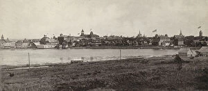
Background imageIsles Collection: Martha's Vineyard: Cottage City and Anthony's Lake, View from the Beecher Cottage

Martha's Vineyard: Cottage City and Anthony's Lake, View from the Beecher Cottage, Highlands (b/w photo)
8640637 Martha's Vineyard: Cottage City and Anthony's Lake, View from the Beecher Cottage, Highlands (b/w photo) by American Photographer

Background imageIsles Collection: Ibex, Ibis, Iceberg, Ice-cream, Ice-house, Idler, Idol, Image, Indian, Inkstand, Insects

Ibex, Ibis, Iceberg, Ice-cream, Ice-house, Idler, Idol, Image, Indian, Inkstand, Insects, Island (engraving)
8650055 Ibex, Ibis, Iceberg, Ice-cream, Ice-house, Idler, Idol, Image, Indian, Inkstand, Insects, Island (engraving) by German School, (19th century) (after); Private Collection; (add.info.: Ibex)

Bird's-eye view of Port Antonio (coloured photo)
8649170 Bird's-eye view of Port Antonio (coloured photo) by English Photographer, (20th century); Private Collection; (add.info.: Bird's-eye view of Port Antonio)

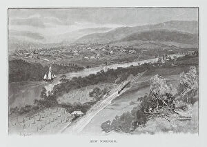
New Norfolk (engraving)
8651717 New Norfolk (engraving) by Australian School, (19th century); Private Collection; (add.info.: New Norfolk. Illustration for Picturesque Atlas of Australasia edited by Andrew Garran)

Background imageIsles Collection: Result of the Treaty of Portsmouth ending the Russo-Japanese War, 1905 (litho)

Result of the Treaty of Portsmouth ending the Russo-Japanese War, 1905 (litho)
8655561 Result of the Treaty of Portsmouth ending the Russo-Japanese War, 1905 (litho) by English School, (20th century); Private Collection; (add.info)


All Professionally Made to Order for Quick Shipping

"Exploring the Isles: A Journey through History, Nature, and Resilience" Unfolding history on a WW2 poster: Map of the British Army's strategic isles. Tracing our roots back to Viking Britain with an ancient map of their conquests. Battling against nature's fury at Bishop Rock Lighthouse during a relentless gale. Discovering tranquility amidst the Scilly Isles' breathtaking landscapes and seascapes. Unlocking Earth's secrets with a geological map showcasing the diverse British Islands. Navigating through time with an 18th-century Channel Islands map as our guide. Marveling at the majestic Wolf Rock Lighthouse from above, guarding Cornwall's coast. Immersing in Clan Macdonald's rich heritage that echoes across these storied isles. Reflecting on sacrifice and duty through a poignant WWI poster - "Is your home here? Defend it. " Stepping into Tresco Abbey's old arches, where whispers of Cornwall's past still linger. Witnessing resilience personified at Bishop Rock Lighthouse amidst the Isles of Scilly. Embracing coastal serenity as domestic cattle graze peacefully on Isle of Man’s Bride. Embark on this captivating journey through these remarkable isles; each holds its own tale waiting to be discovered – tales etched by war, shaped by Vikings, guarded by lighthouses, and nurtured by nature’s beauty.