
John Bartholomew And Co Collection
"Exploring the World through John Bartholomew & Co: A Journey into History" Step back in time and embark on a captivating journey with John Bartholomew & Co


All Professionally Made to Order for Quick Shipping
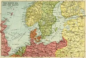
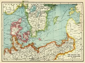
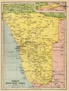
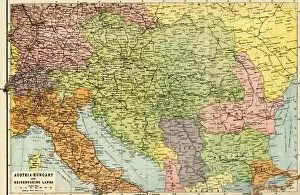
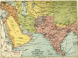
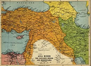
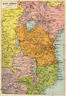
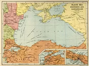
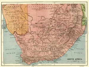
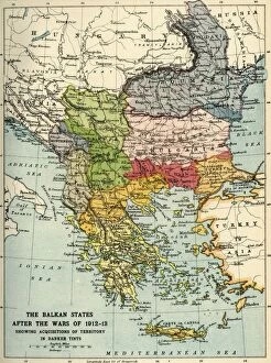
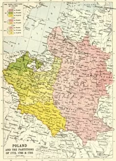
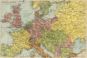
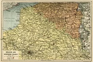
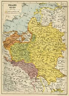
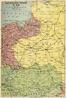
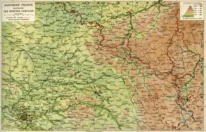
"Exploring the World through John Bartholomew & Co: A Journey into History" Step back in time and embark on a captivating journey with John Bartholomew & Co, as they unveil their remarkable collection of maps from the early 20th century. These intricately crafted works of art provide a window into the world during times of great change and upheaval. Delve into the depths of Europe's tumultuous past with "Austria-Hungary and Neighbouring Lands, " a map that captures the intricate web of borders that once defined this diverse region. Witness the aftermath of war in "The Balkan States After the Wars of 1912-13, " where territorial shifts shaped new nations. Venture beyond European shores to discover far-flung lands meticulously depicted by John Bartholomew & Co. Marvel at their detailed rendering of "Map of German South West Africa, " which offers insight into colonial conflicts during World War I. Explore uncharted territories in "Map of East Africa, " where untamed landscapes beckon intrepid explorers. Navigate treacherous waters with precision using maps such as "Black Sea: Bosphorus and Dardanelles. " Feel the weighty significance behind each line drawn, symbolizing strategic chokepoints that have witnessed countless historical events unfold. Uncover forgotten narratives within these cartographic masterpieces. Trace Poland's turbulent history through "Poland and The Partitions Of 1772, 1793 & 1795. " Immerse yourself in Asia Minor's complex dynamics during World War I with "Asia Minor, The Caucasus Region And Mesopotamia. " Witness how John Bartholomew & Co captured not only geographical features but also political realities. Analyze shifting alliances portrayed in their thought-provoking work, like "Political Map Of Africa" or examine border disputes between Italy and Austria-Hungary showcased in “Map Of Austro-Italian Frontier.