
John Speed Collection
John Speed was a renowned cartographer and historian who left an indelible mark on the world of mapmaking


All Professionally Made to Order for Quick Shipping
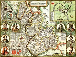
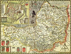
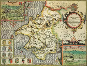
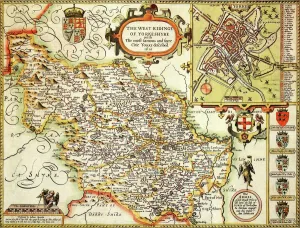
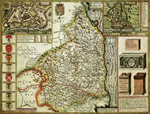
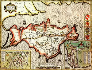
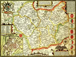
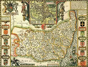
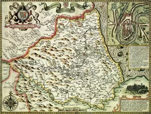
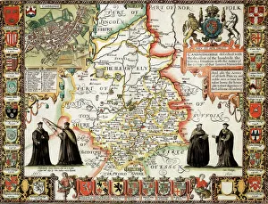
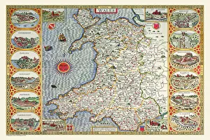
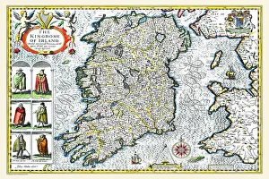
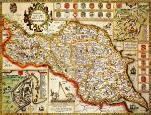
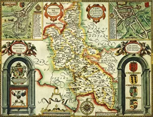
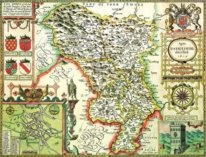
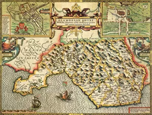
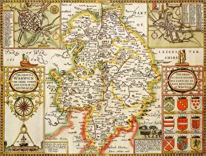
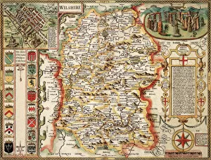
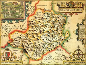
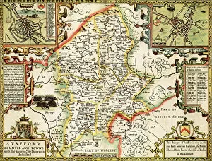
John Speed was a renowned cartographer and historian who left an indelible mark on the world of mapmaking. Born in 1552, he dedicated his life to creating detailed and accurate maps that showcased the rich history and geography of various regions in England. One of his notable works is the Lancashire Historical John Speed 1610 Map, which provides a fascinating glimpse into the county's past. With intricate details and meticulous craftsmanship, this map offers a window into Lancashire's historical landmarks, towns, and landscapes as they existed over four centuries ago. Similarly, the Kent Historical John Speed 1610 Map showcases the beauty and diversity of this southeastern county. From its charming coastal towns to its picturesque countryside, Speed's map captures Kent's essence with precision and artistry. Another masterpiece by the Yorkshire Historical John Speed 1610 Map. This comprehensive depiction of England's largest county reveals its vastness through intricate illustrations of cities like York, Leeds, Sheffield, and more. It serves as a valuable resource for historians studying Yorkshire's evolution throughout time. Speed also created maps for other counties such as Somerset Historical John Speed 1610 Map - showcasing its rolling hillsides; Yorkshire West Riding Historical John Speed 1610 Map - highlighting one specific region within Yorkshire; Lincolnshire Historical John Speed 1610 Map - displaying its unique topography; Nottinghamshire Historical John Speed 1610 Map - revealing insights into Robin Hood folklore; Cornwall Historical John Speed 1610 Map - capturing Cornwall’s rugged coastline; Sussex Historical John Speed 1610 Map – portraying Sussex’s diverse landscape from chalk cliffs to marshlands. Furthermore Pembrokeshire Historical John speed (year) map illustrates Wales' westernmost county with great detail while Oxfordshire historical john speed (year)map presents an insight into one of England’s most prestigious university cities- Oxford. Lastly Surrey historical john speed (year)map showcases this southern English country with its rolling hills and charming villages.