
Land Cover Collection
"Exploring Land Cover: A Satellite Perspective" Witness the captivating beauty of Australia's diverse land cover through a satellite image


All Professionally Made to Order for Quick Shipping
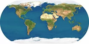
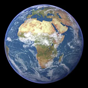
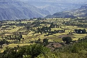
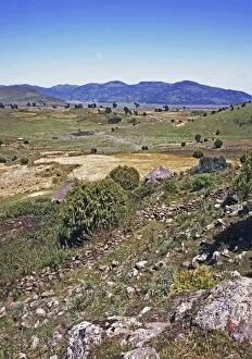
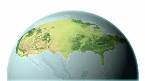
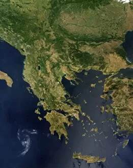
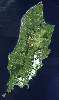
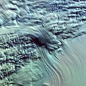
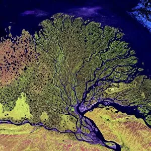
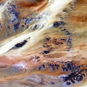
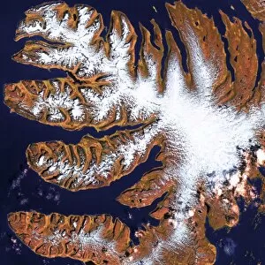
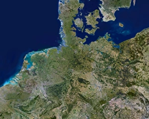
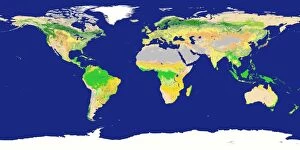
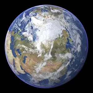
"Exploring Land Cover: A Satellite Perspective" Witness the captivating beauty of Australia's diverse land cover through a satellite image, showcasing its vast landscapes and unique ecosystems. Embark on a visual journey across Africa with a stunning satellite image, revealing the intricate patterns that shape this continent's breathtaking natural wonders. Marvel at the striking contrast between night and day in Africa as captured by a mesmerizing satellite image, offering an extraordinary glimpse into the dynamic changes occurring within its land cover. Behold the awe-inspiring view of our entire planet from space, where a remarkable satellite image showcases Earth's varied land cover and reminds us of its fragile interconnectedness. Delve into the icy realms of The Arctic through an enchanting satellite image, uncovering the delicate balance between frozen landscapes and changing land cover in this remote region. Discover North America like never before with an enthralling satellite image that unveils its diverse land cover patterns, from dense forests to sprawling urban areas. Observe Africa and Atlantic Ocean beneath swirling clouds in a captivating satellite image (C016 / 3727), highlighting how weather systems interact with both continents' distinct land covers. Experience Europe's vibrant transformation from night to day through an illuminating satellite image, showcasing how human activity intertwines with nature to shape its ever-evolving land cover. Immerse yourself in Ethiopia's Bale Mountains marshland (C017 / 7613) as seen from above – witness lush greenery thriving amidst wetlands, forming crucial habitats for various species. Explore Ethiopia's Plateau farmland (C017 / 7622) captured by a detailed satellite image – marvel at agricultural terraces carved into hillsides that sustain communities while transforming their surrounding land covers.