Fraud Blocker Skip to main content

Land Use Collection

"Exploring the diverse tapestry of land use: from the iconic Wimbledon tennis complex in the UK, where sports and leisure meet on carefully maintained grounds

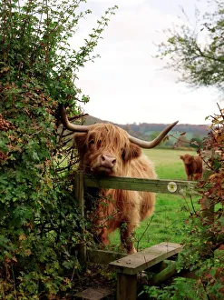
Background imageLand Use Collection: Highland cow

Highland cow (Bos taurus) rubbing its chin on a stile

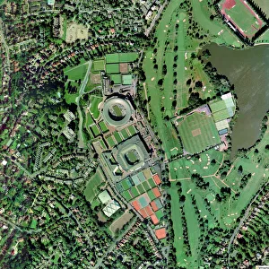
Background imageLand Use Collection: Wimbledon tennis complex, UK

Wimbledon tennis complex, UK
Wimbledon tennis complex, aerial photograph. This complex is host to the Wimbledon tennis championships, the oldest tennis tournament in the world

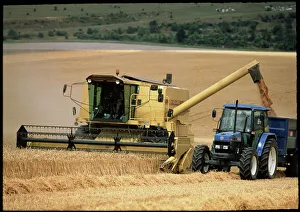
Background imageLand Use Collection: Combine harvester off-loading grain

Combine harvester off-loading grain
Combine harvester. Combine harvester off-loading grain to a tractor. The harvester has a paddlewheel on its front which turns and pushes the crop against a cutting bar

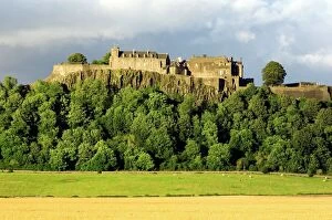
Background imageLand Use Collection: Stirling Castle, Scotland, UK

Stirling Castle, Scotland, UK
Stirling castle. Cows grazing beside a corn field. Stirling castles position on top of steep crags made it easy to defend

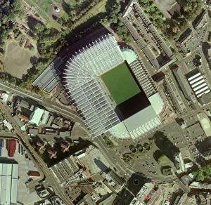
Background imageLand Use Collection: Newcastle Uniteds St James Park Stadium

Newcastle Uniteds St James Park Stadium
St James Park Stadium, home of Newcastle United Football Club, aerial photograph. This all-seater stadium, in Newcastle, UK, can hold over 52, 000 people

Background imageLand Use Collection: Angora goat

Angora goat buck (Capra sp.) used for breeding. Photographed in Karoo, South Africa

Background imageLand Use Collection: Rooster and hens

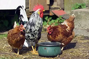
Rooster and hens
Chickens (Gallus gallus). Rooster (male, centre) and two hens (females) on a farm

Background imageLand Use Collection: Highland pony

Highland pony sheltering beneath Scots pine trees during a snow storm. This breed of horse is the largest of the native British breeds

Background imageLand Use Collection: Hereford cow

Hereford cow (Bos taurus) in a field

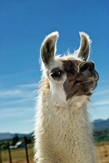
Background imageLand Use Collection: Llama

Llama (Lama glama). These animals are bred as pack animals and for their hair, which is used in textiles, and meat. They have been domesticated since 5000 BC. Photographed in New Zealand

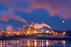
Background imageLand Use Collection: Oil refinery at night

Oil refinery at night. A tailings pond, for the disposal of waste material from the mining and refining process, is seen in the foreground

Background imageLand Use Collection: Parsnip (Pastinaca Tender and True )

Parsnip (Pastinaca Tender and True )
Organic parsnip (Pastinaca sativa Tender and True ) with top stalk sliced off

Background imageLand Use Collection: Shanty town, Nigeria

Shanty town, Nigeria
Shanty town. Photographed on the outskirts of Port Harcourt, in Rivers State, Nigeria

Background imageLand Use Collection: Combine harvester working in a wheat field

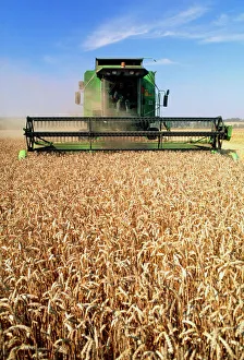
Combine harvester working in a wheat field
Combine harvester. Combine harvester working in a wheat field. Wheat, Triticum sp. is the most important crop in the world, and is largely used to make flour

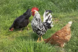
Background imageLand Use Collection: Rooster with chickens

Rooster with chickens
Chickens (Gallus gallus) on a farm. The male (cock, or rooster) is looking around as the females (hens) feed. Photographed in the UK

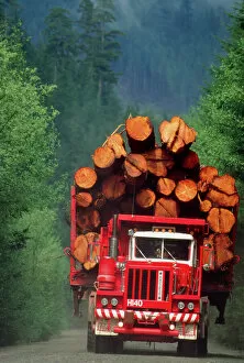
Background imageLand Use Collection: Logging truck loaded with logs

Logging truck loaded with logs

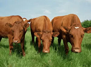
Background imageLand Use Collection: Cows grazing

Cows grazing
Cows (Bos taurus) grazing. Photographed in Herrfallsang, Narke, Sweden

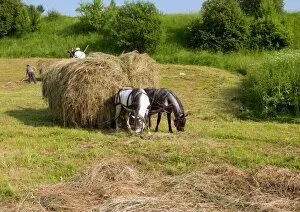
Background imageLand Use Collection: Harvesting hay, Romania

Harvesting hay, Romania
Harvesting hay using horses, near Miclosoara, a Hungarian part of Transylvania in Romania

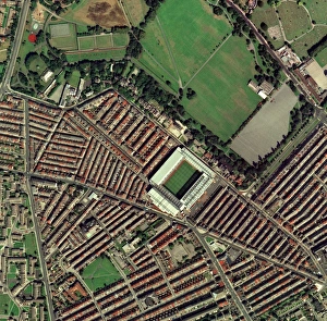
Background imageLand Use Collection: Liverpools Anfield Stadium, aerial view

Liverpools Anfield Stadium, aerial view
Anfield Stadium, home of Liverpool Football Club, aerial photograph. This all-seater stadium, in Liverpool, UK, can hold over 45, 500 people

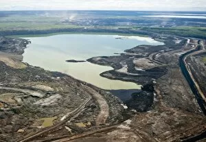
Background imageLand Use Collection: Settling pond, Athabasca Oil Sands

Settling pond, Athabasca Oil Sands
Settling pond. Aerial photograph of a settling pond in the Athabasca Oil Sands, Alberta, Canada. This area used to be an opencast mine for the excavation of oil sands

Background imageLand Use Collection: Opencast mine, Athabasca Oil Sands

Opencast mine, Athabasca Oil Sands
Opencast mine. Aerial photograph of an opencast mine in the Athabasca Oil Sands, Alberta, Canada. This mine is operated by Suncor Energy

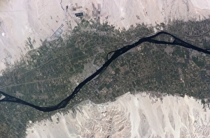
Background imageLand Use Collection: River Nile, Luxor, Egypt

River Nile, Luxor, Egypt, as seen from the International Space Station (ISS). North is towards bottom left

Background imageLand Use Collection: Crop formation, Barbury Castle, Wiltshire

Crop formation, Barbury Castle, Wiltshire

Background imageLand Use Collection: Barley (Hordeum vulgare)

Barley (Hordeum vulgare). Barley is a staple crop throughout the world. Once processed it can be used to make flour, beer and whiskey

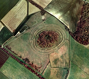
Background imageLand Use Collection: Badbury Rings

Badbury Rings. Aerial photograph of Badbury Rings, an Iron Age hillfort consisting of three circular ramparts surrounding an inner fort (centre)

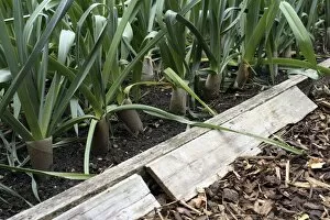
Background imageLand Use Collection: Frog shelter in a vegetable bed

Frog shelter in a vegetable bed
Frog shelter. Planks of wood alongside a row of organically grown leeks (Allium porrum Musselburgh )

Background imageLand Use Collection: Picking sloe fruit (Prunus spinosa)

Picking sloe fruit (Prunus spinosa) from a blackthorn plant

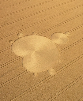
Background imageLand Use Collection: Crop formation in form of Mandelbrot set

Crop formation in form of Mandelbrot set
Crop formation in the form of the " Mandelbrot Set" at Ickleton, near Cambridge, England. The formation appeared in August 1991

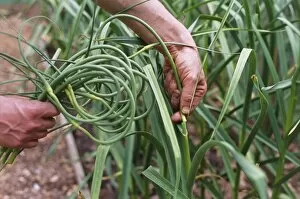
Background imageLand Use Collection: Organic serpent garlic

Organic serpent garlic plants (Allium sativum var. ophioscorodon Bzenc ). Gardener removing the curled tops from garlic plants

Background imageLand Use Collection: Maize flower

Maize flower. Male flower of a maize plant (Zea mays), known as a tassel, with spikelets (green) and anthers (yellow)

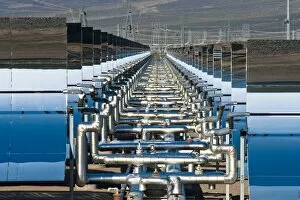
Background imageLand Use Collection: Solar power plant

Solar power plant. Oil pipes and parabolic mirrors at a solar power plant. These mirrors work by tracking the Sun across the sky and focusing its rays onto tubes that contain synthetic oil

Background imageLand Use Collection: River Nile Delta and Suez Canal

River Nile Delta and Suez Canal, Egypt, satellite image. North is at top. Water is black, vegetation is green and arid land is brown. The image data has been decorrelated to enhance the colours

Background imageLand Use Collection: North America, USA, Oregon, Dundee. Spring time in the Bella Vida vineyards with

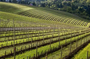
North America, USA, Oregon, Dundee. Spring time in the Bella Vida vineyards with
USA, Oregon, Dundee. Spring time in the Bella Vida vineyards with Maresh vineyards in Red Hills

Background imageLand Use Collection: Sun creates silhouettes of wheat plants at sunset / sunrise

Sun creates silhouettes of wheat plants at sunset / sunrise
Sun creates silhouettes of wheat plants at sunset/sunrise

Background imageLand Use Collection: Settlement, South Africa C017 / 1931

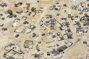
Settlement, South Africa C017 / 1931
Settlement, South Africa

Background imageLand Use Collection: Colonised rainforest land, Ecuador C016 / 7740

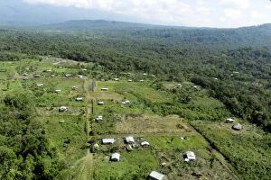
Colonised rainforest land, Ecuador C016 / 7740
Colonised rainforest land. Aerial view of an area of Amazon rainforest that has been cleared for settlement. Photographed in Ecuador

Background imageLand Use Collection: Modern cityscape, artwork

Modern cityscape, artwork
Modern cityscape, computer artwork

Background imageLand Use Collection: Pineapple (Ananas comosus) in flower

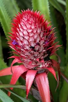
Pineapple (Ananas comosus) in flower
Pineapple (Ananas comosus) plant in flower. Photographed in Mauritius

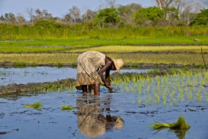
Background imageLand Use Collection: Paddy field, Madagascar

Paddy field, Madagascar
Paddy field. Woman planting rice in a paddy field near the Avenue of the Baobabs in Madagascar

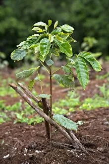
Background imageLand Use Collection: Coffee (Coffea sp. ) plant

Coffee (Coffea sp. ) plant
Coffee (Coffea sp.) plant. Photographed in Mauritius

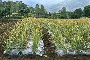
Background imageLand Use Collection: Pineapple farm, Mauritius

Pineapple farm, Mauritius
Pineapple farm. Rows of pineapple (Ananas comosus) plants growing on a farm in Mauritius

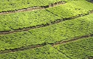
Background imageLand Use Collection: Tea plantation, Rwanda C014 / 0981

Tea plantation, Rwanda C014 / 0981
Tea plantation. View over fields of tea (Camellia sinensis) plants. Photographed in Rwanda

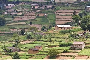
Background imageLand Use Collection: Rwandan farming C014 / 0980

Rwandan farming C014 / 0980
Rwandan farming. View over fields and houses near Kigali, Rwanda

Background imageLand Use Collection: Cape Town and Table Mountain C017 / 1930

Cape Town and Table Mountain C017 / 1930
Cape Town and Table Mountain. Aerial view over the highly developed Cape town suburb of Bloubergstrand, South Africa, looking over Table Bay towards Table Mountain in the distance

Background imageLand Use Collection: Tea plantation, Rwanda C014 / 0982

Tea plantation, Rwanda C014 / 0982
Tea plantation. View over fields of tea (Camellia sinensis) plants. Photographed in Rwanda

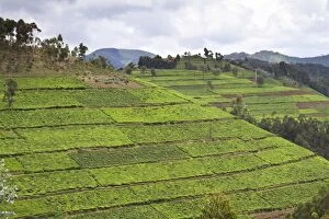
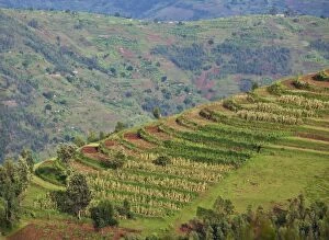
Background imageLand Use Collection: Terraced fields, Rwanda C014 / 0979

Terraced fields, Rwanda C014 / 0979
Terraced fields. View over corn (Zea mays) crops growing on terraces near Kigali, Rwanda

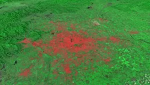
Background imageLand Use Collection: Beijing, China, 2010, satellite image

Beijing, China, 2010, satellite image
Beijing 2010. Satellite image showing the extent of the city of Beijing, China, in 2010. Beijing is one of the oldest cities in the world

Background imageLand Use Collection: Beijing, China, 1978, satellite image

Beijing, China, 1978, satellite image
Beijing 1978. Satellite image showing the extent of the city of Beijing, China, in 1978. Beijing is one of the oldest cities in the world

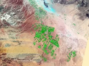
Background imageLand Use Collection: Saudi Arabia agriculture, 2000

Saudi Arabia agriculture, 2000
Saudi Arabia agriculture. False-colour satellite image showing the extent of agricultural operations in the Wadi As-Sirhan Basin of Saudi Arabia in 2000

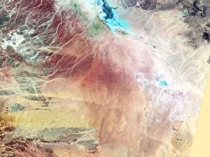
Background imageLand Use Collection: Saudi Arabia agriculture, 1987

Saudi Arabia agriculture, 1987
Saudi Arabia agriculture. False-colour satellite image showing the extent of agricultural operations in the Wadi As-Sirhan Basin of Saudi Arabia in 1987

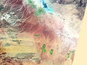
Background imageLand Use Collection: Saudi Arabia agriculture, 1991

Saudi Arabia agriculture, 1991
Saudi Arabia agriculture. False-colour satellite image showing the extent of agricultural operations in the Wadi As-Sirhan Basin of Saudi Arabia in 1991

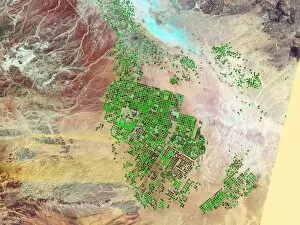
Background imageLand Use Collection: Saudi Arabia agriculture, 2012

Saudi Arabia agriculture, 2012
Saudi Arabia agriculture. False-colour satellite image showing the extent of agricultural operations in the Wadi As-Sirhan Basin of Saudi Arabia in 2012

Background imageLand Use Collection: London, true-colour satellite image C016 / 3888

London, true-colour satellite image C016 / 3888
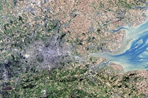
London and its surrounds, true-colour satellite image. North is at top. The Thames Estuary is at right. London is the capital city of the UK

Background imageLand Use Collection: London, infrared satellite image C016 / 3890

London, infrared satellite image C016 / 3890
London and its surrounds, infrared satellite image. North is at top. The Thames Estuary is at right

Background imageLand Use Collection: London, infrared satellite image C016 / 3889

London, infrared satellite image C016 / 3889
London and its surrounds, infrared satellite image. North is at top. The Thames Estuary is at right

Background imageLand Use Collection: Cyprus, satellite image C016 / 3887

Cyprus, satellite image C016 / 3887
Cyprus, satellite image. North is at top. Vegetation is green, bare ground is brown and tan, built up areas are grey, and water is dark blue

Background imageLand Use Collection: Isle of Man, satellite image C016 / 3886

Isle of Man, satellite image C016 / 3886
Isle of Man, satellite image. North is at bottom

Background imageLand Use Collection: Sand Dunes State Park, USA C016 / 3586

Sand Dunes State Park, USA C016 / 3586
Off-road vehicle use is allowed on the dunes in Coral Pink Sand Dunes State Park, Utah, USA

Background imageLand Use Collection: Shrimp farming, Fonseca, 1985-2011 C013 / 7115

Shrimp farming, Fonseca, 1985-2011 C013 / 7115
Shrimp farming, Fonseca, 1985-2011. Landsat satellite photographs of shrimp farming in the Gulf of Fonseca in 1985 (left), 1999 (centre) and 2011 (right)

Background imageLand Use Collection: Isle of Man, satellite image C013 / 5151

Isle of Man, satellite image C013 / 5151
Isle of Man, satellite image. North is towards top left

Background imageLand Use Collection: Cocoa plantation, Indonesia C013 / 5091

Cocoa plantation, Indonesia C013 / 5091
Cocoa plantation. Man holding cocoa (cacao) pods he has harvested from trees at a plantation. Photographed in Sausu Peore, Central Sulawesi, Indonesia

Background imageLand Use Collection: Cocoa plantation, Indonesia C013 / 5090

Cocoa plantation, Indonesia C013 / 5090
Cocoa plantation. Cocoa (cacao) pods from trees at a plantation. Photographed in Sausu Peore, Central Sulawesi, Indonesia

Background imageLand Use Collection: Cocoa plantation, Indonesia C013 / 5089

Cocoa plantation, Indonesia C013 / 5089
Cocoa plantation. Man harvesting cocoa (cacao, Theobroma cacao) pods from trees at a plantation. Photographed in Sausu Peore, Central Sulawesi, Indonesia

Background imageLand Use Collection: Australia, South Australia, Adelaide Hills, Summertown. Farm building with vineyards

Australia, South Australia, Adelaide Hills, Summertown. Farm building with vineyards

Background imageLand Use Collection: Settling pond reclamation

Settling pond reclamation. Pile of overburden (black) in a oil plants settling pond. The buildings of the oil mine and processing plant are in the background

Background imageLand Use Collection: Oil plant settling pond

Oil plant settling pond, aerial photograph. The waste water in this settling pond contains crushed rock, sand, crude oil and bitumen

Background imageLand Use Collection: Chicken embryo

Chicken embryo (Gallus domesticus) developing in the egg. Here at three days old the embryo is seen on top of the yolk. Its developing spinal cord and organs are visible

Background imageLand Use Collection: Chelseas Stamford Bridge stadium, aerial

Chelseas Stamford Bridge stadium, aerial
Stamford Bridge Stadium, home of Chelsea Football Club, aerial photograph. This all-seater stadium, in Fulham, west London, UK, can hold nearly 42, 500 people

Background imageLand Use Collection: Evertons Goodison Park stadium, aerial

Evertons Goodison Park stadium, aerial
Goodison Park Stadium, home of Everton Football Club, aerial photograph. This all-seater stadium, in Liverpool, UK, can hold just over 40, 000 people. It has been the home of Everton FC since 1892

Background imageLand Use Collection: Arsenals Highbury stadium, aerial view

Arsenals Highbury stadium, aerial view
Highbury Stadium, home of Arsenal Football Club from 1913-2006, aerial view. The stadium, officially called Arsenal Stadium, is located in Highbury, in the London Borough of Islington, UK

Background imageLand Use Collection: Charlton Athletics Valley stadium

Charlton Athletics Valley stadium
The Valley stadium, home of Charlton Athletic Football Club, aerial photograph. This all-seater stadium, in Charlton, southeast London, UK, can hold just over 27, 000 people

Background imageLand Use Collection: Wigan Athletics JJB Stadium, aerial view

Wigan Athletics JJB Stadium, aerial view
JJB Stadium, home of Wigan Athletic Football Club, aerial photograph. This all-seater stadium, in Wigan, Greater Manchester, UK, has a capacity of 25, 000 people

Background imageLand Use Collection: Bolton Wanderers Reebok stadium, aerial

Bolton Wanderers Reebok stadium, aerial
Reebok Stadium, home of Bolton Wanderers Football Club, aerial view. The stadium is located in Horwich, near Bolton, UK. It is an all-seater stadium with a capacity of 28, 000

Background imageLand Use Collection: Aston Villas Villa Park stadium, aerial

Aston Villas Villa Park stadium, aerial
Villa Park stadium, home of Aston Villa Football Club, aerial view. The stadium is located in Birmingham, UK

Background imageLand Use Collection: Manchester Uniteds Old Trafford Stadium

Manchester Uniteds Old Trafford Stadium
Old Trafford Stadium, home of Manchester United Football Club, aerial photograph. This all-seater stadium, in Manchester, UK, can hold over 68, 000 people

Background imageLand Use Collection: Tottenham Hotspurs White Hart Lane

Tottenham Hotspurs White Hart Lane
White Hart Lane Stadium, home of Tottenham Hotspur Football Club, aerial photograph. This all-seater stadium, in north London, UK, can hold over 36, 000 people

Background imageLand Use Collection: Gatwick Airport, UK, aerial image

Gatwick Airport, UK, aerial image
Gatwick Airport, West Sussex, UK, aerial photograph. Gatwick acts as Londons second airport (after Heathrow), despite being some 40 kilometres from the city

Background imageLand Use Collection: Redeveloping West Hams stadium

Redeveloping West Hams stadium
Rebuilding West Ham Uniteds Stadium, aerial view. This stadium, officially called the Boleyn Ground but more commonly known as Upton Park, is located in Newham, east London, UK

Background imageLand Use Collection: Buckingham Palace, UK, aerial image

Buckingham Palace, UK, aerial image
Buckingham Palace, London, UK, aerial photograph. The Palace (square, lower left) is the official residence of the British monarch. Its private gardens extend to the left of the Palace

Background imageLand Use Collection: Wembley Stadium being rebuilt, 2003

Wembley Stadium being rebuilt, 2003
Rebuilding Wembley Stadium, UK, aerial view. Wembley is the home of the English national football team, as well as being a venue for other sports and events

Background imageLand Use Collection: Ellis and Liberty Islands, aerial image

Ellis and Liberty Islands, aerial image
Ellis and Liberty Islands, New York, USA, aerial image. Ellis Island (upper right) was the site of the main immigration port into the USA between 1892 and 1954

Background imageLand Use Collection: Hydroponic waste management system

Hydroponic waste management system in Kapalai Island, Sabah, Malaysia

Background imageLand Use Collection: Oil refinery at dusk

Oil refinery at dusk. A tailings pond, for the disposal of waste material from the mining and refining process, is seen in the foreground

Background imageLand Use Collection: Oil refinery at sunset

Oil refinery at sunset. A tailings pond, for the disposal of waste material from the mining and refining process, is seen in the foreground


All products are expertly crafted, using premium materials, tailored to your specifications and promptly shipped

"Exploring the diverse tapestry of land use: from the iconic Wimbledon tennis complex in the UK, where sports and leisure meet on carefully maintained grounds, to the majestic Stirling Castle in Scotland overlooking a landscape shaped by centuries of human settlement. Witnessing agricultural marvels like a combine harvester off-loading grain, showcasing how modern technology aids efficient land utilization. Amidst bustling cities lies Newcastle United's St James Park Stadium, an urban oasis blending recreation with city life. Nature's wonders also take center stage as we encounter Highland cows grazing peacefully amidst rolling Scottish hills and charming Angora goats showcasing their luxurious fleece. The vibrant presence of roosters and hens reminds us of sustainable farming practices that rely on responsible land management. Delving into culinary delights, we discover parsnips thriving in fertile soil; Pastinaca Tender and True variety offering a tantalizing taste experience. In contrast to nature's bounty, an oil refinery at night illuminates industrial landscapes shaped by mankind's pursuit of energy resources. Embracing equine beauty, we are captivated by the gracefulness of Highland ponies galloping freely across vast meadows while Hereford cows symbolize traditional livestock farming methods passed down through generations. And finally, meeting llamas who have found their niche in various roles from companionship to wool production. " In this captivating journey through different facets of land use, one thing becomes clear - our relationship with the earth is multifaceted and ever-evolving. From sporting arenas to natural habitats and everything in between, each corner holds its own story within this intricate web woven by humans and nature alike.

© Copyright Media Storehouse, All Rights Reserved 2003 - 2024
Facebook     Pinterest     100% Payment Secure     Reviews IO