Fraud Blocker Skip to main content

Mapping Collection (page 4)

"Exploring the World Through Maps: A Journey of Discovery" Embark on a captivating journey through time and space as we delve into the fascinating world of mapping

Background imageMapping Collection: Map of the Battle of Hohenlinden, published by William Blackwood and Sons

Map of the Battle of Hohenlinden, published by William Blackwood and Sons
746919 Map of the Battle of Hohenlinden, published by William Blackwood and Sons, Edinburgh & London, 1848 (hand-coloured engraving) by Johnston

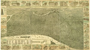
Background imageMapping Collection: Philadelphia in 1886 (colour litho)

Philadelphia in 1886 (colour litho)
483714 Philadelphia in 1886 (colour litho) by Burk, William, and McFetridge, John (fl.1886); 104x183 cm; Free Library of Philadelphia; eFree Library of Philadelphia; Map Collection

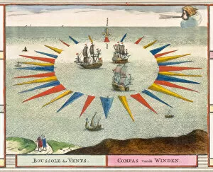
Background imageMapping Collection: Compass of the Winds, 1693 (colour litho)

Compass of the Winds, 1693 (colour litho)
STC414278 Compass of the Winds, 1693 (colour litho) by Mortier, Pierre (Pieter) (1661-1711); Private Collection; The Stapleton Collection; French, out of copyright

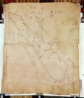
Background imageMapping Collection: Ms 1288 Chart of Sumatra, 1653 (pen, ink & wash on paper)

Ms 1288 Chart of Sumatra, 1653 (pen, ink & wash on paper)
BIF391162 Ms 1288 Chart of Sumatra, 1653 (pen, ink & wash on paper) by Blaeu, Joan (1596-1673); Bibliotheque de l Institut de France, Paris, France; Dutch, out of copyright

Background imageMapping Collection: In the Cyrenaic plateau, patrols of the Vestone Alpini in reconnaissance on the sides of the Derna

In the Cyrenaic plateau, patrols of the Vestone Alpini in reconnaissance on the sides of the Derna in... (colour litho)
2815565 In the Cyrenaic plateau, patrols of the Vestone Alpini in reconnaissance on the sides of the Derna in... (colour litho) by Beltrame

Background imageMapping Collection: 'Appleton - either the Admiral routes the convoys further south

"Appleton - either the Admiral routes the convoys further south
" Appleton - either the Admiral routes the convoys further south, or Snodgrass goes into trousers." A young woman in a naval operations room reveals her stockings while perching on a ladder

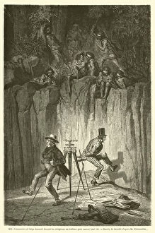
Background imageMapping Collection: MM Fitzmaurice et Keys dansant devant les indigenes australiens pour sauver leur vie (engraving)

MM Fitzmaurice et Keys dansant devant les indigenes australiens pour sauver leur vie (engraving)
2789918 MM Fitzmaurice et Keys dansant devant les indigenes australiens pour sauver leur vie (engraving) by French School

Background imageMapping Collection: Hexamer General Survey; volume 25, plate 2432-2433, 1891 (hand-coloured engraving)

Hexamer General Survey; volume 25, plate 2432-2433, 1891 (hand-coloured engraving)
486271 Hexamer General Survey; volume 25, plate 2432-2433, 1891 (hand-coloured engraving) by Hexamer, Ernest (1827-1912); 50x88 cm; Free Library of Philadelphia; eFree Library of Philadelphia; Map

Background imageMapping Collection: Map of Sevastopol, 1854 (colour litho)

Map of Sevastopol, 1854 (colour litho)
CHT365095 Map of Sevastopol, 1854 (colour litho) by Russian School (19th century); Archives des Tsars, St. Petersburg, Russia; (add.info)

Background imageMapping Collection: The Sun end of the Tsari rongkor (painted cloth)

The Sun end of the Tsari rongkor (painted cloth)
XCF311206 The Sun end of the Tsari rongkor (painted cloth) by Tibetan School; Victoria & Albert Museum, London, UK; (add.info.: the Tsari rongkor (rong bskor) is a two week

Background imageMapping Collection: The Southern Portion of Rajpootana, 1820 (colour engraving)

The Southern Portion of Rajpootana, 1820 (colour engraving)
XCF285174 The Southern Portion of Rajpootana, 1820 (colour engraving) by English School, (19th century); Private Collection; (add.info)

Background imageMapping Collection: Froggetts Map of the Country Fifteen Miles around London, 1833 (colour litho)

Froggetts Map of the Country Fifteen Miles around London, 1833 (colour litho)
STC255315 Froggetts Map of the Country Fifteen Miles around London, 1833 (colour litho) by English School, (19th century); Private Collection; The Stapleton Collection; English, out of copyright

Background imageMapping Collection: Chart of the Coasts, Sindh and Cutch, Surveyed by Lieutenant A. M

Chart of the Coasts, Sindh and Cutch, Surveyed by Lieutenant A. M
XCF291080 Chart of the Coasts, Sindh and Cutch, Surveyed by Lieutenant A. M. Grieve, 1848-50, 1868 (colour litho) by English School, (19th century); Private Collection; English, out of copyright

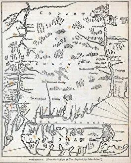
Background imageMapping Collection: Connecticut (litho)

Connecticut (litho)
PNP329794 Connecticut (litho) by American School, (18th century); Private Collection; (add.info.: from the Mapp of New England, by John Seller; ); Peter Newark Pictures; American, out of copyright

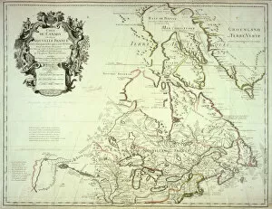
Background imageMapping Collection: Map of Canada, published Paris, 1703 (hand-coloured engraving)

Map of Canada, published Paris, 1703 (hand-coloured engraving)
NBY332310 Map of Canada, published Paris, 1703 (hand-coloured engraving) by Delisle, Guillaume (1675-1726) (after); 50x65 cm; Newberry Library, Chicago, Illinois

Background imageMapping Collection: View of Venice, illustration from the Liber Chronicarum

View of Venice, illustration from the Liber Chronicarum
REV345838 View of Venice, illustration from the Liber Chronicarum by Hartmann Schedel (1440-1514) published in Nuremberg, 1493 (woodcut) by German School

Background imageMapping Collection: Map of Serravalle, from Les Villes de Venetie, 1704

Map of Serravalle, from Les Villes de Venetie, 1704
REV345813 Map of Serravalle, from Les Villes de Venetie, 1704, published by Pierre Mortier in Amsterdam (engraving) by Mortier

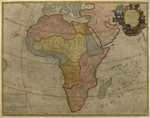
Background imageMapping Collection: Map of Africa, published in 1700, Paris (colour engraving)

Map of Africa, published in 1700, Paris (colour engraving)
REV345805 Map of Africa, published in 1700, Paris (colour engraving) by Delisle, Guillaume (1675-1726) (after); Private Collection; (add.info.: Guillaume de L Isle)

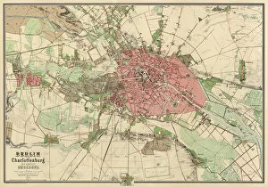
Background imageMapping Collection: Map of Berlin, printed by Koenigl. Lithogr. Institut, Berlin, 1857 (colour litho)

Map of Berlin, printed by Koenigl. Lithogr. Institut, Berlin, 1857 (colour litho)
AGD355563 Map of Berlin, printed by Koenigl. Lithogr. Institut, Berlin, 1857 (colour litho) by German School, (19th century); 85.1x119 cm; Private Collection; (add.info.: Koenigl. Preuss)

Background imageMapping Collection: Colonial America: the Dutch Colony of New Netherland (litho)

Colonial America: the Dutch Colony of New Netherland (litho)
PNP351122 Colonial America: the Dutch Colony of New Netherland (litho) by Vanderbank, John (1694-1739) (after); Private Collection; (add.info)

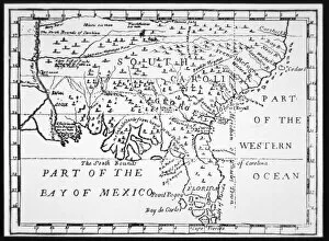
Background imageMapping Collection: Colony of Georgia, America, 1733 (litho)

Colony of Georgia, America, 1733 (litho)
PNP351109 Colony of Georgia, America, 1733 (litho) by American School, (18th century); Private Collection; (add.info.: the earliest map of Georgia; ); Peter Newark American Pictures; American

Background imageMapping Collection: Map of Boston and Charlestown, 1775 (pen, ink & w / c on paper)

Map of Boston and Charlestown, 1775 (pen, ink & w / c on paper)
PNP351105 Map of Boston and Charlestown, 1775 (pen, ink & w/c on paper) by Montresor, John (1736-99); Private Collection; Peter Newark American Pictures; English, out of copyright

Background imageMapping Collection: Map of the Western Hemisphere in 1626 (colour litho)

Map of the Western Hemisphere in 1626 (colour litho)
PNP351107 Map of the Western Hemisphere in 1626 (colour litho) by Speed, John (1552-1629); Private Collection; Peter Newark American Pictures; English, out of copyright

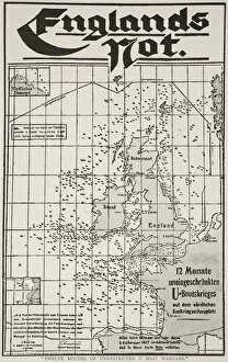
Background imageMapping Collection: Twelve Months of Unrestricted U Boat Warfare, 1917-19 (litho)

Twelve Months of Unrestricted U Boat Warfare, 1917-19 (litho)
STC359560 Twelve Months of Unrestricted U Boat Warfare, 1917-19 (litho) by German School, (20th century); Private Collection; (add.info)

Background imageMapping Collection: Map of Vicenza, illustration from Civitates Orbis Terrarum, c. 1580 (engraving)

Map of Vicenza, illustration from Civitates Orbis Terrarum, c. 1580 (engraving)
REV345839 Map of Vicenza, illustration from Civitates Orbis Terrarum, c.1580 (engraving) by Braun, Georg (1541-1622) and Hogenberg

Background imageMapping Collection: Map showing the world trade shipping routes, cartography by Pierre Duval (1619-83

Map showing the world trade shipping routes, cartography by Pierre Duval (1619-83
REV345800 Map showing the world trade shipping routes, cartography by Pierre Duval (1619-83) published in 1686, Paris (colour engraving) by French School

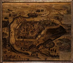
Background imageMapping Collection: Gotha during the siege of Grimmenstein, 1567 (oil on panel)

Gotha during the siege of Grimmenstein, 1567 (oil on panel)
BFM286623 Gotha during the siege of Grimmenstein, 1567 (oil on panel) by German School, (16th century); Schlossmuseum, Schloss Friedenstein, Gotha

Background imageMapping Collection: Map of the East Indies (colour engraving)

Map of the East Indies (colour engraving)
XCF286475 Map of the East Indies (colour engraving) by American School; Private Collection; American, out of copyright

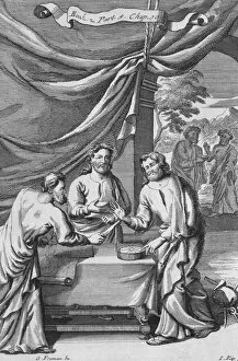
Background imageMapping Collection: An Argument Between Cartographers, illustration from Book 2 Part 5 Chapter 10 of

An Argument Between Cartographers, illustration from Book 2 Part 5 Chapter 10 of
STC134237 An Argument Between Cartographers, illustration from Book 2 Part 5 Chapter 10 of The Principles of Philosophy, engraved by Johannes Kip (1653/53-1722), 1694 (engraving) by Freman, G (fl)

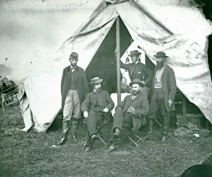
Background imageMapping Collection: Group portrait of Union Mappers at Antietam, Maryland, 1862 (b / w photo)

Group portrait of Union Mappers at Antietam, Maryland, 1862 (b / w photo)
TPG165976 Group portrait of Union Mappers at Antietam, Maryland, 1862 (b/w photo) by American School, (19th century); Private Collection; (add.info.: Seated: R)

Background imageMapping Collection: 'Londinium Antiqua', map of London, pub. by William Darton

"Londinium Antiqua", map of London, pub. by William Darton
GHL6266 " Londinium Antiqua", map of London, pub. by William Darton, 1563 (hand-coloured engraving) by English School, (16th century); London Metropolitan Archives

Background imageMapping Collection: Map of the County of Cornwall, 1579 (hand-coloured engraving)

Map of the County of Cornwall, 1579 (hand-coloured engraving)
OPT18636 Map of the County of Cornwall, 1579 (hand-coloured engraving) by Saxton, Christopher (c.1542-c.1610); Private Collection; English, out of copyright

Background imageMapping Collection: Map of Central America and Peru (map)

Map of Central America and Peru (map)
AIS5391595 Map of Central America and Peru (map) by Santa Cruz, Alonso de (1505-67); Biblioteca Nacional, Madrid, Spain; (add.info.: Colourful manuscript, in Islario General, ca)

Background imageMapping Collection: Harlem, survey of 1888-89 and 1897, ed. of 1900, repr. 1908 (colour litho)

Harlem, survey of 1888-89 and 1897, ed. of 1900, repr. 1908 (colour litho)
6256735 Harlem, survey of 1888-89 and 1897, ed. of 1900, repr. 1908 (colour litho) by American School, (19th century); New York Public Library, USA; American, out of copyright

Background imageMapping Collection: Boston and environs, c. 1905 (colour litho)

Boston and environs, c. 1905 (colour litho)
6256306 Boston and environs, c.1905 (colour litho) by American School, (20th century); Private Collection; (add.info.: Boston, Geo. H. Walker & Co.); American, out of copyright

Background imageMapping Collection: The Battle of Falkirk, 28 January 1746 (line engraving)

The Battle of Falkirk, 28 January 1746 (line engraving)
5920001 The Battle of Falkirk, 28 January 1746 (line engraving) by Jefferys, Thomas (c.1719-71); National Army Museum, London; (add.info.: The Battle of Falkirk, 28 January 1746)

Background imageMapping Collection: Terrestrial Globe, 1632 (engraving)

Terrestrial Globe, 1632 (engraving)
2654783 Terrestrial Globe, 1632 (engraving) by Greuter, Matthaus (c.1556-1638); each segment 33.5x12.5 cm; Private Collection; Photo eChristies Images; French, out of copyright

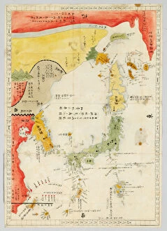
Background imageMapping Collection: Sangoku tsuran zusetsu (Illustrated General Survey of the Three Countries)

Sangoku tsuran zusetsu (Illustrated General Survey of the Three Countries)
3502614 Sangoku tsuran zusetsu (Illustrated General Survey of the Three Countries), 1785 (colour woodblock print) by Shihei, Hayashi (1738-93); Private Collection; (add.info.: SHIHEI)

Background imageMapping Collection: Mappa Mundi, the first printed map of the world, from Etymologiae

Mappa Mundi, the first printed map of the world, from Etymologiae
3482941 Mappa Mundi, the first printed map of the world, from Etymologiae by Isidorus Hispalensis, Augsburg: GAonther Zainer, 19 November 1472 (woodcut) by German School

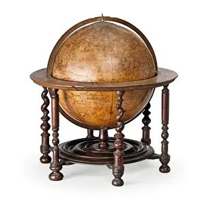
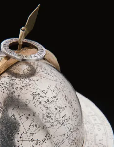
Background imageMapping Collection: Early English terrestrial globe, c. 1673 (engraving, brass, walnut & oak)

Early English terrestrial globe, c. 1673 (engraving, brass, walnut & oak)
3482913 Early English terrestrial globe, c.1673 (engraving, brass, walnut & oak) by Berry, William (1639-1718) & Morden, Robert (c.1650-1703); height: 53 cm; Private Collection; (add.info)

Background imageMapping Collection: Two exceptional terrestrial and celestial globes, supported by Hercules and Atlas

Two exceptional terrestrial and celestial globes, supported by Hercules and Atlas
3482912 Two exceptional terrestrial and celestial globes, supported by Hercules and Atlas, Augsburg, 1697-99 (silver & silver-gilt) by Drentwett

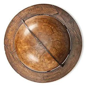
Background imageMapping Collection: Early English terrestrial globe, c. 1673 (engraving, brass, walnut & oak)

Early English terrestrial globe, c. 1673 (engraving, brass, walnut & oak)
3482911 Early English terrestrial globe, c.1673 (engraving, brass, walnut & oak) by Berry, William (1639-1718) & Morden, Robert (c.1650-1703); height: 53 cm; Private Collection; (add.info)

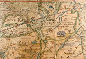
Background imageMapping Collection: Detail of Africa from a terrestrial globe 1645 / 48 (plaster, wood & engraved paper)

Detail of Africa from a terrestrial globe 1645 / 48 (plaster, wood & engraved paper)
3482883 Detail of Africa from a terrestrial globe 1645/48 (plaster, wood & engraved paper) by Blaeu, Willem (1571-1638); height: 99 cm; Private Collection; (add.info)

Background imageMapping Collection: Rare Continental globe cup, North German or Flemish, c. 1600 (silver gilt

Rare Continental globe cup, North German or Flemish, c. 1600 (silver gilt
CH438768 Rare Continental globe cup, North German or Flemish, c.1600 (silver gilt) (detail of 438767) by German School; Private Collection; Photo eChristies Images; out of copyright

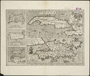
Background imageMapping Collection: Cuba Insula; Hispaniola Insula, engraved by Hendrik Hondius, 1633 (engraving)

Cuba Insula; Hispaniola Insula, engraved by Hendrik Hondius, 1633 (engraving)
5648408 Cuba Insula; Hispaniola Insula, engraved by Hendrik Hondius, 1633 (engraving) by Mercator, Gerard (1512-94) (after); 48x57 cm; Boston Public Library, Boston, Massachusetts, USA; Flemish

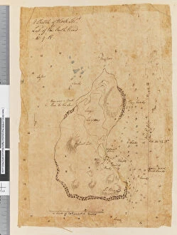
Background imageMapping Collection: Page 37a A Sketch of Block Island, latitude of the South Head 41: 9 N

Page 37a A Sketch of Block Island, latitude of the South Head 41: 9 N
5670302 Page 37a A Sketch of Block Island, latitude of the South Head 41: 9 N, 1768-75 (pen & ink) by Hodges, William (1744-97); Mitchell Library

Background imageMapping Collection: Page 19 (a) Middleburg Island bearing W bys distant 3 leagues (b

Page 19 (a) Middleburg Island bearing W bys distant 3 leagues (b
5670271 Page 19 (a) Middleburg Island bearing W bys distant 3 leagues (b) West point of Middleburg N by W four miles (c) Middleburg E bys distant five miles (d)


All Professionally Made to Order for Quick Shipping

"Exploring the World Through Maps: A Journey of Discovery" Embark on a captivating journey through time and space as we delve into the fascinating world of mapping. From the iconic Wimbledon tennis complex in the UK to the enchanting Theatre of the Empire of Great Britain, these maps offer glimpses into diverse landscapes and historical narratives. Transport yourself back to 1560 Mexico with Alonso de Santa Cruz's Map of Tenochtitlan, where you can trace the ancient streets and waterways that once thrived in this vibrant city. Or marvel at Durer's intricate world map from 1515, which showcases an era when cartography was still in its infancy but held immense potential for exploration. Step foot onto 16th-century Florence with a meticulously detailed plan that captures every nook and cranny of this Renaissance gem. Meanwhile, an Italian map from 1537 unveils Corfu's allure nestled within Greece's Ionian Sea – a testament to both artistic skill and geographical accuracy. As we venture further into history, a stunning 17th-century European map unfolds before our eyes, revealing political boundaries that have since evolved but continue to shape our present-day understanding. Witness Dubrovnik's pre-1667 earthquake charm through an intricately crafted depiction that preserves its architectural grandeur. The allure extends beyond terrestrial realms as well; explore Bermuda’s beauty through a vividly colored engraving or immerse yourself in Roman glory with "A New Map of the Roman Empire. " These maps not only guide us geographically but also provide insights into cultural heritage and societal dynamics. Finally, let us contemplate White Matter Fibres' artwork from 1930 – an abstract representation reminding us that mapping transcends physical borders too. It invites us to explore neural pathways within our own minds while appreciating how cartography has become intertwined with human cognition throughout history. Intricate lines, vibrant colors, and meticulous details come together on these maps, inviting us to embark on a visual and intellectual adventure.