Fraud Blocker Skip to main content

Mapping Collection (page 5)

"Exploring the World Through Maps: A Journey of Discovery" Embark on a captivating journey through time and space as we delve into the fascinating world of mapping

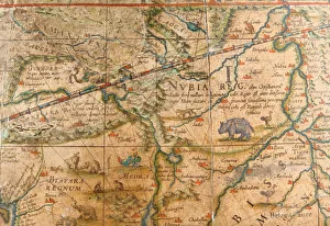
Background imageMapping Collection: Detail of Africa from a terrestrial globe 1645 / 48 (plaster, wood & engraved paper)

Detail of Africa from a terrestrial globe 1645 / 48 (plaster, wood & engraved paper)
3482883 Detail of Africa from a terrestrial globe 1645/48 (plaster, wood & engraved paper) by Blaeu, Willem (1571-1638); height: 99 cm; Private Collection; (add.info)

Background imageMapping Collection: Rare Continental globe cup, North German or Flemish, c. 1600 (silver gilt

Rare Continental globe cup, North German or Flemish, c. 1600 (silver gilt
CH438768 Rare Continental globe cup, North German or Flemish, c.1600 (silver gilt) (detail of 438767) by German School; Private Collection; Photo eChristies Images; out of copyright

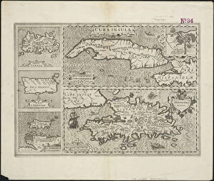
Background imageMapping Collection: Cuba Insula; Hispaniola Insula, engraved by Hendrik Hondius, 1633 (engraving)

Cuba Insula; Hispaniola Insula, engraved by Hendrik Hondius, 1633 (engraving)
5648408 Cuba Insula; Hispaniola Insula, engraved by Hendrik Hondius, 1633 (engraving) by Mercator, Gerard (1512-94) (after); 48x57 cm; Boston Public Library, Boston, Massachusetts, USA; Flemish

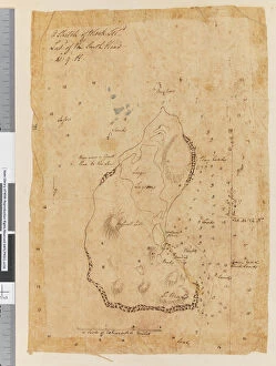
Background imageMapping Collection: Page 37a A Sketch of Block Island, latitude of the South Head 41: 9 N

Page 37a A Sketch of Block Island, latitude of the South Head 41: 9 N
5670302 Page 37a A Sketch of Block Island, latitude of the South Head 41: 9 N, 1768-75 (pen & ink) by Hodges, William (1744-97); Mitchell Library

Background imageMapping Collection: Page 19 (a) Middleburg Island bearing W bys distant 3 leagues (b

Page 19 (a) Middleburg Island bearing W bys distant 3 leagues (b
5670271 Page 19 (a) Middleburg Island bearing W bys distant 3 leagues (b) West point of Middleburg N by W four miles (c) Middleburg E bys distant five miles (d)

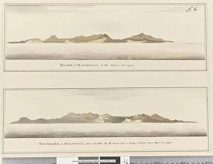
Background imageMapping Collection: Page 6 Island of Bonavista: 2 Profiles. Titled: Island of Bonavista S. W

Page 6 Island of Bonavista: 2 Profiles. Titled: Island of Bonavista S. W
5670257 Page 6 Island of Bonavista: 2 Profiles. Titled: Island of Bonavista S.W. distant 5 leagues and The Island of Bonavista when the hill A, off which lies a ledge of rocks bears west 2 leagues

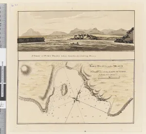
Background imageMapping Collection: Page 3a Chart of Port Praya in the Island of St Jago, Cape Verde Islands

Page 3a Chart of Port Praya in the Island of St Jago, Cape Verde Islands
5670253 Page 3a Chart of Port Praya in the Island of St Jago, Cape Verde Islands. Titled Port Praya in the Island St Jago one of the Cape de Verds sic A scale of 2 to 1/2 a mile / A View of Port

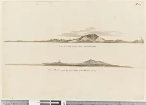
Background imageMapping Collection: Page 1 (a) Profile of the coast of the Isle of Mayo, Cape Verde Islands

Page 1 (a) Profile of the coast of the Isle of Mayo, Cape Verde Islands
5670251 Page 1 (a) Profile of the coast of the Isle of Mayo, Cape Verde Islands. (b) Profile of the coast of Isle of Mayo Cape Verde Islands, looking north west, 1768-75 (pencil)

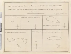
Background imageMapping Collection: iii. Sketches of the islands Lagoon, Thrum-Cap, Bow-Island, the Two Groups

iii. Sketches of the islands Lagoon, Thrum-Cap, Bow-Island, the Two Groups
5670248 iii. Sketches of the islands Lagoon, Thrum-Cap, Bow-Island, the Two Groups, Bird Island and Chain Island, lying in the South, Sea

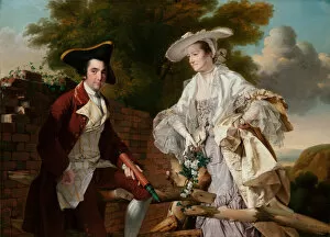
Background imageMapping Collection: Portrait of Peter Perez Burdett and His First Wife Hannah, 1765 (oil on canvas)

Portrait of Peter Perez Burdett and His First Wife Hannah, 1765 (oil on canvas)
5614471 Portrait of Peter Perez Burdett and His First Wife Hannah, 1765 (oil on canvas) by Wright of Derby, Joseph (1734-97); 145X205 cm; Narodni Galerie, Prague

Background imageMapping Collection: A description of a view of New York, now exhibiting at the Panorama, Leicester Square

A description of a view of New York, now exhibiting at the Panorama, Leicester Square
5897731 A description of a view of New York, now exhibiting at the Panorama, Leicester Square, 1834 (engraving) by Burford, Robert (1791-1861); 28.5x43.5 cm; Private Collection; American

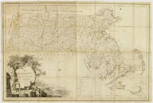
Background imageMapping Collection: Map of Massachusetts proper: compiled from actual surveys made by order of the General

Map of Massachusetts proper: compiled from actual surveys made by order of the General
5905725 Map of Massachusetts proper: compiled from actual surveys made by order of the General Court and under the inspection of agents of their appointment, 1802 (engraving) by Carleton

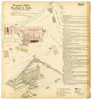
Background imageMapping Collection: Hexamer General Surveys, Volume 11, Plate 960, 1876 (colour litho)

Hexamer General Surveys, Volume 11, Plate 960, 1876 (colour litho)
4072736 Hexamer General Surveys, Volume 11, Plate 960, 1876 (colour litho) by Hexamer, Ernest (1827-1912); Free Library of Philadelphia; eFree Library of Philadelphia; Map Collection

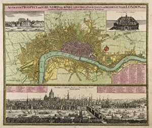
Background imageMapping Collection: Map and Prospect of London, c. 1710 (hand coloured engraving)

Map and Prospect of London, c. 1710 (hand coloured engraving)
GHL45972 Map and Prospect of London, c.1710 (hand coloured engraving) by Homann, Johann Baptista (1663-1724); London Metropolitan Archives, City of London; eLondon Metropolitan Archives; German

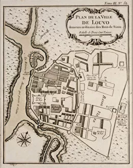
Background imageMapping Collection: Plan of Lopburi, 1751 (litho)

Plan of Lopburi, 1751 (litho)
LIT389801 Plan of Lopburi, 1751 (litho) by French School, (18th century); (add.info.: made in Paris; Plan de la Ville de Louvo, demeure ordinaire des Rois de Siam; ); Photo eLuca Tettoni; French

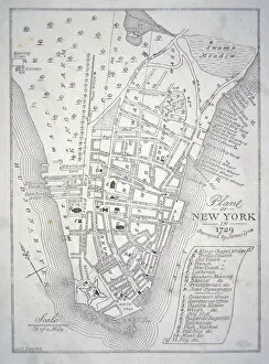
Background imageMapping Collection: Plan of New York in 1729 (litho)

Plan of New York in 1729 (litho)
PNP351119 Plan of New York in 1729 (litho) by English School; Private Collection; Peter Newark American Pictures; English, out of copyright

Background imageMapping Collection: Map of New York in 1766-67 (w / c on paper)

Map of New York in 1766-67 (w / c on paper)
PNP351108 Map of New York in 1766-67 (w/c on paper) by American School, (18th century); Private Collection; (add.info.: map surveyed by Lt)

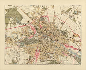
Background imageMapping Collection: Map of Berlin, printed by C. L. Keller, Berlin, 1890 (colour litho)

Map of Berlin, printed by C. L. Keller, Berlin, 1890 (colour litho)
AGD355564 Map of Berlin, printed by C.L. Keller, Berlin, 1890 (colour litho) by Straube, Jul. (fl.1890); 51.1x65.2 cm; Private Collection; (add.info.: Illustrierter Plan von Berlin; ); German

Background imageMapping Collection: Map of Berlin, 1802 (coloured engraving)

Map of Berlin, 1802 (coloured engraving)
AGD355561 Map of Berlin, 1802 (coloured engraving) by Schneider, J.F. (fl.1802); Private Collection; (add.info.: Plan von Berlin nebst denen umliegenden Gegenden; ); German, out of copyright

Background imageMapping Collection: Map of Berlin and Coelln, 1688 (engraving)

Map of Berlin and Coelln, 1688 (engraving)
AGD355556 Map of Berlin and Coelln, 1688 (engraving) by Schultz, Joh. Bernhard (fl.1688); 47.5x142.7 cm; Private Collection; (add.info)

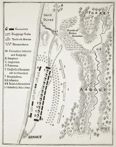
Background imageMapping Collection: The Battle of Arsuf, 7th September 1191 (litho) (b / w photo)

The Battle of Arsuf, 7th September 1191 (litho) (b / w photo)
STC400587 The Battle of Arsuf, 7th September 1191 (litho) (b/w photo) by English School, (19th century); Private Collection; (add.info)

Background imageMapping Collection: An inciting map of the Turbid Amazon, illustration from

An inciting map of the Turbid Amazon, illustration from
STC405567 An inciting map of the Turbid Amazon, illustration from Just So Stories for Little Children by Rudyard Kipling, pub

Background imageMapping Collection: Map of New Spain, New Galicia and Guatemala, 1625 (coloured engraving)

Map of New Spain, New Galicia and Guatemala, 1625 (coloured engraving)
REV397910 Map of New Spain, New Galicia and Guatemala, 1625 (coloured engraving) by Spanish School, (17th century); Biblioteca Nacional de Mexico, Mexico; Spanish, out of copyright

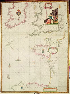
Background imageMapping Collection: Ms 1288 Chart of the Sea Coasts of England & Ireland and of the Bay of Biscay (engraving)

Ms 1288 Chart of the Sea Coasts of England & Ireland and of the Bay of Biscay (engraving)
BIF391161 Ms 1288 Chart of the Sea Coasts of England & Ireland and of the Bay of Biscay (engraving) by Seller, John (1632-97); Bibliotheque de l Institut de France, Paris, France; English

Background imageMapping Collection: Italian advance, August 1917 (litho)

Italian advance, August 1917 (litho)
STC410975 Italian advance, August 1917 (litho) by English School, (20th century); Private Collection; The Stapleton Collection; English, out of copyright

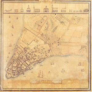
Background imageMapping Collection: Map of Manhattan, c. 1740 (colour litho)

Map of Manhattan, c. 1740 (colour litho)
NYH412353 Map of Manhattan, c.1740 (colour litho) by Grim, David (18th Century); Collection of the New-York Historical Society, USA; eNew York Historical Society; American, out of copyright

Background imageMapping Collection: Plan of the attack on Sholapore, illustration from Cassell

Plan of the attack on Sholapore, illustration from Cassell
876379 Plan of the attack on Sholapore, illustration from Cassells Illustrated History of India by James Grant, pub. 1879 (litho) by English School

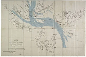
Background imageMapping Collection: Sketch showing defences and channels of Charleston Harbour, June 1864 (ink on oilcloth)

Sketch showing defences and channels of Charleston Harbour, June 1864 (ink on oilcloth)
696119 Sketch showing defences and channels of Charleston Harbour, June 1864 (ink on oilcloth) by Bartelle, Charles V. (fl.1864); 37.3x56 cm; Gilder Lehrman Collection, New York

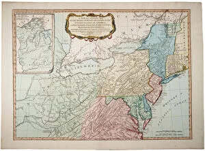
Background imageMapping Collection: A new and general map of the middle dominion belonging to the United States

A new and general map of the middle dominion belonging to the United States
696116 A new and general map of the middle dominion belonging to the United States, 14th May 1794 (colour litho) by Whittle, James (1757-1818) and Laurie

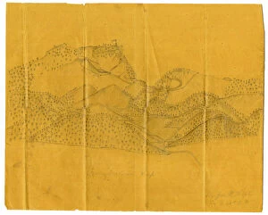
Background imageMapping Collection: Pencil illustration of the Cumberland Gap, c. 1862-1865 (litho)

Pencil illustration of the Cumberland Gap, c. 1862-1865 (litho)
696114 Pencil illustration of the Cumberland Gap, c.1862-1865 (litho) by Hopte, John W. (fl.1862-1865); 25.5x31.4 cm; Gilder Lehrman Collection, New York

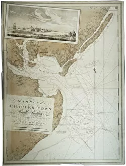
Background imageMapping Collection: The Harbour of Charlestown [Charleston] in South Carolina, 1780 (colour litho)

The Harbour of Charlestown [Charleston] in South Carolina, 1780 (colour litho)
696112 The Harbour of Charlestown [Charleston] in South Carolina, 1780 (colour litho) by DesBarres, Joseph Frederick Wallet (1721-1824); Gilder Lehrman Collection, New York

Background imageMapping Collection: The Holy Spirit with a Model of Ptolemys World, 1610 (oil on panel)

The Holy Spirit with a Model of Ptolemys World, 1610 (oil on panel)
NMG146017 The Holy Spirit with a Model of Ptolemys World, 1610 (oil on panel) by Han, Hermann (1574-1627/8); 122x87 cm; Muzeum Narodowe, Gdansk

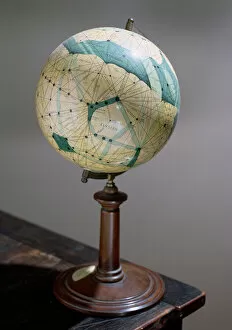
Background imageMapping Collection: Globe of the planet Mars, made 1903-09

Globe of the planet Mars, made 1903-09
CHT176313 Globe of the planet Mars, made 1903-09 by Lowell, Percival (1855-1916) (after); Observatoire Camille Flammarion, Juvisy

Background imageMapping Collection: Plan of proposed street running from Charing Cross to Portland Place, 1848 (colour litho)

Plan of proposed street running from Charing Cross to Portland Place, 1848 (colour litho)
GHL6094 Plan of proposed street running from Charing Cross to Portland Place, 1848 (colour litho) by English School, (19th century); London Metropolitan Archives

Background imageMapping Collection: Central Park, Looking North from 59th Street, engraved by F. Hepperheimer (fl

Central Park, Looking North from 59th Street, engraved by F. Hepperheimer (fl
MNY90550 Central Park, Looking North from 59th Street, engraved by F. Hepperheimer (fl.1849-79) pub. by John Bachmann, New York, 1863 (litho) by American School

Background imageMapping Collection: Map of the Kingdom of Siam, Paris, 1686 (engraving) (b / w photo)

Map of the Kingdom of Siam, Paris, 1686 (engraving) (b / w photo)
CHT286981 Map of the Kingdom of Siam, Paris, 1686 (engraving) (b/w photo) by French School, (17th century); Bibliotheque Nationale, Paris

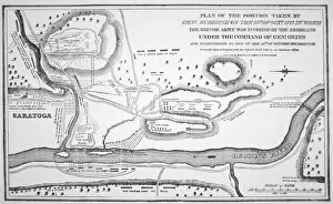
Background imageMapping Collection: Plan of the Battle of Saratoga, October 1777 (litho)

Plan of the Battle of Saratoga, October 1777 (litho)
PNP332821 Plan of the Battle of Saratoga, October 1777 (litho) by American School, (18th century) (after); Private Collection; (add.info)

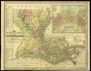
Background imageMapping Collection: The Travellers Pocket Map of Louisiana, published in 1830 (coloured engraving)

The Travellers Pocket Map of Louisiana, published in 1830 (coloured engraving)
NBY332324 The Travellers Pocket Map of Louisiana, published in 1830 (coloured engraving) by Brose, W. (fl.1830); 41x51 cm; Newberry Library, Chicago, Illinois, USA; eNewberry Library; American

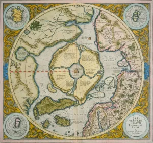
Background imageMapping Collection: Septentrionalium Terrarum descriptio, 1595 (coloured engraving)

Septentrionalium Terrarum descriptio, 1595 (coloured engraving)
NBY332291 Septentrionalium Terrarum descriptio, 1595 (coloured engraving) by Mercator, Gerardus (1512-94); Newberry Library, Chicago, Illinois, USA; eNewberry Library; Flemish, out of copyright

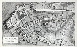
Background imageMapping Collection: Part of Bernard Ratzers smaller map of New York City (litho)

Part of Bernard Ratzers smaller map of New York City (litho)
PNP329789 Part of Bernard Ratzers smaller map of New York City (litho) by American School, (18th century); Private Collection; Peter Newark American Pictures; American, out of copyright

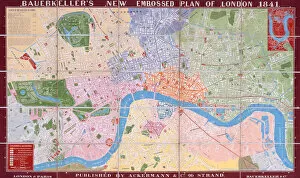
Background imageMapping Collection: Bauerkellers New, Embossed, Plan of London, 1841 (colour lithograph)

Bauerkellers New, Embossed, Plan of London, 1841 (colour lithograph)
STC255320 Bauerkellers New, Embossed, Plan of London, 1841 (colour lithograph) by Bauerkeller, George (fl.1841); Private Collection; The Stapleton Collection; English, out of copyright

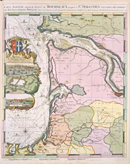
Background imageMapping Collection: La Naptune Francois, ou Atlas des Cartes Marines, 1693 (colour litho)

La Naptune Francois, ou Atlas des Cartes Marines, 1693 (colour litho)
STC255319 La Naptune Francois, ou Atlas des Cartes Marines, 1693 (colour litho) by Mortier, Pierre (Pieter) (1661-1711); Private Collection; The Stapleton Collection; French, out of copyright

Background imageMapping Collection: Pair of 12-inch celestial and territorial globes (mixed media)

Pair of 12-inch celestial and territorial globes (mixed media)
MFR348320 Pair of 12-inch celestial and territorial globes (mixed media) by Blaeu, Willem (1571-1638); 30.48 cm; Private Collection; Dutch, out of copyright

Background imageMapping Collection: Map of Rovigo, from Les Villes de Venetie, 1704

Map of Rovigo, from Les Villes de Venetie, 1704
REV345835 Map of Rovigo, from Les Villes de Venetie, 1704, published by Pierre Mortier in Amsterdam (engraving) by Mortier

Background imageMapping Collection: Map of Verona, from Les Villes de Venetie, 1704

Map of Verona, from Les Villes de Venetie, 1704
REV345808 Map of Verona, from Les Villes de Venetie, 1704, published by Pierre Mortier in Amsterdam (engraving) by Mortier

Background imageMapping Collection: Map of South America, published in 1700, Paris (colour engraving)

Map of South America, published in 1700, Paris (colour engraving)
REV345803 Map of South America, published in 1700, Paris (colour engraving) by Delisle, Guillaume (1675-1726) (after); Private Collection; (add.info.: Guillaume de L Isle)

Background imageMapping Collection: Battle of Edgehill, October 23rd 1642 (litho)

Battle of Edgehill, October 23rd 1642 (litho)
STC373362 Battle of Edgehill, October 23rd 1642 (litho) by English School, (19th century); Private Collection; The Stapleton Collection; English, out of copyright

Background imageMapping Collection: The centre section of the Tsari rongkor (painted cloth)

The centre section of the Tsari rongkor (painted cloth)
XCF311207 The centre section of the Tsari rongkor (painted cloth) by Tibetan School; Victoria & Albert Museum, London, UK; (add.info.: the Tsari rongkor (rong bskor) is a two week


All Professionally Made to Order for Quick Shipping

"Exploring the World Through Maps: A Journey of Discovery" Embark on a captivating journey through time and space as we delve into the fascinating world of mapping. From the iconic Wimbledon tennis complex in the UK to the enchanting Theatre of the Empire of Great Britain, these maps offer glimpses into diverse landscapes and historical narratives. Transport yourself back to 1560 Mexico with Alonso de Santa Cruz's Map of Tenochtitlan, where you can trace the ancient streets and waterways that once thrived in this vibrant city. Or marvel at Durer's intricate world map from 1515, which showcases an era when cartography was still in its infancy but held immense potential for exploration. Step foot onto 16th-century Florence with a meticulously detailed plan that captures every nook and cranny of this Renaissance gem. Meanwhile, an Italian map from 1537 unveils Corfu's allure nestled within Greece's Ionian Sea – a testament to both artistic skill and geographical accuracy. As we venture further into history, a stunning 17th-century European map unfolds before our eyes, revealing political boundaries that have since evolved but continue to shape our present-day understanding. Witness Dubrovnik's pre-1667 earthquake charm through an intricately crafted depiction that preserves its architectural grandeur. The allure extends beyond terrestrial realms as well; explore Bermuda’s beauty through a vividly colored engraving or immerse yourself in Roman glory with "A New Map of the Roman Empire. " These maps not only guide us geographically but also provide insights into cultural heritage and societal dynamics. Finally, let us contemplate White Matter Fibres' artwork from 1930 – an abstract representation reminding us that mapping transcends physical borders too. It invites us to explore neural pathways within our own minds while appreciating how cartography has become intertwined with human cognition throughout history. Intricate lines, vibrant colors, and meticulous details come together on these maps, inviting us to embark on a visual and intellectual adventure.