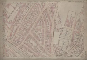
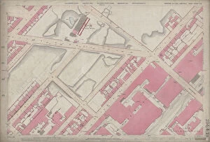
Ordnance Survey Map, Fowler Street, Pitsmoor area of Sheffield, 1889 (Yorkshire sheet no. 294. 4. 21)
This map features: Top left: Rutland Road, [Woodside Board School] School (Girls and Infants), Playground, Botsford Street, Rutland Street, Woodside Lane Birley Street, Fowler Street, Grove Street
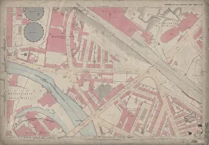
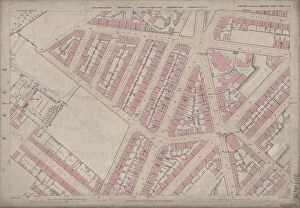
Ordnance Survey Map, Somerset Street area, Burngreave, Sheffield, 1889 (Yorkshire sheet no. 294. 4. 22)
This map features: Top left: Rock Street, Nottingham Street, Brackley Street, Somerset Road, Catherine Street, Somerset Street, Leicester Villas, Fox Street, Cranworth Road, Brotherton Street
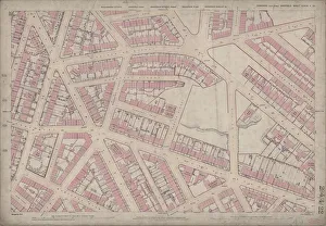
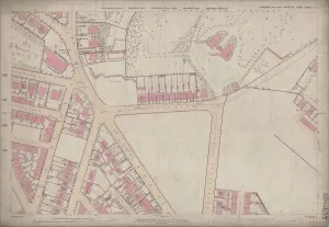
Ordnance Survey Map, Lyons Street / Carlisle Street area, Sheffield, 1889 (Yorkshire sheet no. 294. 4. 19)
This map features: Top left: Jamaica Street, Kingston Street, Petre Street, Edgar Street, Thorndon Road (marked in pencil), Earsham Street, Lyons Street, Carwood Lane Brick and Stone Works, Kiln
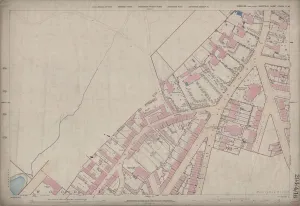
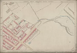
Ordnance Survey Map, Ellesmere Road / Lyons Road area of Sheffield, 1889 (Yorkshire sheet number 294. 4. 18)
This map features: Top left: Earldom Street, Grimesthorpe Road, Lyons Road, The Hills, Malton Street, Burngreave Cemetery, Hooton Street, Lucas Street, Normanton Street