Fraud Blocker Skip to main content

Physical Geography Collection (page 6)

"Exploring the Diverse Landscapes

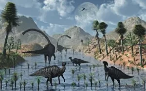
Background imagePhysical Geography Collection: Sauropod and duckbill dinosaurs feed peacefully together

Sauropod and duckbill dinosaurs feed peacefully together
In this prehistoric scene, both sauropod and duckbill dinosaurs feed peacefully together, but remain alert to any possible dangers

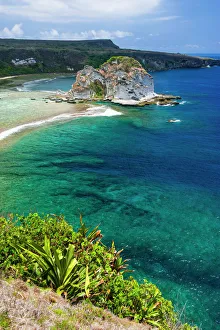
Background imagePhysical Geography Collection: Bird island outlook, Saipan, Northern Marianas, Central Pacific

Bird island outlook, Saipan, Northern Marianas, Central Pacific

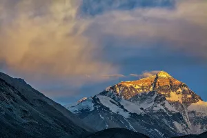
Background imagePhysical Geography Collection: mt. Everest from Everest Base Camp, Tibet, China
mt. Everest from Everest Base Camp, Tibet, China
Background imagePhysical Geography Collection: Northern Ireland, Giants Causeway, near Bushmills, geologic hexagonal basalt columns

Northern Ireland, Giants Causeway, near Bushmills, geologic hexagonal basalt columns
Giants Causeway, County Antrim, Northern Ireland

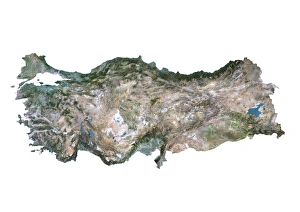
Background imagePhysical Geography Collection: Turkey, Satellite Image

Turkey, Satellite Image
Satellite view of Turkey. This image was compiled from data acquired by LANDSAT satellite

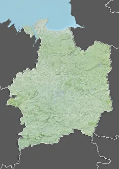
Background imagePhysical Geography Collection: Departement of Ille-et-Vilaine, France, Relief Map

Departement of Ille-et-Vilaine, France, Relief Map
Relief map of the departement of Ille-et-Vilaine, France. It is bordered by the English Channel to the north. This image was compiled from data acquired by LANDSAT 5 & 7 satellites combined with

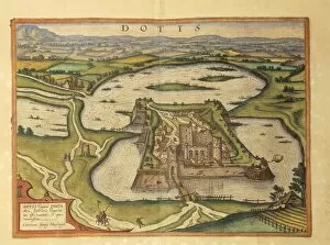
Background imagePhysical Geography Collection: Tata, Dotis from Civitates Orbis Terrarum by Georg Braun, 1541-1622 and Franz Hogenberg

Tata, Dotis from Civitates Orbis Terrarum by Georg Braun, 1541-1622 and Franz Hogenberg, 1540-1590, engraving
Cartography, Hungary, 16th century. Tata (Dotis). From Civitates Orbis Terrarum by Georg Braun (1541-1622) and Franz Hogenberg (1540-1590), Cologne. Engraving

Background imagePhysical Geography Collection: Bacchus and Vesuvius, fresco

Bacchus and Vesuvius, fresco
Roman civilization. Bacchus and Vesuvius, fresco from Pompei

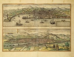
Background imagePhysical Geography Collection: Map of Genoa and Florence from Civitates Orbis Terrarum by Georg Braun

Map of Genoa and Florence from Civitates Orbis Terrarum by Georg Braun, 1541-1622 and Franz Hogenberg, 1540-1590
Cartography, Italy, 16th century. Map of Genoa and Florence. From Civitates Orbis Terrarum by Georg Braun (1541-1622) and Franz Hogenberg (1540-1590), Cologne. Engraving

Background imagePhysical Geography Collection: Map of Perugia from Civitates Orbis Terrarum by Georg Braun, 1541-1622 and Franz Hogenberg

Map of Perugia from Civitates Orbis Terrarum by Georg Braun, 1541-1622 and Franz Hogenberg, 1540-1590, engraving
Cartography, Italy, 16th century. Map of Perugia. From Civitates Orbis Terrarum by Georg Braun (1541-1622) and Franz Hogenberg (1540-1590), Cologne. Engraving

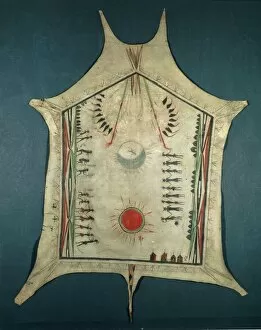
Background imagePhysical Geography Collection: Map of Indian territories, depicting three villages of Quapaw tribe, painted buffalo skins

Map of Indian territories, depicting three villages of Quapaw tribe, painted buffalo skins, 18th Century
Cartography, United States of America, 18th century. Map of Indian territories, depicting three villages of the Quapaw tribe. Painted buffalo skins from mid 18th century. 189.4 x 146.5 cm

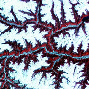
Background imagePhysical Geography Collection: Eastern Himalayas, satellite image

Eastern Himalayas, satellite image. North is at top. Snow is white, vegetation is red, barren areas are light blue and water is dark blue

Background imagePhysical Geography Collection: Desert alluvial fan, satellite image

Desert alluvial fan, satellite image. North is at top. Desert areas can sometimes go for years without rain, and then intense storms will cause flooding that fills old dry river beds

Background imagePhysical Geography Collection: Stromboli double eruption

Stromboli double eruption. Two craters of the volcano Stromboli erupting at night, throwing out pyroclastic material in the form of lava (molten rock)

Background imagePhysical Geography Collection: Capo Caccia, Alghero, Sardinia, Italy

Capo Caccia, Alghero, Sardinia, Italy

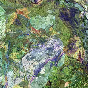
Background imagePhysical Geography Collection: Great Sandy Desert, satellite image

Great Sandy Desert, satellite image. North is at upper left. Vegetation is green and purple, while more barren, rocky areas are various shades of white and brown

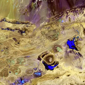
Background imagePhysical Geography Collection: Great Salt Desert, satellite image

Great Salt Desert, satellite image. North is at top. Desert soil and mud is light brown, barren rocky areas are pink, and salt pans are blue

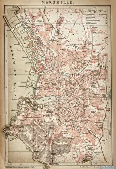
Background imagePhysical Geography Collection: Map of Marseille 1898

Map of Marseille 1898
Antique illustration of Map of Marseille 1898

Background imagePhysical Geography Collection: MA Essex Swampscott Vector Road Map

MA Essex Swampscott Vector Road Map. All source data is in the public domain. U.S. Census Bureau Census Tiger. Used Layers: areawater, linearwater, roads, rails, cousub, pointlm, uac10

Background imagePhysical Geography Collection: MA Barnstable Town Vector Road Map

MA Barnstable Town Vector Road Map. All source data is in the public domain. U.S. Census Bureau Census Tiger. Used Layers: areawater, linearwater, roads, rails, cousub, pointlm, uac10

Background imagePhysical Geography Collection: Mountains From Champoluc; Italy

Mountains From Champoluc; Italy

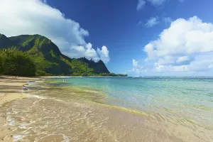
Background imagePhysical Geography Collection: Turquoise Ocean Water Off Tunnels Beach; Kauai, Hawaii, United States Of America

Turquoise Ocean Water Off Tunnels Beach; Kauai, Hawaii, United States Of America

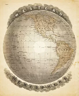
Background imagePhysical Geography Collection: World western hemispheres 1883

World western hemispheres 1883
Warrens Common School Geography

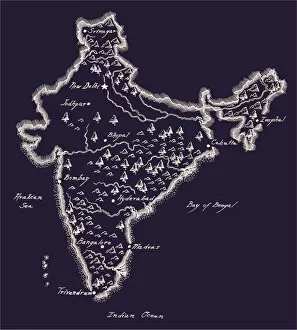
Background imagePhysical Geography Collection: Antique India Map

Antique India Map
India Map, - Antique style. Includes mountains and water bodies. High detail - vector illustration

Background imagePhysical Geography Collection: Ocean currents map 1875

Ocean currents map 1875
The Independent Course Comprehensive Geography by James Monteith, A.S. Barnes & Co, New York & Chicago 1875

Background imagePhysical Geography Collection: London and Environs Historical Map, Engraving, 1892

London and Environs Historical Map, Engraving, 1892
Very rare, beautifully detailed engraving of London and Environs Historical Map, Engraving, Published in 1892. Original edition from my own archives. Copyright has expired on this artwork

Background imagePhysical Geography Collection: Map of Washington 1898

Map of Washington 1898
Antique illustration of a Map of Washington 1898

Background imagePhysical Geography Collection: Wilhelmshaven. Germany

Wilhelmshaven. Germany
Antique illustration of a Wilhelmshaven, Germany map

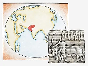
Background imagePhysical Geography Collection: Illustration of map highlighting Indus Valley region and ancient tablet showing water buffalo

Illustration of map highlighting Indus Valley region and ancient tablet showing water buffalo

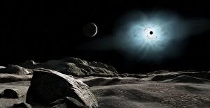
Background imagePhysical Geography Collection: The bright star Rigel eclipsed by a moon of a hypothetical planet

The bright star Rigel eclipsed by a moon of a hypothetical planet
Rigel is one of the two brightest stars in the constellation Orion. It is a blue-white giant star. We see it here eclipsed by a moon of a hypothetical planet

Background imagePhysical Geography Collection: Tranquil ocean at night against starry sky and moon

Tranquil ocean at night against starry sky and moon

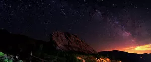
Background imagePhysical Geography Collection: Starry night sky above Alamut castle, Qazvin Province, Iran

Starry night sky above Alamut castle, Qazvin Province, Iran

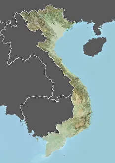
Background imagePhysical Geography Collection: Vietnam, Relief Map with Border and Mask

Vietnam, Relief Map with Border and Mask
Relief map of Vietnam (with border and mask). This image was compiled from data acquired by landsat 5 & 7 satellites combined with elevation data

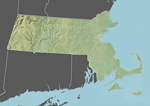
Background imagePhysical Geography Collection: State of Massachusetts, United States, Relief Map

State of Massachusetts, United States, Relief Map
Relief map of the State of Massachusetts, United States. This image was compiled from data acquired by LANDSAT 5 & 7 satellites combined with elevation data

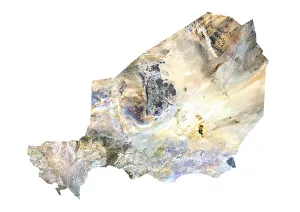
Background imagePhysical Geography Collection: Niger, Satellite Image

Niger, Satellite Image
Satellite view of Niger. This image was compiled from data acquired by LANDSAT satellite

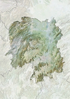
Background imagePhysical Geography Collection: Province of Hunan, China, Relief Map

Province of Hunan, China, Relief Map
Relief map of the province of Hunan, China. This image was compiled from data acquired by LANDSAT 5 & 7 satellites combined with elevation data

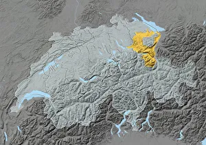
Background imagePhysical Geography Collection: Canton of Appenzell Ausserrhoden, Switzerland, Relief Map

Canton of Appenzell Ausserrhoden, Switzerland, Relief Map
Relief map of the canton of Appenzell Ausserrhoden, Switzerland. This image was compiled from data acquired by LANDSAT 5 & 7 satellites combined with elevation data

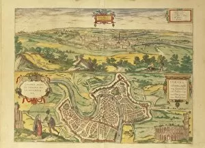
Background imagePhysical Geography Collection: Map of Verona from Civitates Orbis Terrarum by Georg Braun, 1541-1622 and Franz Hogenberg

Map of Verona from Civitates Orbis Terrarum by Georg Braun, 1541-1622 and Franz Hogenberg, 1540-1590, engraving
Cartography, Italy, 16th century. Map of Verona, from Civitates Orbis Terrarum by Georg Braun (1541-1622) and Franz Hogenberg (1540-1590), Cologne. Engraving

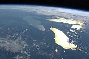
Background imagePhysical Geography Collection: The Great Lakes, ISS image C016 / 3870

The Great Lakes, ISS image C016 / 3870
The Great Lakes. View from the International Space Station (ISS) of the Great Lakes of the USA and Canada. North is towards upper right. Here, the ISS is over a point to the southeast of Nova Scotia

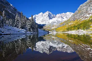
Background imagePhysical Geography Collection: USA, Colorado, Early Snow; Near Aspen, Landscape Of Maroon Lake And Maroon Bells In Distance

USA, Colorado, Early Snow; Near Aspen, Landscape Of Maroon Lake And Maroon Bells In Distance

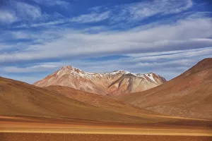
Background imagePhysical Geography Collection: The Surreal Landscape Of Bolivias Altiplano Region, Near Uyuni; Bolivia

The Surreal Landscape Of Bolivias Altiplano Region, Near Uyuni; Bolivia

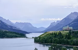
Background imagePhysical Geography Collection: Waterton Valley In Waterton Lakes National Park; Alberta, Canada

Waterton Valley In Waterton Lakes National Park; Alberta, Canada

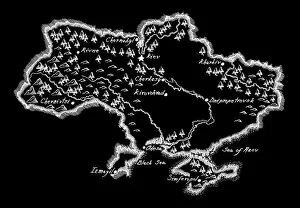
Background imagePhysical Geography Collection: Antique Ukraine Map

Antique Ukraine Map
Ukraine Map, - Antique style. Includes mountains and water bodies. High detail - vector illustration

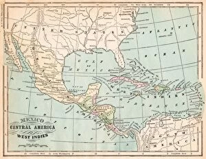
Background imagePhysical Geography Collection: Mexico and West indies map 1875

Mexico and West indies map 1875
The Independent Course Comprehensive Geography by James Monteith, A.S. Barnes & Co, New York & Chicago 1875

Background imagePhysical Geography Collection: Antique map of the Key Islands

Antique map of the Key Islands

Background imagePhysical Geography Collection: Page from the Illustrated London News with map

Page from the Illustrated London News with map

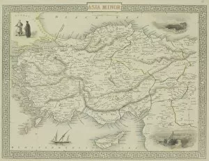
Background imagePhysical Geography Collection: Antique map of Asia Minor

Antique map of Asia Minor


All Professionally Made to Order for Quick Shipping

"Exploring the Diverse Landscapes: A Journey through Physical Geography" Embark on a captivating journey through physical geography as we delve into the intricate details of our world's diverse landscapes. From the political map of Africa, showcasing its nations and boundaries, to Mappa Mundi - an exquisite ink and color creation from 1265 London that offers a glimpse into medieval cartography. Travel back in time with the antique maps such as Map of Ireland (1897), Great Britain and Ireland (1867), Sicily (1895), Palestine (1875), and even Tasmania. These historical artifacts not only provide geographical information but also offer insights into how our understanding of land has evolved over centuries. Discover the wonders hidden within Antarctica as you explore a unique map overlaid with illustrations of sea gulls, penguins, elephant seals, shrimp, and buildings. Witness China unfold before your eyes through its intricately detailed map or marvel at Earth's tectonic plates marked by lines on a global scale. Experience rare moments captured by nature itself like never before – witness a snow-covered United Kingdom during January 2010 or immerse yourself in Earth's topographic and bathymetric features depicted meticulously on one single map. Physical geography is more than just studying landforms; it is about unraveling stories etched onto every inch of our planet's surface. Join us on this fascinating expedition where maps become windows to exploration, knowledge, and appreciation for the remarkable diversity that exists right beneath our feet.