Fraud Blocker Skip to main content

Physical Geography Collection (page 7)

"Exploring the Diverse Landscapes

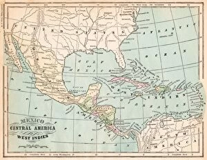
Background imagePhysical Geography Collection: Mexico and West indies map 1875

Mexico and West indies map 1875
The Independent Course Comprehensive Geography by James Monteith, A.S. Barnes & Co, New York & Chicago 1875

Background imagePhysical Geography Collection: Antique map of the Key Islands

Antique map of the Key Islands

Background imagePhysical Geography Collection: Page from the Illustrated London News with map

Page from the Illustrated London News with map

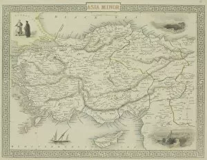
Background imagePhysical Geography Collection: Antique map of Asia Minor

Antique map of Asia Minor

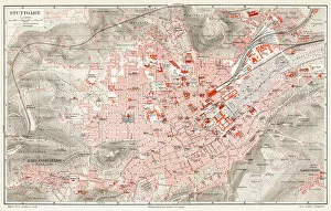
Background imagePhysical Geography Collection: Stuttgart map 1895

Stuttgart map 1895
Meyers Konversations-Lexikon. Ein Nachschlagewerk des allgemeinen Wissens, 5th edition 17 volumes Bibliographisches Institut - Leipzig 1895-1897

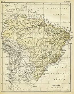
Background imagePhysical Geography Collection: Map of Brazil 1878

Map of Brazil 1878
Encyclopedia Britannica 9th Edition Vol II New York, Samuel Hall 1878

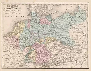
Background imagePhysical Geography Collection: Prussia and german states map 1867

Prussia and german states map 1867
Mitchellas Modern Atlas - Published by E.H. Butler and Co - Philadelphia 1867

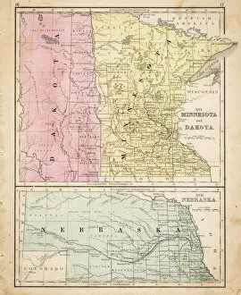
Background imagePhysical Geography Collection: Dakota Missesota Nebraska map 1867

Dakota Missesota Nebraska map 1867
Mitchellas Modern Atlas - Published by E.H. Butler and Co - Philadelphia 1867

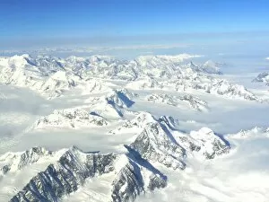
Background imagePhysical Geography Collection: St. Elias National Park

St. Elias National Park
Park is included in an International Biosphere Reserve and is part of UNESCO World Heritage Site

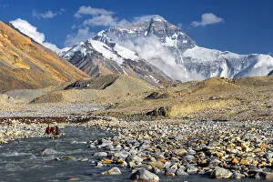
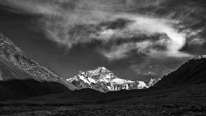
Background imagePhysical Geography Collection: mt. Everest from Everest Base Camp, Tibet

mt. Everest from Everest Base Camp, Tibet

Background imagePhysical Geography Collection: mt. Everest from Everest Base Camp, Tibet, China

mt. Everest from Everest Base Camp, Tibet, China

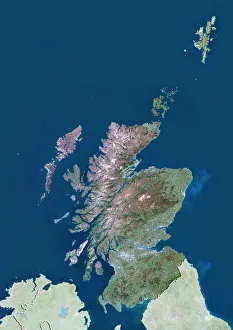
Background imagePhysical Geography Collection: Scotland with Shetland, United Kingdom, True Colour Satellite Image

Scotland with Shetland, United Kingdom, True Colour Satellite Image
Satellite view of Scotland including Shetland, United Kingdom. This image was compiled from data acquired by LANDSAT 5 & 7 satellites

Background imagePhysical Geography Collection: Otto Schmidt, Soviet Arctic explorer

Otto Schmidt, Soviet Arctic explorer
Otto Yulievich Schmidt (left, 1891-1956), Soviet Arctic explorer and geophysicist, greeting one of the rescue pilots (right) during the Chelyuskin expedition to the Arctic

Background imagePhysical Geography Collection: Crystal skull and Maya pyramid, artwork

Crystal skull and Maya pyramid, artwork
Crystal skull and Maya pyramid, computer artwork

Background imagePhysical Geography Collection: Spider rock, Arizona, USA

Spider rock, Arizona, USA
Spider Rock (lower centre left). This eroded sandstone spire is located in Canyon de Chelley National Monument, Arizona, USA

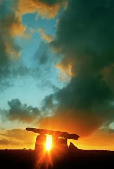
Background imagePhysical Geography Collection: Clouds Over A Tomb, Poulnabrone Dolmen, Burren, County Clare, Republic Of Ireland

Clouds Over A Tomb, Poulnabrone Dolmen, Burren, County Clare, Republic Of Ireland

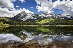
Background imagePhysical Geography Collection: Snowcapped East Beckwith Mountain In The Background Reflected In Lost Lake Slough; Colorado

Snowcapped East Beckwith Mountain In The Background Reflected In Lost Lake Slough; Colorado, United States Of America

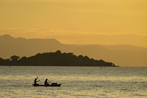
Background imagePhysical Geography Collection: Silhouette Of Fishermen In Dugout Canoe Leaving Cape Maclear In The Evening, Lake Malawi; Malawi

Silhouette Of Fishermen In Dugout Canoe Leaving Cape Maclear In The Evening, Lake Malawi; Malawi

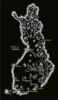
Background imagePhysical Geography Collection: Antique Finland Map

Antique Finland Map
Finland Map, - Antique style. Includes mountains and water bodies. High detail - vector illustration

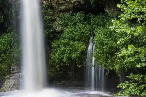
Background imagePhysical Geography Collection: Water Pours Over Natural Falls After A Heavy Rain; Oklahoma, United States Of America

Water Pours Over Natural Falls After A Heavy Rain; Oklahoma, United States Of America

Background imagePhysical Geography Collection: Map of Azores Islands, c.1900 (engraving)

Map of Azores Islands, c.1900 (engraving)
533297 Map of Azores Islands, c.1900 (engraving); (add.info.: Map of Azores Islands (Portuguese), circa 1900, from the 10th edition of Encyclopaedia Britannica.); Encyclopaedia Britannica/UIG.

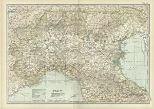
Background imagePhysical Geography Collection: Map of Italy, c.1900 (engraving)

Map of Italy, c.1900 (engraving)
532986 Map of Italy, c.1900 (engraving); (add.info.: Map of northern Italy, circa 1902, from the 10th edition of Encyclopaedia Britannica.); Encyclopaedia Britannica/UIG.

Background imagePhysical Geography Collection: Map of Switzerland and Liechtenstein, c.1900 (engraving)

Map of Switzerland and Liechtenstein, c.1900 (engraving)
532974 Map of Switzerland and Liechtenstein, c.1900 (engraving); (add.info.: Map showing historical boundaries of Switzerland and Liechtenstein, circa 1902)

Background imagePhysical Geography Collection: Map of the northern part of the German Empire, c.1900 (engraving)

Map of the northern part of the German Empire, c.1900 (engraving)
532959 Map of the northern part of the German Empire, c.1900 (engraving); (add.info.: Map of the northern part of the German empire, circa 1902)

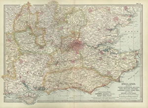
Background imagePhysical Geography Collection: Map of England, c.1900 (engraving)

Map of England, c.1900 (engraving)
532917 Map of England, c.1900 (engraving); (add.info.: Map of England, with Oxford, Buckingham, Hertford, Essex, Middlesex, Berkshire, Hampshire, parts of Bedford and Wiltshire, circa 1902)

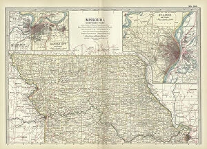
Background imagePhysical Geography Collection: Map of the northern part of Missouri, c.1900 (engraving)

Map of the northern part of Missouri, c.1900 (engraving)
533200 Map of the northern part of Missouri, c.1900 (engraving); (add.info.: Map of the northern part of Missouri with inset maps of Kansas City and St)

Background imagePhysical Geography Collection: Map of Nebraska with inset of Omaha, c.1900 (engraving)

Map of Nebraska with inset of Omaha, c.1900 (engraving)
533197 Map of Nebraska with inset of Omaha, c.1900 (engraving); (add.info.: Map of Nebraska, United States, with an inset map of Omaha, circa 1902)

Background imagePhysical Geography Collection: Map of Rochester, c.1900 (engraving)

Map of Rochester, c.1900 (engraving)
532845 Map of Rochester, c.1900 (engraving); (add.info.: Map of Rochester, New York, circa 1900, from the 10th edition of Encyclopaedia Britannica.); Encyclopaedia Britannica/UIG.

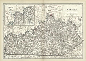
Background imagePhysical Geography Collection: Map of Kentucky, c.1900 (engraving)

Map of Kentucky, c.1900 (engraving)
533143 Map of Kentucky, c.1900 (engraving); (add.info.: Map of Kentucky, United States, circa 1902, from the 10th edition of Encyclopaedia Britannica.); Encyclopaedia Britannica/UIG.

Background imagePhysical Geography Collection: Map of Pennsylvania with inset map of Philadelphia, c.1900 (engraving)

Map of Pennsylvania with inset map of Philadelphia, c.1900 (engraving)
533115 Map of Pennsylvania with inset map of Philadelphia, c.1900 (engraving); (add.info.: Map of eastern Pennsylvania with inset map of Philadelphia, circa 1902)

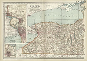
Background imagePhysical Geography Collection: Map of New York State, c.1900 (engraving)

Map of New York State, c.1900 (engraving)
533109 Map of New York State, c.1900 (engraving); (add.info.: Map of western New York State, with inset map of Buffalo, Niagara Frontier, and Rochester, circa 1902)

Background imagePhysical Geography Collection: Map of New York State, c.1900 (engraving)

Map of New York State, c.1900 (engraving)
533104 Map of New York State, c.1900 (engraving); (add.info.: Map of southern New York State, United States, insets map of New York City, the Hudson River, and the Catskill Mountains, circa 1902)

Background imagePhysical Geography Collection: Map of North America and Central America, c.1900 (engraving)

Map of North America and Central America, c.1900 (engraving)
533069 Map of North America and Central America, c.1900 (engraving); (add.info.: Map of North America and Central America, circa 1902)

Background imagePhysical Geography Collection: Map of Southern Africa, c.1900 (engraving)

Map of Southern Africa, c.1900 (engraving)
533065 Map of Southern Africa, c.1900 (engraving); (add.info.: Map of colonial southern Africa, with insets of Cape Town, Johannesburg, and Ladysmith, circa 1902)

Background imagePhysical Geography Collection: Map of Cincinnati, c.1900 (engraving)

Map of Cincinnati, c.1900 (engraving)
532743 Map of Cincinnati, c.1900 (engraving); (add.info.: Map of Cincinnati, Ohio, circa 1900, from the 10th edition of Encyclopaedia Britannica.); Encyclopaedia Britannica/UIG.

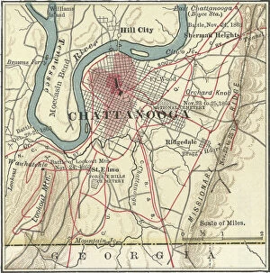
Background imagePhysical Geography Collection: Map of Chattanooga, c.1900 (engraving)

Map of Chattanooga, c.1900 (engraving)
532737 Map of Chattanooga, c.1900 (engraving); (add.info.: Map of Chattanooga, Tennessee, circa 1900, from the 10th edition of Encyclopaedia Britannica.); Encyclopaedia Britannica/UIG.

Background imagePhysical Geography Collection: Map of Charleston, c.1900 (engraving)

Map of Charleston, c.1900 (engraving)
532734 Map of Charleston, c.1900 (engraving); (add.info.: Map of Charleston, South Carolina, circa 1900, from the 10th edition of Encyclopaedia Britannica.); Encyclopaedia Britannica/UIG.

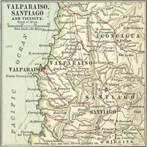
Background imagePhysical Geography Collection: Map of Valparaiso and Santiago, c.1900 (engraving)

Map of Valparaiso and Santiago, c.1900 (engraving)
533503 Map of Valparaiso and Santiago, c.1900 (engraving); (add.info.: Map of Valparaiso and Santiago, Chile, circa 1902, from the 10th edition of Encyclopaedia Britannica)

Background imagePhysical Geography Collection: Map of Buenos Aires and Montevideo, c.1900 (engraving)

Map of Buenos Aires and Montevideo, c.1900 (engraving)
533500 Map of Buenos Aires and Montevideo, c.1900 (engraving); (add.info.: Inset map of Buenos Aires (Argentina) and Montevideo (Uruguay), circa 1902

Map of Trinidad and Martin Vas, c.1900 (engraving)
533494 Map of Trinidad and Martin Vas, c.1900 (engraving); (add.info.: Map of Trinidad and Martin Vas, circa 1902, from the 10th edition of Encyclopaedia Britannica.); Encyclopaedia Britannica/UIG.

Background imagePhysical Geography Collection: Map of Barbados, c.1900 (engraving)

Map of Barbados, c.1900 (engraving)
533469 Map of Barbados, c.1900 (engraving); (add.info.: Map showing the parish boundaries of Barbados, circa 1902, from the 10th edition of Encyclopaedia Britannica.); Encyclopaedia Britannica/UIG.

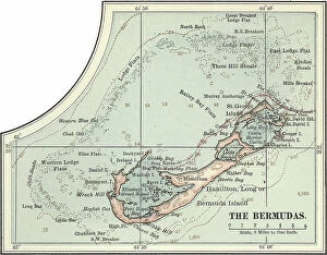
Background imagePhysical Geography Collection: Map of the Bermudas, c.1900 (engraving)

Map of the Bermudas, c.1900 (engraving)
533466 Map of the Bermudas, c.1900 (engraving); (add.info.: Map of the Bermudas, circa 1902, from the 10th edition of Encyclopaedia Britannica.); Encyclopaedia Britannica/UIG.

Background imagePhysical Geography Collection: Map of the Catskill Mountains, New York, c.1900 (engraving)

Map of the Catskill Mountains, New York, c.1900 (engraving)
533423 Map of the Catskill Mountains, New York, c.1900 (engraving); (add.info.: Map of Catskill Mountains, New York, circa 1902)

Background imagePhysical Geography Collection: Map of Ladysmith, c.1900 (engraving)

Map of Ladysmith, c.1900 (engraving)
533405 Map of Ladysmith, c.1900 (engraving); (add.info.: Map of Ladysmith, South Africa, circa 1902, from the 10th edition of Encyclopaedia Britannica.); Encyclopaedia Britannica/UIG.

Background imagePhysical Geography Collection: Map of Johannesburg, c.1900 (engraving)

Map of Johannesburg, c.1900 (engraving)
533402 Map of Johannesburg, c.1900 (engraving); (add.info.: Map of Johannesburg, South Africa, circa 1902, from the 10th edition of Encyclopaedia Britannica.); Encyclopaedia Britannica/UIG.

Background imagePhysical Geography Collection: Map of Saint Helena Island, c.1900 (engraving)

Map of Saint Helena Island, c.1900 (engraving)
533393 Map of Saint Helena Island, c.1900 (engraving); (add.info.: Map of Saint Helena Island, circa 1902, from the 10th edition of Encyclopaedia Britannica.); Encyclopaedia Britannica/UIG.

Background imagePhysical Geography Collection: Map of Solomon Islands, c.1900 (engraving)

Map of Solomon Islands, c.1900 (engraving)
533372 Map of Solomon Islands, c.1900 (engraving); (add.info.: Map of Solomon Islands, Bougainville, South Pacific, circa 1902)


All Professionally Made to Order for Quick Shipping

"Exploring the Diverse Landscapes: A Journey through Physical Geography" Embark on a captivating journey through physical geography as we delve into the intricate details of our world's diverse landscapes. From the political map of Africa, showcasing its nations and boundaries, to Mappa Mundi - an exquisite ink and color creation from 1265 London that offers a glimpse into medieval cartography. Travel back in time with the antique maps such as Map of Ireland (1897), Great Britain and Ireland (1867), Sicily (1895), Palestine (1875), and even Tasmania. These historical artifacts not only provide geographical information but also offer insights into how our understanding of land has evolved over centuries. Discover the wonders hidden within Antarctica as you explore a unique map overlaid with illustrations of sea gulls, penguins, elephant seals, shrimp, and buildings. Witness China unfold before your eyes through its intricately detailed map or marvel at Earth's tectonic plates marked by lines on a global scale. Experience rare moments captured by nature itself like never before – witness a snow-covered United Kingdom during January 2010 or immerse yourself in Earth's topographic and bathymetric features depicted meticulously on one single map. Physical geography is more than just studying landforms; it is about unraveling stories etched onto every inch of our planet's surface. Join us on this fascinating expedition where maps become windows to exploration, knowledge, and appreciation for the remarkable diversity that exists right beneath our feet.