Fraud Blocker Skip to main content

Satellite Image Collection (page 3)

"Exploring the vastness of our universe, satellite images capture breathtaking views that redefine our perspective

Background imageSatellite Image Collection: North America, topographic map

North America, topographic map. Highlands and lowlands of the continents are also shown, as ridges and flat areas. South America (bottom right) and the Arctic (top) are also seen

Background imageSatellite Image Collection: The Arctic, satellite image

The Arctic, satellite image
The Arctic. Satellite image of the Earth centred on the Arctic. The North Pole is at centre. Clouds and Arctic sea ice are white, oceans are blue and land is green and brown
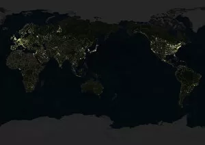
Background imageSatellite Image Collection: Whole Earth At Night Centred On Pacific Ocean, True Colour Satellite Image Of The Earth

Whole Earth At Night Centred On Pacific Ocean, True Colour Satellite Image Of The Earth
Whole Earth At Night Centred On Pacific Ocean, True Colour Satellite Image. True colour satellite image of the whole Earth at night, centred on the Pacific Ocean, with country borders

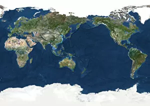
Background imageSatellite Image Collection: Whole Earth Centred On Pacific Ocean, True Colour Satellite Image Of The Earth

Whole Earth Centred On Pacific Ocean, True Colour Satellite Image Of The Earth
Whole Earth Centred On Pacific Ocean, True Colour Satellite Image. True colour satellite image of the whole Earth centred on the Pacific Ocean, with bump effect

Background imageSatellite Image Collection: Globe Showing Europe And Africa, True Colour Satellite Image Of The Earth

Globe Showing Europe And Africa, True Colour Satellite Image Of The Earth
Globe Showing Europe And Africa, True Colour Satellite Image. True colour satellite image of the Earth showing Europe and Africa, half in shadow, and the sun

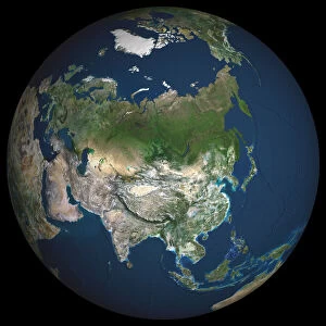
Background imageSatellite Image Collection: Globe Asia, True Colour Satellite Image. Earth. True colour satellite image of the Earth, centred

Globe Asia, True Colour Satellite Image. Earth. True colour satellite image of the Earth, centred on Asia. The North Pole is at upper centre

Background imageSatellite Image Collection: Africa At Night With Country Borders, True Colour Satellite Image

Africa At Night With Country Borders, True Colour Satellite Image. True colour satellite image of Africa at night with country borders

Background imageSatellite Image Collection: Globe Europe, True Colour Satellite Image. True colour satellite image of the whole earth, showing E

Globe Europe, True Colour Satellite Image. True colour satellite image of the whole earth, showing Europe at centre. The picture is a composite created from thousands of separate images recorded by

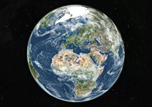
Background imageSatellite Image Collection: Globe Centred On Europe And Africa, True Colour Satellite Image Of The Earth

Globe Centred On Europe And Africa, True Colour Satellite Image Of The Earth
Globe Centred On Europe And Africa, True Colour Satellite Image. True colour satellite image of the Earth centred on Europe and Africa with cloud coverage, during summer solstice at 12 a.m GMT

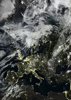
Background imageSatellite Image Collection: Europe At Night With Cloud Coverage, True Colour Satellite Image

Europe At Night With Cloud Coverage, True Colour Satellite Image. True colour satellite image of Europe at night with cloud coverage

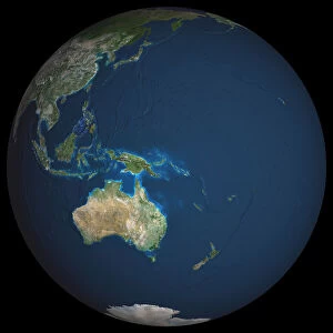
Background imageSatellite Image Collection: Globe Oceania, True Colour Satellite Image. Earth. True colour satellite image of the Earth, centred

Globe Oceania, True Colour Satellite Image. Earth. True colour satellite image of the Earth, centred on the region of Oceania. North is at top

Background imageSatellite Image Collection: Europe At Night, True Colour Satellite Image. True colour satellite image of Europe at night

Europe At Night, True Colour Satellite Image. True colour satellite image of Europe at night. This image in Lambert Conformal Conic projection was compiled from data acquired by LANDSAT 5 & 7

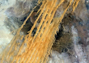
Background imageSatellite Image Collection: Desert Erg Iguidi, Algeria, True Colour Satellite Image. True colour satellite image of Erg Iguidi

Desert Erg Iguidi, Algeria, True Colour Satellite Image. True colour satellite image of Erg Iguidi, a sand desert between Algeria and Mauritania

Background imageSatellite Image Collection: City Of Harbin, Mandchouria, China, True Colour Satellite Image

City Of Harbin, Mandchouria, China, True Colour Satellite Image. The city of Harbin and surroundings covered by snow. The river Songhua that crosses the picture is frozen

Background imageSatellite Image Collection: Globe South America, True Colour Satellite Image. Earth. True colour satellite image of the Earth, c

Globe South America, True Colour Satellite Image. Earth. True colour satellite image of the Earth, centred on South America. North is at top

Background imageSatellite Image Collection: Lake Yamma, Queensland, Australia, True Colour Satellite Image

Lake Yamma, Queensland, Australia, True Colour Satellite Image. The Lake Yamma is a salted lake located in a semi-arid area. The lake evaporates totally during the dry season

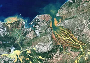
Background imageSatellite Image Collection: Betsiboka River, Madagascar, True Colour Satellite Image. Betsiboka river

Betsiboka River, Madagascar, True Colour Satellite Image. Betsiboka river, the major river of Madagascar, goes into the Mozambique canal, close to the city of Mahajanga

Background imageSatellite Image Collection: Bissagos Archipelago, Guinea-Bissau, True Colour Satellite Image

Bissagos Archipelago, Guinea-Bissau, True Colour Satellite Image. True colour satellite image of Guinea-Bissau, a small country in West Africa

Background imageSatellite Image Collection: Western Europe At Night, Satellite Image. Lights of Western Europe at night from space. Coloured ima

Western Europe At Night, Satellite Image. Lights of Western Europe at night from space. Coloured image derived from satellite data showing Western Europe at night

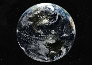
Background imageSatellite Image Collection: Globe Centred On The Americas, True Colour Satellite Image. True colour satellite image of

Globe Centred On The Americas, True Colour Satellite Image. True colour satellite image of the Earth centred on the Americas with cloud coverage, during summer solstice at 6 a.m GMT

Background imageSatellite Image Collection: Libyan Desert, Egypt, True Colour Satellite Image. True colour satellite image of the Egyptian

Libyan Desert, Egypt, True Colour Satellite Image. True colour satellite image of the Egyptian part of the Libyan desert, made of both sand and rock; sand dunes are stretched out by the winds

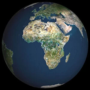
Background imageSatellite Image Collection: Globe Africa, True Colour Satellite Image. Earth. True colour satellite image of the Earth, centred

Globe Africa, True Colour Satellite Image. Earth. True colour satellite image of the Earth, centred on Africa. North is at top

Background imageSatellite Image Collection: Globe Showing Asia, True Colour Satellite Image Of The Earth Showing Asia, Oceania And The Sun

Globe Showing Asia, True Colour Satellite Image Of The Earth Showing Asia, Oceania And The Sun
Globe Showing Asia, True Colour Satellite Image. True colour satellite image of the Earth showing Asia and Oceania, half in shadow, and the sun

Background imageSatellite Image Collection: Globe Showing Northern America, True Colour Satellite Image Of The Earth

Globe Showing Northern America, True Colour Satellite Image Of The Earth
Globe Showing Northern America, True Colour Satellite Image. True colour satellite image of the Earth showing Greenland, the North Pole and Northern America

Background imageSatellite Image Collection: Globe Showing The Americas, True Colour Satellite Image Of The Earth, Half In Shadow And The Sun

Globe Showing The Americas, True Colour Satellite Image Of The Earth, Half In Shadow And The Sun
Globe Showing The Americas, True Colour Satellite Image. True colour satellite image of the Earth showing the Americas, half in shadow, and the sun

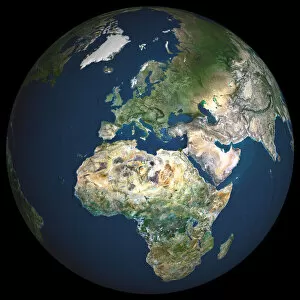
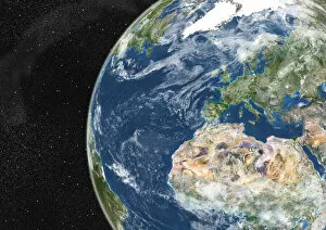
Background imageSatellite Image Collection: Globe Showing Europe And Northern Africa, True Colour Satellite Image Of The Earth

Globe Showing Europe And Northern Africa, True Colour Satellite Image Of The Earth
Globe Showing Europe And Northern Africa, True Colour Satellite Image. True colour satellite image of the Earth showing Europe and Northern Africa, with cloud coverage

Background imageSatellite Image Collection: Globe Centred On The South Pole, True Colour Satellite Image Of The Earth

Globe Centred On The South Pole, True Colour Satellite Image Of The Earth
Globe Centred On The South Pole, True Colour Satellite Image. True colour satellite image of the Earth centred on the South Pole with cloud coverage, during summer solstice at 12 a.m GMT

Background imageSatellite Image Collection: North America At Night, True Colour Satellite Image. True colour satellite image of North America

North America At Night, True Colour Satellite Image. True colour satellite image of North America at night. This image in Lambert Conformal Conic projection was compiled from data acquired by LANDSAT

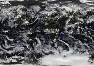
Background imageSatellite Image Collection: Whole Earth At Night With Cloud Coverage, True Colour Satellite Image

Whole Earth At Night With Cloud Coverage, True Colour Satellite Image. True colour satellite image of the whole Earth at night with cloud coverage

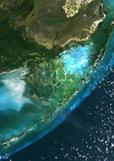
Background imageSatellite Image Collection: Everglades, Florida, Usa, True Colour Satellite Image. Satellite image of the Everglades

Everglades, Florida, Usa, True Colour Satellite Image. Satellite image of the Everglades. At the top of the image is the edge of the city of Miami

Background imageSatellite Image Collection: Rub Al Khali Desert, Saudi Arabia, True Colour Satellite Image. Rub Al Khali

Rub Al Khali Desert, Saudi Arabia, True Colour Satellite Image. Rub Al Khali, a sand desert South East of Saudi Arabia; sand dunes are sculptured and moved by the winds

Background imageSatellite Image Collection: Simpson Desert, Australia, True Colour Satellite Image. True colour satellite image of the Simpson

Simpson Desert, Australia, True Colour Satellite Image. True colour satellite image of the Simpson Desert in the Australian Outback. The sand dunes are coloured in red because of iron oxyd

Background imageSatellite Image Collection: Mississippi River Delta, Louisiana, Usa, True Colour Satellite Image

Mississippi River Delta, Louisiana, Usa, True Colour Satellite Image. True colour satellite image of the Mississippi River Delta

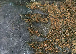
Background imageSatellite Image Collection: Agriculture, Texas, Usa, True Colour Satellite Image. True colour satellite image of center-pivot

Agriculture, Texas, Usa, True Colour Satellite Image. True colour satellite image of center-pivot irrigated fields in Texas, USA. Image taken on 21 September 1993 using LANDSAT data

Background imageSatellite Image Collection: Globe North America, True Colour Satellite Image. Earth. True colour satellite image of the Earth, c

Globe North America, True Colour Satellite Image. Earth. True colour satellite image of the Earth, centred on North America. The North Pole is at upper centre

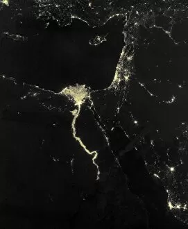
Background imageSatellite Image Collection: Nile at night, satellite image

Nile at night, satellite image
Nile at night. Black marble satellite image of the Nile at night. The Nile is illuminated by the many boats along its length

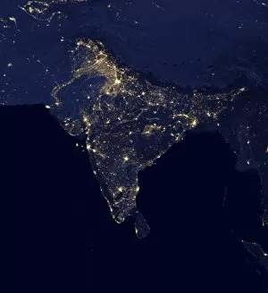
Background imageSatellite Image Collection: India at night, satellite image

India at night, satellite image
India at night. Black marble satellite image of India at night. More densely populated areas are brighter. The nocturnal glow produced by the Earths atmosphere is shown as well as man-made light

Background imageSatellite Image Collection: Valles Marineris, Mars, artwork

Valles Marineris, Mars, artwork
Valles Marineris. Artwork of an aerial view of Valles Marineris (Mariner Valleys), a massive system of canyons near the equator on Mars. The Sun is at upper left, and North is towards upper right

Background imageSatellite Image Collection: DR Congo, satellite image

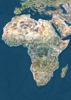
DR Congo, satellite image
DR Congo. North is at top. Satellite image of the Democratic Republic of the Congo (DRC) in Central Africa, with the surrounding countries shaded out

Background imageSatellite Image Collection: US South West, satellite artwork C015 / 6579

US South West, satellite artwork C015 / 6579
US South West. Simulated panoramic satellite image of the southwestern United States taken from low Earth orbit. Image created using a cloud-free mosaic of satellite images of the Earths surface

Background imageSatellite Image Collection: Asia, 3D artwork C015 / 6575

Asia, 3D artwork C015 / 6575
Asia. 3D computer graphic map of Asia and the surrounding sea floor in the Pacific and Indian oceans. Image based on cloud-free satellite imagery, digital terrain and bathymetry data

Background imageSatellite Image Collection: Global winds, satellite-based diagram C016 / 3731

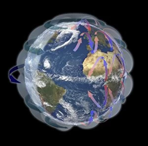
Global winds, satellite-based diagram C016 / 3731
Global winds, satellite-based diagram. The rotation of this Earth globe (dark blue arrow) and the Coriolis effect causes the wind patterns shown

Background imageSatellite Image Collection: Africa and Atlantic Ocean, with clouds C016 / 3727

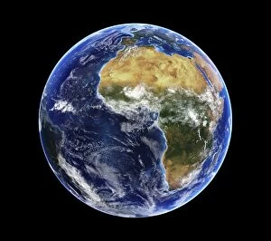
Africa and Atlantic Ocean, with clouds C016 / 3727
Africa and Atlantic Ocean, with clouds. Computer graphic of an Earth globe centred on West Africa, generated using satellite and mapping data

Background imageSatellite Image Collection: Mars, composite satellite image

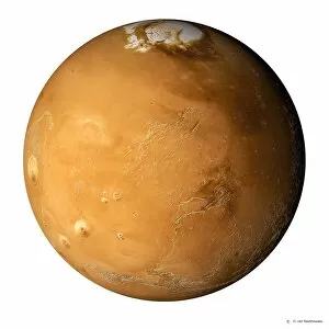
Mars, composite satellite image
Mars. Composite satellite image of the surface of Mars, showing the north polar cap (white), a mixture of ice and dust that extends to the 80 degree latitude circle

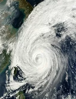
Background imageSatellite Image Collection: Typhoon Tokage

Typhoon Tokage. Satellite image of Typhoon Tokage (centre) hitting the western coast of Japan (upper left) on 19 October 2004 at 0215 GMT. The typhoon produced winds of 225 kilometres per hour

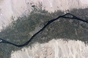
Background imageSatellite Image Collection: River Nile, Luxor, Egypt

River Nile, Luxor, Egypt, as seen from the International Space Station (ISS). North is towards bottom left. Agricultural fields (green) are sustained by the waters of the Nile (dark blue)

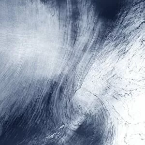
Background imageSatellite Image Collection: High-altitude clouds, satellite image

High-altitude clouds, satellite image. These swirling clouds are being shaped by high-altitude winds. They are over the Mediterranean Sea, just north of the coast of Morocco

Background imageSatellite Image Collection: Extratropical storm Katia, 2011

Extratropical storm Katia, 2011
Extratropical storm Katia. Satellite image of the remains of Hurricane Katia approaching the UK as an extratropical storm on 11 September 2011. North is at top


All Professionally Made to Order for Quick Shipping

"Exploring the vastness of our universe, satellite images capture breathtaking views that redefine our perspective. Inspired by Voyager 1's iconic 'Pale Blue Dot' image, we witness the beauty and fragility of Earth from space. From the British Isles to Europe at night, these satellite images reveal a tapestry of lights illuminating cities and towns across continents. Marvel at the mesmerizing glow as darkness blankets Europe or gaze in awe at the captivating sight of our entire planet aglow during nighttime. Delve into Tenerife's intricate landscapes, where satellite imagery unveils its hidden wonders with stunning clarity. Venturing beyond our home planet, New Horizons grants us an extraordinary glimpse into Jupiter and its moon Io – a celestial dance frozen in time. Witnessing Earth from afar reminds us of its remarkable diversity; behold Scotland's rugged terrain captured through a lens high above. Satellite imagery also unravels nature's grandeur: observe awe-inspiring solar prominences erupting from the sun’s surface like fiery tendrils reaching towards infinity. In January 2010, witness Mother Nature transforming the United Kingdom into a winter wonderland as snow blankets every corner. Finally, explore North America at night through satellite lenses – an ethereal spectacle showcasing bustling metropolises intertwined with serene natural landscapes under starlit skies. " Note.