
Stannington Collection
"Discover the Historic Charm of Stannington: A Land of Opportunity" Stannington, a quaint village nestled in the heart of Yorkshire


All Professionally Made to Order for Quick Shipping
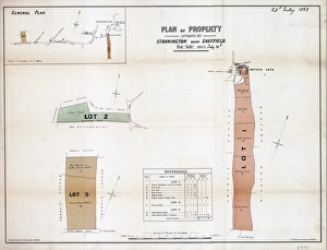
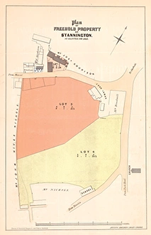
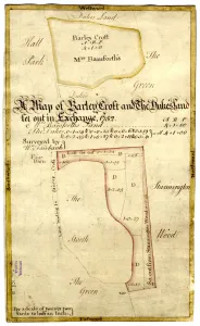
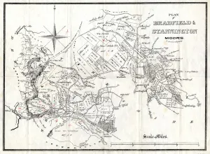
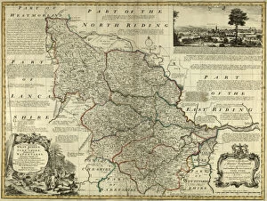
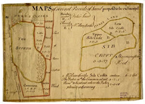
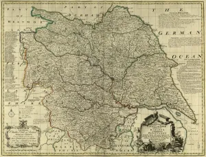
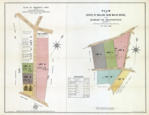
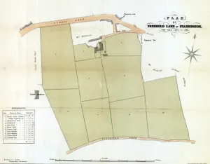
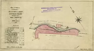
"Discover the Historic Charm of Stannington: A Land of Opportunity" Stannington, a quaint village nestled in the heart of Yorkshire, holds a rich history and promises endless possibilities. With its picturesque landscapes and diverse properties up for sale, this hidden gem is sure to captivate both investors and dreamers alike. Step into the past with maps dating back centuries, such as the 1747 map showcasing Wm. Carrs Farm at Stannington. Immerse yourself in the stories behind The Crown and Glove Public House and other land offerings through an intriguing plan from years gone by. Explore nature's wonders on Bradfield and Stannington Moors, where time seems to stand still amidst breathtaking scenery that has inspired generations. Delve further into history with a glimpse into Barley Croft and The Dukes' land through a fascinating map from 1752. Witness how land exchanges shaped Bradfield with maps depicting several parcels proposed for exchange during the mid-18th century – a testament to the area's ever-evolving landscape. Expand your horizons beyond Stannington itself as you uncover Upperthorpe's vast lands or venture towards Hollins near Malin Bridge – an estate waiting to be explored within this charming hamlet. For those seeking investment opportunities or simply looking for their forever home, Knowl Farm offers freehold land ready to embrace new dreams while preserving its rural essence since 1869. As you navigate through these historical documents, immerse yourself in Yorkshire's grandeur with county maps showcasing West Riding's beauty circa 1777. And when it comes to modern convenience, Sheffield S6 5 Map ensures easy navigation within this vibrant region while Northumberland NE61 6 Map unveils nearby treasures worth discovering. Whether you're drawn by heritage or enticed by potential investments, Stannington beckons you with open arms. Uncover its secrets today; let this enchanting village become the backdrop for your own story.