Fraud Blocker Skip to main content

Territory Collection (page 4)

"Exploring the Rich Tapestry of Territory

Background imageTerritory Collection: Terra Firma, Spanish, Dutch, French and Portguese Guyana and the northern part of Brazil

Terra Firma, Spanish, Dutch, French and Portguese Guyana and the northern part of Brazil, engraving by G. Zuliani taken from Tome IV of the "Newest Atlas" published in Venice in 1785 by

Background imageTerritory Collection: Part of the eastern coast of Africa with the Island of Madagascar

Part of the eastern coast of Africa with the Island of Madagascar and the detailed maps of the islands belonging to France and Bourbon, engraving by G

Background imageTerritory Collection: The Barbary Coast or The Kingdoms of Morocco, Fez, Algeria, Tunisia

The Barbary Coast or The Kingdoms of Morocco, Fez, Algeria, Tunisia and Tripoli with surrounding countries, engraving by G

Background imageTerritory Collection: Ancient and Modern Egypt, engraving by G. Zuliani taken from Tome IV of the 'Newest Atlas'

Ancient and Modern Egypt, engraving by G. Zuliani taken from Tome IV of the "Newest Atlas" published in Venice in 1784 by Antonio Zatta

Background imageTerritory Collection: Asian Russia, divided into its provinces, engraving by G. Zuliani taken from Tome IV of

Asian Russia, divided into its provinces, engraving by G. Zuliani taken from Tome IV of the "Newest Atlas" published in Venice by Antonio Zatta

Background imageTerritory Collection: Chinese Empire with the islands of Japan, engraving by G. Zuliani taken from Tome IV of

Chinese Empire with the islands of Japan, engraving by G. Zuliani taken from Tome IV of the "Newest Atlas" published in Venice in 1784 by Antonio Zatta

Background imageTerritory Collection: Kingdoms of Arakan, Pegu, Siam, Cambodia and Laos, engraving by G

Kingdoms of Arakan, Pegu, Siam, Cambodia and Laos, engraving by G. Zuliani taken from Tome IV of the "Newest Atlas" published in Venice in 1785 by Antonio Zatta

Background imageTerritory Collection: East Indies and their Archipelago, engraving by G. Zuliani taken from Tome IV of the 'Newest

East Indies and their Archipelago, engraving by G. Zuliani taken from Tome IV of the "Newest Atlas" published in Venice in 1784 by Antonio Zatta

Background imageTerritory Collection: Principates of Moldavia and Vallakia, engraving by G. Zuliani taken from Tome III of the 'Newest

Principates of Moldavia and Vallakia, engraving by G. Zuliani taken from Tome III of the "Newest Atlas" published in Venice in 1782 by Antonio Zatta

Background imageTerritory Collection: Duchies of Livonia and Estonia and the States of Novogorod, Bielogorod

Duchies of Livonia and Estonia and the States of Novogorod, Bielogorod and Kiovia with their Districts in European Russia, engraving by G

Background imageTerritory Collection: European Russia divided into its governances and provinces, engraving by G

European Russia divided into its governances and provinces, engraving by G. Zuliani taken from Tome III of the "Newest Atlas" published in Venice in 1781 by Antonio Zatta

Background imageTerritory Collection: The Palatinates of Braclaw and Kiovia, engraving by G. Zuliani taken from Tome III of the 'Newest

The Palatinates of Braclaw and Kiovia, engraving by G. Zuliani taken from Tome III of the "Newest Atlas" published in Venice in 1781 by Antonio Zatta

Background imageTerritory Collection: The Palatinates of Krakov, Lekzyca, Sieradz, Sandomir and Lublin, engraving by G

The Palatinates of Krakov, Lekzyca, Sieradz, Sandomir and Lublin, engraving by G. Zuliani taken from Tome III of the "Newest Atlas" published in Venice in 1781 by Antonio Zatta

Background imageTerritory Collection: The Palatinates of Mazovia, Rava and Plock, engraving by G. Zuliani taken from Tome III of

The Palatinates of Mazovia, Rava and Plock, engraving by G. Zuliani taken from Tome III of the "Newest Atlas" published in Venice in 1781 by Antonio Zatta

Background imageTerritory Collection: Poland divided into its Palatinates, engraving by G. Zuliani taken from Tome III of the 'Newest

Poland divided into its Palatinates, engraving by G. Zuliani taken from Tome III of the "Newest Atlas" published in Venice in 1782 by Antonio Zatta

Background imageTerritory Collection: Helvetia divided into its 13 Cantons and its allies, engraving by G

Helvetia divided into its 13 Cantons and its allies, engraving by G. Zuliani taken from Tome III of the "Newest Atlas" published in Venice in 1781 by Antonio Zatta

Background imageTerritory Collection: Iceland divided into its districts, engraving by G. Zuliani taken from Tome III of the 'Newest

Iceland divided into its districts, engraving by G. Zuliani taken from Tome III of the "Newest Atlas" published in Venice in 1781 by Antonio Zatta

Background imageTerritory Collection: The Kingdoms of Sweden, Denmark and Norway, engraving by G. Zuliani taken from Tome III of

The Kingdoms of Sweden, Denmark and Norway, engraving by G. Zuliani taken from Tome III of the "Newest Atlas" published in Venice in 1781 by Antonio Zatta

Background imageTerritory Collection: The Margraves of Anspach and Bayreuth in Franconia with the Bailaggi situated between the Inn

The Margraves of Anspach and Bayreuth in Franconia with the Bailaggi situated between the Inn, the Salza and the Danube Rivers in Bavaria, engraving by G

Background imageTerritory Collection: The Circle of Lower Saxony divided into its States, engraving by G

The Circle of Lower Saxony divided into its States, engraving by G. Zuliani taken from Tome III of the "Newest Atlas" published in Venice in 1780 by Antonio Zatta

Background imageTerritory Collection: The Circle of Westphalia divided into its States, engraving by G

The Circle of Westphalia divided into its States, engraving by G. Zuliani taken from Tome III of the "Newest Atlas" published in Venice in 1780 by Antonio Zatta

Background imageTerritory Collection: Southern part of the Circle of Upper Saxony, engraving by G. Zuliani taken from Tome III of

Southern part of the Circle of Upper Saxony, engraving by G. Zuliani taken from Tome III of the "Newest Atlas" published in Venice in 1780 by Antonio Zatta

Background imageTerritory Collection: Lusatia, divided into its States, engraving by G. Zuliani taken from Tome III of the 'Newest

Lusatia, divided into its States, engraving by G. Zuliani taken from Tome III of the "Newest Atlas" published in Venice in 1780 by Antonio Zatta

Background imageTerritory Collection: Moravia, divided into its Circles, engraving by G. Zuliani taken from Tome III of the 'Newest Atlas'

Moravia, divided into its Circles, engraving by G. Zuliani taken from Tome III of the "Newest Atlas" published in Venice in 1779 by Antonio Zatta

Background imageTerritory Collection: Upper Slesia, divided into its Principates, engraving by G. Zuliani taken from Tome III of

Upper Slesia, divided into its Principates, engraving by G. Zuliani taken from Tome III of the "Newest Atlas" published in Venice in 1779 by Antonio Zatta

Background imageTerritory Collection: Kingdom of Bohemia, Duchy of Silesia and the Marquessates of Moravia and Lusatia, engraving by G

Kingdom of Bohemia, Duchy of Silesia and the Marquessates of Moravia and Lusatia, engraving by G. Zuliani taken from Tome III of the "Newest Atlas" published in Venice in 1779 by Antonio

Background imageTerritory Collection: Germany divided into its Circles, engraving by G. Zuliani taken from Tome III of the 'Newest

Germany divided into its Circles, engraving by G. Zuliani taken from Tome III of the "Newest Atlas" published in Venice in 1776 by Antonio Zatta

Background imageTerritory Collection: Hither Calabria, engraving by G. Zuliani taken from Tome II of the 'Newest Atlas' published in

Hither Calabria, engraving by G. Zuliani taken from Tome II of the "Newest Atlas" published in Venice in 1783 by Antonio Zatta, Private Collection Florence Engraving Eighteenth Century

Background imageTerritory Collection: Farther Calabria, engraving by G. Zuliani taken from Tome II of the 'Newest Atlas' published in

Farther Calabria, engraving by G. Zuliani taken from Tome II of the "Newest Atlas" published in Venice in 1783 by Antonio Zatta, Private Collection Florence Engraving Eighteenth Century

Background imageTerritory Collection: Land of Bari and Basilicata, engraving by G. Zuliani taken from Tome II of the 'Newest Atlas'

Land of Bari and Basilicata, engraving by G. Zuliani taken from Tome II of the "Newest Atlas" published in Venice in 1783 by Antonio Zatta

Background imageTerritory Collection: Farther and Hither Principates, engraving by G. Zuliani taken from Tome II of the 'Newest Atlas'

Farther and Hither Principates, engraving by G. Zuliani taken from Tome II of the "Newest Atlas" published in Venice in 1783 by Antonio Zatta

Background imageTerritory Collection: Terra di Lavoro and County of Molise, engraving by G. Zuliani taken from Tome II of the 'Newest

Terra di Lavoro and County of Molise, engraving by G. Zuliani taken from Tome II of the "Newest Atlas" published in Venice in 1783 by Antonio Zatta

Background imageTerritory Collection: Kingdom of Naples divided into its provinces, engraving by G

Kingdom of Naples divided into its provinces, engraving by G. Zuliani taken from Tome II of the "Newest Atlas" published in Venice in 1781 by Antonio Zatta

Background imageTerritory Collection: Territory of Florence, engraving by G. Zuliani taken from Tome II of the 'Newest Atlas' published

Territory of Florence, engraving by G. Zuliani taken from Tome II of the "Newest Atlas" published in Venice in 1783 by Antonio Zatta

Background imageTerritory Collection: State of the Republic of Genoa, engraving by G. Zuliani taken from Tome II of the 'Newest Atlas'

State of the Republic of Genoa, engraving by G. Zuliani taken from Tome II of the "Newest Atlas" published in Venice in 1782 by Antonio Zatta

Background imageTerritory Collection: The part of Piedmont that contains the Marquessates of Susa and Saluzzo, the Districts of Lucerne

The part of Piedmont that contains the Marquessates of Susa and Saluzzo, the Districts of Lucerne, Cuneo and Mondovi, and the County of Nice, engraving by G

Background imageTerritory Collection: The part of Piedmont that contains the District of Turin, Contado of Asti, the provinces of Alba

The part of Piedmont that contains the District of Turin, Contado of Asti, the provinces of Alba, Allesandria and Tortona, Upper and Lower Monferrato, Lumellina and Pavese Oltre Po, engraving by G

Background imageTerritory Collection: Duchy of Savoy including the Duchies of Chablais and Genevois, Savoy, the Barony of Faucigny

Duchy of Savoy including the Duchies of Chablais and Genevois, Savoy, the Barony of Faucigny, the Signoria of Tarantaise and the County of Maurienne, engraving by G

Background imageTerritory Collection: The States of Piedmont and Savoy divided into their territories and districts, engraving by G

The States of Piedmont and Savoy divided into their territories and districts, engraving by G. Zuliani taken from Tome II of the "Newest Atlas" published in Venice in 1782 by Antonio Zatta

Background imageTerritory Collection: Territories of Lodi, Cremona and Pavia on this side of the Po River, engraving by G

Territories of Lodi, Cremona and Pavia on this side of the Po River, engraving by G. Zuliani taken from Tome II of the "Newest Atlas" published in Venice in 1784 by Antonio Zatta

Background imageTerritory Collection: The Republic of Lucca with the part of Modena that includes the Garfagnana

The Republic of Lucca with the part of Modena that includes the Garfagnana and the Duchy of Massa and Carrara, engraving by G

Background imageTerritory Collection: The States of the Duke of Modena, Piacenza and Guastalla, engraving by G

The States of the Duke of Modena, Piacenza and Guastalla, engraving by G. Zuliani taken from Tome II of the "Newest Atlas" published in Venice in 1783 by Antonio Zatta

Background imageTerritory Collection: Countryside of Rome, engraving by G. Zuliani taken from Tome II of the 'Newest Atlas' published in

Countryside of Rome, engraving by G. Zuliani taken from Tome II of the "Newest Atlas" published in Venice in 1783 by Antonio Zatta, Private Collection Florence Engraving Eighteenth Century

Background imageTerritory Collection: Umbria and the Territories of Perugia and Orvieto, engraving by G

Umbria and the Territories of Perugia and Orvieto, engraving by G. Zuliani taken from Tome II of the "Newest Atlas" published in Venice in 1783 by Antonio Zatta

Background imageTerritory Collection: The Legations of Bologna and Ferrara, engraving by G. Zuliani taken from Tome II of the 'Newest

The Legations of Bologna and Ferrara, engraving by G. Zuliani taken from Tome II of the "Newest Atlas" published in Venice in 1783 by Antonio Zatta

Background imageTerritory Collection: The State of the Church divided into its provinces, engraving by G

The State of the Church divided into its provinces, engraving by G. Zuliani taken from Tome II of the "Newest Atlas" published in Venice in 1780 by Antonio Zatta

Background imageTerritory Collection: Asia Minor divided into its parts or rather provinces, engraving by G

Asia Minor divided into its parts or rather provinces, engraving by G. Zuliani taken from Tome IV of the "Newest Atlas" published in Venice in 1785 by Antonio Zatta

Background imageTerritory Collection: Sea area of the State of the Veneto: the southern part of Istria, engraving by G

Sea area of the State of the Veneto: the southern part of Istria, engraving by G. Zuliani taken from Tome II of the "Newest Atlas" published in Venice in 1784 by Antonio Zatta


All Professionally Made to Order for Quick Shipping

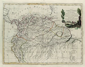
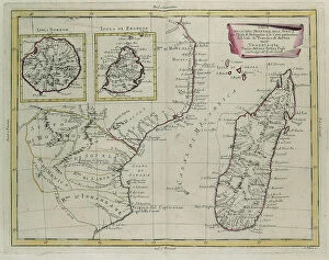
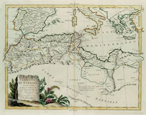
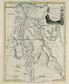
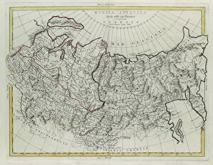
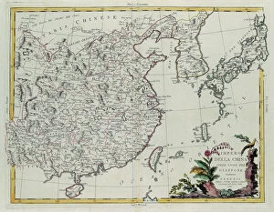
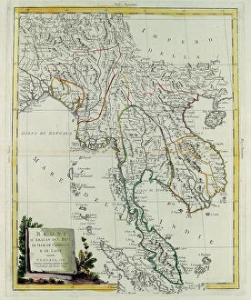
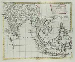
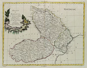
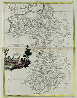
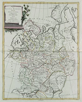
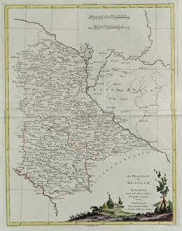
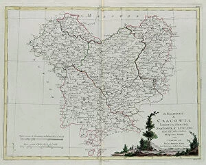
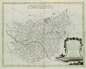
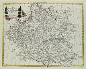
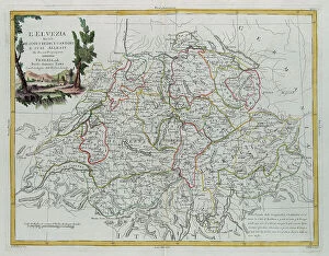
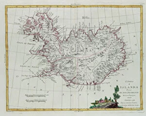
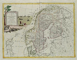
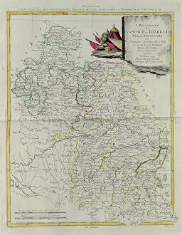
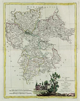
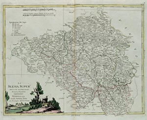
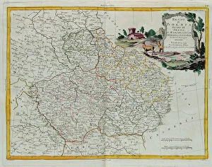
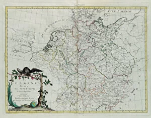
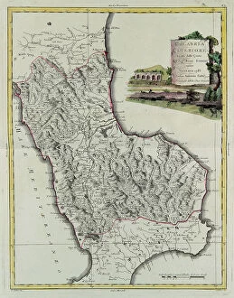
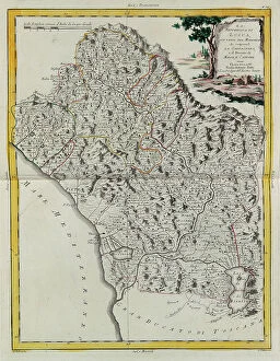
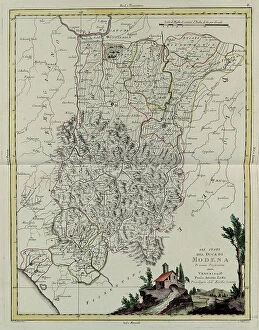
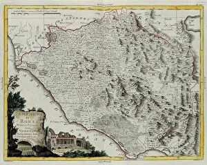
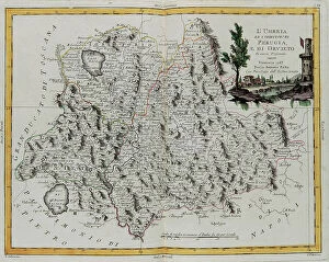
"Exploring the Rich Tapestry of Territory: From Ancient Empires to Majestic Landscapes" Embark on a captivating journey through time and space as we delve into the concept of territory. Let us begin our expedition with a glance at Scotland in the 1870s, where an intricate map unravels tales of clans and their territorial disputes. Shifting our focus eastward, we encounter a mesmerizing Map of the Ancient Persian Empire. Marvel at its vast expanse, once ruled by mighty kings who sought to expand their dominion across ancient lands. Transporting ourselves to Britain in 597 AD, another map reveals how territories evolved over centuries. Witness the birth of kingdoms and empires that shaped this island nation's history. As dusk descends upon Uluru, Ayers Rock in Australia, soak in nature's splendor while contemplating indigenous peoples' connection to their ancestral territories. The sunset paints vibrant hues across this sacred land. Journeying back to Europe, let us explore Ireland through a map from the 1870s. Discover its lush landscapes and ponder upon historical struggles for control over this enchanting island. Expand your horizons further with the World Map Empire McVitie; marvel at how various nations carved out their territories during different eras – each stroke representing power dynamics and conquests. Venturing into antiquity, immerse yourself in Alexander the Great's empire through an awe-inspiring map. Uncover his audacious quest for dominance as he conquered vast stretches of land under his rule. Witnessing nature's wonders takes flight as we observe a majestic Red Kite soaring above its nest territory in Lower Saxony, Germany. A symbol of freedom within defined boundaries - it reminds us that even wildlife has territorial instincts ingrained within them. Turning towards spiritual realms brings us face-to-face with Palestine and Holy Land on an intricately detailed map. Contemplate millennia-old conflicts rooted deeply in territorial claims and religious significance.