Fraud Blocker Skip to main content

Territory Collection (page 8)

"Exploring the Rich Tapestry of Territory

Background imageTerritory Collection: Aboriginal Warramunga man, Northern Territory, Australia

Aboriginal Warramunga man, Northern Territory, Australia
Aboriginal Warramunga (Warumungu) man, Northern Territory, Australia. Seen here in profile, with his nostrils broken under the weight of a large wooden spike. Date: 1922

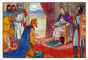
Background imageTerritory Collection: The Irish Chiefs and Kings kneel before King Henry II

The Irish Chiefs and Kings kneel before King Henry II (1133-1189) at Dublin, Ireland. In October 1171, King Henry landed with a large army in Ireland to establish control over both the Anglo-Normans

Background imageTerritory Collection: Gravid female Giant cave gecko {Pseudothecadactylus lindneri lindneri} NT, Australia

Gravid female Giant cave gecko {Pseudothecadactylus lindneri lindneri} NT, Australia

Background imageTerritory Collection: Eurasian coot (Fulica atra) males fighting over territory. London, England, UK. December

Eurasian coot (Fulica atra) males fighting over territory. London, England, UK. December.;

Background imageTerritory Collection: Two Black woodpeckers (Dryocopus martius) males on tree trunk in territorial dispute

Two Black woodpeckers (Dryocopus martius) males on tree trunk in territorial dispute, Peerdsbos, Braschaat, Belgium. April

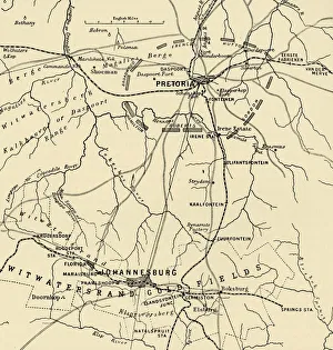
Background imageTerritory Collection: Map Showing District Between Johannesburg and Pretoria, and the Position of the British

Map Showing District Between Johannesburg and Pretoria, and the Position of the British Forces Round the Latter, 1901. From " South Africa and the Transvaal War, Vol

Background imageTerritory Collection: Muster of the Cape Town Guard on the Parade Ground Cape Town, January 12, 1901, 1901

Muster of the Cape Town Guard on the Parade Ground Cape Town, January 12, 1901, 1901
Muster of the Cape Town Guard on the Parade Ground Cape Town, for Inspection by General Brabant, January 12, 1901, 1901. British military parade in colonial South Africa

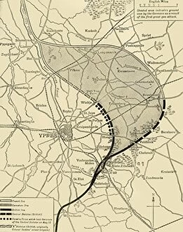
Background imageTerritory Collection: The Ypres Salient before and after the Second Battle of Ypres... First World War, 1915, (c1920)

The Ypres Salient before and after the Second Battle of Ypres... First World War, 1915, (c1920)
The Ypres Salient before and after the Second Battle of Ypres, April 22-May 13, First World War, 1915, (c1920). Map showing positions of the allied forces around Ypres in Belgium: French

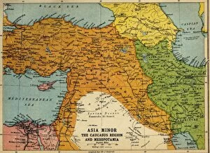
Background imageTerritory Collection: Asia Minor, the Caucasus Region and Mesopotamia, First World War, c1915, (c1920)

Asia Minor, the Caucasus Region and Mesopotamia, First World War, c1915, (c1920). Map of part of the Middle East, showing eastern Turkey, Cyprus, Syria, Lebanon, Palestine

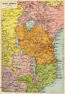
Background imageTerritory Collection: Map of East Africa, First World War, (c1920). Creator: John Bartholomew & Son

Map of East Africa, First World War, (c1920). Creator: John Bartholomew & Son
Map of East Africa, First World War, (c1920). Map showing colonial possessions including the Belgian Congo, British East Africa, German East Africa, Northern Rhodesia and Portuguese East Africa

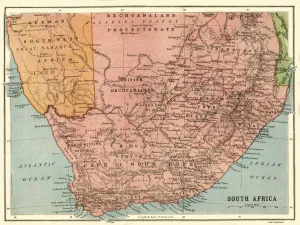
Background imageTerritory Collection: Map of South Africa, c1914, (c1920). Creator: John Bartholomew & Son

Map of South Africa, c1914, (c1920). Creator: John Bartholomew & Son
Map of South Africa, c1914, (c1920). Map of the southern tip of Africa at the start of the First World War, showing German South-West Africa (later Namibia)

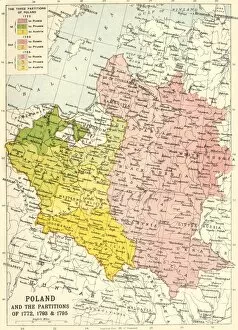
Background imageTerritory Collection: Poland and the Partitions of 1772, 1793 & 1795, (c1920). Creator: John Bartholomew & Son

Poland and the Partitions of 1772, 1793 & 1795, (c1920). Creator: John Bartholomew & Son
Poland and the Partitions of 1772, 1793 & 1795, (c1920). Map showing how territory in Europe was divided between the empires of Russia, Prussia and Austria in the 18th century

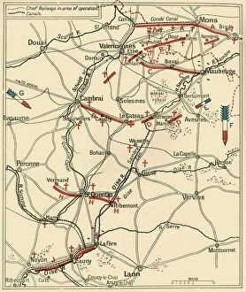
Background imageTerritory Collection: The Second Phase of the Great Retreat... 1914, (c1920). Creator: Unknown

The Second Phase of the Great Retreat... 1914, (c1920). Creator: Unknown
The Second Phase of the Great Retreat: Plan Showing the British Positions from August 28 to September 6, 1914, 1920. The map also indicates the positions of the Allies

Background imageTerritory Collection: The First Phase of the Great Retreat... 1914, (c1920). Creator: Unknown

The First Phase of the Great Retreat... 1914, (c1920). Creator: Unknown
The First Phase of the Great Retreat: Plan Showing the British Positions from August 23 to August 28, 1914, (c1920). Map of northern France and Belgium

Background imageTerritory Collection: American avocets (Recurvirostra americana) two during aggressive (territorial) encounter

American avocets (Recurvirostra americana) two during aggressive (territorial) encounter, Bear River Migratory Bird Refuge, Utah, USA, May

Background imageTerritory Collection: Wood Ducks (Aix sponsa), females behave aggressively toward a male (second from right)

Wood Ducks (Aix sponsa), females behave aggressively toward a male (second from right) that is trying to join them on a floating log, autumn, New York, USA, October

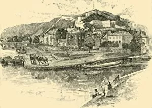
Background imageTerritory Collection: Namur, 1890. Creator: Unknown

Namur, 1890. Creator: Unknown
Namur, 1890. The Citadel of Namur on the confluence of Sambre and Meuse rivers was a disputed territory between Spain, France, England

Background imageTerritory Collection: Signing of the accord between the Vatican and Italy, 1929. Creator: Unknown

Signing of the accord between the Vatican and Italy, 1929. Creator: Unknown
Signing of the accord between the Vatican and Italy, 1929. L Accord Est Signe Entre Le Vatican Et L Italie. The Lateran Treaty, an agreement made between the Kingdom of Italy and the Holy See

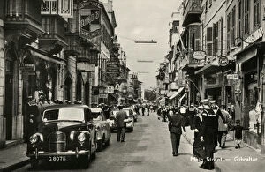
Background imageTerritory Collection: Main Street, Gibraltar

Main Street, Gibraltar. British sailors stationed at Gibraltar using some of their spare time to do a spot of shopping. Date: circa late 1940s

Background imageTerritory Collection: Malta - Mosta Church and Maltese Island Tour Buses

Malta - Mosta Church and Maltese Island Tour Buses
The Church of the Assumption of Our Lady, commonly known as the Rotunda of Mosta or Rotunda of St Marija Assunta (sometimes shortened to as The Mosta Dome) - a Roman Catholic church in Mosta, Malta

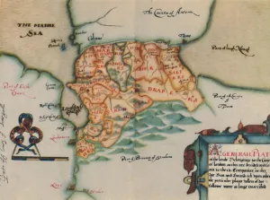
Background imageTerritory Collection: The Plantation of Ulster, 17th century, (1948). Creator: Unknown

The Plantation of Ulster, 17th century, (1948). Creator: Unknown
The Plantation of Ulster, 17th century, (1948). Map: Plan of lands belonging to the Companies of London in Ireland. The Plantation of Ulster was the organised colonisation (plantation)

Background imageTerritory Collection: Buzz Aldrin stands next to the American flag on the surface of the Moon, July 1969

Buzz Aldrin stands next to the American flag on the surface of the Moon, July 1969
Buzz Aldrin stands next to the American flag on the surface of the Moon, Apollo 11 mission, July 1969. US astronaut Edwin E " Buzz" Aldrin, Jr

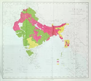
Background imageTerritory Collection: Map of India, showing the progress of the Imperial Surveys, published under the direction

Map of India, showing the progress of the Imperial Surveys, published under the direction
XCF306005 Map of India, showing the progress of the Imperial Surveys, published under the direction of Colonel H.R. Thuillier, R.E

Background imageTerritory Collection: Devils Marbles, Devils Marbles Conservation Reserve, Northern Territory, Australia

Devils Marbles, Devils Marbles Conservation Reserve, Northern Territory, Australia, June 2010

Background imageTerritory Collection: A group of meerkats (Suricata suricatta) or suricates, stand on an old termite mound

A group of meerkats (Suricata suricatta) or suricates, stand on an old termite mound to gain extra height and watch for predators in their territory on the edge of Makgadikgadi Pans National Park

Background imageTerritory Collection: Airport Parking Pattern

Airport Parking Pattern
Planes parked at airport

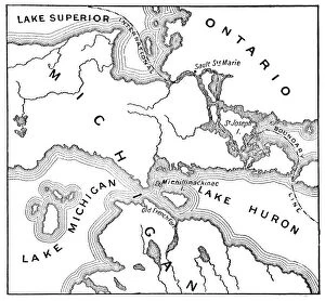
Background imageTerritory Collection: Antique Map of the Mackinac Island Area during the War of 1812 - 19th Century

Antique Map of the Mackinac Island Area during the War of 1812 - 19th Century
Vintage map showing early territorial borders and military positions in the Mackinac area during the War of 1812. Vintage etching circa late 19th century

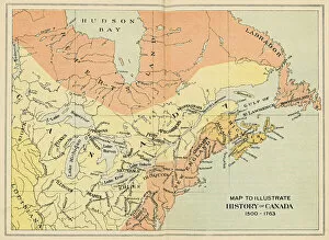
Background imageTerritory Collection: Antique Map of Canada from the 16th to 18th Century

Antique Map of Canada from the 16th to 18th Century
Vintage map of Canada showing the early territorial boundaries of European Occupation. Vintage etching circa late 19th century

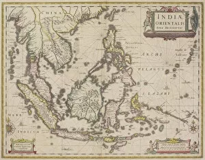
Background imageTerritory Collection: antique, archival, border, burma, cambodia, cartography, country, document, geography

antique, archival, border, burma, cambodia, cartography, country, document, geography, historic, historical, india orientalis, indian ocean, indonesia, islands, latitude, legend, longitude, malaysia

Background imageTerritory Collection: Bluethroat Male; Territory Song

Bluethroat Male; Territory Song

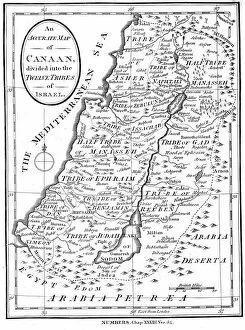
Background imageTerritory Collection: Map of Canaan divided into the twelve tribes of Israel, c1830

Map of Canaan divided into the twelve tribes of Israel, c1830
Map of Canaan divided into the twelve tribes of Israel, 1830. Map of Canaan divided into the territories of the Twelve Tribes of Israel as described in the Bible, Numbers 23:54. Engraving c1830

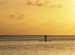
Background imageTerritory Collection: Stand up paddle along Seven Mile Beach at sunset, George Town, Grand Cayman

Stand up paddle along Seven Mile Beach at sunset, George Town, Grand Cayman, Cayman Islands

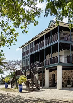
Background imageTerritory Collection: Traditional House, George Town, Grand Cayman, Cayman Islands

Traditional House, George Town, Grand Cayman, Cayman Islands

Background imageTerritory Collection: Southern stingray (Hypanus americanus), Stingray City, Grand Cayman, Cayman Islands

Southern stingray (Hypanus americanus), Stingray City, Grand Cayman, Cayman Islands

Background imageTerritory Collection: Boats at Stingray City, Grand Cayman, Cayman Islands

Boats at Stingray City, Grand Cayman, Cayman Islands

Background imageTerritory Collection: Governors Harbour, West Bay, Grand Cayman, Cayman Islands

Governors Harbour, West Bay, Grand Cayman, Cayman Islands

Background imageTerritory Collection: Sunset seen from Seven Mile Beach, West Bay, Grand Cayman, Cayman Islands

Sunset seen from Seven Mile Beach, West Bay, Grand Cayman, Cayman Islands

Background imageTerritory Collection: Seven Mile Beach at sunset, West Bay, Grand Cayman, Cayman Islands

Seven Mile Beach at sunset, West Bay, Grand Cayman, Cayman Islands

Background imageTerritory Collection: Heritage Kitchen Bar, Seven Mile Beach, West Bay, Grand Cayman, Cayman Islands

Heritage Kitchen Bar, Seven Mile Beach, West Bay, Grand Cayman, Cayman Islands

Background imageTerritory Collection: Ministry of Peace Church, West Bay, Grand Cayman, Cayman Islands

Ministry of Peace Church, West Bay, Grand Cayman, Cayman Islands

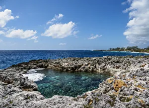
Background imageTerritory Collection: Coast of Pedro St. James National Historic Site, Savannah, Bodden Town District

Coast of Pedro St. James National Historic Site, Savannah, Bodden Town District, Grand Cayman, Cayman Islands

Background imageTerritory Collection: Pedro St. James National Historic Site, Savannah, Bodden Town District, Grand Cayman

Pedro St. James National Historic Site, Savannah, Bodden Town District, Grand Cayman, Cayman Islands

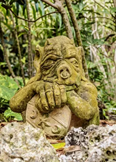
Background imageTerritory Collection: Gnome Figure at Queen Elizabeth II Botanic Park, North Side, Grand Cayman, Cayman Islands

Gnome Figure at Queen Elizabeth II Botanic Park, North Side, Grand Cayman, Cayman Islands

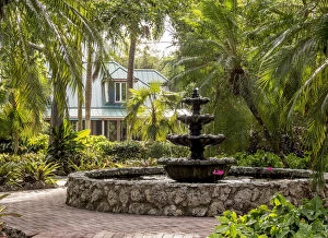
Background imageTerritory Collection: Rankine House, Heritage Garden, Queen Elizabeth II Botanic Park, North Side, Grand Cayman

Rankine House, Heritage Garden, Queen Elizabeth II Botanic Park, North Side, Grand Cayman, Cayman Islands

Background imageTerritory Collection: Queen Elizabeth II Botanic Park, North Side, Grand Cayman, Cayman Islands

Queen Elizabeth II Botanic Park, North Side, Grand Cayman, Cayman Islands

Background imageTerritory Collection: Hammock at North Side, Grand Cayman, Cayman Islands

Hammock at North Side, Grand Cayman, Cayman Islands

Background imageTerritory Collection: Starfish Point Beach, North Side, Grand Cayman, Cayman Islands

Starfish Point Beach, North Side, Grand Cayman, Cayman Islands

Background imageTerritory Collection: Sea star st Starfish Point, North Side, Grand Cayman, Cayman Islands

Sea star st Starfish Point, North Side, Grand Cayman, Cayman Islands


All Professionally Made to Order for Quick Shipping

"Exploring the Rich Tapestry of Territory: From Ancient Empires to Majestic Landscapes" Embark on a captivating journey through time and space as we delve into the concept of territory. Let us begin our expedition with a glance at Scotland in the 1870s, where an intricate map unravels tales of clans and their territorial disputes. Shifting our focus eastward, we encounter a mesmerizing Map of the Ancient Persian Empire. Marvel at its vast expanse, once ruled by mighty kings who sought to expand their dominion across ancient lands. Transporting ourselves to Britain in 597 AD, another map reveals how territories evolved over centuries. Witness the birth of kingdoms and empires that shaped this island nation's history. As dusk descends upon Uluru, Ayers Rock in Australia, soak in nature's splendor while contemplating indigenous peoples' connection to their ancestral territories. The sunset paints vibrant hues across this sacred land. Journeying back to Europe, let us explore Ireland through a map from the 1870s. Discover its lush landscapes and ponder upon historical struggles for control over this enchanting island. Expand your horizons further with the World Map Empire McVitie; marvel at how various nations carved out their territories during different eras – each stroke representing power dynamics and conquests. Venturing into antiquity, immerse yourself in Alexander the Great's empire through an awe-inspiring map. Uncover his audacious quest for dominance as he conquered vast stretches of land under his rule. Witnessing nature's wonders takes flight as we observe a majestic Red Kite soaring above its nest territory in Lower Saxony, Germany. A symbol of freedom within defined boundaries - it reminds us that even wildlife has territorial instincts ingrained within them. Turning towards spiritual realms brings us face-to-face with Palestine and Holy Land on an intricately detailed map. Contemplate millennia-old conflicts rooted deeply in territorial claims and religious significance.