Fraud Blocker Skip to main content

Topographic Map Collection

"Journey through Time

Background imageTopographic Map Collection: Austro-Hungarian Empire, Habsburg Monarchy, lithograph, published in 1877

Austro-Hungarian Empire, Habsburg Monarchy, lithograph, published in 1877
Ancient map of Austro-Hungarian Empire. Habsburg Monarchy. Lithograph, published in 1877

Background imageTopographic Map Collection: Map of Cyprus, published in 1880

Map of Cyprus, published in 1880
Ancient map of Cyprus. Lithograph, published in 1880

Background imageTopographic Map Collection: Historical city map of Heidelberg, Baden-WAOErttemberg, Germany, lithograph, published 1897

Historical city map of Heidelberg, Baden-WAOErttemberg, Germany, lithograph, published 1897
Historical city map of Heidelberg, Baden-WAOErttemberg, Germany. Lithograph, published in 1897

Background imageTopographic Map Collection: Map of the Netherlands, lithograph, published in 1877

Map of the Netherlands, lithograph, published in 1877
Map of the Netherlands. Lithograph, published in 1877

Background imageTopographic Map Collection: City map of Paris, lithograph, published in 1877

City map of Paris, lithograph, published in 1877
City map of Paris, France. Lithograph, published in 1877

Background imageTopographic Map Collection: City map of Rome, lithograph, published in 1878

City map of Rome, lithograph, published in 1878
City map of Rome, Italy. Lithograph, published in 1878

Background imageTopographic Map Collection: Historic city map of Beirut, Lebanon, wood engraving, published 1897

Historic city map of Beirut, Lebanon, wood engraving, published 1897
Historic city map of Beirut - capital and largest city of Lebanon. Wood engraving, published in 1897

Background imageTopographic Map Collection: Ancient map of Persia, lithograph, published in 1877

Ancient map of Persia, lithograph, published in 1877
Ancient map of Persia. Lithograph, published in 1877

Background imageTopographic Map Collection: Map of Capri, Italian island, wood engraving published in 1897

Map of Capri, Italian island, wood engraving published in 1897
Map of Capri, Italian island. Wood engraving, published in 1897

Background imageTopographic Map Collection: Gaul in the time of Julius Caesar, published in 1867

Gaul in the time of Julius Caesar, published in 1867
Gaul in the time of Roman politican Gaius Iulius Caesar (100 - 44 BC). Steel engraving with hand-colored borderlines and Latin legend, published in 1867

Background imageTopographic Map Collection: Panama Canal Project, lithograph, published in 1880

Panama Canal Project, lithograph, published in 1880
Ancient map of the Panama Canal Project. Lithograph, published in 1880

Background imageTopographic Map Collection: Sweden and Norway, lithograph, published in 1878

Sweden and Norway, lithograph, published in 1878
Ancient map of Sweden and Norway. Lithograph, published in 1878

Background imageTopographic Map Collection: Topographic map of Europe, lithograph, published in 1897

Topographic map of Europe, lithograph, published in 1897
Topographic map of Europe. Lithograph, published in 1897

Background imageTopographic Map Collection: City map of Aachen, Germany, lithograph, published in 1897

City map of Aachen, Germany, lithograph, published in 1897
City map of Aachen, Germany. Lithograph, published in 1897

Background imageTopographic Map Collection: Balkan Peninsula in 1878, lithograph

Balkan Peninsula in 1878, lithograph
Ancient map Balkan. The political classification of the Balkan Peninsula after the Treaty of Berlin in 1878. Lithograph, published in 1878

Background imageTopographic Map Collection: Vienna inner city

Vienna inner city
Antique map of Vienna from 1898

Background imageTopographic Map Collection: Ottoman Empire, lithograph, published in 1878

Ottoman Empire, lithograph, published in 1878
Ancient map of Ottoman Empire. Lithograph, published in 1878

Background imageTopographic Map Collection: Ancient map of Northern Italy, lithograph, published in 1876

Ancient map of Northern Italy, lithograph, published in 1876
Ancient map of Northern Italy. Lithograph, published in 1876

Background imageTopographic Map Collection: City map of Bremen, Germany, lithograph, published 1897

City map of Bremen, Germany, lithograph, published 1897
City map of Bremen, Germany. Lithograph, published in 1897

Background imageTopographic Map Collection: Afghanistan, lithograph, published in 1881

Afghanistan, lithograph, published in 1881
Ancient map of Afghanistan. Lithograph, published in 1881

Background imageTopographic Map Collection: Peru, Ecuador, Colombia, Venezuela, lithograph, published in 1877

Peru, Ecuador, Colombia, Venezuela, lithograph, published in 1877
Ancient map of Peru, Ecuador, Colombia, and Venezuela. Lithograph, published in 1877

Background imageTopographic Map Collection: Mexico, ancient map, lithograph, published in 1877

Mexico, ancient map, lithograph, published in 1877
Ancient map of Mexico. Lithograph, published in 1877

Background imageTopographic Map Collection: Map of British Isles, lithograph, lithograph, published in 1876

Map of British Isles, lithograph, lithograph, published in 1876
Map of British Isles. Lithograph, published in 1876

Background imageTopographic Map Collection: City map of London, lithograph, lithograph, published in 1877

City map of London, lithograph, lithograph, published in 1877
City map of London, United Kingdom. Lithograph, published in 1877

Background imageTopographic Map Collection: City map of Erfurt, Germany, lithograph, published in 1897

City map of Erfurt, Germany, lithograph, published in 1897
City map of Erfurt with street directory, Thuringia, Germany. Lithograph, published in 1897

Background imageTopographic Map Collection: German federal state of Bavaria, lithograph, published in 1874

German federal state of Bavaria, lithograph, published in 1874
Map of German federal state of Bavaria. Lithograph, published in 1874

Background imageTopographic Map Collection: Topographic map of Sicily, Italy, lithograph, published in 1897

Topographic map of Sicily, Italy, lithograph, published in 1897
Topographic map of Sicily, Italy - largest island in the Mediterranean Sea. Lithograph, published in 1897

Background imageTopographic Map Collection: Topographic map of Styria, Austria, lithograph, published in 1897

Topographic map of Styria, Austria, lithograph, published in 1897
Topographic map of Styria - state (Bundesland) located in the southeast of Austria. Lithograph, published in 1897

Background imageTopographic Map Collection: Tyrol, historical region in Austria and Italy, lithograph, published 1897

Tyrol, historical region in Austria and Italy, lithograph, published 1897
Tyrol - historical region in the Alps; in northern Italy and western Austria. Lithograph, published in 1897

Background imageTopographic Map Collection: Historical map of the Ottoman Empire (Turkey), European part, 1897

Historical map of the Ottoman Empire (Turkey), European part, 1897
Historical map of European part of the Ottoman Empire (Turkey) at the end of the 19th century. Lithograph, published in 1897

Background imageTopographic Map Collection: Topographic map of Spain and Portugal, lithograph, published in 1897

Topographic map of Spain and Portugal, lithograph, published in 1897
Topographic map of Spain and Portugal. Lithograph, published in 1897

Background imageTopographic Map Collection: South America Map Illustration, Travel, Exploration, Antique 1871 Illustration

South America Map Illustration, Travel, Exploration, Antique 1871 Illustration
Color stock photo of an antique South America map illustration. Salvaged from an 1871 geography book

Background imageTopographic Map Collection: Old topographic map of Asia Minor (Turkey), lithograph, published 1897

Old topographic map of Asia Minor (Turkey), lithograph, published 1897
Old topographic map of Asia Minor (Turkey). Lithograph, published 1897

Background imageTopographic Map Collection: Development of the British Empire, lithograph, published 1897

Development of the British Empire, lithograph, published 1897
Map of the territorial development of the British Empire from the 17th century to the end of the 19th century. Lithograph, published in 1897

Background imageTopographic Map Collection: Topographic maps of the former German colonies, lithograph, published 1897

Topographic maps of the former German colonies, lithograph, published 1897
Topographic maps of the former German colonies in Africa and the South Seas. Lithograph, published in 1897

Background imageTopographic Map Collection: Historical map of Crimea (Ukraine / Russia), wood engraving, published in 1897

Historical map of Crimea (Ukraine / Russia), wood engraving, published in 1897
Historical map of the Peninsula Crimea (Ukraine/Russia). Wood engraving, published in 1897

Background imageTopographic Map Collection: City map of Frankfurt am Main, Hesse, Germany, lithograph, 1897

City map of Frankfurt am Main, Hesse, Germany, lithograph, 1897
City map of Frankfurt am Main - largest city of the German state of Hesse (with street directory). Lithograph, published in 1897

Background imageTopographic Map Collection: Old, Map of Eastern and Western Hemispheres, From 1875

Old, Map of Eastern and Western Hemispheres, From 1875
Old black and white illustration of the Eastern Hemisphere and the Western Hemisphere, from the 1800 s

Background imageTopographic Map Collection: Map of Palestine and Jerusalem, lithograph, published in 1881

Map of Palestine and Jerusalem, lithograph, published in 1881
Detailed topographic map of Palestine and Jerusalem. Facsimile from my archive, published in 1881

Background imageTopographic Map Collection: Poznan

Poznan
Ancient map of Poznan from 1898

Background imageTopographic Map Collection: Balkan States

Balkan States
Map of Rumania, Bulgaria, Serbia, Montenegro

Background imageTopographic Map Collection: The six principal colonies of German Africa

The six principal colonies of German Africa
Illustration of a The six principal colonies of German Africa

Background imageTopographic Map Collection: City map of Cologne, North Rhine-Westphalia, Germany, lithograph, published 1897

City map of Cologne, North Rhine-Westphalia, Germany, lithograph, published 1897
City map of Cologne, North Rhine-Westphalia, Germany. Lithograph, published in 1897

Background imageTopographic Map Collection: Map of Frankfurt / Main and surroundings, Hesse, Germany, lithograph, published 1897

Map of Frankfurt / Main and surroundings, Hesse, Germany, lithograph, published 1897
Map of Frankfurt am Main and surroundings in Hesse, Germany. Lithograph, published in 1897

Background imageTopographic Map Collection: Old, Black and White Illustration of Eastern Hemisphere, From 1800 s

Old, Black and White Illustration of Eastern Hemisphere, From 1800 s
Old black and white illustration of the Old World (Eastern Hemisphere), from 1875

Background imageTopographic Map Collection: Topographic map of the European Alps, lithograph, published in 1897

Topographic map of the European Alps, lithograph, published in 1897
Topographic map of the European Alps. Lithograph, published in 1897

Background imageTopographic Map Collection: Historic city map of Belgrade, Serbia, wood engraving, published 1897

Historic city map of Belgrade, Serbia, wood engraving, published 1897
Historic city map of Belgrade - capital and largest city of Serbia. Wood engraving, published in 1897


All Professionally Made to Order for Quick Shipping

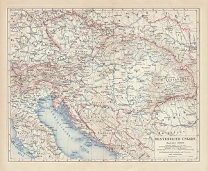
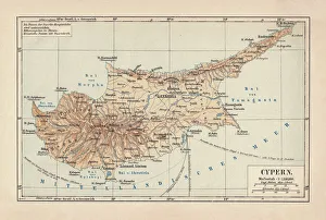
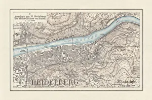
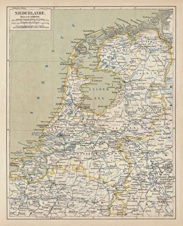
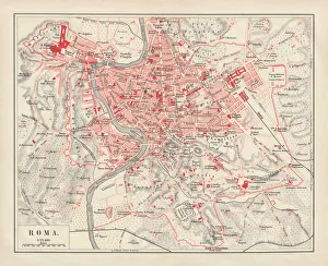
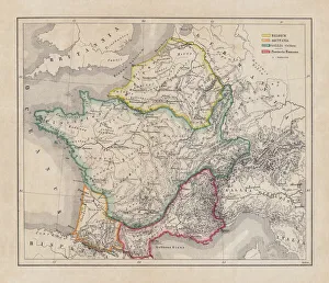
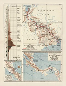
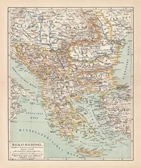
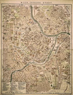
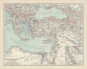
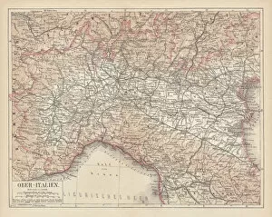
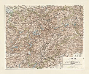
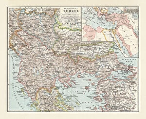
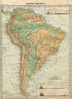
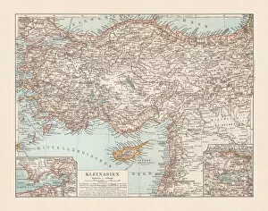
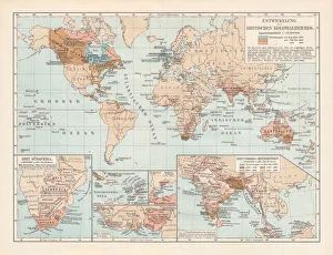
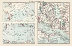
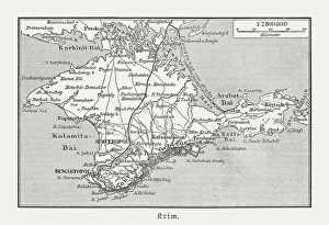
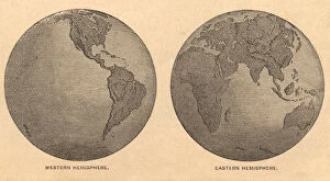
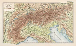
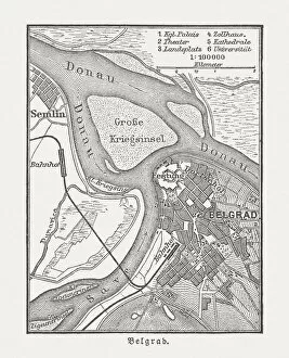
"Journey through Time: Exploring the World with Topographic Maps" Step back in time and embark on a captivating journey as we delve into the fascinating world of topographic maps. These intricate works of art, meticulously crafted centuries ago, offer us a glimpse into the landscapes and cities of yesteryears. Let's start our adventure in 1880, where we find ourselves traversing the enchanting island of Cyprus. This topographic map showcases its diverse terrain, from rugged mountains to serene coastlines, inviting us to explore its hidden treasures. Next, we stumble upon a historical city map of Heidelberg in Baden-Württemberg, Germany. Published in 1897 as a lithograph masterpiece, it reveals the architectural marvels that have stood tall for generations within this picturesque town. As our voyage continues, we encounter an intricately detailed map of the Netherlands published in 1877. Its lithograph craftsmanship allows us to appreciate every canal and windmill that dots this iconic landscape. Moving southward towards Italy's eternal city, Rome beckons us with its rich history depicted on a lithograph from 1878. This stunning piece captures Rome's grandeur during ancient times while showcasing its timeless landmarks such as the Colosseum and Pantheon. Our exploration takes an imperial turn as we uncover an Austro-Hungarian Empire map dating back to 1877. A testament to Habsburg Monarchy's vast dominion across Central Europe at that time – it offers insights into their expansive territories and cultural diversity. The Panama Canal Project comes alive before our eyes through an intriguing lithograph published in 1880. Witness how human ingenuity transformed this narrow strip between two continents into one of mankind's greatest engineering feats. Venturing further eastwards brings us to Beirut - Lebanon’s historic gem captured beautifully on wood engraving from 1897. Explore winding streets filled with tales untold and discover the city's vibrant past through this captivating piece of art.