mail_outline sales@mediastorehouse.com
Framed Print
Canvas Print
Metal Print
Photographic Print
Poster Print
Fine Art Print
Jigsaw Puzzle
Photo Mug
Greetings Card
Cushion
Mouse Mat
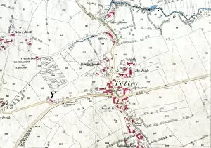
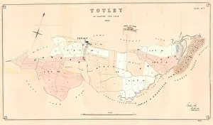
Ordnance Survey map: Totley, 1876Scale: 25 inches to 1 mile.Original at Sheffield Local Studies Library: Derbyshire sheet XI.15.Includes: Old Hay Brook, Grove House, Crown Inn, Hillfoot, Totley Bents, Cricket Inn, recreation ground
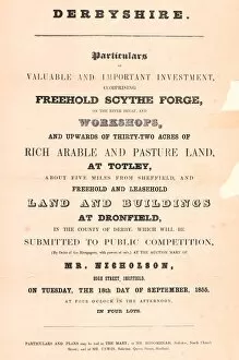
Particulars of valuable and important investment, comprising freehold scythe forge on the River Sheaf and workshopsLocal Studies Library: Sale Plans 18 Sep 1855.Lot 1 includes Buttermans School (Dronfield); Lot 4 (Totley) comprises scythe forge, with dam, banks, goights, weirs, stable, workshops, etc
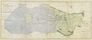
Totley enclosure map, 1842By George Sanderson, surveyor of Mansfield. From an original at Sheffield Libraries: arc02952
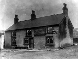
Fleur de Lys Public House, Totley Hall Lane, SheffieldFrom an original at Sheffield Libraries: s06893
Plan of Totley as allotted for sale, 1859From an original at Sheffield Libraries: y10756
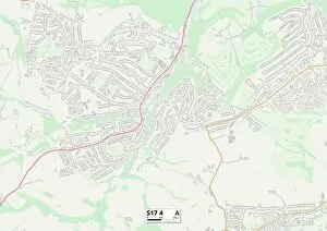
Sheffield S17 4 MapPostcode Sector Map of Sheffield S17 4
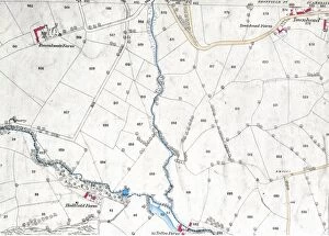
Ordnance Survey map: Totley, 1876Scale: 25 inches to 1 mile. Original at Sheffield Local Studies Library: Derbyshire sheet XI.15. Includes: Hallfield Farm, Totley Range, Roundseats Farm, quarry, Townhead in Dronfield, Redcar Brook