
Western Script Collection (page 8)
"Exploring the Rich Tapestry of Western Script: A Journey through Time and Knowledge" Step into the fascinating world of Western script


All Professionally Made to Order for Quick Shipping
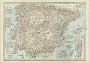
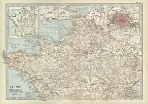
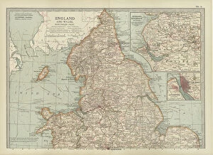
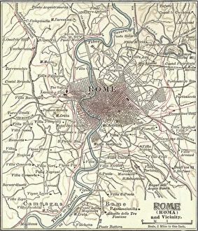
"Exploring the Rich Tapestry of Western Script: A Journey through Time and Knowledge" Step into the fascinating world of Western script, where ink and colors on parchment come alive to tell stories from centuries past. One such masterpiece is the Mappa Mundi, a captivating map created in London around 1265, showcasing intricate details of our ever-evolving world. In this journey, we encounter diverse facets of human knowledge. A black and white illustration of the Snellen chart reminds us of the importance of eyesight tests for clear vision. Delving deeper into anatomy, we explore the intricate workings of the human brain from an inferior view and unravel the complexity behind facial muscles with detailed labels. As we traverse across continents, we find ourselves at Cardiff Bay's Millennium Centre in Wales—a testament to architectural marvels that blend tradition with modernity. Further exploring anatomy, we uncover secrets hidden within our knee joints—an engineering marvel that allows us to walk tall. Venturing across borders brings us to Lincoln in New Mexico, USA—where time seems frozen as an old mailbox stands as a reminder of bygone eras. Vintage World War II posters featuring fedoras and Army helmets transport us back to a time when bravery knew no bounds. Returning to our exploration inside ourselves once more, we witness a superior view of the human brain adorned with vibrant lobes labeled meticulously—a stunning reminder that beauty lies not only on its surface but also within its depths. Our final stop takes us northwards—to John O Groats in Scotland—where a multi-directional signpost beckons adventurers towards new horizons. Just like these signposts guide travelers towards unknown destinations, so does Western script lead humanity towards enlightenment. In this captivating journey through time and space captured by Eugene Samuel Grasset's Decembre artwork from 1896—we are reminded that Western script is not merely words on paper but rather an embodiment of history itself—an eternal connection between past civilizations and our present world.