Fraud Blocker Skip to main content

Whole Earth Collection

Discover the beauty and wonder of our Whole Earth, captured in stunning images

Background imageWhole Earth Collection: Whole Earth (Blue Marble 2000)

Whole Earth (Blue Marble 2000)
Whole Earth. Composite satellite image of Earth centred on the Americas. This is Blue Marble 2000, one of the most detailed Earth images ever made

Background imageWhole Earth Collection: Whole Earth at night, satellite image

Whole Earth at night, satellite image
Whole Earth map at night, satellite image. Here, Africa is seen at centre. City lights (yellow) of increasing intensity show areas of increasing population

Background imageWhole Earth Collection: Earth, topographic and bathymetric map

Earth, topographic and bathymetric map. This whole Earth map is centred on the Greenwich meridian, at zero degrees latitude

Background imageWhole Earth Collection: Earth, topographic and bathymetric map

Earth, topographic and bathymetric map. This map is centred on the Pacific Ocean, at longitude 140 degrees west. Highlands and lowlands of the continents are shown as ridges and flat areas

Background imageWhole Earth Collection: Whole Earth, satellite image

Whole Earth, satellite image. This map is centred on the Greenwich meridian, at zero degrees latitude. Arctic and Antarctic ice is white, oceans are blue and land is green and brown

Background imageWhole Earth Collection: Whole Earth at night, satellite image

Whole Earth at night, satellite image. This map is centred on the Greenwich meridian, at zero degrees latitude. City lights (yellow) show areas of dense population

Background imageWhole Earth Collection: Europe and North Africa

Europe and North Africa
Europe. Satellite image of the Earth showing the continent of Europe at the centre and north Africa at the bottom

Background imageWhole Earth Collection: Earth

Earth
Planet Earth. Enhanced colour version of the classic Apollo 17 view of the Earth taken in December 1972. The image shows the continents of Africa (centre) and Antarctica (bottom)

Background imageWhole Earth Collection: Earth from space

Earth from space
Planet Earth. Enhanced colour version of the classic Apollo 17 view of the Earth taken in December 1972. The image shows the continents of Africa (centre) and Antarctica (bottom)

Background imageWhole Earth Collection: Ratcatcher mid late 17th century Etching second state

Ratcatcher mid late 17th century Etching second state
Artokoloro

Background imageWhole Earth Collection: Gravity map of Earth C018 / 9377

Gravity map of Earth C018 / 9377
Gravity map of Earth. Computer model showing the variation of the Earths gravity field. Colours represent gravity anomaly

Background imageWhole Earth Collection: Hurricane Sandy, 28th October 2012 C014 / 5781

Hurricane Sandy, 28th October 2012 C014 / 5781
Hurricane Sandy. Satellite image of hurricane Sandy off the east coast of the USA (top centre) on 28th October 2012 at 17.45 UTC

Background imageWhole Earth Collection: Hurricane Sandy, 29th October 2012 C014 / 5782

Hurricane Sandy, 29th October 2012 C014 / 5782
Hurricane Sandy, 29th October 2012

Background imageWhole Earth Collection: Computer artwork of the Earth being constructed

Computer artwork of the Earth being constructed
Earth under construction. Computer artwork of the Earth being built by an orbiting spacecraft. The spacecraft is using a blue energy beam to move a chunk of Africa into place

Background imageWhole Earth Collection: Computer art of Earth as a circuit board

Computer art of Earth as a circuit board
Information superhighway. Abstract computer artwork depicting the information superhighway. This shows the Earth as a circuit board above a plane of circuitry

Background imageWhole Earth Collection: Computer art of the Earth seen on mobile telephone

Computer art of the Earth seen on mobile telephone
Global communication. Computer artwork representing global communications showing the Earth on the screen on a mobile telephone

Background imageWhole Earth Collection: Earths magnetosphere, artwork

Earths magnetosphere, artwork
Earths magnetic field. Artwork showing Earths magnetosphere (blue) in the solar wind (not to scale). The field lines originate from the poles

Background imageWhole Earth Collection: Simulation of the Earths magnetic field

Simulation of the Earths magnetic field

Background imageWhole Earth Collection: Earth with 5 hurricanes, satellite image

Earth with 5 hurricanes, satellite image
Earth with five hurricanes, satellite image. North is at top. There are five rotating cloud systems (white) seen across the upper hemisphere of Earth

Background imageWhole Earth Collection: Simulation of a magnetic field reversal on Earth

Simulation of a magnetic field reversal on Earth
Model of geomagnetic field reversal. Third of three frames showing the magnetic field structure produced by a numerical simulation of the geodynamo, the source of the Earths magnetic field

Background imageWhole Earth Collection: Plasma in Earths magnetic field, UV image

Plasma in Earths magnetic field, UV image
Earths magnetic field. Ultraviolet image of hot plasma (ionised gas, orange) trapped in the Earths magnetic field. The Earth has been superimposed at centre

Background imageWhole Earth Collection: Americas, artwork

Americas, artwork
Americas. Computer artwork of the whole Earth centred on the Americas. North is at top with the Atlantic Ocean to the east and the Pacific Ocean to the west

Background imageWhole Earth Collection: Earth centred on the Pacific Ocean

Earth centred on the Pacific Ocean
Whole Earth. Satellite image of the whole Earth centred on the Pacific Ocean. At top right is the west coast of North America. Weather systems demarcated by white cloud formations are seen

Background imageWhole Earth Collection: Earth centred on Australasia

Earth centred on Australasia
Australasia. Combined visible and infrared satellite image of Australasia taken by the Chinese FY-2 satellite. This geostationary weather satellite was launched by China on 10th June 1997

Background imageWhole Earth Collection: GOES satellite image of South America

GOES satellite image of South America
South America. Coloured combined visible and infrared GOES satellite image of South America and storms in the Atlantic Ocean. The continent of South America is seen at lower centre

Background imageWhole Earth Collection: GOES satellite image of Earth showing day / night

GOES satellite image of Earth showing day / night
GOES satellite image of Earth showing day/night

Background imageWhole Earth Collection: Whole earth abstract

Whole earth abstract
Earth in light rays. Artwork of the whole Earth with light rays in the background. The oceans are transparent, and the rays can be seen behind the Earth. The view is centred on the North Atlantic

Background imageWhole Earth Collection: Computer artwork of the Earth with a glow

Computer artwork of the Earth with a glow
Whole Earth. Computer illustration of the whole Earth seen with a glowing light on a starfield. The Earth is centred on Africa with land seen as brown, water as blue and clouds as white

Background imageWhole Earth Collection: Computer artwork of Earth centred on Asia

Computer artwork of Earth centred on Asia
Asia. Computer artwork of the whole Earth centred on Asia. North is at top. The islands which form the region of Australasia are also visible in the Pacific Ocean

Background imageWhole Earth Collection: Computer artwork of whole Earth showing Americas

Computer artwork of whole Earth showing Americas
Americas. Computer artwork of the whole Earth centred on the Americas. North is at top with the Atlantic Ocean to the east and the Pacific Ocean to the west

Background imageWhole Earth Collection: True-colour satellite image of the Earth

True-colour satellite image of the Earth
Earth from space. True-colour cloudless satellite image of the whole surface of the Earth, centred on Europe and Africa. North is at top

Background imageWhole Earth Collection: Computer artwork of Earth with burning continents

Computer artwork of Earth with burning continents
Earth. Computer artwork of the whole Earth with burning continents. North is towards the upper left. The Sun is seen rising behind the Earth

Background imageWhole Earth Collection: Earth and moon

Earth and moon
Earth and Moon. Computer composite image showing the Earth and the Moon set against a background of stars. The image of the Earth is derived from a photograph taken during the Apollo 17 mission in

Background imageWhole Earth Collection: Whole earth

Whole earth

Background imageWhole Earth Collection: Satellite image centred on Indian Ocean

Satellite image centred on Indian Ocean
False-colour satellite image of the Earth, centered on the Indian Ocean. The outline of the whole east coast of Africa may be seen, with the island of Madagascar lower left of centre

Background imageWhole Earth Collection: Earth and Hurricane Dean, 20 August 2007

Earth and Hurricane Dean, 20 August 2007
Earth and Hurricane Dean, satellite image. North is at top. Hurricane Dean is the large rotating cloud system (white) at upper left, in the western Caribbean, to the east of Mexico


All Professionally Made to Order for Quick Shipping

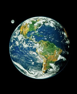
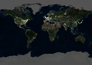
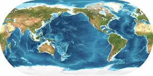
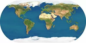
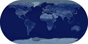
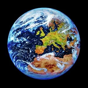
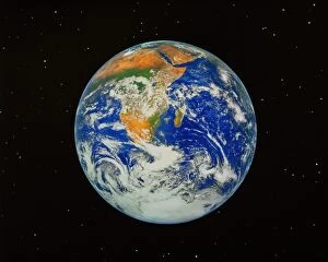
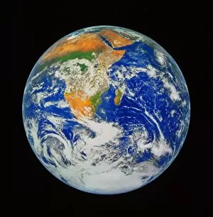
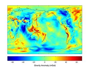
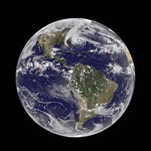
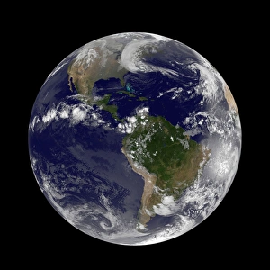
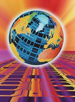
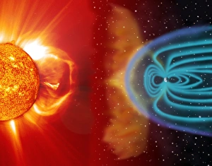
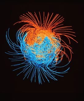
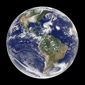
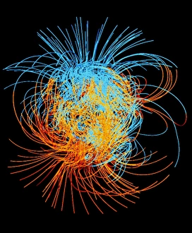
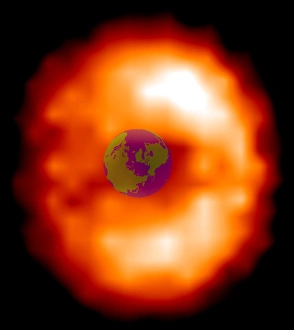
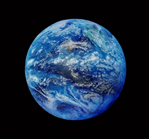
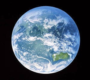
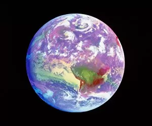
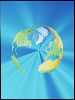
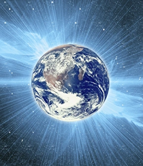
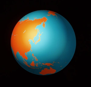
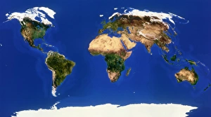
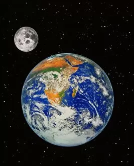
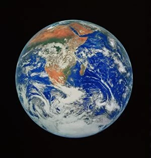
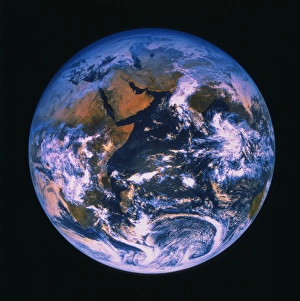
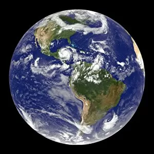
Discover the beauty and wonder of our Whole Earth, captured in stunning images. From the breathtaking Blue Marble 2000 view to the mesmerizing Whole Earth at night satellite image, witness our planet's magnificence from space. Dive deep into its secrets with the topographic and bathymetric maps that unveil both land and ocean depths. Marvel at Europe and North Africa as they come alive on this diverse canvas we call home. Journey back in time with Ratcatcher mid-late 17th-century etching, a glimpse into history's artistic portrayal of our world. Explore the invisible forces shaping our planet through the gravity map of Earth, revealing hidden mysteries beneath its surface. Remember Hurricane Sandy's devastating impact on October 28th, 2012 - a reminder of nature's power and resilience. Let these captivating visuals remind us to cherish and protect every corner of our precious Whole Earth.