
World Collection
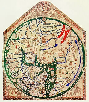
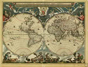
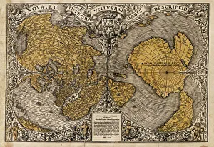
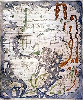
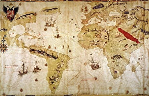
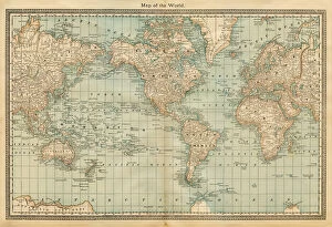
"Exploring the Vastness: A Journey through the World" Embarking on a historical voyage, we delve into the depths of time with Al-Idrisi's world map from 1154


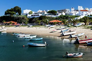


All Professionally Made to Order for Quick Shipping
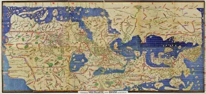
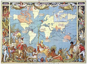
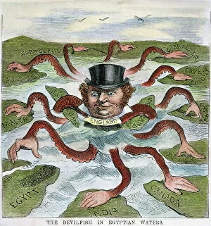
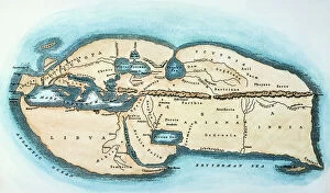
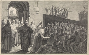
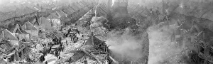
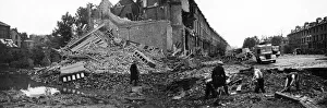
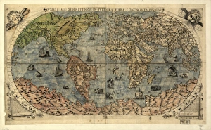
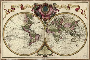
"Exploring the Vastness: A Journey through the World" Embarking on a historical voyage, we delve into the depths of time with Al-Idrisi's world map from 1154. This ancient cartographic masterpiece unveils the intricate knowledge and curiosity that shaped our understanding of the world. As dusk descends upon Uluru, Ayers Rock in Australia, nature paints a breathtaking canvas with hues of orange and pink. The sunset at this sacred site reminds us of Earth's awe-inspiring beauty and its ability to captivate our senses. Traveling back to 1886, we uncover Walter Crane's map showcasing the vast expanse of the British Empire. It serves as a reminder of an era when nations sought to expand their influence across continents, leaving lasting imprints on history. In Namibia's Walvis Bay, white pelicans gracefully glide over shimmering waters. Their presence symbolizes harmony within nature and highlights how diverse ecosystems coexist harmoniously in different corners of our planet. The scars left by war are etched into Brampton Road in Bexleyheath from World War II bombings. These remnants serve as poignant reminders that peace is fragile and must be cherished above all else. A satirical cartoon by James Gillray takes us back to 1805 when Napoleon Bonaparte attempted peace negotiations with British Prime Minister William Pitt. Depicting them carving up the world like plumb pudding, it humorously portrays political power struggles amidst global affairs. Revving engines echo as BMW S1000RR motorcycles race against time, embodying human innovation and pushing boundaries beyond what was once thought possible – reminding us that progress knows no bounds. Al-Idrisi's Tabula Rogeriana transports us further back to medieval times when maps were meticulously hand-drawn for Sicilian King Roger II. This remarkable piece showcases early geographical knowledge while highlighting cultural exchange between civilizations.