Fraud Blocker Skip to main content

World Collection (page 7)

"Exploring the Vastness: A Journey through the World" Embarking on a historical voyage, we delve into the depths of time with Al-Idrisi's world map from 1154

Background imageWorld Collection: Preparation for the Normandy Landings, Slapton Sands, Devon, 1944 (b / w photo)

Preparation for the Normandy Landings, Slapton Sands, Devon, 1944 (b / w photo)
1741643 Preparation for the Normandy Landings, Slapton Sands, Devon, 1944 (b/w photo) by Unknown photographer, (20th century); (add.info)

Background imageWorld Collection: The Pinta, the Nina and the Santa Maria sailing towards the West Indies in 1492

The Pinta, the Nina and the Santa Maria sailing towards the West Indies in 1492, from The Discovery of America
IND113069 The Pinta, the Nina and the Santa Maria sailing towards the West Indies in 1492, from The Discovery of America, 1878 (colour litho) by Spanish School

Background imageWorld Collection: DDE-90035205

DDE-90035205
Europe, Spain, Granada. The Generalife gardens are part of the Alhambra grounds. Date: 19/11/2009

Background imageWorld Collection: DDE-90029091

DDE-90029091
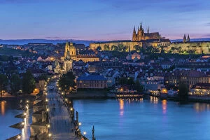
Czech Republic, Bohemia, Prague, Charles Bridge Twilight (Large format sizes available). Date: 15/04/2010

Background imageWorld Collection: DDE-90025042

DDE-90025042
Israel, The Galilee, Tiberias, Sea of Galilee-Lake Tiberias, late afternoon Date: 26/01/2008

Background imageWorld Collection: African-American Marines, Battle of Peleliu, 15th September 1944 (b / w photo)

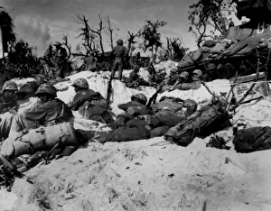
African-American Marines, Battle of Peleliu, 15th September 1944 (b / w photo)
1720216 African-American Marines, Battle of Peleliu, 15th September 1944 (b/w photo) by American Photographer, (20th century); (add.info.: Peleliu battle, september 15)

Background imageWorld Collection: Atlas 1587: Orbis Terrae Compendiosa Descriptio de Rumold Mercator (1546 / 48-1599)

Atlas 1587: Orbis Terrae Compendiosa Descriptio de Rumold Mercator (1546 / 48-1599), third son of Gerhard Kremer
GIA4699208 Atlas 1587: Orbis Terrae Compendiosa Descriptio de Rumold Mercator (1546/48-1599), third son of Gerhard Kremer, known as Gerardus Mercator

Background imageWorld Collection: Leon Camier MV Agusta 1000 F4

Leon Camier MV Agusta 1000 F4
World Superbikes 2017

Background imageWorld Collection: The Nativity at Night, c. 1490 (oil on oak)

The Nativity at Night, c. 1490 (oil on oak)
3709992 The Nativity at Night, c.1490 (oil on oak) by Geertgen tot Sint Jans (c.1460-90); 34x25.3 cm; National Gallery, London, UK; Netherlandish, out of copyright

Background imageWorld Collection: Beautiful Butterflies: A collector at work in New Guinea (colour litho)

Beautiful Butterflies: A collector at work in New Guinea (colour litho)
6003270 Beautiful Butterflies: A collector at work in New Guinea (colour litho) by Twidle, Arthur (1865-1936); Private Collection; (add.info.: A collector at work in New Guinea)

Background imageWorld Collection: Map of Ptolemy published in 1482

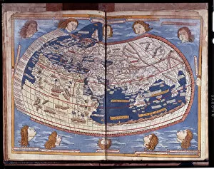
Map of Ptolemy published in 1482
GIA4812936 Map of Ptolemy published in 1482. by Unknown Artist, (15th century); Pinacoteca di Brera, Milan, Italy; (add.info.: Map of Ptolemy published in 1482.); eGiancarlo Costa; out of copyright

Background imageWorld Collection: Truffle hunters in Perigord in France (chromolitho)

Truffle hunters in Perigord in France (chromolitho)
736029 Truffle hunters in Perigord in France (chromolitho) by European School, (19th century); Private Collection; (add.info.: Truffle hunters in Perigord in France)

Background imageWorld Collection: SS 'Orizaba'and SS 'Oroya', Promenade Deck (litho)

SS "Orizaba"and SS "Oroya", Promenade Deck (litho)
3651324 SS " Orizaba" and SS " Oroya", Promenade Deck (litho) by English School, (19th century); Private Collection; (add.info.: SS " Orizaba" and SS " Oroya")

Background imageWorld Collection: Antique Double-Hemisphere World Map, 1686 (coloured coloured engraving

Antique Double-Hemisphere World Map, 1686 (coloured coloured engraving
2630127 Antique Double-Hemisphere World Map, 1686 (coloured coloured engraving by Bormeester, Joachim (d.1702); Private Collection; (add.info)

Background imageWorld Collection: Dahomeyan Amazons (b / w photo)

Dahomeyan Amazons (b / w photo)
5990420 Dahomeyan Amazons (b/w photo) by English Photographer, (20th century); Private Collection; (add.info.: Dahomeyan Amazons. Living Races of Mankind (Hutchinson, c 1910)

Background imageWorld Collection: Sir W Raleigh, The History of the World, W Stansby for W Burre 1614 (b / w photo)

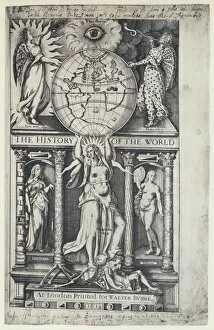
Sir W Raleigh, The History of the World, W Stansby for W Burre 1614 (b / w photo)
5988844 Sir W Raleigh, The History of the World, W Stansby for W Burre 1614 (b/w photo) by English Photographer, (20th century); Private Collection; (add.info.: Sir W Raleigh)

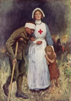
Background imageWorld Collection: Red Cross Nurse in WWI

Red Cross Nurse in WWI
3781054 Red Cross Nurse in WWI by Hatherell, William (1855-1928); (add.info.: Red Cross nurse supporting an injured soldier and child dseeking shelter)

Background imageWorld Collection: Mr Edmund Hodgson Yates, The World, 16 November 1878, Vanity Fair cartoon (colour litho)

Mr Edmund Hodgson Yates, The World, 16 November 1878, Vanity Fair cartoon (colour litho)
611597 Mr Edmund Hodgson Yates, The World, 16 November 1878, Vanity Fair cartoon (colour litho) by Ward, Leslie Matthew (Spy) (1851-1922); Private Collection; (add.info.: Mr Edmund Hodgson Yates)

Background imageWorld Collection: Schutzenfisch (chromolitho)

Schutzenfisch (chromolitho)
5211224 Schutzenfisch (chromolitho) by European School, (19th century); Private Collection; (add.info.: Schutzenfisch. Illustration for Brehms Thierleben Allgemeine Kunde des Thierreichs)

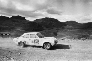
Background imageWorld Collection: Footballer Jimmy Greaves World Cup Rally car seen here during the Argentinian stages

Footballer Jimmy Greaves World Cup Rally car seen here during the Argentinian stages. Circa May 1970

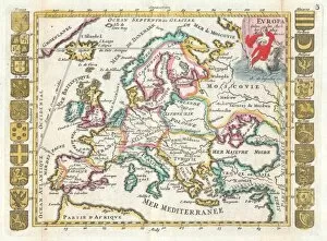
Background imageWorld Collection: 1706, De La Feuille Map of Europe, topography, cartography, geography, land, illustration

1706, De La Feuille Map of Europe, topography, cartography, geography, land, illustration
1706, De La Feuille Map of Europe

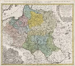
Background imageWorld Collection: 1750, Homann Heirs Map of Poland, topography, cartography, geography, land, illustration

1750, Homann Heirs Map of Poland, topography, cartography, geography, land, illustration
1750, Homann Heirs Map of Poland

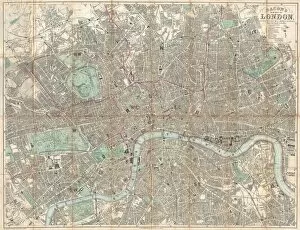
Background imageWorld Collection: 1890, Bacon Travelers Pocket Map of London, England, topography, cartography

1890, Bacon Travelers Pocket Map of London, England, topography, cartography
1890, Bacon Travelers Pocket Map of London, England

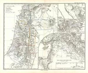
Background imageWorld Collection: 1865, Spruner Map of Israel, Canaan, or Palestine in Ancient Times, topography, cartography

1865, Spruner Map of Israel, Canaan, or Palestine in Ancient Times, topography, cartography
1865, Spruner Map of Israel, Canaan, or Palestine in Ancient Times

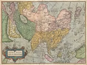
Background imageWorld Collection: 1570, Ortelius Map of Asia, first edition, Abraham Ortelius, also Orthellius, 1527 - 1598

1570, Ortelius Map of Asia, first edition, Abraham Ortelius, also Orthellius, 1527 - 1598, Flemish, Netherlandish cartographer and geographer

Background imageWorld Collection: Ocean currents map 1875

Ocean currents map 1875
The Independent Course Comprehensive Geography by James Monteith, A.S. Barnes & Co, New York & Chicago 1875

Background imageWorld Collection: A young pug is dozing on a wooden bench

A young pug is dozing on a wooden bench

Background imageWorld Collection: Snowy Owl, Arctic Owl, Great White Owl, Harfang (Bubo scandiacus) (Nyctea scandiaca), calling

Snowy Owl, Arctic Owl, Great White Owl, Harfang (Bubo scandiacus) (Nyctea scandiaca), calling

Background imageWorld Collection: WORLD MAP, c1490. Map of the world incorporating the discoveries of Bartholomeu Diaz in 1488

WORLD MAP, c1490. Map of the world incorporating the discoveries of Bartholomeu Diaz in 1488, but not those of Christopher Columbus

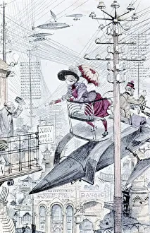
Background imageWorld Collection: Young lady paying calls by personal airship among a maze of telegraph and telephone wires

Young lady paying calls by personal airship among a maze of telegraph and telephone wires. Robidas idea of world in 1953. From A Robida Le Vingtieme Siecle Paris 1883

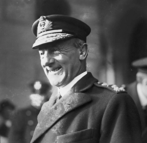
Background imageWorld Collection: Admiral John Jellicoe (1859-1935) who commanded the British Grand Fleet at the Battle of Jutland

Admiral John Jellicoe (1859-1935) who commanded the British Grand Fleet at the Battle of Jutland (1916) in World War I. Jutland was an indecisive naval battle between heavily armed dreadnoughts

Background imageWorld Collection: Bee Hummingbird (Mellisuga helenae) immature male, perched on vine, worlds smallest bird

Bee Hummingbird (Mellisuga helenae) immature male, perched on vine, worlds smallest bird, Zapata Peninsula, Matanzas Province, Cuba, March

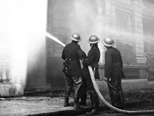
Background imageWorld Collection: Blitz in City of London -- Newgate Street, WW2

Blitz in City of London -- Newgate Street, WW2
Blitz in the City of London -- three firefighters in action with a hosepipe outside Newgate Street post office, 30 December 1940

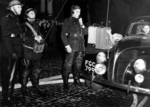
Background imageWorld Collection: WW2 - Blitz on London - Fire Force Commander taking charge

WW2 - Blitz on London - Fire Force Commander taking charge
WW2 - Blitz on London - Fire Force Commander C P McDuell takes charge at a major fire. Senior Company Officer Jimmy Syrett operates the walkie talkie set and Company Officer Obie Walker

Background imageWorld Collection: Blitz in London -- warehouses, Surrey Docks, WW2

Blitz in London -- warehouses, Surrey Docks, WW2
Warehouses in a smoky atmosphere following heavy bombing raids on the Surrey Commercial Docks in Rotherhithe, SE London. This raid took place on 7 September 1940

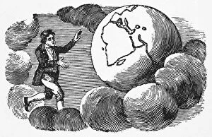
Background imageWorld Collection: MAN, EARTH & CLOUDS. Wood engraving by Thomas Bewick, early 19th century

MAN, EARTH & CLOUDS. Wood engraving by Thomas Bewick, early 19th century

Background imageWorld Collection: The Lighthouse On Pharos Island, Alexandria, Egypt, After A Fanciful 19Th Century Illustration

The Lighthouse On Pharos Island, Alexandria, Egypt, After A Fanciful 19Th Century Illustration. It Was One Of The Seven Wonders Of The Ancient World

Background imageWorld Collection: Temple Of Apollo; Delphi, Greece

Temple Of Apollo; Delphi, Greece

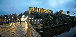
Background imageWorld Collection: Pedestrians Walking On A Walkway Over A River At Dusk With Durham Cathedral And Castle On A

Pedestrians Walking On A Walkway Over A River At Dusk With Durham Cathedral And Castle On A Hilltop; Durham, England

Background imageWorld Collection: 4th Hallamshire Machine Gun Section, c. 1914-1918

4th Hallamshire Machine Gun Section, c. 1914-1918
From an album of photographs of the Hallamshire Rifles (1st Hallamshire Volunteer Battalion, York and Lancaster Regiment). From an original item at Sheffield Libraries: arc00436

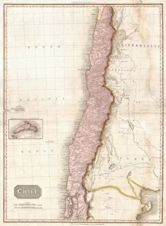
Background imageWorld Collection: 1818, Pinkerton Map of Chile, John Pinkerton, 1758 - 1826, Scottish antiquarian, cartographer

1818, Pinkerton Map of Chile, John Pinkerton, 1758 - 1826, Scottish antiquarian, cartographer, UK

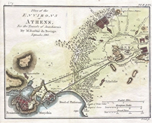
Background imageWorld Collection: 1784, Bocage Map of the City of Athens in Ancient Greece, topography, cartography

1784, Bocage Map of the City of Athens in Ancient Greece, topography, cartography
1784, Bocage Map of the City of Athens in Ancient Greece

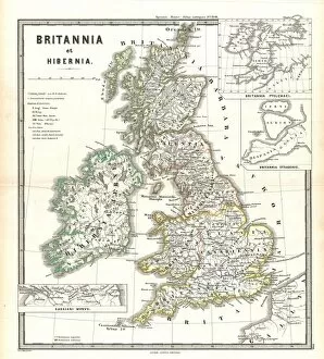
Background imageWorld Collection: 1865, Spruner Map of the British Isles, England, Scotland, Ireland, topography, cartography

1865, Spruner Map of the British Isles, England, Scotland, Ireland, topography, cartography
1865, Spruner Map of the British Isles, England, Scotland, Ireland

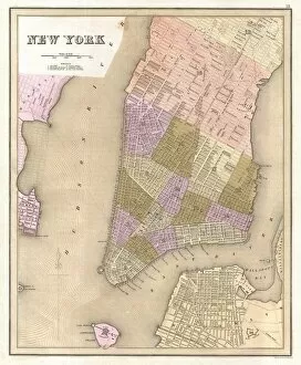
Background imageWorld Collection: 1839, Bradford Map of New York City, New York, topography, cartography, geography

1839, Bradford Map of New York City, New York, topography, cartography, geography
1839, Bradford Map of New York City, New York

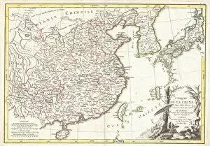
Background imageWorld Collection: 1770, Bonne Map of China, Korea, Japan and Formosa, Rigobert Bonne 1727 - 1794, one

1770, Bonne Map of China, Korea, Japan and Formosa, Rigobert Bonne 1727 - 1794, one of the most important cartographers of the late 18th century


All Professionally Made to Order for Quick Shipping

"Exploring the Vastness: A Journey through the World" Embarking on a historical voyage, we delve into the depths of time with Al-Idrisi's world map from 1154. This ancient cartographic masterpiece unveils the intricate knowledge and curiosity that shaped our understanding of the world. As dusk descends upon Uluru, Ayers Rock in Australia, nature paints a breathtaking canvas with hues of orange and pink. The sunset at this sacred site reminds us of Earth's awe-inspiring beauty and its ability to captivate our senses. Traveling back to 1886, we uncover Walter Crane's map showcasing the vast expanse of the British Empire. It serves as a reminder of an era when nations sought to expand their influence across continents, leaving lasting imprints on history. In Namibia's Walvis Bay, white pelicans gracefully glide over shimmering waters. Their presence symbolizes harmony within nature and highlights how diverse ecosystems coexist harmoniously in different corners of our planet. The scars left by war are etched into Brampton Road in Bexleyheath from World War II bombings. These remnants serve as poignant reminders that peace is fragile and must be cherished above all else. A satirical cartoon by James Gillray takes us back to 1805 when Napoleon Bonaparte attempted peace negotiations with British Prime Minister William Pitt. Depicting them carving up the world like plumb pudding, it humorously portrays political power struggles amidst global affairs. Revving engines echo as BMW S1000RR motorcycles race against time, embodying human innovation and pushing boundaries beyond what was once thought possible – reminding us that progress knows no bounds. Al-Idrisi's Tabula Rogeriana transports us further back to medieval times when maps were meticulously hand-drawn for Sicilian King Roger II. This remarkable piece showcases early geographical knowledge while highlighting cultural exchange between civilizations.