Fraud Blocker Skip to main content

Home > Granger Art on Demand > Maps

Maps Collection

Choose a picture from our Maps Collection for your Wall Art and Photo Gifts

394 items

We are proud to offer this selection in partnership with Granger Art on Demand

Background imageMaps Collection: MAP: PHILIPPINES, 1905. Map of the Philippine Islands printed in the United States in 1905

MAP: PHILIPPINES, 1905. Map of the Philippine Islands printed in the United States in 1905

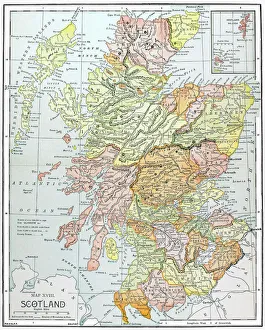
Background imageMaps Collection: MAP: SCOTLAND. Line engraving, 19th century

MAP: SCOTLAND. Line engraving, 19th century

Background imageMaps Collection: MAP: BRITISH EMPIRE, 1886. Map, 1886, of the British Empire by Walter Crane

MAP: BRITISH EMPIRE, 1886. Map, 1886, of the British Empire by Walter Crane. The small insert shows, in red, the extent of the British territories in 1786

Background imageMaps Collection: MAP OF ITALY, c1585. By Ignazio Danti from Sistine Chapel Gallery of Maps

MAP OF ITALY, c1585. By Ignazio Danti from Sistine Chapel Gallery of Maps

Background imageMaps Collection: STRABO WORLD MAP, c20 A. D. According to the writings of the Greek geographer Strabo

STRABO WORLD MAP, c20 A. D. According to the writings of the Greek geographer Strabo
STRABO WORLD MAP, c20 A.D. According to the writings of the Greek geographer Strabo: a 19th century reconstruction

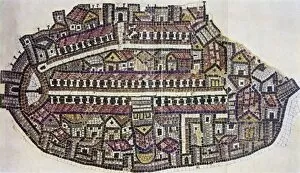
Background imageMaps Collection: MADABA MAP, 6TH CENTURY. The Madaba Mosaic Map, the oldest known map of the city of Jerusalem

MADABA MAP, 6TH CENTURY. The Madaba Mosaic Map, the oldest known map of the city of Jerusalem, located in the Byzantine Church of Saint George at Madaba, Jordan, 6th century A.D

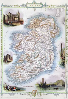
Background imageMaps Collection: MAP: IRELAND, 1851. An engraved map of Ireland, 1851

MAP: IRELAND, 1851. An engraved map of Ireland, 1851

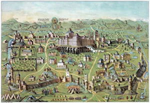
Background imageMaps Collection: ANCIENT JERUSALEM. The ancient city of Jerusalem, with Solomons Temple in the center

ANCIENT JERUSALEM. The ancient city of Jerusalem, with Solomons Temple in the center. Lithograph, c1851

Background imageMaps Collection: WORLD MAP, 1529. The Western Hemisphere in the world map by Franciscus Monachus

WORLD MAP, 1529. The Western Hemisphere in the world map by Franciscus Monachus, from De orbis situ, Antwerp, 1529. North America is misrepresented as an extension of Asia

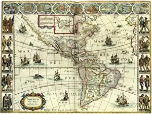
Background imageMaps Collection: MAP: AMERICAS, c1630. A map of North and South America created by Dutch cartographer

MAP: AMERICAS, c1630. A map of North and South America created by Dutch cartographer and atlas maker Willem Blaeu. Map, c1630

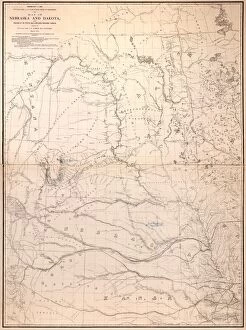
Background imageMaps Collection: MAP: NEBRASKA, 1867. Map of Nebraska and Dakota and portions of the states

MAP: NEBRASKA, 1867. Map of Nebraska and Dakota and portions of the states and territories bordering thereon, 1867

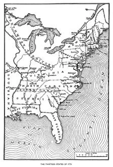
Background imageMaps Collection: MAP: THIRTEEN STATES. A map of the thirteen original American states, the Northwest Territory

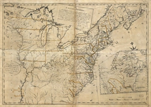
MAP: THIRTEEN STATES. A map of the thirteen original American states, the Northwest Territory and Louisiana, as it appeared in the 1770s. Engraving, c1900

Background imageMaps Collection: MAP: JAMAICA, 1893. British map of Jamaica by Colin Liddell, published 1893

MAP: JAMAICA, 1893. British map of Jamaica by Colin Liddell, published 1893

Background imageMaps Collection: MAP: JAMAICA, 1752. British map of the island of Jamaica, divided into its principal parishes

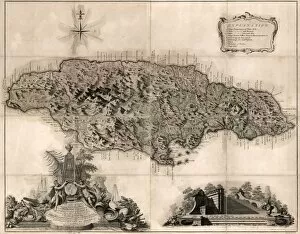
MAP: JAMAICA, 1752. British map of the island of Jamaica, divided into its principal parishes, published 1752

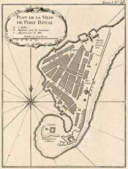
Background imageMaps Collection: MAP: JAMAICA, 1764. French map of Port Royal, Jamaica, by Jacques Nicolas Bellin

MAP: JAMAICA, 1764. French map of Port Royal, Jamaica, by Jacques Nicolas Bellin, published 1764

Background imageMaps Collection: MAP: JAMAICA, 1767. French map of the islands of Jamaica and Bermuda, published 1767

MAP: JAMAICA, 1767. French map of the islands of Jamaica and Bermuda, published 1767

Background imageMaps Collection: MAP: JAMAICA, 1763. British map of the island of Jamaica, published 1763

MAP: JAMAICA, 1763. British map of the island of Jamaica, published 1763

Background imageMaps Collection: MAP: JAMAICA, 1756. British map of the harbors of Port Royal and Kingston, Jamaica

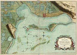
MAP: JAMAICA, 1756. British map of the harbors of Port Royal and Kingston, Jamaica from surveys by Richard Jones, 1756

Background imageMaps Collection: MAP: JAMAICA, 1755. British map of Jamaica from surveys by Mr. Sheffield, drawn by Patrick Browne

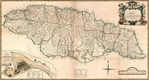
MAP: JAMAICA, 1755. British map of Jamaica from surveys by Mr. Sheffield, drawn by Patrick Browne, 1755

Background imageMaps Collection: MAP: JAMAICA, 1755. French map of Port Royal in Jamaica by Georges Louis Le Rouge, 1755

MAP: JAMAICA, 1755. French map of Port Royal in Jamaica by Georges Louis Le Rouge, 1755

Background imageMaps Collection: MAP: USA, 1783. The United States according to the definitive treaty of peace

MAP: USA, 1783. The United States according to the definitive treaty of peace signed at Paris Sept. 3d. 1783. Map by William McMurray, 1784

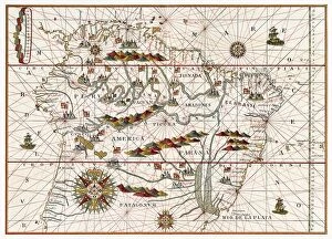
Background imageMaps Collection: MAP: AMERICA, 1582. Map of South America by Juan Martinez, 1582

MAP: AMERICA, 1582. Map of South America by Juan Martinez, 1582

Background imageMaps Collection: SHAKER VILLAGE MAP, 1849. Diagram of the South part of Shaker Village in Canterbury

SHAKER VILLAGE MAP, 1849. Diagram of the South part of Shaker Village in Canterbury, New Hampshire. Ink and watercolor on paper by Peter Foster, 1849

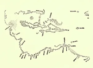
Background imageMaps Collection: MAP: CARIBBEAN, 1511. The first map to show Bermuda, also showing coastline detail

MAP: CARIBBEAN, 1511. The first map to show Bermuda, also showing coastline detail of the Bay Islands of Honduras at Guanaca and Florida (labeled Isla de Beimenhi)

Background imageMaps Collection: ISOGONIC MAP, 1888. Isogonic map showing the lines of magnetic declination in the United States

ISOGONIC MAP, 1888. Isogonic map showing the lines of magnetic declination in the United States, 1888

Background imageMaps Collection: HOLY LAND, 1695. Map of the Holy Land from a Passover Haggadah, 1695

HOLY LAND, 1695. Map of the Holy Land from a Passover Haggadah, 1695

Background imageMaps Collection: MAP: WALDSEEMUELLER, 1507. Universalis Cosmographia Secundum Ptholomaei Traditionem

MAP: WALDSEEMUELLER, 1507. Universalis Cosmographia Secundum Ptholomaei Traditionem et Americi Vespucii Alioru[m]que Lustrationes. Map by Martin Waldseemueller, 1507

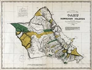
Background imageMaps Collection: MAP: OAHU, 1881. Map of Oahu, Hawaiian Islands. Map by C. J. Lyons, 1881

MAP: OAHU, 1881. Map of Oahu, Hawaiian Islands. Map by C. J. Lyons, 1881
MAP: OAHU, 1881. Map of Oahu, Hawaiian Islands. Map by C.J. Lyons, 1881

Background imageMaps Collection: MAP: MAUI, 1885. Map of Maui, Hawaiian Islands. Map by F. S. Dodge, 1885

MAP: MAUI, 1885. Map of Maui, Hawaiian Islands. Map by F. S. Dodge, 1885
MAP: MAUI, 1885. Map of Maui, Hawaiian Islands. Map by F.S. Dodge, 1885

Background imageMaps Collection: IRELAND, 1797. Map of Ireland by Daniel Augustus Beaufort, 1797

IRELAND, 1797. Map of Ireland by Daniel Augustus Beaufort, 1797

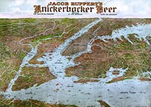
Background imageMaps Collection: NEW YORK CITY, 1912. Panoramic view of New York City and vicinity. Lithograph, c1912

NEW YORK CITY, 1912. Panoramic view of New York City and vicinity. Lithograph, c1912

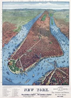
Background imageMaps Collection: NEW YORK CITY, c1879. Bird s-eye view of New York City. Map drawn by J. W. Williams

NEW YORK CITY, c1879. Bird s-eye view of New York City. Map drawn by J. W. Williams
NEW YORK CITY, c1879. Bird s-eye view of New York City. Map drawn by J.W. Williams, published by Root & Tinker, 1879

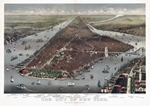
Background imageMaps Collection: NEW YORK CITY, 1884. Bird s-eye view of New York and parts of Brooklyn

NEW YORK CITY, 1884. Bird s-eye view of New York and parts of Brooklyn. Lithograph by Currier & Ives, 1884

Background imageMaps Collection: MAP: FLORIDA, 1898. The east coast of Florida is paradise regained

MAP: FLORIDA, 1898. The east coast of Florida is paradise regained. Lithograph for the Florida East Coast Railway and Florida East Coast Steamship Co. 1898

Background imageMaps Collection: ANDERSONVILLE PRISON, 1864. Plan of the Confederate prison at Andersonville, Georgia

ANDERSONVILLE PRISON, 1864. Plan of the Confederate prison at Andersonville, Georgia. Drawn by Robert Knox Sneden while he was a prisoner there, 1864

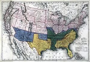
Background imageMaps Collection: MAP: CIVIL WAR, 1864. Map of the United States, showing the territory in possession

MAP: CIVIL WAR, 1864. Map of the United States, showing the territory in possession of the Federal Union, January, 1864

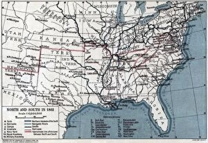
Background imageMaps Collection: MAP: CIVIL WAR, 1861. Map showing the division of the North and South in 1861. Lithograph

MAP: CIVIL WAR, 1861. Map showing the division of the North and South in 1861. Lithograph, 1921

Background imageMaps Collection: MAP: BROOKLYN, 1890. Map of Kings County, New York. Lithograph, 1890

MAP: BROOKLYN, 1890. Map of Kings County, New York. Lithograph, 1890

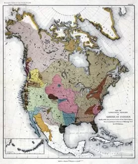
Background imageMaps Collection: MAP: AMERICAN INDIANS. Map of linguistic stocks of American Indians. Lithograph, 1890

MAP: AMERICAN INDIANS. Map of linguistic stocks of American Indians. Lithograph, 1890

Background imageMaps Collection: MAP: BROOKLYN, 1897. Birds eye view of Brooklyn, New York. Lithograph, 1897

MAP: BROOKLYN, 1897. Birds eye view of Brooklyn, New York. Lithograph, 1897

Background imageMaps Collection: MAP: BROOKLYN, 1908. Birds eye view of Brooklyn, New York. Lithograph, 1908

MAP: BROOKLYN, 1908. Birds eye view of Brooklyn, New York. Lithograph, 1908

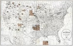
Background imageMaps Collection: MAP: RESERVATIONS, 1888. Map showing the location of the Indian reservations within

MAP: RESERVATIONS, 1888. Map showing the location of the Indian reservations within the limits of the United States and territories. Lithograph, 1888

Background imageMaps Collection: MAP: RESERVATIONS, 1892. Map showing Indian reservations within the limits of the United States

MAP: RESERVATIONS, 1892. Map showing Indian reservations within the limits of the United States, compiled under the direction of the Hon. T.J. Morgan, Commissioner of Indian Affairs

Background imageMaps Collection: MAP: NORTH PACIFIC. The Russian discoveries from the map published by the Imperial Academy of St

MAP: NORTH PACIFIC. The Russian discoveries from the map published by the Imperial Academy of St. Petersburg, showing the voyage of the Great Northern Expedition led by Vitus Bering, 1733-1743

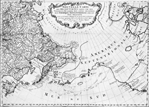
Background imageMaps Collection: MAP: NORTH PACIFIC. Nouvelle Carte des ecouvertes faites par des Vaisseaux Russiens

MAP: NORTH PACIFIC. Nouvelle Carte des ecouvertes faites par des Vaisseaux Russiens, showing the voyage of the Great Northern Expedition led by Vitus Bering, 1733-1743. Map by the St

Background imageMaps Collection: MAP: NORTH AND SOUTH, 1861. Map showing the comparitive area of the Northern

MAP: NORTH AND SOUTH, 1861. Map showing the comparitive area of the Northern and Southern states east of the Rocky Mountains. Engraving, 1861

Background imageMaps Collection: MAP: MARYLAND, 1863. The New War Map Of Maryland, Part Of Virginia & Pennsylvania

MAP: MARYLAND, 1863. The New War Map Of Maryland, Part Of Virginia & Pennsylvania. Map by B.B. Russell, 1863

Background imageMaps Collection: MAP: VANCOUVER ISLAND, 1859. Map of Vancouver Island and Washington Territory

MAP: VANCOUVER ISLAND, 1859. Map of Vancouver Island and Washington Territory, shwoing San Juan Island and the disputed territory. Map, 1859


All Professionally Made to Order for Quick Shipping


-

Why Choose Us?

We are a leading provider of Art Prints and Photo Gifts since 2004, working in partnership with a range of Sporting Clubs, Charities, Museums and Picture Libraries. A large share of profits from any of their images will go directly towards supporting that charity or club. Our archive of images is carefully curated to bring you a wide range of subjects, including landscapes, wildlife, architecture, and more. We ship from our partner labs in the UK, USA, EU (Netherlands) and Australia.
+

How do I place an order?

Ordering is quick & easy - Just follow 5 Simple Steps:
  1. Find your image: Use our search box or browse our online photo Collections to find the image you want.

  2. Choose your print format: Select your desired product and add it to your cart.

  3. Enter your details: If you're a returning customer, simply enter your email address and password, and we'll fill in your billing and shipping address details. All personal details are held securely and are fully GDPR compliant. As standard, we remove all Personally Identifiable Information after 12 months.

  4. Pay for your purchase: We use state-of-the-art security for online shopping and do not have access to your card details.

  5. Sit back and relax: We'll email you confirmation of your order and when it's dispatched. Registered customers can also track orders in the 'My Account' area.

+

How do I pay for an order?

You can pay for your order with most of the major credit and debit cards, or PayPal. For added security, major financial institutions process payment details separately and securely on our behalf. We do not have access to your online payment card details. Online payments are preferred however we do take phone orders. For UK customers only we accept cheques issued against a UK bank.
+

Is my data safe?

We take data security very seriously. We do not have access to your full card details and all payments are requested over a fully secure connection. Additionally, we fully comply with current European and GDPR legislation, and automatically remove all personal data after at most 12 months (unless you have an account with us and have signed in recently). We also have a strict opt-in policy and would never sell your personal details. Your data is only used to fulfill your order promptly and efficiently.
+

Is wall art ready to hang?

For quick and easy installation all wall art, including framed prints, canvas prints and metal prints are supplied with a ready to hang solution on the back. Generally, saw tooth hangers are applied as they allow wall art to hang flush against the wall. The serrated edge of the hanger prevents the frame from shifting or tilting when hung.
+

Are the photo prints fade resistant?

Yes, we use archival quality photo paper photographic paper for vivid reproduction Prints are an accurate representations of the original artwork, which is preserved for artistic character and authenticity. We guarantee they match previews shown on our web site