Fraud Blocker Skip to main content

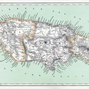
MAP: JAMAICA, 1893. British map of Jamaica by Colin Liddell, published 1893

MAP: JAMAICA, 1893. British map of Jamaica by Colin Liddell, published 1893
Sold 6
In Stock
We accept all major payment options so you can pay for the things you need in the way that is most convenient for you

Granger Photo Prints and Wall Art

MAP: JAMAICA, 1893. British map of Jamaica by Colin Liddell, published 1893

MAP: JAMAICA, 1893.
British map of Jamaica by Colin Liddell, published 1893. Granger holds millions of images spanning more than 25,000 years of world history, from before the Stone Age to the dawn of the Space Age.

Media ID 12321410

1893 British Colin Island Jamaica Liddell

SECURE PAYMENTS
We accept all major payment options so you can pay for the things you need in the way that is most convenient for you

Made in Australia
Safe Shipping, Easy Returns

FREE PERSONALISATION
We are proud to offer a range of customisation including Cropping, Captions, and Filters. Zoom Cropping can be adjusted in the basket


EDITORS COMMENTS

This print showcases a remarkable piece of history - a British map of Jamaica from 1893. Created by the talented cartographer Colin Liddell, this intricately detailed engraving offers a glimpse into the island's past during the late 19th century. The map itself is a testament to Liddell's expertise and dedication, as every contour and feature of Jamaica is meticulously depicted. From its lush landscapes to its bustling towns and cities, this vintage map provides an invaluable snapshot of the island's geography at that time. As we delve into this historical artifact, we are transported back to an era when Jamaica was under British rule. The mid-1890s marked a significant period for the island nation as it navigated through various social, political, and economic changes. Through careful examination of this print, one can uncover hidden details embedded within its borders - perhaps discovering forgotten landmarks or tracing ancestral roots on this Caribbean gem. Granger Art on Demand has beautifully preserved this piece from their extensive collection in New York City. By offering us access to such rare artifacts like "MAP: JAMAICA, 1893" they allow us to connect with our shared heritage and gain deeper insights into our world's rich tapestry of cultures and histories.


Framed Prints

Introducing the stunning addition to your decor from Media Storehouse's Framed Prints collection: a vintage, antique map of Jamaica from 1893. This exquisite piece, published by The Granger Collection in New York City, is an authentic reproduction of a British map created by Colin Liddell. Travel back in time with this captivating historical artifact, showcasing intricate detail and vibrant colors. Elevate the look of your home or office with this unique and educational framed print. Experience the charm of the past, brought to life in the present.


Photo Prints

Discover the rich history of Jamaica with our vintage Map Print from Granger, NYC. This exquisite 1893 British map of Jamaica, created by Colin Liddell, offers a captivating glimpse into the past. The intricate details and authentic antique aesthetic make this print an exceptional addition to your home or office. Travel back in time and adorn your space with this beautiful piece from The Granger Collection, available now through Granger Art on Demand.


Poster Prints

Discover the rich history of Jamaica with our vintage Map: Jamaica, 1893 poster print. This beautiful antique map, published by Colin Liddell in 1893, offers a captivating glimpse into the past, showcasing Jamaica during the British colonial era. The intricate details of this map, available through Granger Art on Demand, make it an excellent addition to any home or office space. Bring a touch of history and culture into your surroundings with this stunning piece from The Granger Collection, New York City.


Jigsaw Puzzles

Discover the rich history of Jamaica with our captivating jigsaw puzzle from Media Storehouse. This intricately designed puzzle features a vintage map of Jamaica, published in 1893 by Colin Liddell. Printed from The Granger Collection, this puzzle brings a piece of historical cartography into your home. Immerse yourself in the detailed depiction of Jamaica's geography during this era, and enjoy the satisfying process of piecing together this beautiful and educational puzzle. Travel back in time and explore the wonders of Jamaica's past, one puzzle piece at a time.

diamond
Made With High Grade Materials
thumb_up
Professional Quality Finish
package_2
Carefully Packed To Aid Safe Arrival

You May Also Like


Jamaica country mapJamaica country map
Add to Basket
Maps / JamaicaMaps / Jamaica
Add to Basket
Dunns River Falls, Ocho Rios, Jamaica, West Indies, Caribbean, Central AmericaDunns River Falls, Ocho Rios, Jamaica, West Indies, Caribbean, Central America
Add to Basket
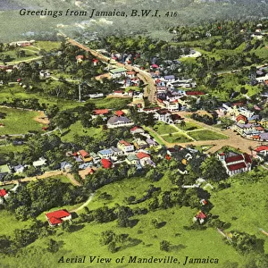
Jamaica, West Indies - The Town of Mandeville - Aerial ViewJamaica, West Indies - The Town of Mandeville - Aerial View
Add to Basket
Caribbean mapCaribbean map
Add to Basket
Ricks CafeRicks Cafe
Add to Basket
Morgan Aero 8 BritishMorgan Aero 8 British
Add to Basket
Caribbean islands, 1870sCaribbean islands, 1870s
Add to Basket
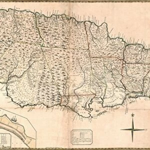
MAP: JAMAICA, 1755. British map of Jamaica from surveys by Mr. Sheffield, drawn by Patrick BrowneMAP: JAMAICA, 1755. British map of Jamaica from surveys by Mr. Sheffield, drawn by Patrick Browne
Add to Basket
Tunisia country mapTunisia country map
Add to Basket
Newcastle, in the Blue Mountains, Jamaica, 19th CenturyNewcastle, in the Blue Mountains, Jamaica, 19th Century
Add to Basket
View over Blue Mountains towards Kingston at sunset, Saint Andrew Parish, JamaicaView over Blue Mountains towards Kingston at sunset, Saint Andrew Parish, Jamaica
Add to Basket

Gallery Wall Inspiration

MAP: PHILIPPINES, 1905. Map of the Philippine Islands printed in the United States in 1905
MAP: SCOTLAND. Line engraving, 19th century
MAP: BRITISH EMPIRE, 1886. Map, 1886, of the British Empire by Walter Crane
MAP OF ITALY, c1585. By Ignazio Danti from Sistine Chapel Gallery of Maps
MAP: JAMAICA, 1893. British map of Jamaica by Colin Liddell, published 1893
MAP OF FRANCE, c1900. With inset detail of Paris and surrounding area
MAP: HAWAII, 1905. Map of the Hawaiian Islands printed in the United States in 1905
MAP OF MACEDONIAN EMPIRE. Map of the Macedonian Empire following the conquests of Alexander the Great, 4th
MAP: CUBA, 1900. Map of Cuba printed in the United States, c1900
MAP: IRELAND, 1851. An engraved map of Ireland, 1851
PLYMOUTH, MA, MAP 1605. Samuel de Champlains map of Port St. Louis, later settled by the English as Plymouth, Massachusetts, drawn during an expedetion of 1605
VESPUCCIs WORLD MAP, 1526. Juan Vespuccis world map, 1526
STRABO WORLD MAP, c20 A. D. According to the writings of the Greek geographer Strabo
WORLD MAP, 11th CENTURY. The Cottonian or Anglo-Saxon World Map
VENICE: MAP, 17TH CENTURY. Map of Venice by Guiseppe Heintz, 17th century
WORLD MAP. Pre-Christian era, c450 B. C. according to the writings of Herodotus
MADABA MAP, 6TH CENTURY. The Madaba Mosaic Map, the oldest known map of the city of Jerusalem
CONSTELLATION MAP. An Indian Sanskrit star map, 1840, ordered as a manuscript horoscope for Prince
MAP: UNITED STATES, 1905. Map of the continental United States (excluding Alaska), 1905
TENOCHTITLAN (MEXICO CITY) at the time of the Spanish Conquest: colored woodcut, 1556
CARIBBEAN MAP. A map of the Caribbean islands: woodcut, French, c. 1688
AFRICA: MAP. Birds eye view of the Sudan and surrounding countries
CANTINO WORLD MAP, 1502. Western half of the Cantino map of the world
ICELAND: MAP, 1595. Map of Iceland from a 1595 edition of Abraham Ortelius atlas Theatrum
ST. BRENDAN: MASS. St. Brendan and his monks celebrate Mass on the back of a whale


© Copyright Media Storehouse, All Rights Reserved 2003 - 2024
Facebook     Pinterest     100% Payment Secure     Reviews IO