Fraud Blocker Skip to main content

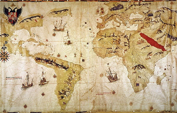
VESPUCCIs WORLD MAP, 1526. Juan Vespuccis world map, 1526

VESPUCCIs WORLD MAP, 1526. Juan Vespuccis world map, 1526
Sold 5
In Stock
We accept all major payment options so you can pay for the things you need in the way that is most convenient for you

Granger Photo Prints and Wall Art

VESPUCCIs WORLD MAP, 1526. Juan Vespuccis world map, 1526

VESPUCCIs WORLD MAP, 1526. Juan Vespuccis world map, 1526. Granger holds millions of images spanning more than 25,000 years of world history, from before the Stone Age to the dawn of the Space Age.

Media ID 6622355

1526 Age Of Discovery Continent Juan New World Portolan Chart Ship Vespucci World

SECURE PAYMENTS
We accept all major payment options so you can pay for the things you need in the way that is most convenient for you

Made in Australia
Safe Shipping, Easy Returns

FREE PERSONALISATION
We are proud to offer a range of customisation including Cropping, Captions, and Filters. Zoom Cropping can be adjusted in the basket


EDITORS COMMENTS

This print showcases the iconic "VESPUCCIs WORLD MAP, 1526" a masterpiece created by Juan Vespucci during the Renaissance period. Stepping into the world of exploration and maritime adventure, this map takes us back to the Age of Discovery when intrepid explorers set sail in search of new lands and treasures. The intricate details on this map transport us to a time when continents were still being discovered and charted. The carefully drawn coastlines reveal the vastness of unexplored territories waiting to be conquered. Ships gracefully glide across oceans, symbolizing the spirit of adventure that fueled these expeditions. As we delve deeper into this artwork, our eyes are drawn to rivers winding through lush landscapes, connecting distant regions with their life-giving waters. Each portolan chart meticulously marked represents a gateway for trade and cultural exchange between civilizations. Juan Vespucci's world map is not just an artistic representation; it encapsulates an era defined by curiosity and ambition. It serves as a testament to human ingenuity and determination in unraveling the mysteries of our planet. This print from Granger Art on Demand allows us to bring home a piece of history, reminding us that there is always more to explore beyond what meets the eye. Let it inspire you with its beauty and ignite your own sense of wanderlust as you embark on your own journey through life's uncharted territories.


Framed Prints

Discover the captivating history of exploration with our Framed Prints featuring Juan Vespucci's World Map from 1526. This exquisite piece, sourced from The Granger Collection at Granger Art on Demand, showcases intricate detail and vibrant colors. The map, created by the Italian explorer himself, is a testament to the spirit of discovery and the early understanding of the world. Add this stunning work of art to your home or office to inspire curiosity and transport you back in time.


Photo Prints

Discover the captivating history of exploration with our exquisite collection of photographic prints featuring Juan Vespucci's World Map from 1526, available at Media Storehouse. This rare and intriguing map, sourced from The Granger Collection through Granger Art on Demand, showcases the groundbreaking cartography of the early 16th century. With stunning detail and exceptional clarity, this photographic print brings to life the vast new world that Vespucci and his contemporaries discovered, charted, and named. Delve into the rich history of geography and cartography, and adorn your walls with this unique and captivating piece.


Poster Prints

Discover the intriguing history of explorations with our stunning poster print of Juan Vespucci's World Map from 1526. This captivating vintage map, sourced from The Granger Collection, showcases the newly discovered lands of the Americas, adding an enchanting touch to any room. Bring the spirit of adventure into your home or office with this exquisite piece from Media Storehouse's Poster Prints collection.


Jigsaw Puzzles

Discover the rich history of cartography with our captivating Jigsaw Puzzle from Media Storehouse, featuring Juan Vespucci's World Map from 1526. This intriguing puzzle brings you a piece of history as you piece together the iconic image of Vespucci's map, which was one of the earliest European maps to depict the New World. The exquisite detail and vibrant colors of "Vespucci's World Map, 1526" by The Granger Collection are beautifully captured in this puzzle, making it an engaging and educational experience for puzzle enthusiasts and history buffs alike. Immerse yourself in the past as you reconstruct this fascinating piece of cartographic history.

diamond
Made With High Grade Materials
thumb_up
Professional Quality Finish
package_2
Carefully Packed To Aid Safe Arrival

You May Also Like


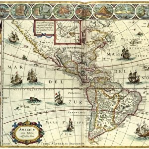
MAP: AMERICAS, c1630. A map of North and South America created by Dutch cartographerMAP: AMERICAS, c1630. A map of North and South America created by Dutch cartographer
Add to Basket
CHAPLIN: THE GOLD RUSH. Charlie Chaplin in a scene from The Gold Rush, 1925CHAPLIN: THE GOLD RUSH. Charlie Chaplin in a scene from The Gold Rush, 1925
Add to Basket
ARRIVAL OF AMERIGO VESPUCCI in the New World. (Vespucci meeting the allegorical representation of America). Engraving by Theodor Galle after the drawing, c1580, by StradanusARRIVAL OF AMERIGO VESPUCCI in the New World. (Vespucci meeting the allegorical representation of America). Engraving by Theodor Galle after the drawing, c1580, by Stradanus
Add to Basket
Billy LiarBilly Liar
Add to Basket
South American cannibals, 16th centurySouth American cannibals, 16th century
Add to Basket
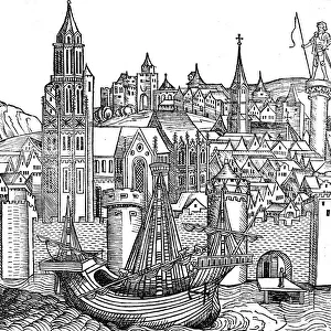
View of fortified city, 1493View of fortified city, 1493
Add to Basket
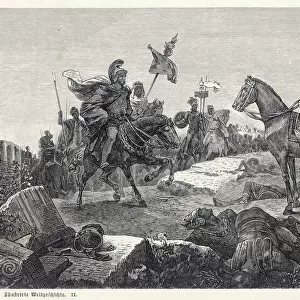
Scipio Africanus meeting Hannibal at Battle of ZamaScipio Africanus meeting Hannibal at Battle of Zama
Add to Basket
Bonhomme Richard / SerapisBonhomme Richard / Serapis
Add to Basket
Charlie Chaplin and Paulette Goddard in Modern Times (1936)Charlie Chaplin and Paulette Goddard in Modern Times (1936)
Add to Basket
Three Castles. Deal, Walmer and Sandown J920039Three Castles. Deal, Walmer and Sandown J920039
Add to Basket
Advert for Chaplin in The Gold RushAdvert for Chaplin in The Gold Rush
Add to Basket
Map of Britain in 597 ADMap of Britain in 597 AD
Add to Basket

Gallery Wall Inspiration

MAP: PHILIPPINES, 1905. Map of the Philippine Islands printed in the United States in 1905
MAP: SCOTLAND. Line engraving, 19th century
MAP: BRITISH EMPIRE, 1886. Map, 1886, of the British Empire by Walter Crane
MAP OF ITALY, c1585. By Ignazio Danti from Sistine Chapel Gallery of Maps
MAP: JAMAICA, 1893. British map of Jamaica by Colin Liddell, published 1893
MAP OF FRANCE, c1900. With inset detail of Paris and surrounding area
MAP: HAWAII, 1905. Map of the Hawaiian Islands printed in the United States in 1905
MAP OF MACEDONIAN EMPIRE. Map of the Macedonian Empire following the conquests of Alexander the Great, 4th
MAP: CUBA, 1900. Map of Cuba printed in the United States, c1900
MAP: IRELAND, 1851. An engraved map of Ireland, 1851
PLYMOUTH, MA, MAP 1605. Samuel de Champlains map of Port St. Louis, later settled by the English as Plymouth, Massachusetts, drawn during an expedetion of 1605
VESPUCCIs WORLD MAP, 1526. Juan Vespuccis world map, 1526
STRABO WORLD MAP, c20 A. D. According to the writings of the Greek geographer Strabo
WORLD MAP, 11th CENTURY. The Cottonian or Anglo-Saxon World Map
VENICE: MAP, 17TH CENTURY. Map of Venice by Guiseppe Heintz, 17th century
WORLD MAP. Pre-Christian era, c450 B. C. according to the writings of Herodotus
MADABA MAP, 6TH CENTURY. The Madaba Mosaic Map, the oldest known map of the city of Jerusalem
CONSTELLATION MAP. An Indian Sanskrit star map, 1840, ordered as a manuscript horoscope for Prince
MAP: UNITED STATES, 1905. Map of the continental United States (excluding Alaska), 1905
TENOCHTITLAN (MEXICO CITY) at the time of the Spanish Conquest: colored woodcut, 1556
CARIBBEAN MAP. A map of the Caribbean islands: woodcut, French, c. 1688
AFRICA: MAP. Birds eye view of the Sudan and surrounding countries
CANTINO WORLD MAP, 1502. Western half of the Cantino map of the world
ICELAND: MAP, 1595. Map of Iceland from a 1595 edition of Abraham Ortelius atlas Theatrum
ST. BRENDAN: MASS. St. Brendan and his monks celebrate Mass on the back of a whale


© Copyright Media Storehouse, All Rights Reserved 2003 - 2024
Facebook     Pinterest     100% Payment Secure     Reviews IO