Fraud Blocker Skip to main content

Home > Europe > United Kingdom > Scotland > Edinburgh > Edinburgh

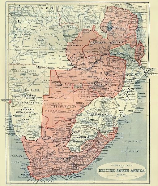
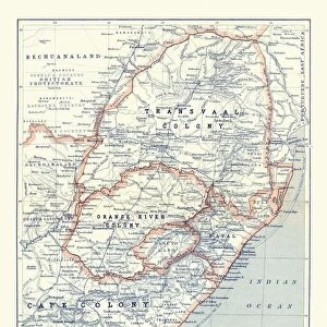
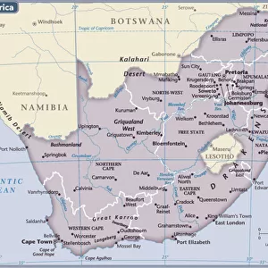
General Map of British South Africa, 1900. Creator: Unknown

General Map of British South Africa, 1900. Creator: Unknown
Sold 2
In Stock
We accept all major credit cards

Heritage Images Photo Prints and Wall Art

General Map of British South Africa, 1900. Creator: Unknown

General Map of British South Africa, 1900. From " South Africa and the Transvaal War, Vol. I", by Louis Creswicke. [T. C. & E. C. Jack, Edinburgh, 1900]. Heritage Images features heritage image collections. © The Print Collector/Heritage Images

Media ID 19780675

Cartography Creswicke Jack Louis Louis Creswicke Map Making Mapmaking South Africa South Africa And The Transvaal War Tc And Ec Tc And Ec Jack British Empire

FEATURES IN THESE COLLECTIONS

> Africa > South Africa > Maps

> Africa > South Africa > Related Images

> Arts > Literature > Illustration

> Arts > Literature

> Europe > United Kingdom > Scotland > Edinburgh > Edinburgh

> Europe > United Kingdom > Scotland > Lothian > Edinburgh

> Maps and Charts > Africa

> Maps and Charts > British Empire Maps

> Maps and Charts > Related Images

> Popular Themes > Edinburgh

SECURE PAYMENTS
We happily accept a wide range of payment options so you can pay for the things you need in the way that is most convenient for you

MADE IN AUSTRALIA
Safe Shipping with 30 Day Money Back Guarantee

FREE PERSONALISATION
We are proud to offer a range of customisation including Cropping, Captions, and Filters. Zoom Cropping can be adjusted in the Basket.


EDITORS COMMENTS

This print showcases a piece of history frozen in time - the "General Map of British South Africa, 1900". Created by an unknown artist, this map is a remarkable representation of the African continent during the colonial era. It was featured in Louis Creswicke's renowned book "South Africa and the Transvaal War, Vol. I", published by T. C. & E. C. Jack in Edinburgh in 1900. The map provides a comprehensive view of South Africa, highlighting its diverse geography and intricate cartography. It serves as a testament to the British Empire's influence on the region during that period, reflecting their colonial ambitions and territorial control. As we delve into this image, we are transported back to the late 19th century when exploration and colonization were at their peak. The artistry behind this illustration demonstrates meticulous attention to detail and precision in mapmaking techniques prevalent at that time. This print not only captures an important historical artifact but also represents a significant contribution to literature on African geography. Its presence evokes curiosity about how maps like these shaped perceptions of nations and territories within both academic circles and popular culture. Preserved by The Print Collector, this visual treasure allows us to appreciate the rich heritage of South Africa while contemplating its complex past marked by imperialism and colonialism.


Framed Prints

Discover the rich history of British South Africa with our stunning Framed Print of the General Map from the year 1900. This intriguing vintage map, taken from "South Africa and the Transvaal War, Vol. I" by Louis Creswicke, provides a captivating glimpse into the political landscape of the region during a pivotal period. The intricate details of the map are brought to life with our high-quality framing, making this a perfect addition to any home or office. Delve into the past and add a touch of history to your space with our General Map of British South Africa, 1900 Framed Print. Unknown creator, but known to ignite curiosity and conversation.


Photo Prints

Discover the historical depth of the past with our exquisite collection of vintage maps from Media Storehouse. This particular print showcases a General Map of British South Africa from the year 1900. Originally published in "South Africa and the Transvaal War, Vol. I" by Louis Creswicke, this map provides a fascinating insight into the geographical landscape and political boundaries of the region during that time. With intricate details and an authentic, aged appearance, this print is not just a decorative piece, but a window into history. Uncover the stories of the past and add a touch of historical charm to your home or office with our Media Storehouse range of Photographic Prints.


Poster Prints

Discover the rich history of British South Africa with our captivating poster print from Media Storehouse. This vintage map, created in 1900, depicts the general layout of British South Africa during the Transvaal War. The intricate details showcase the territories under British rule at the time, providing a fascinating glimpse into the past. Originally published in "South Africa and the Transvaal War, Vol. I" by Louis Creswicke, this rare map is now available as a stunning poster print. With its antique charm and historical significance, this poster is an excellent addition to any home office, classroom, or historical collection. Bring the past into your present with this captivating and authentic representation of British South Africa in 1900. Order your Media Storehouse poster print of the General Map of British South Africa today and embark on a journey through history.


Jigsaw Puzzles

Discover the rich history of British South Africa with our intricately designed Jigsaw Puzzle from Media Storehouse. This educational puzzle features a captivating General Map of British South Africa from 1900, as seen in the historic publication "South Africa and the Transvaal War, Vol. I." Delve into the intricacies of this unknown creator's work, a testament to the era's cartographic detail. Piece together this puzzle and bring a piece of history into your home. Ideal for history enthusiasts and puzzle lovers alike.

diamond
Made With High Grade Materials
thumb_up
Professional Quality Finish
package_2
Carefully Packed To Aid Safe Arrival

You May Also Like


Map of South Africa 1900Map of South Africa 1900
Add to Basket
General Map Of British South Africa. From The Book South Africa And The Transvaal War, Volume 1 By Louis Creswicke, Published 1900General Map Of British South Africa. From The Book South Africa And The Transvaal War, Volume 1 By Louis Creswicke, Published 1900
Add to Basket
Map /s Africa / Boer C1898Map /s Africa / Boer C1898
Add to Basket
Map of South Africa during the Second Boer WarMap of South Africa during the Second Boer War
Add to Basket
Pte Josiah Egerton Hills undated map of South AfricaPte Josiah Egerton Hills undated map of South Africa
Add to Basket
Map of Africa, 1902. Creator: UnknownMap of Africa, 1902. Creator: Unknown
Add to Basket
Map of South Africa, 1902. Creator: UnknownMap of South Africa, 1902. Creator: Unknown
Add to Basket
Map of Africa 1900Map of Africa 1900
Add to Basket
Map of South Africa 1896Map of South Africa 1896
Add to Basket
Map of Africa after the signing of the Anglo-French Agreement of March 1899 (colour litho)Map of Africa after the signing of the Anglo-French Agreement of March 1899 (colour litho)
Add to Basket
Map of Cape Colony, South AfricaMap of Cape Colony, South Africa
Add to Basket
South Africa country mapSouth Africa country map
Add to Basket

Gallery Wall Inspiration

Murrayfield Stadium Fine Art - Scotland Rugby Union
Dr Joseph Bell
Wells Shannon class lifeboat Duke of Edinburgh 13-46
Diego Velazquez (1599-1660). Old Woman Cooking Eggs, 1618
Wells Shannon class lifeboat Duke of Edinburgh 13-46
Trial 1949: MCC London to Edinburgh Run
Sir James Young Simpson (engraving)
Nigerian women, wearing feathered headdresses and traditional costumes
Launch a Memory event at the All-weather Lifeboat Centre (ALC) in Poole. Members of the public were invited to view the Wells-next-the-Sea Shannon class lifeboat Duke of Edinburgh 13-46 whilst on display at the ALC
Forth Rail Bridge over the River Forth illuminated at night, South Queensferry, Edinburgh, Midlothian, Scotland, United Kingdom, Europe
Queen Elizabeth II and Duke of Edinburgh, 1954
Boeing 747-400
Wells Shannon class lifeboat Duke of Edinburgh 13-46
Royal Wedding 1947 - family tree
The Military Tattoo
Map or Chart of the Caledonian Canal, or Inland Navigation from the Western to the Eastern Sea by Fort William and Inverness
Miss Jane Bowles, 1775, (1911). Artist: Sir Joshua Reynolds
Edinburgh, directly served by LMS, poster, c 1930s
Mallard steam train, Flying Scotsman service a062835
The Coronation, LNER poster, 1937
Launch a Memory event at the All-weather Lifeboat Centre (ALC) in Poole. Members of the public were invited to view the Wells-next-the-Sea Shannon class lifeboat Duke of Edinburgh 13-46 whilst on display at the ALC
Edinburgh, Scotland, United Kingdom
Pictorial map of Edinburgh
Forth railway bridge at night
Taymouth Castle, LMS poster, 1923-1947
Portobello, Edinburgh, Scotland
The Flying Scotsman pulls out of Londons Kings Cross station to make the last

Discover Our Collections


LiteratureLiterature
View Collection
IllustrationIllustration
View Collection
British Empire MapsBritish Empire Maps
View Collection
EdinburghEdinburgh
View Collection
South Africa Related ImagesSouth Africa Related Images
View Collection
MapsMaps
View Collection
Maps and Charts Related ImagesMaps and Charts Related Images
View Collection
EdinburghEdinburgh
View Collection
EdinburghEdinburgh
View Collection
AfricaAfrica
View Collection


© Copyright Media Storehouse, All Rights Reserved 2003 - 2024
Facebook     Pinterest     Card Payments     Reviews IO