Home > Arts > Artists > A > John White Alexander
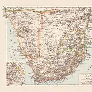
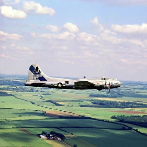
The New Territory which General Botha added to the Empire, 1916. Creator: Unknown

![]()
Wall Art and Photo Gifts from Heritage Images
The New Territory which General Botha added to the Empire, 1916. Creator: Unknown
The New Territory which General Botha added to the Empire, 1916. General Botha declared the Transvaal to the British Empire and represented the Boers in peace negotiations. From " The War Illustrated Album De Luxe - Volume IV. The Summer Campaign - 1915", edited by J. A. Hammerton. [The Amalgamated Press, Limited, London, 1916]
Heritage Images features heritage image collections
Media ID 19661309
© The Print Collector/Heritage Images
Agreement Album Amalgamated Press Amalgamated Press Limited Amalgamated Press Ltd Boer Boers General Louis Botha Hammerton Hammerton J A Hammerton Ja Hammerton Sir John Alexander J A Hammerton Ja Hammerton John Hammerton Louis Botha Namibia Sir John Alexander Sir John Alexander Hammerton Sir John Hammerton South Africa South African Strategic Strategy Summer Campaign 1915 Territorial Territory The Amalgamated Press The War Illustrated Transvaal Transvaal South Africa 1st World War British Empire Khomas Windhoek
FEATURES IN THESE COLLECTIONS
> Africa
> Namibia
> Related Images
> Africa
> South Africa
> Maps
> Africa
> South Africa
> Related Images
> Arts
> Artists
> A
> John White Alexander
> Arts
> Artists
> W
> John White
> Historic
> World War I and II
> Generals and leaders
> Historic
> World War I and II
> World War I
> Historic
> World War I and II
The New Territory - General Botha's Expansion of the Empire
EDITORS COMMENTS
. This print captures a significant moment in history - the addition of new territory to the British Empire by General Louis Botha during World War I. The image, taken in 1916, showcases an unknown location within this newly acquired land. General Botha, representing the Boers, played a crucial role in peace negotiations and declared the Transvaal as part of the British Empire. This strategic move not only expanded Britain's influence but also marked a turning point for South Africa. The photograph is sourced from "The War Illustrated Album De Luxe - Volume IV" edited by J. A. Hammerton. Published by The Amalgamated Press Ltd. , London in 1916, this album provides a comprehensive visual account of the Summer Campaign of 1915. Although we do not have specific details about where exactly this photo was taken within this new territory, it offers viewers a glimpse into its exterior landscape. With its vastness and untouched beauty, one can imagine the potential that lay ahead for development and exploration. As we reflect on this historical moment captured through time, let us appreciate General Botha's contribution to expanding the British Empire and acknowledge how it shaped both South African history and global politics during that era.
MADE IN AUSTRALIA
Safe Shipping with 30 Day Money Back Guarantee
FREE PERSONALISATION*
We are proud to offer a range of customisation features including Personalised Captions, Color Filters and Picture Zoom Tools
SECURE PAYMENTS
We happily accept a wide range of payment options so you can pay for the things you need in the way that is most convenient for you
* Options may vary by product and licensing agreement. Zoomed Pictures can be adjusted in the Cart.