Home > Europe > United Kingdom > England > London > Sights > St Pauls Cathedral
Plan of the parish of St Georges, Hanover Square, London, 1907

![]()
Wall Art and Photo Gifts from Heritage Images
Plan of the parish of St Georges, Hanover Square, London, 1907
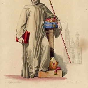
Plan of the parish of St George s, Hanover Square, London, 1907. A print from The History of the Squares of London Topographical and Historical by E Beresford Chancellor, Kegan Paul, Trench, Trubner and Co Ltd, London, 1907
Heritage Images features heritage image collections
Media ID 14951850
© The Print Collector / Heritage-Images
Beresford Chancellor Cartography Chancellor E Beresford E Beresford Chancellor Hanover Square Map Making Print Collector14 Square City Of Westminster
FEATURES IN THESE COLLECTIONS
> Arts
> Artists
> W
> George White
> Arts
> Minimalist artwork
> Monochrome artwork
> Fine art
> Arts
> Minimalist artwork
> Monochrome artwork
> Monochrome paintings
> Europe
> United Kingdom
> England
> Ely
> Europe
> United Kingdom
> England
> London
> Boroughs
> City of Westminster
> Europe
> United Kingdom
> England
> London
> Sights
> St Pauls Cathedral
> Europe
> United Kingdom
> England
> Maps
> Europe
> United Kingdom
> England
> Westminster
> Maps and Charts
> Early Maps
> Maps and Charts
> Related Images
EDITORS COMMENTS
This print showcases the detailed plan of the parish of St George's, Hanover Square in London, dating back to 1907. The print is a fascinating piece from "The History of the Squares of London Topographical and Historical" by E Beresford Chancellor, published by Kegan Paul, Trench, Trubner and Co Ltd in London. In this meticulously engraved map, we can see the intricate layout of streets and buildings that make up this historic area. The map provides a glimpse into the past with its monochrome aesthetic capturing the essence of early 20th century Britain. It offers an invaluable resource for those interested in cartography or studying English geography. Hanover Square itself takes center stage on this map as one of London's notable squares within the City of Westminster. Surrounding areas such as Westminster Abbey and Buckingham Palace are also depicted, giving us a sense of location within the bustling cityscape. Created by an unknown artist but curated by E Beresford Chancellor himself, this print serves as a testament to their dedication to preserving historical records through meticulous map-making. Its inclusion in "The History of Squares" adds further significance to its value as a historical artifact. As we gaze upon this image, we are transported back in time to experience life in early 20th century London through the lens of cartography.
MADE IN AUSTRALIA
Safe Shipping with 30 Day Money Back Guarantee
FREE PERSONALISATION*
We are proud to offer a range of customisation features including Personalised Captions, Color Filters and Picture Zoom Tools
SECURE PAYMENTS
We happily accept a wide range of payment options so you can pay for the things you need in the way that is most convenient for you
* Options may vary by product and licensing agreement. Zoomed Pictures can be adjusted in the Cart.