Home > South America > Peru > Maps
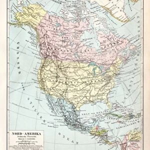
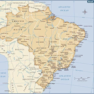
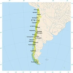
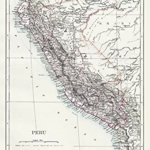
South America political map 1895

![]()
Wall Art and Photo Gifts from Fine Art Storehouse
South America political map 1895
Meyers Konversations-Lexikon. Ein Nachschlagewerk des allgemeinen Wissens, 5th edition 17 volumes Bibliographisches Institut - Leipzig 1895-1897
Unleash your creativity and transform your space into a visual masterpiece!
THEPALMER
Media ID 13611831
© This content is subject to copyright
Argentina Atlas Mythological Figure Brazil Chile Paper Peru South America World Map
FEATURES IN THESE COLLECTIONS
> Fine Art Storehouse
> The Magical World of Illustration
> Palmer Illustrated Collection
> Fine Art Storehouse
> Map
> Historical Maps
> Fine Art Storehouse
> Map
> USA Maps
> Maps and Charts
> Early Maps
> Maps and Charts
> World
> North America
> United States of America
> Maps
> South America
> Argentina
> Maps
> South America
> Brazil
> Maps
> South America
> Chile
> Maps
> South America
> Peru
> Maps
EDITORS COMMENTS
This print showcases a historical gem - the South America political map from 1895. Taken from the renowned Meyers Konversations-Lexikon, this antique piece of cartography offers a fascinating glimpse into the world as it was over a century ago. The intricate engraving and attention to detail make this illustration truly remarkable. The map features various countries that shape the diverse landscape of South America, including Chile, USA, Brazil, Peru, and Argentina. Its vertical orientation adds an artistic touch to its presentation, making it an ideal decorative piece for any wall. Printed on high-quality paper, this vintage map exudes elegance and charm. It serves as a reminder of our ever-changing world and how borders have evolved throughout history. Beyond its aesthetic appeal lies a wealth of information about physical geography - mountains ranges, rivers, coastlines - all meticulously depicted in this engraving. As we gaze upon this relic from another era, we are transported back in time to when exploration and discovery were at their peak. This print by THEPALMER is not just an artwork; it is also a testament to human curiosity and our desire to understand the world around us. Whether you are an avid collector or simply appreciate historical artifacts with cultural significance, this South America political map will undoubtedly be a cherished addition to your collection.
MADE IN AUSTRALIA
Safe Shipping with 30 Day Money Back Guarantee
FREE PERSONALISATION*
We are proud to offer a range of customisation features including Personalised Captions, Color Filters and Picture Zoom Tools
SECURE PAYMENTS
We happily accept a wide range of payment options so you can pay for the things you need in the way that is most convenient for you
* Options may vary by product and licensing agreement. Zoomed Pictures can be adjusted in the Cart.