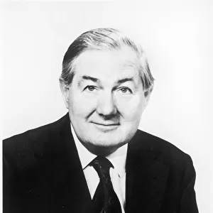
Home > Europe > United Kingdom > England > London > Politics > Clement Attlee
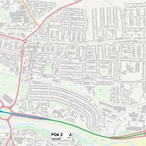
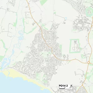
Hampshire PO6 4 Map

![]()
Wall Art and Photo Gifts from Map Marketing
Hampshire PO6 4 Map
Postcode Sector Map of Hampshire PO6 4
Media ID 19979564
Bodmin Road Bourne Road Browning Avenue Bude Close Chaucer Avenue Coleridge Road Dryden Avenue Edwards Close Elgar Close Falmouth Road Hamilton Road Hampshire Hatherley Road Helston Road Hillside Crescent Hopkins Close Huntley Close Jubilee Avenue Keats Avenue Kingsland Close Ledbury Road Lime Grove Littlefield Road Marsden Road Masefield Avenue Mortimer Road Mullion Close Parry Close Pendennis Road Port Way Ralph Road Raymond Road Ridgeway Close Rowland Road Rydal Close Sedgefield Close Severn Close Shelley Avenue Southampton Road St Michaels Court Stroud Close Sullivan Close Tintern Close Truro Road Walford Road Westbury Close Westfield Road Winchcombe Road Winterbourne Road Wordsworth Avenue The Edge
FEATURES IN THESE COLLECTIONS
> Aerial Photography
> Related Images
> Animals
> Insects
> Related Images
> Arts
> Artists
> B
> James Bourne
> Arts
> Artists
> H
> James Holland
> Europe
> United Kingdom
> England
> Hampshire
> Mortimer
> Europe
> United Kingdom
> England
> Hampshire
> Related Images
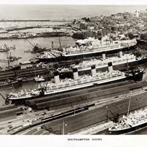
> Europe
> United Kingdom
> England
> Hampshire
> Southampton
> Europe
> United Kingdom
> England
> Hampshire
> Stroud
> Europe
> United Kingdom
> England
> London
> Politics
> Clement Attlee
> Europe
> United Kingdom
> England
> London
> Politics
> James Callaghan
> Map Marketing
> Postcode Sector Maps
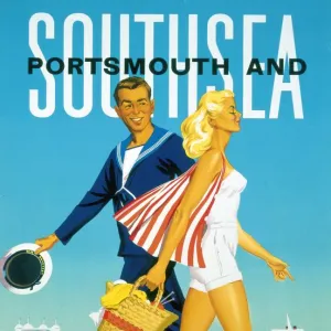
> PO - Portsmouth
MADE IN AUSTRALIA
Safe Shipping with 30 Day Money Back Guarantee
FREE PERSONALISATION*
We are proud to offer a range of customisation features including Personalised Captions, Color Filters and Picture Zoom Tools
SECURE PAYMENTS
We happily accept a wide range of payment options so you can pay for the things you need in the way that is most convenient for you
* Options may vary by product and licensing agreement. Zoomed Pictures can be adjusted in the Cart.