Home > Europe > United Kingdom > England > Gloucestershire > Amberley
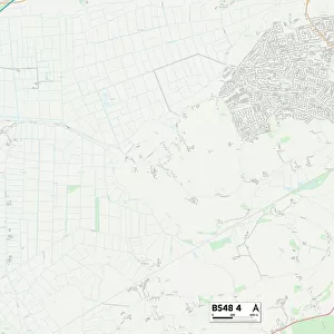
South Gloucestershire BS34 6 Map

![]()
Wall Art and Photo Gifts from Map Marketing
South Gloucestershire BS34 6 Map
Postcode Sector Map of South Gloucestershire BS34 6
Media ID 19966834
Amberley Road Bourton Close Brockley Close Brookfield Road Burford Avenue Clay Lane Collins Avenue Elm Close Farley Close Gloucester Road Grange Avenue Harvest Close Kingsway Manor Grove Maple Close Morley Close Orion Drive Pond Close Queensway Ravenscourt Road Sandhurst Close School Close Silver Birch Close South Gloucestershire Station Road Stoke Lane Stratton Close The Avenue The Close The Common The Saplings
FEATURES IN THESE COLLECTIONS
> Europe
> United Kingdom
> England
> Gloucestershire
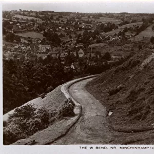
> Amberley
> Europe
> United Kingdom
> England
> Gloucestershire
> Bibury
> Europe
> United Kingdom
> England
> Gloucestershire
> Fairford
> Europe
> United Kingdom
> England
> Gloucestershire
> Gloucester
> Europe
> United Kingdom
> England
> Gloucestershire
> Highnam
> Europe
> United Kingdom
> England
> Gloucestershire
> Painswick
> Europe
> United Kingdom
> England
> Gloucestershire
> Patchway
> Europe
> United Kingdom
> England
> Gloucestershire
> Related Images
> Europe
> United Kingdom
> England
> Gloucestershire
> Stratton
> Europe
> United Kingdom
> England
> Gloucestershire
> Tetbury
> Map Marketing
> Postcode Sector Maps
> BS - Bristol
MADE IN AUSTRALIA
Safe Shipping with 30 Day Money Back Guarantee
FREE PERSONALISATION*
We are proud to offer a range of customisation features including Personalised Captions, Color Filters and Picture Zoom Tools
SECURE PAYMENTS
We happily accept a wide range of payment options so you can pay for the things you need in the way that is most convenient for you
* Options may vary by product and licensing agreement. Zoomed Pictures can be adjusted in the Cart.