Home > Europe > United Kingdom > Scotland > West Lothian > Whitburn
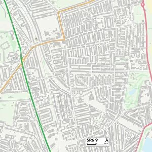
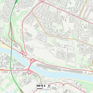
Sunderland SR6 8 Map

![]()
Wall Art and Photo Gifts from Map Marketing
Sunderland SR6 8 Map
Postcode Sector Map of Sunderland SR6 8
Media ID 19981494
Barton Court Birkdale Avenue Borrowdale Avenue Bower Street Chapman Street Coniston Avenue Dacre Road Dartford Road Dorking Road Dorset Avenue Douglas Road Dovedale Road Drayton Road Dudley Avenue Eskdale Road Farndale Avenue Hawthorn Terrace Kentmere Avenue Keswick Avenue King Street Kings Avenue Lonsdale Avenue Princes Avenue Princes Gardens Queens Avenue Rosedale Avenue Sea Road Shields Road Station Road Staveley Road Sunderland Swaledale The Square Troutbeck Road Whitburn Road Whitby Avenue Denham Avenue Rockville Ryedale
FEATURES IN THESE COLLECTIONS
> Arts
> Portraits
> Pop art gallery
> Street art portraits
> Europe
> United Kingdom
> England
> Cleveland
> Europe
> United Kingdom
> England
> Dorset
> Grove
> Europe
> United Kingdom
> England
> Dorset
> Hill View
> Europe
> United Kingdom
> England
> Dorset
> Related Images
> Europe
> United Kingdom
> Northern Ireland
> County Londonderry
> Derry
> Europe
> United Kingdom
> Scotland
> Falkirk
> Dunmore
> Europe
> United Kingdom
> Scotland
> Stirlingshire
> Dunblane
> Europe
> United Kingdom
> Scotland
> West Lothian
> Whitburn
> Map Marketing
> Postcode Sector Maps
> SR - Sunderland
> Maps and Charts
> Related Images
MADE IN AUSTRALIA
Safe Shipping with 30 Day Money Back Guarantee
FREE PERSONALISATION*
We are proud to offer a range of customisation features including Personalised Captions, Color Filters and Picture Zoom Tools
SECURE PAYMENTS
We happily accept a wide range of payment options so you can pay for the things you need in the way that is most convenient for you
* Options may vary by product and licensing agreement. Zoomed Pictures can be adjusted in the Cart.