Home > Maps and Charts > World
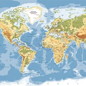
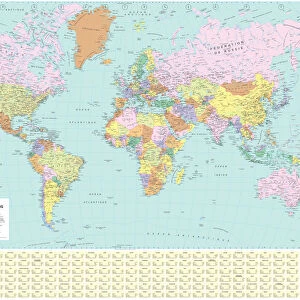
Physical World Map

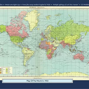
![]()
Wall Art and Photo Gifts from Map Marketing
Physical World Map
A Physical map of the World designed for school children. Based on the Van Der Grinten projection, the map displays the continents of the world labelling significant rivers, lakes and mountain ranges combined with land height and bathymetric data. The corners of the map feature inserts showing the layout of the solar system and phases of the moon along with graphics ranking the longest rivers and highest mountains in each continent compared to their equivalents in the British Isles. Lines of latitude (parallels) and longitude (meridians) are marked
Media ID 19950553
© Map Marketing Ltd
FEATURES IN THESE COLLECTIONS
> Arts
> Artists
> O
> Oceanic Oceanic
> Arts
> Landscape paintings
> Waterfall and river artworks
> River artworks
> Europe
> France
> Canton
> Landes
> Maps and Charts
> Related Images
> Maps and Charts
> World
MADE IN AUSTRALIA
Safe Shipping with 30 Day Money Back Guarantee
FREE PERSONALISATION*
We are proud to offer a range of customisation features including Personalised Captions, Color Filters and Picture Zoom Tools
SECURE PAYMENTS
We happily accept a wide range of payment options so you can pay for the things you need in the way that is most convenient for you
* Options may vary by product and licensing agreement. Zoomed Pictures can be adjusted in the Cart.